Mid-Canada Boreal Plains & Foothill Forests bioregion
The bioregion’s land area is provided in units of 1,000 hectares. The conservation target is the combined Global Safety Net (GSN1) areas for the component ecoregions. The protection level indicates the percentage of the GSN goal that is currently protected on a scale of 0-10. N/A means data is not available at this time.
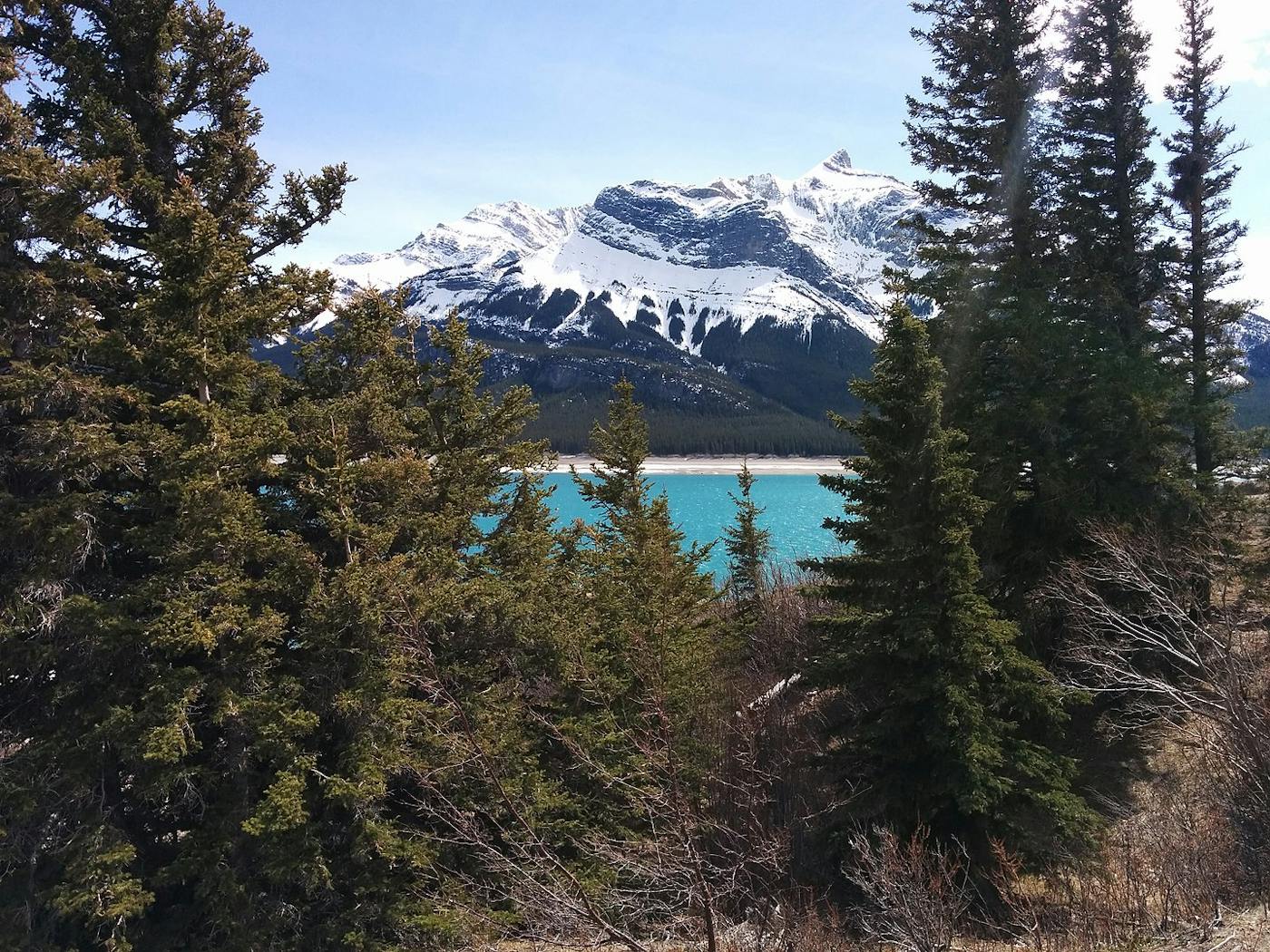
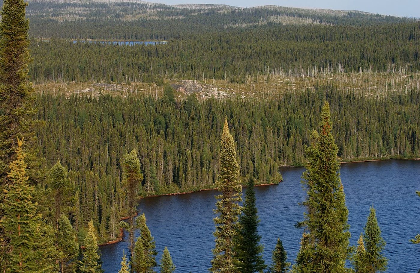
The Mid-Canada Boreal Plains & Foothill Forests bioregion, part of the Canadian Boreal Forests subrealm located in the Subarctic America realm, is defined predominantly by the plains and foothill forests lying between the Northern Rockies to the west and the Canadian Shield forests to the east. It consists of two ecoregions—Alberta-British Columbia Foothills Forests (345) and Mid-Canada Boreal Plains Forests (376)—and includes Lake Winnipeg, with one of the largest watersheds in Canada. The total area of this bioregion is approximately 69 million hectares.
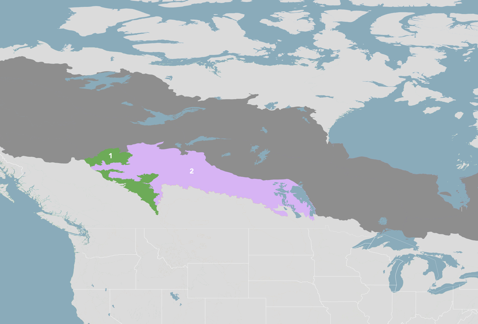
The Mid-Canada Boreal Plains & Foothill Forests bioregion is part of the Canadian Boreal Forests subrealm and is made up of two ecoregions: (1) Alberta-British Columbia Foothills Forests (2) Mid-Canada Boreal Plains Forests.
Learn more about each of the Mid-Canada Boreal Plains & Foothill Forests ecoregions below.

Subscribe to receive monthly updates on climate solutions, environmental heroes, and the profound beauty and wonder of our shared planet Earth.

Explore the Bioregions
Want to learn more about the fascinating species, diverse ecosystems, and natural wonders of the Earth? Click the button below to launch One Earth's interactive navigator and discover your Bioregion!
LAUNCH NAVIGATOR