
Rio de la Plata Grasslands bioregion
The bioregion’s land area is provided in units of 1,000 hectares. The conservation target is the combined Global Safety Net (GSN1) areas for the component ecoregions. The protection level indicates the percentage of the GSN goal that is currently protected on a scale of 0-10. N/A means data is not available at this time.
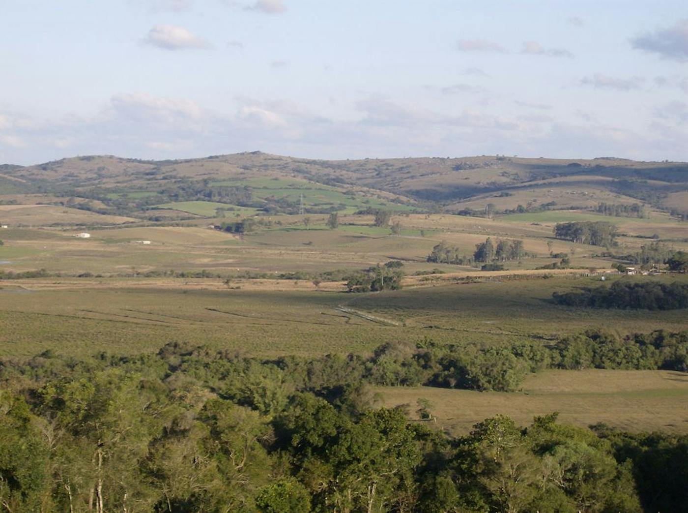
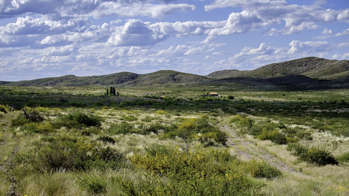
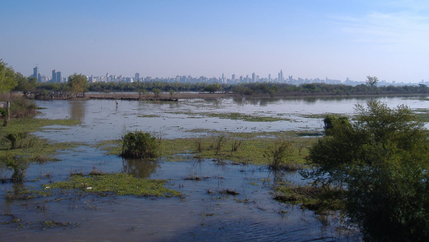
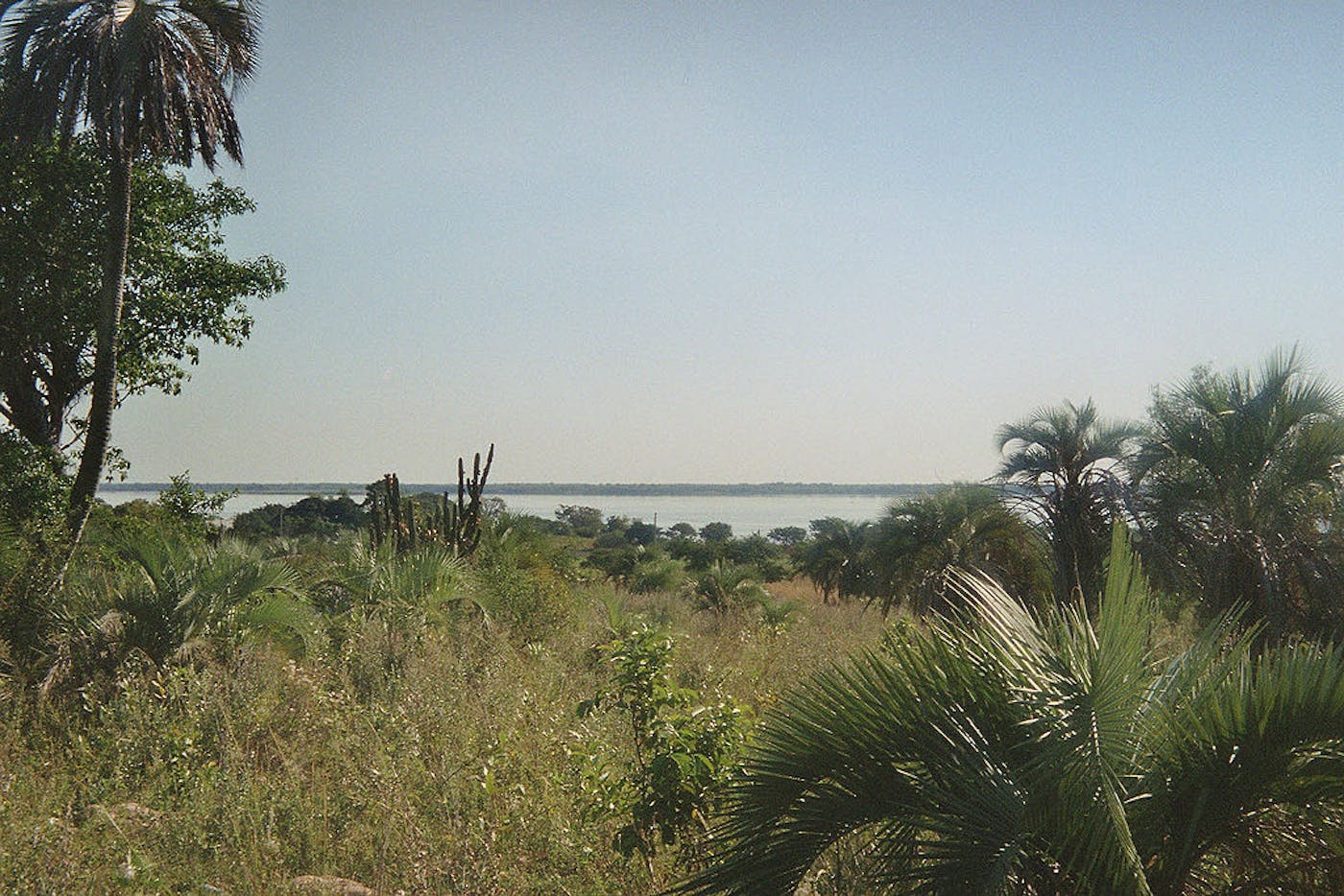
The Rio de la Plata bioregion, located in the Southern America (Neotropical) realm, extends from the Espinal drylands east of the Andes Mountains to the Atlantic Ocean, encompassing Argentina’s humid pampas grasses and the flooded savannas formed by the Paraná River and its tributaries. This bioregion also includes Uruguay’s subtropical savanna, which forms the Northern border of the Río de la Plata estuary, containing five ecoregions in total—Uruguayan Savanna (574), Espinal (575), Humid Pampas (576), Paraná Flooded Savanna (585), Southern Cone Mesopotamian Savanna (586)—as well as adjacent marine areas in the Atlantic Ocean. The total land area of this bioregion is more than 111 million hectares.
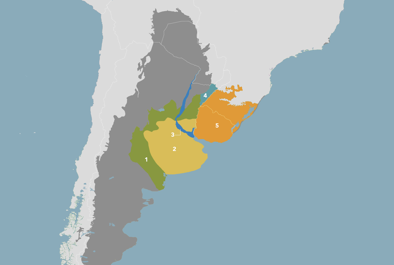
The Rio de la Plata Grasslands bioregion is part of the South American Grasslands subrealm and is made up of five ecoregions: (1) Espinal (2) Humid Pampas (3) Paraná Flooded Savanna (4) Southern Cone Mesopotamian Savanna (5) Uruguayan Savanna.
Learn more about each of the Rio de la Plata Grasslands ecoregions below.

Subscribe to receive monthly updates on climate solutions, environmental heroes, and the profound beauty and wonder of our shared planet Earth.

Explore the Bioregions
Want to learn more about the fascinating species, diverse ecosystems, and natural wonders of the Earth? Click the button below to launch One Earth's interactive navigator and discover your Bioregion!
LAUNCH NAVIGATOR