
North Tibetan Plateau-Kunlun Mountains Alpine Desert
The ecoregion’s land area is provided in units of 1,000 hectares. The conservation target is the Global Safety Net (GSN1) area for the given ecoregion. The protection level indicates the percentage of the GSN goal that is currently protected on a scale of 0-10. N/A means data is not available at this time.
Bioregion: Greater Tibetan Plateau Alpine Meadows & Shrublands (PA40)
Realm: Eastern Eurasia
Ecoregion Size (1000 ha):
37,527
Ecoregion ID:
759
Conservation Target:
75%
Protection Level:
6
States: China
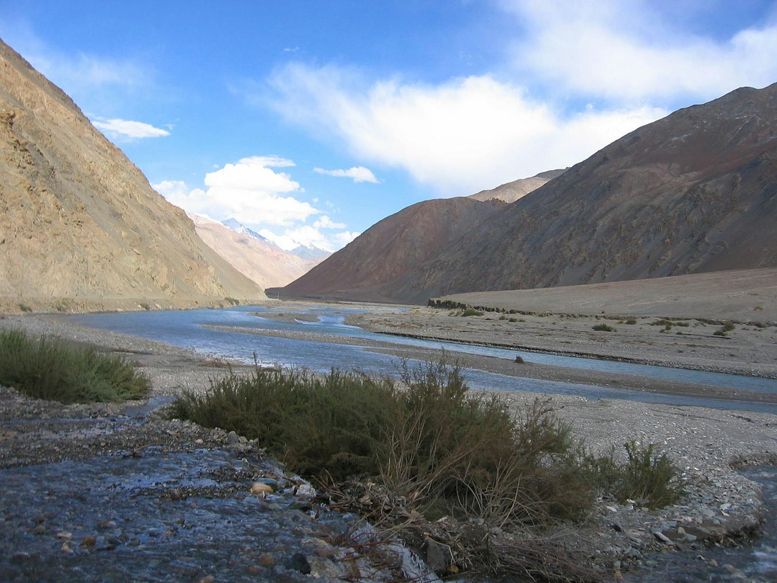
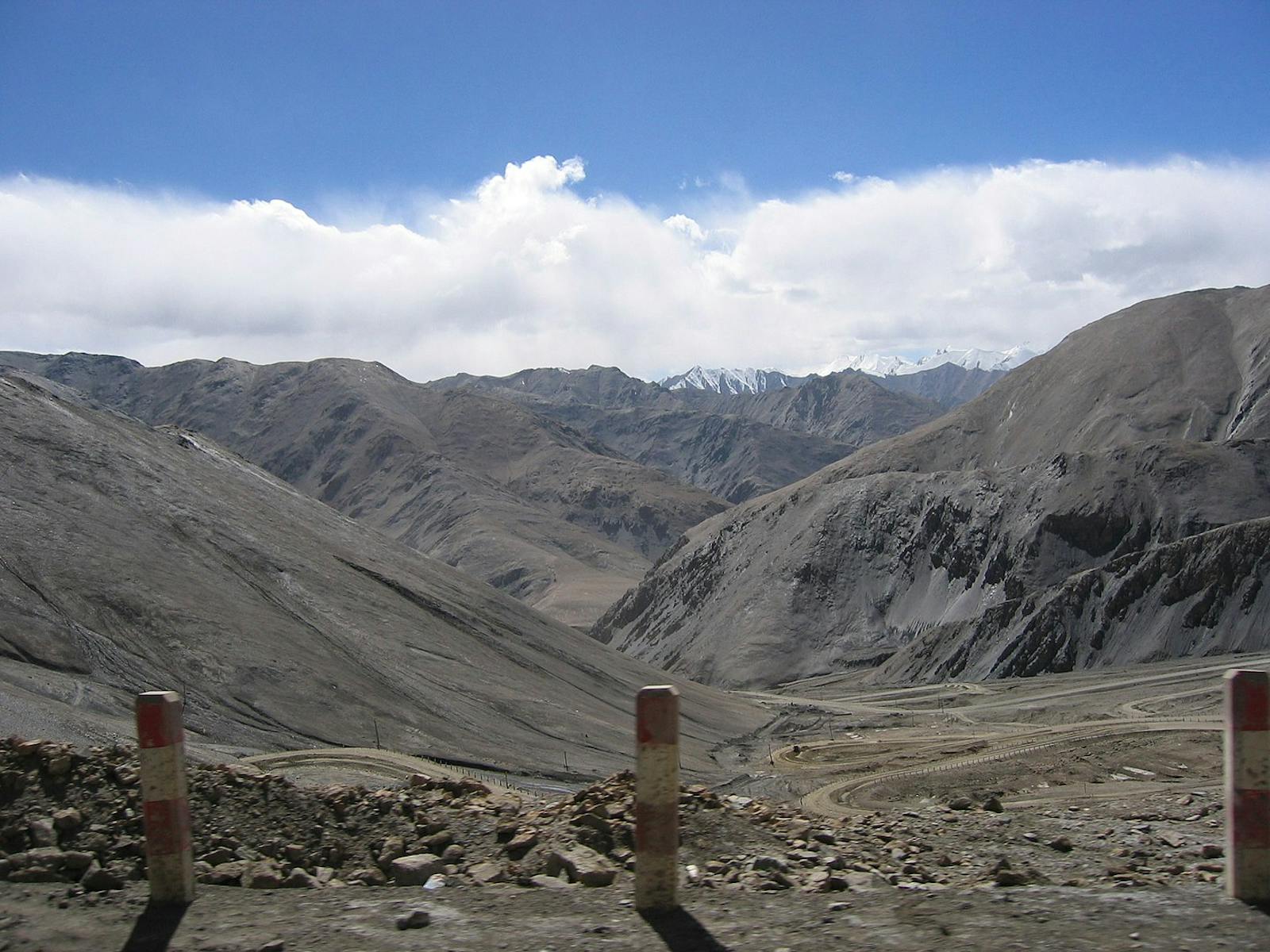
The vast Tibetan Plateau supports a range of alpine habitats, of which the most extreme environments are located in the northwest where precipitation is scant, temperatures are frigid, and elevations exceed 4,800 m for hundreds of kilometers in all directions. Vegetation of the North Tibetan Plateau-Kunlun Mountains Alpine Desert ecoregion is only productive for a few months a year, but still it supports populations of large hoofed mammals, small, burrowing mammals, and their predators.
Few mid-latitude environments are less hospitable than the lake basins of northwestern Tibet. Winds persist; mean temperatures lie below freezing for nine months a year; hard frosts occur nearly every night. Precipitation is scant, about 20–50 mm a year, all in the form of snow, which sublimates quickly in the intense sunlight. Soils are saline, soaked with water in summer, frozen in winter, and lie atop permafrost. Formidable as it is, this ecoregion holds the main calving ground of chiru, the Tibetan antelope, and encompasses much of the migratory corridor for this species.
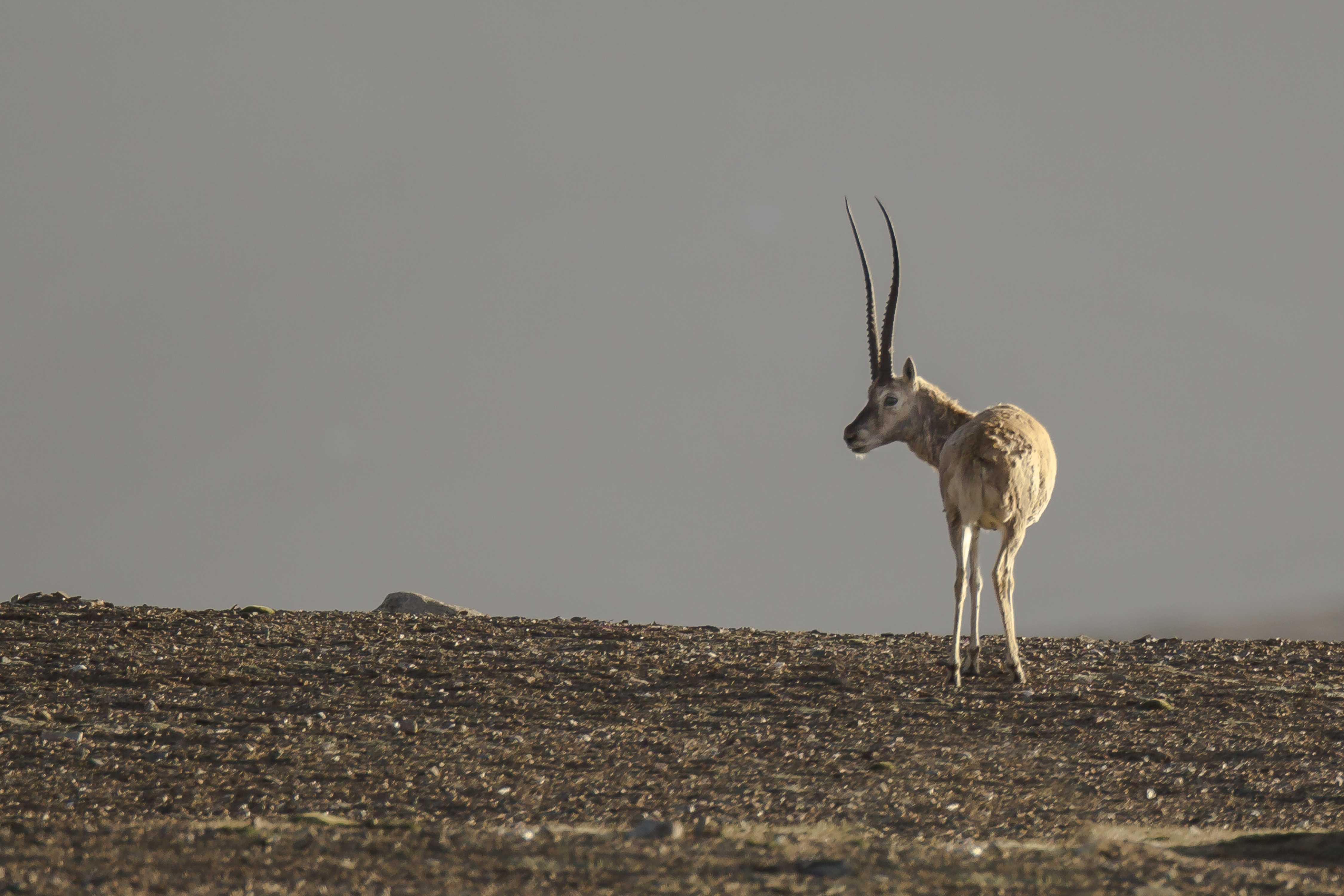
The flagship species of the North Tibetan Plateau-Kunlun Mountains Alpine Desert ecoregion is the Tibetan antelope. Image credit: Wildscreen Exchange
Lake basins of the North Tibetan Plateau are particularly extreme habitats because, when winds abate in winter, cold air sinks and settles into them. Upslope, away from this inverted temperature gradient, the vegetation is better developed, although plants cover remains less than 10%. Below 5,200 m elevation, vegetation is represented by Carex sedges and compact, tufted forbs in the amaranth and mustard families.
The highest elevations, above 5,300 m, support woolly cushion plants like the specialized alpine thistle, Saussurea gnaphaloides. In this arid realm, permanent snowline is situated at or a little above 6,000 m elevation, and radiant solar energy during summer is strong enough to feed streams with snowmelt. The only woody plant in this high country is a dwarfed tamarisk in the genus Myricaria that grows along seasonal watercourses. To survive, it keeps its woody tissues below ground, exposing only branchlets and minuscule leaves a few centimeters high.
In July 2017, the Qinghai Hoh Xil property (37,356 km2), which lies within this ecoregion, was added to the UNESCO World Heritage List. It adjoins Sanjiangyuan National Nature Reserve to the east, Changtang Nature Reserve to the west, and Altun Shan Nature Reserve to the north, consolidating a vast protected landscape. Here, more than a third of the plant species and all of the herbivorous mammals are endemic to the Tibetan Plateau.
Like other parts of the Tibetan Plateau, this ecoregion supports a guild of large carnivores—snow leopard, gray wolf, and brown bear—that are widely dispersed, nowhere frequent. Large, hoofed mammals include Tibetan antelope, Tibetan wild ass, white-lipped deer, and a small population of wild yak.
Zhuonai Lake, at 4,760 m elevation within the Hoh Xil property, is regarded as the main calving ground for chiru, the Tibetan antelope. Together with other protected areas, Qinghai Hoh Xil secures the Tibetan antelope’s migratory route. As anti-poaching efforts have strengthened, the Tibetan antelope population has doubled to more than 100,000 individuals and the species has been reclassified from endangered to near-threatened.
Concern remains, however, that the Tibetan railroad might be affecting the antelope’s migratory behavior and concentrating humans and livestock in a corridor along the rail line. Hoh Xil is also the region of the Tibetan Plateau with the highest density of brown bear, which are reported to gain most of their sustenance from a diet of the abundant plateau pika (Ochotona curzoniae).
Priority conservation actions for the next decade are to: 1) study and continue to monitor the great migration of Tibetan antelope through this ecoregion; 2) ensure that adventure tourism into this remote area is managed carefully; and 3) monitor the effects of climate change in a temperature-sensitive habitat.
Citations
Ministry of Housing and Urban-Rural Development, People’s Republic of China. 2016. Qinghai Hoh Xil World Heritage Nomination.
Schaller, George B. 1997. Tibet's Hidden Wilderness: Wildlife and Nomads of the Chang Tang Reserve. Abrams.
UNESCO World Heritage Programme. 2017. Qinghai Hoh Xil. https://whc.unesco.org/en/list/1540/documents. Accessed November 2018.

Subscribe to receive monthly updates on climate solutions, environmental heroes, and the profound beauty and wonder of our shared planet Earth.
