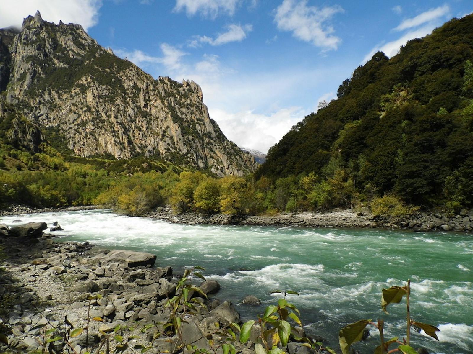
Northeastern Himalayan Subalpine Conifer Forests
The ecoregion’s land area is provided in units of 1,000 hectares. The conservation target is the Global Safety Net (GSN1) area for the given ecoregion. The protection level indicates the percentage of the GSN goal that is currently protected on a scale of 0-10. N/A means data is not available at this time.
Bioregion: Himalayan-Pamir Alpine Shrub & Meadows (PA41)
Realm: Eastern Eurasia
Ecoregion Size (1000 ha):
4,638
Ecoregion ID:
702
Conservation Target:
50%
Protection Level:
8
States: China, India, Bhutan
The Northeastern Himalayan Subalpine Conifer Forests ecoregion occupy slopes of the Zangbo Gorge, the deepest river valley on Earth, at elevations of 2,500–4,200 m. This massive gorge is a product of millions of years of rapid river incision by the Yarlung Zangbo River, which, after meandering for thousands of kilometers across southern Tibet, crosses a physiographic knick-point and drops steeply from the edge of the Tibetan Plateau to cut through a tectonically active granite dome.
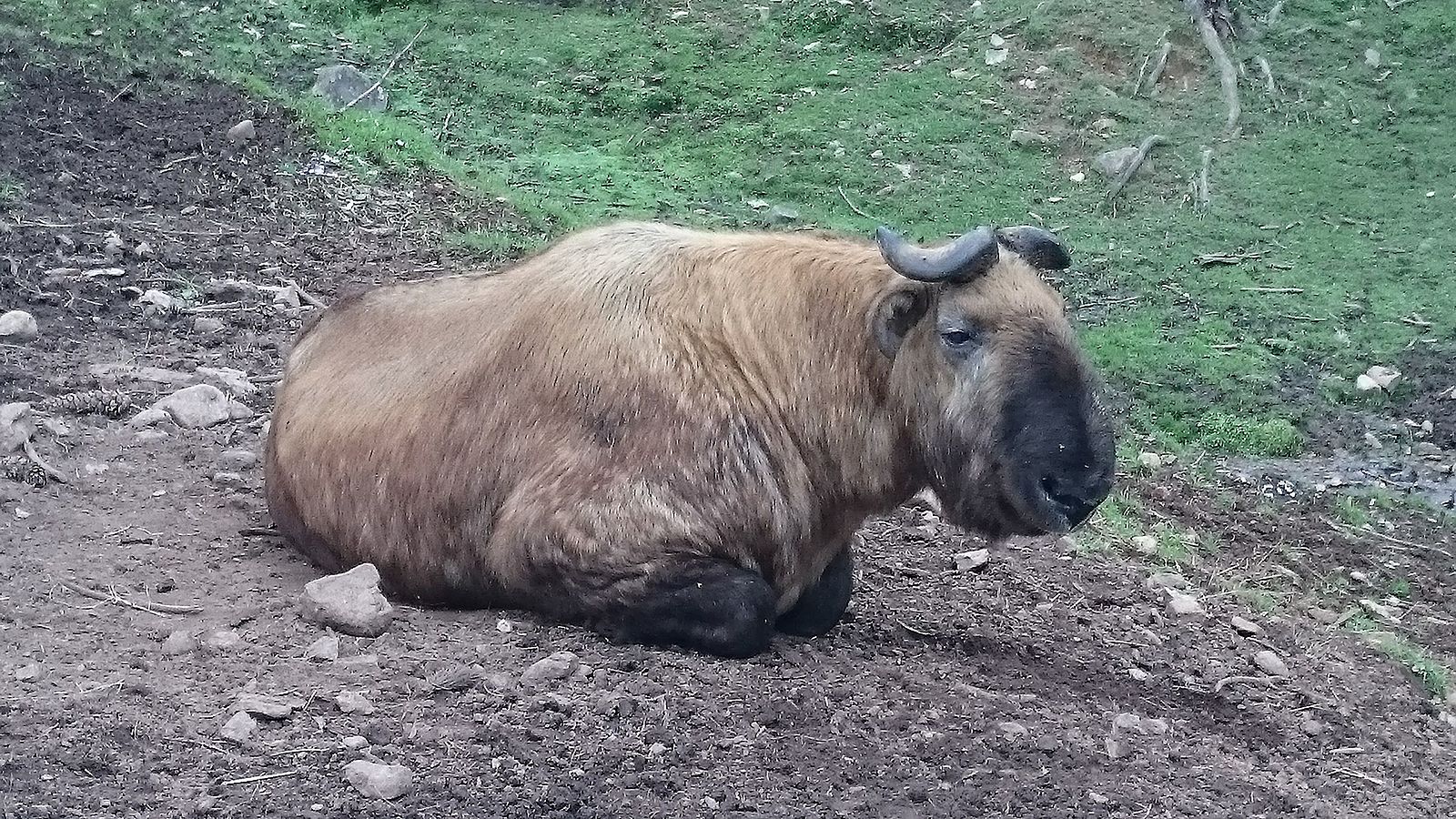
The flagship species of the Northeastern Himalayan Subalpine Conifer Forests ecoregion is the Bhutan takin. Image credit: Creative Commons
While the upper Yarlung Zangbo catchment, rain-shadowed by the Himalaya, has been settled by humans for thousands of years and probably lost its forests in prehistoric times, the middle reaches, which comprise this ecoregion, have incurred less human impact and have sustained their forest cover, probably because the landscape is so steep and the monsoon is so intense. Like other regions of the Himalaya, the vertical relief is exceptional so that bioclimatic zones are stacked one atop the other, their boundaries as convoluted as the topographic contour intervals that define them.
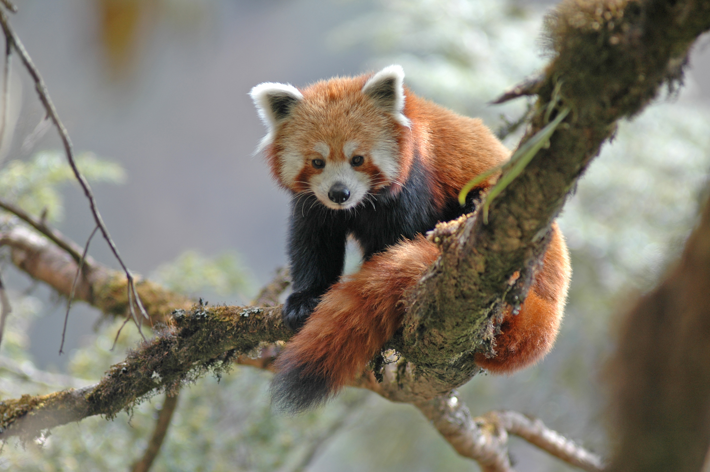
Red panda. Image credit: Peter Prokosch, Creative Commons
Within the subalpine conifer forest belt, dominant tree taxa include (by increasing elevation) blue pine, hemlock, spruce, and fir. Juniper grow as trees to about 4,000 m elevation, and the same species may extend hundreds of meters further upslope in a scrubby krummoltz growth form.
Favorable sites within the subalpine conifer forest support a lower tier of deciduous broadleaf trees. Himalayan birch is the most abundant, but maple, mountain ash, and other northern temperate taxa also occur. The evergreen broadleaf genus Rhododendron is prominent and diverse in the northeastern Himalaya, and many of the sixty-plus rhododendron species from this region are associated with the subalpine forest, some growing as shrubs, others as full-sized trees.4 Plant species richness here is lower than the lower elevation temperate forests, but standing biomass is very high, and a rich assemblage of lichens and epiphytic mosses in the forest canopy enhances productivity by capturing nutrients from fog.
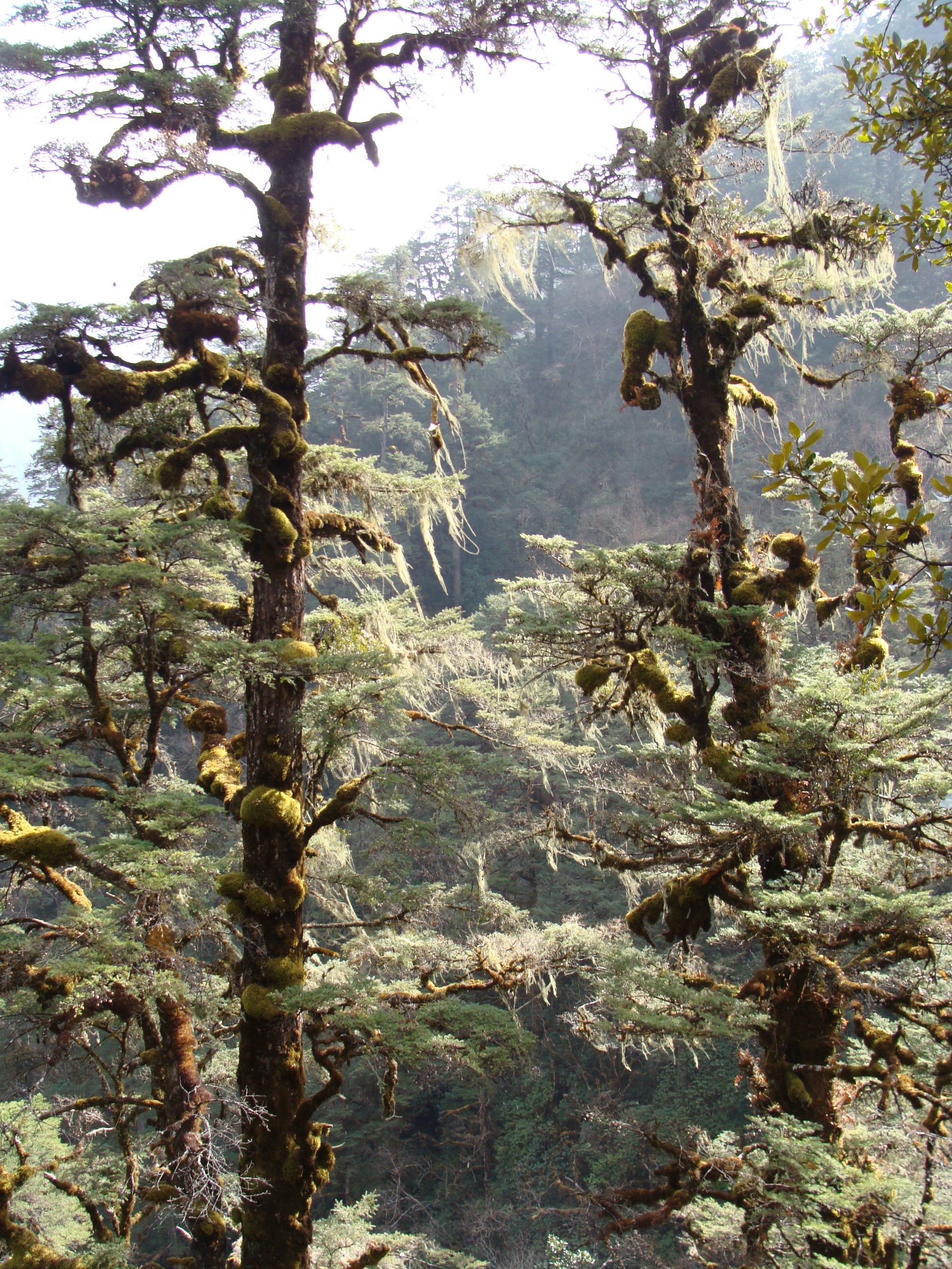
Tsuga dumosa. Image credit: Creative Commons
Forests at subalpine elevations support takin, a member of the subfamily of hoofed mammals that includes goats and sheep. Although genetically closer to sheep, takin have horns and physiognomy like a North American musk ox, and a large male can weigh nearly a ton. This ecoregion supports the ‘Bhutan’ takin, one of four subspecies. Other mammals of conservation significance include red panda, takin, musk deer, leopard (both common and clouded), Assamese macaque, and Asiatic black bear. Red goral, a goat-antelope whose range is restricted to the common border region of India, China, and Myanmar, occurs at lower elevations (below 2,000 m) within the boundaries of this ecoregion.
The Tsangpo Gorge occupies the eastern part of the Southern Tibet endemic bird area. Three range-restricted, near-threatened bird species endemic to southern Tibet—Tibetan eared-pheasant, white eared-pheasant, and giant babax—are reported to be locally common here in subalpine forests and adjacent alpine scrub at 3,000 to 5,000 meters elevation.
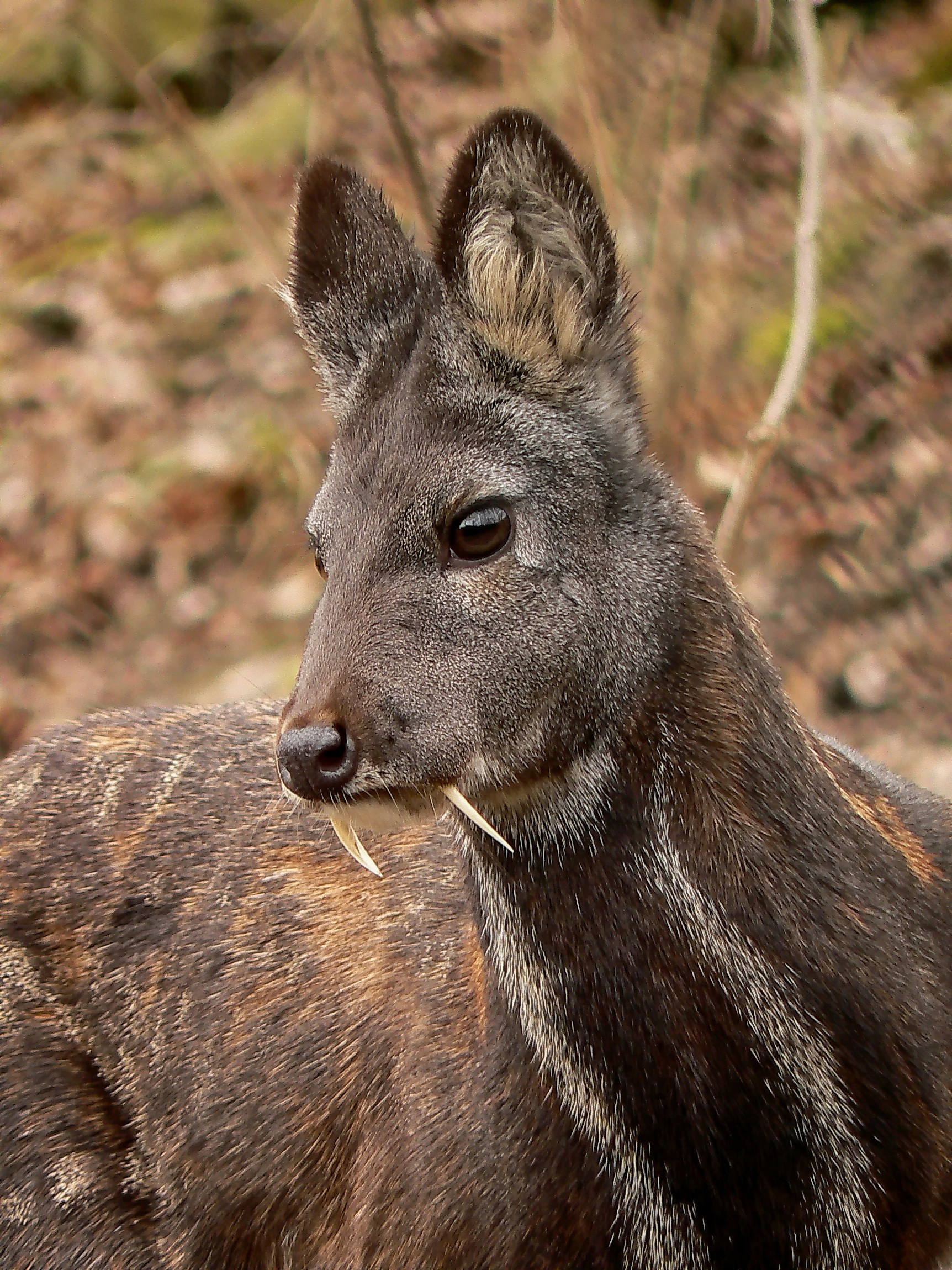
Musk deer. Image credit: Creative Commons
Steep, inaccessible terrain and heavy monsoon precipitation limit human settlement in much of this ecoregion, and local traditions regard the Zangbo Gorge, locally called Pemako, as a sacred landscape that is off-limits to hunting.2 This ecoregion also includes Yarlung Tsangpo Grand Canyon National Nature Reserve (9,600 km2) and the smaller Yi’ong National Geopark.
Despite protected status, efforts are underway to assess the feasibility of damming the Zangbo for hydropower, or to export locally abundant water resources to other, drier parts of China: a dam cascade in this catchment could generate up to 50 GW of electricity. This scenario worries India, whose residents downstream would be affected. With respect to habitat conservation of this ecoregion, the elephant in the room, so to speak, is the status of the international border that runs through it, as China asserts an historic claim to the Indian State of Arunchal Pradesh.
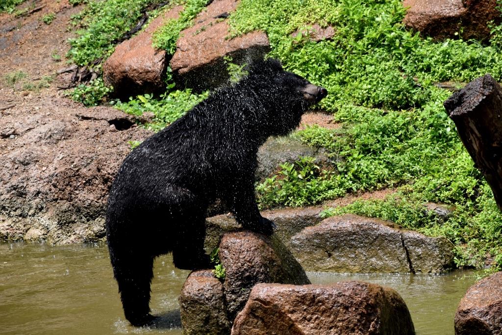
Asiatic black bear. Image credit: Creative Commons
Although commercial logging has been banned for 20 years, road construction makes it easier than before to remove medicinal plants and other commercially valuable wildlife. Climate change is affecting species distribution patterns and altering the livelihoods of people who live in the region.
Priority conservation actions for the next decade are to: 1) work constructively to initiate trans-boundary conservation; 2) move prudently with regard to hydroelectric and water diversion infrastructure in a diverse, near pristine and tectonically active region; and 3) follow best practices to monitor and control the collection of wild plants and animals from this ecoregion, which contains China’s most pristine forest habitat.
Citations
- Baker, I. 2004. The Heart of the World: A Journey to the Last Secret Place. The Penguin Press, New York, N.Y.
- Carpenter, C. 2000. Southern Asia: Tibet, India, and central Bhutan. https://www.worldwildlife.org/ecoregions/pa0514. Accessed November 2018.
- Lang, K.A., Huntington, K.W., Burmester, R., Housen, B., 2016. Rapid exhumation of the eastern Himalayan syntaxis since the late Miocene. Geol. Soc. Am. Bull. (B31419.1).
