.png?auto=compress%2Cformat&w=300)
Taiheiyo Evergreen Forests
The ecoregion’s land area is provided in units of 1,000 hectares. The conservation target is the Global Safety Net (GSN1) area for the given ecoregion. The protection level indicates the percentage of the GSN goal that is currently protected on a scale of 0-10. N/A means data is not available at this time.
Bioregion: Japan Forest Islands (PA47)
Realm: Eastern Eurasia
Ecoregion Size (1000 ha):
13,861
Ecoregion ID:
682
Conservation Target:
36%
Protection Level:
8
States: Japan
From volcanic mountains and ethereal waterfalls to striking archipelago seascapes and sandy beaches, the exceptional diversity of habitats in this ecoregion is matched by an equally varied flora and fauna. Evergreen forests are home to the vibrant flowers of Camellia japonica, with fauna characterised by Japanese macaque, Japanese weasel, and the endemic Japanese serow. There is also much to see for birdwatchers here, including the fairy pitta, Japanese accentor, Japanese murrelet, and copper pheasant.
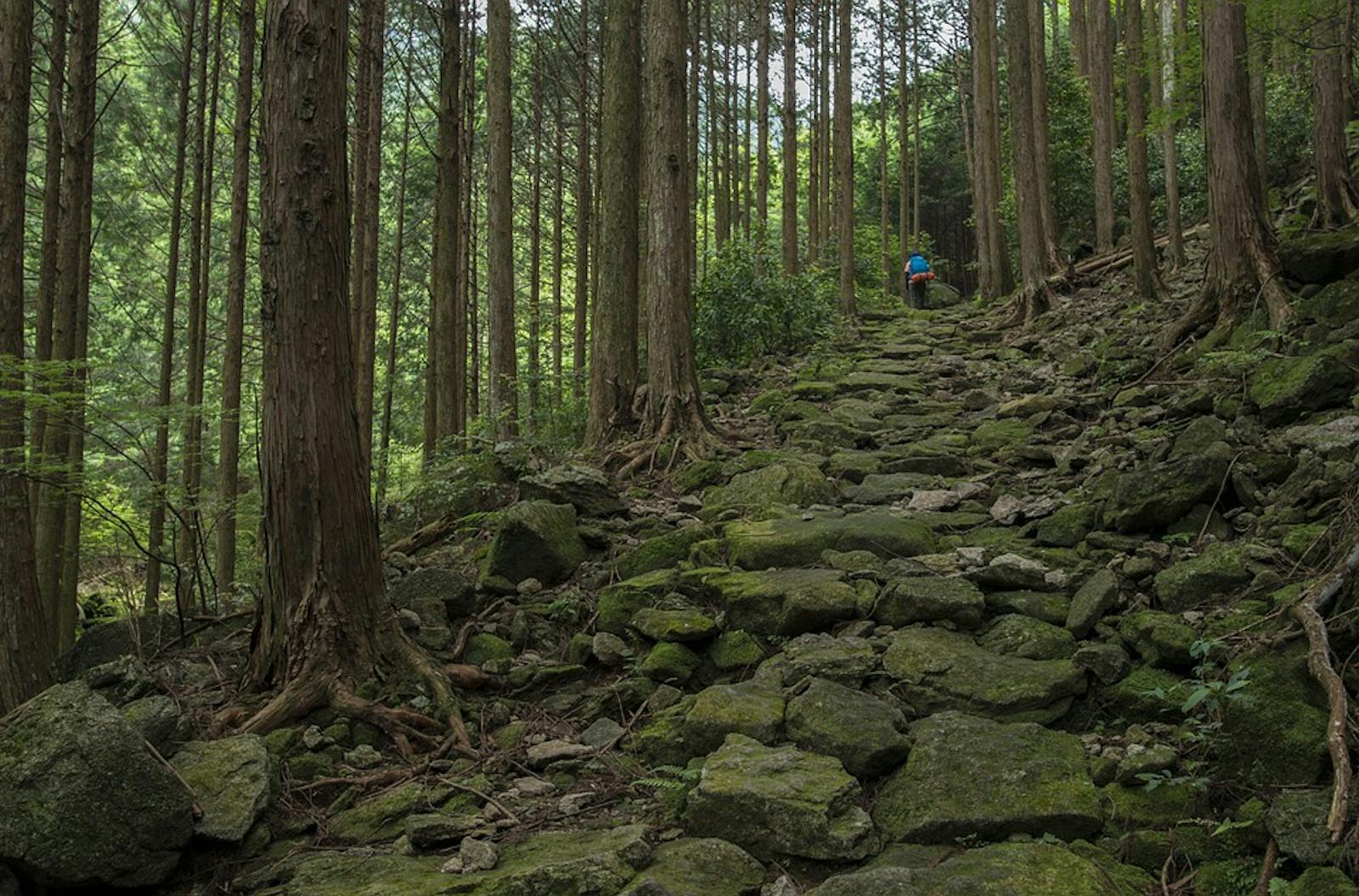
This ecoregion encompasses areas across several of Japan’s major islands, stretching from Kyushu and Shikoku in the south to the western coast of Honshu further north. Numerous smaller islands such as Oshina, Hirado, Iki, Tsushima and Goto are also included. Spectacular volcanic mountain ranges can be found inland, including a section of the Omine range where one the world’s largest volcanic craters or calderas can be found on Mount Aso.
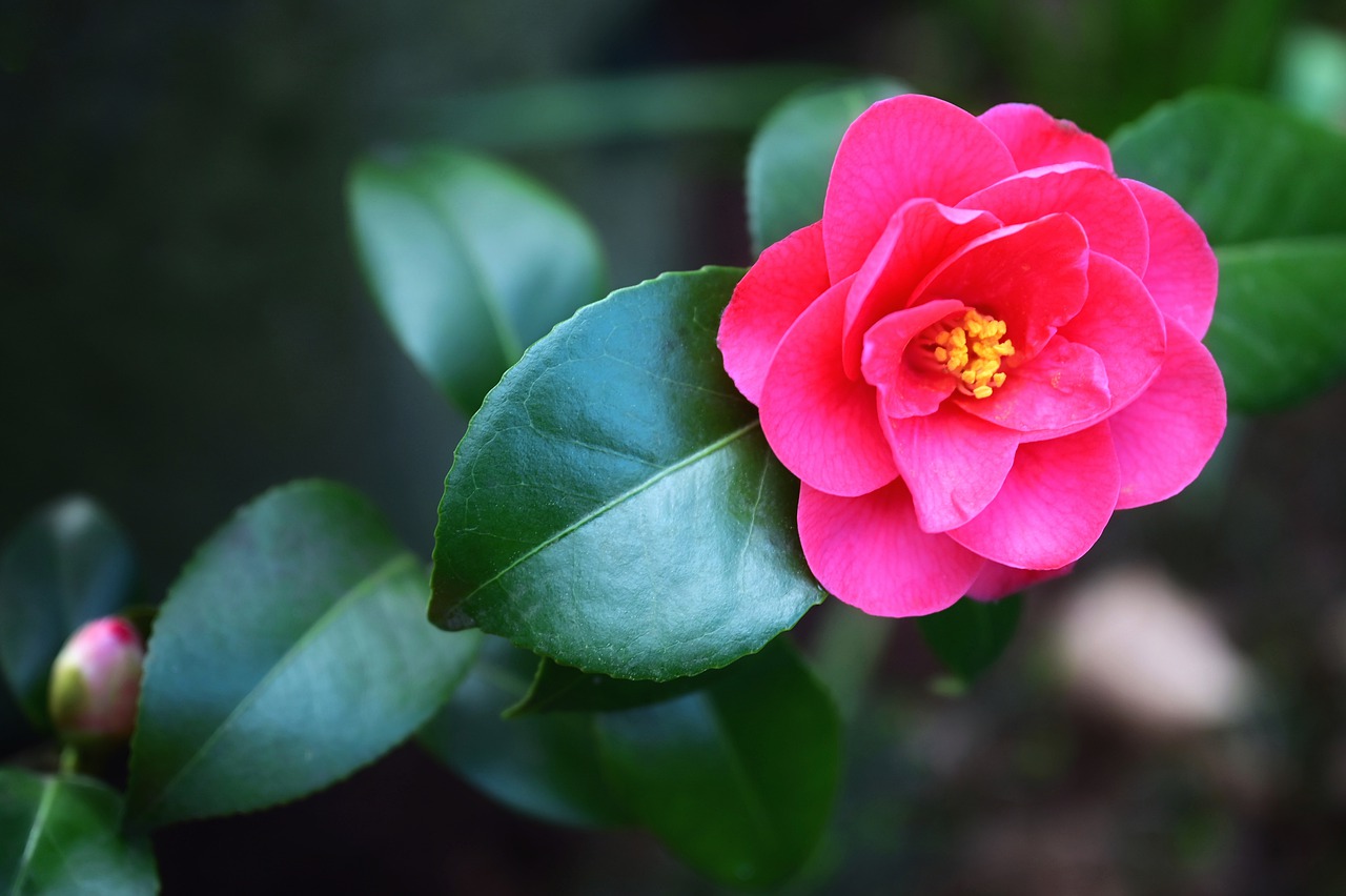
The flagship species of the Taiheiyo Evergreen Forests ecoregion is the Japanese camellia. Image credit: Creative Commons
The region also boasts Japan’s tallest waterfall—Nachi Falls—at 133 m, and Lake Biwa, the nation’s largest freshwater lake. The coastal landscape is equally spectacular, with archipelagos, sandy beaches, tidal flats and the world’s northernmost coral reefs. Temperatures are generally warmer in the south, reaching highs of around 28–32ºC in summer and sub-zero lows in winter. Precipitation is highest in the summer months with up to 400 mm per month in some areas, and dropping below 100 mm in winter.
The warm Kuroshio or Japan current generates a humid climate along the west coast, creating a long-growing season for the evergreen forests which characterise this ecoregion. Castanopsis cuspidate and Persea thunbergii are typical canopy species in coastal areas, with evergreen oak found further inland. Mochi trees and Japanese camellia—the symbol of Cape Ashizuri in the south—are common in the understorey. Japanese red pine and Japanese black pine can also be found near the coast where species such as the roundleaf chastetree and Hibiscus syriacus ‘hamabo’ grow on sandy beaches and vast beds of sea-grass form under the water’s surface.
An exceptional diversity of wildlife inhabiting the marine and coastal areas characterises this ecoregion. Japanese macaque, Japanese weasel, sika deer, and the Japanese serow—a nationally symbolic species often described as a ‘goat-antelope’—can all be found here, with Tshushima deer—a sub-species of sika deer—endemic to Tsushima island. Aves include the Japanese accentor, fairy pitta, Japanese reed bunting and copper pheasant. Tonegawa plain is one of the few breeding sites of Japanese Marsh warblers, and the grey-faced buzzard and Chinese goshawk are known to stop off in the Sata area during migration. The vulnerable Japanese murrelet is largely endemic to Japan, as is the Japanese cormorant which can be found on rocky coastlines and islands. Other coastal fauna includes loggerhead turtles and the critically endangered Japanese horseshoe crab—also known as living fossils—for which this ecoregion hosts Japan’s only population.
Japan’s largest cities, including Tokyo, Osaka, and Nagoya, are situated in the ecoregion, meaning that a large percentage of primary forest has given way to urban developments or agricultural land surrounding the major settlements. Alongside agriculture, tourism is a major economic activity in the region. The UNESCO World Heritage Site in the Kii Mountain range attracts many visitors, where sacred sites and pilgrimage routes reflect the bringing together of ancient traditions and Buddhism, which was introduced to Japan from China and the Korean peninsula. Several protected areas exist, including Japan’s largest national park Setonaikai, which for centuries has been a major port connecting to the rest of the world.
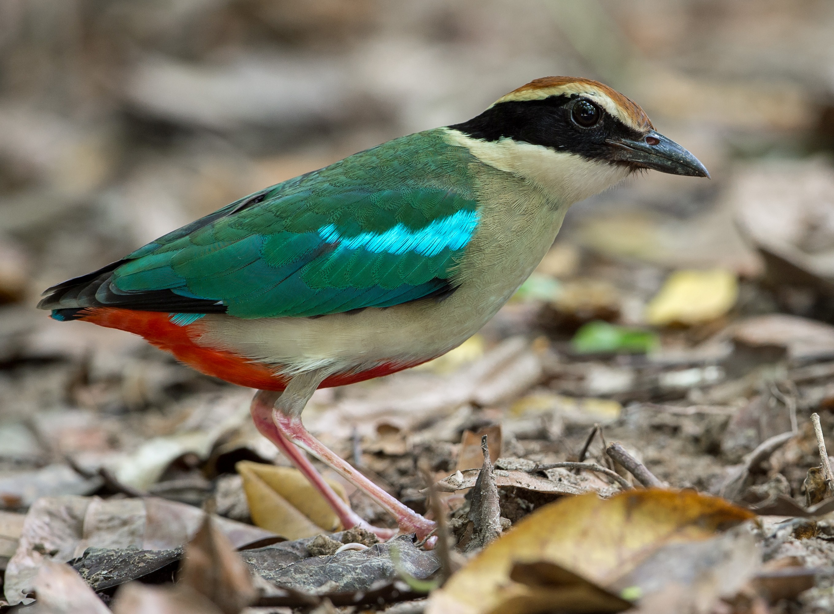
Fairy pitta. Image credit: Creative Commons
Numerous threats endanger the continued existence of ecosystems in this region. Rapidly growing populations of sika deer and wild boar threaten the health of current and regeneration of new forests through severe overgrazing, whilst invasive populations of largemouth bass in waterbodies outcompete native species. The impact of climate change permeates across the entire region, ranging from coral bleaching and loss of seagrass beds in coastal regions, to increased drought frequency threatening to disrupt normal functioning of Lake Biwa’s ecosystem.
In the north of the ecoregion, the 2011 tsunami caused extensive degradation of tidal flats and sand dunes, and reduced a kilometer-long stretch of over 7,000 pines at Takata Matsubara to a single tree. In response to such widespread devastation, the Sanriku Fukko National Park was established to aid reconstruction efforts in the Sanriku region.
The priority conservation actions in the next decade will be to: 1) continue with efforts to restore habitats in the northern section of the ecoregion following damage caused by the 2011 tsunami; 2) develop effective management strategies for growing populations of problematic species such as sika deer; and 3) put in place measures to protect natural ecosystems in the face of predicted future global temperature rise.
Citations:
1. Government of Japan (2014). ‘Fifth National Report of Japan to the Convention on Biological Diversity’. [Online]. Available from: https://www.cbd.int/doc/world/jp/jp-nr-05-en.pdf [Accessed 10/11/2019]
2. Ministry of the Environment (2019) ‘Setonaikai National Park’. [Online] Available from: https://www.env.go.jp/en/nature/nps/park/setonaikai/index.html [Accessed 11/11/2019]
3. Miyawaki, A. (1984). ‘A Vegetation-Ecological View of the Japanese Archipelago’. Bull. Inst. Environ. Sci. Technol. 11: pp.85-101

Subscribe to receive monthly updates on climate solutions, environmental heroes, and the profound beauty and wonder of our shared planet Earth.
