
Blue Mountains Forests
The ecoregion’s land area is provided in units of 1,000 hectares. The conservation target is the Global Safety Net (GSN1) area for the given ecoregion. The protection level indicates the percentage of the GSN goal that is currently protected on a scale of 0-10. N/A means data is not available at this time.
Bioregion: Columbia Plateau & Blue Mountains (NA17)
Realm: Northern America
Ecoregion Size (1000 ha):
7,092
Ecoregion ID:
348
Conservation Target:
24%
Protection Level:
4
States: United States: OR, WA, ID
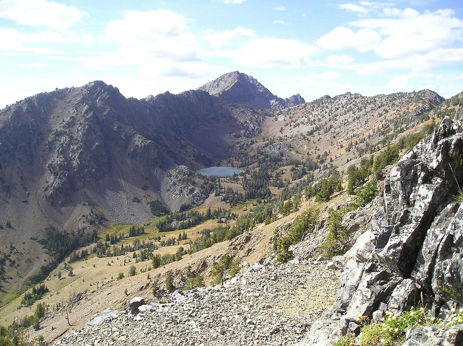
The Blue Mountains Forests ecoregion occupies a broad swath of central Oregon (east of the Eastern Cascades) and northeastern Oregon, as well as adjacent areas of southeastern Washington and western Idaho. This ecoregion is extremely heterogeneous in geology and vegetation, with alternating basins and ranges, rivers, and extensive floodplains.
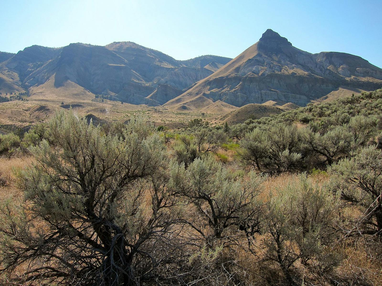
The western portion of the region has Paleozoic rocks more than 300 million years old, some of the oldest in Oregon. More recent deposits include the Cenozoic rocks at John Day Fossil Beds National Monument, well known for their outstanding plant and vertebrate fossils. Much of the region was covered by the Columbia River Flood Basalts from eruptions 17–14 million years ago. Soils are largely of volcanic origin.
%20(1).jpeg "American black bear")
The flagship species of the Blue Mountains Forests ecoregion is the American black bear.
Mountain ranges include the Strawberry, Greenhorn, Elkhorn, Aldrich, Maury, Ochoco, Blue, Wallowa, and Seven Devils. The latter range, on the eastern edge of this ecoregion in Idaho, is part of the Rocky Mountains. Elevations in mountainous areas range from 2,100 to 2,900 m, with basins at 750-900 m. Major rivers include the John Day, Grande Ronde, Powder, Malheur, and Snake Rivers.
The latter has cut one of the largest and deepest canyons in the world: Hells Canyon, which at 1,600 m deep—and 2,300 m below the peaks of the Seven Devils Mountains to the east—is deeper than the Grand Canyon. This ecoregion is not just forest, however. In addition to many different forest community types, there are grasslands, sagebrush steppe, wetlands, and other communities.
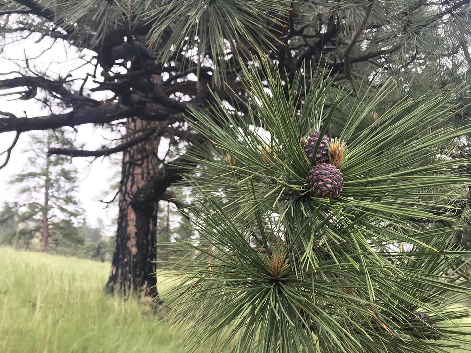
Ponderosa pine
The climate of the Blue Mountains Forests ecoregion is warm to hot in summer and cold in winter. Precipitation, mostly in winter, is low, ranging from 305 to 1,270 mm. Like the Eastern Cascades, this ecoregion is best distinguished by its massive ponderosa pines, which occur largely in the montane zone of the mountain ranges, although relatively little old-growth remains today.
Major vegetation types in addition to ponderosa pine include big sagebrush, western juniper, Douglas-fir, western larch, spruce-fir, lodgepole pine, mountain shrub, mountain grassland, and alpine. Fire regimes range from frequent, low-severity fire in ponderosa pine woodlands to infrequent, high-severity fire in dense higher-elevation types such as lodgepole pine and spruce-fir. Mixed-severity fire regimes, with patches ranging across a spectrum of severities, were common.
Intensive logging, livestock grazing, fire exclusion, and exotic species invasions have greatly altered the natural fire regime. Whereas fire exclusion has affected many communities, the invasion of cheatgrass has made fires unnaturally frequent in many areas, to the point that even native bunchgrasses are declining.

Great gray owl
This ecoregion is home to a diverse assemblage of native fauna. Mammals of this ecoregion include elk, mule deer, bighorn sheep, pronghorn, cougar, American marten, and the American black bear. Characteristic birds include flammulated owl, great gray owl, pileated woodpecker, black-backed woodpecker, three-toed woodpecker, white-headed woodpecker, pinyon jay, gray jay, Clark’s nutcracker, mountain chickadee, pygmy nuthatch, golden-crowned kinglet, Townsend’s solitaire, mountain bluebird, hermit thrush, Townsend’s warbler, Cassin’s finch, red crossbill, and evening grosbeak.
The 1,300 km2 Zumwalt Prairie, a high-elevation grassland along the west edge of Hells Canyon, part of it a preserve managed by The Nature Conservancy, has a diverse array of raptors, including breeding ferruginous, Swainson's, and red-tailed hawks, as well as golden eagles and wintering rough-legged hawks.
.jpg)
White-headed woodpecker
\Heavy logging and fire exclusion have altered this ecoregion, and relatively few old-growth forests and roadless areas remain. Only 9% of the ecoregion is protected, but opportunities remain to protect the 25% of the region containing relatively natural habitats. Urban sprawl is affecting a limited area, mostly near Bend, Oregon, which is on the edge of this ecoregion.
Priority conservation actions for the next decade are to 1) establish new federal and state protected areas to capture all remaining late-seral forests, naturally disturbed early-seral forests, roadless areas, and biodiversity hotspots; 2) improve forest management, including introducing prescribed fire and prohibiting salvage logging after disturbance; and 3) implement effective control and removal of invasive exotic plants, especially cheatgrass, which has invaded most of this ecoregion.
Citations
1. Franklin, J.F., and C.T. Dyrness. 1973 (plus 1988 Supplement). Natural Vegetation of Oregon and Washington. Oregon State University Press, Corvallis.
2. Ricketts, T.H. et al. 1999. Terrestrial Ecoregions of North America: A Conservation Assessment. Island Press, Washington, D.C.
3. Garrison, G.A., A.J. Bjugstad, D.A. Duncan, M.E. Lesis, and D.R. Smith. 1977. Vegetation and Environmental Features of Forest and Range Ecosystems. USDA Forest Service Agricultural Handbook No. 475. Washington, DC.

Subscribe to receive monthly updates on climate solutions, environmental heroes, and the profound beauty and wonder of our shared planet Earth.
