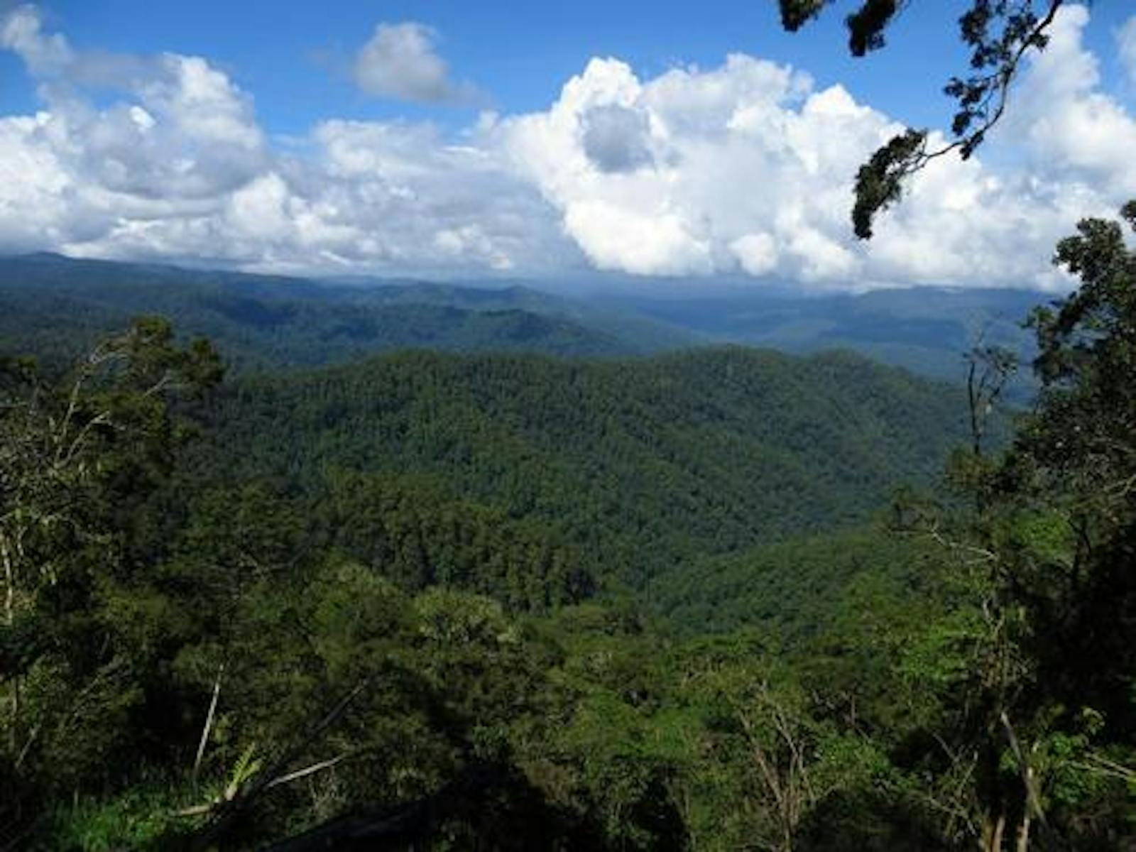

Buru Rainforests
The ecoregion’s land area is provided in units of 1,000 hectares. The conservation target is the Global Safety Net (GSN1) area for the given ecoregion. The protection level indicates the percentage of the GSN goal that is currently protected on a scale of 0-10. N/A means data is not available at this time.
Bioregion: Sulawesi & Maluku Islands (AU14)
Realm: Australasia
Ecoregion Size (1000 ha):
864
Ecoregion ID:
138
Conservation Target:
76%
Protection Level:
0
States: Indonesia
Buru Island is a long-isolated stepping stone for plants and animals between Southeast Asia and New Guinea. The island’s isolation by deep water, but close proximity to rich Southeast Asian and New Guinea biotas, has facilitated the arrival of many groups over millennia that have evolved into unique forms. A remarkably high number of endemic species occur here and include the Buru boobook, Buru racket-tail, Buru threadtail, and the Buru opalescent birdwing butterfly, a splendid giant of the butterfly world.
.jpg)
The flagship species of the Buru Rainforests ecoregion is the Buru opalescent birdwing butterfly. Image credit: Marietarrant, iNaturalist
Of 178 recorded birds, ten are only found on Buru and nearby islets. Another 19 only occur in a cluster of Wallacean islands that Buru is part of. Four of 25 mammals are near endemic. The Buru babirusa, a unique, primitive, hog-like animal with curved tusks occurs only here and is considered threatened due to habitat loss and hunting pressure.
Buru rises to 2,700 m with two major mountain ranges covered in dense tropical evergreen and semi-evergreen forests. Tall, straight Dipterocarp trees dominate, like Hopea, Shorea, and Vatica. Many trees are endemic and some are endangered, such as Grynops moluccanum (Thymeliaceae) that has been included in the CITES Red List of Endangered Species. Montane forests occur above 800 to 900 m in altitude. Many of the rare and endemic birds are confined to these cool and rainy mountain forests. The fire-resistant paper-bark tree is common in drier areas. Unusual karst (limestone) outcrops occur in the southwest and support a specialized vegetation, including insectivorous Nepenthes pitcher plants.
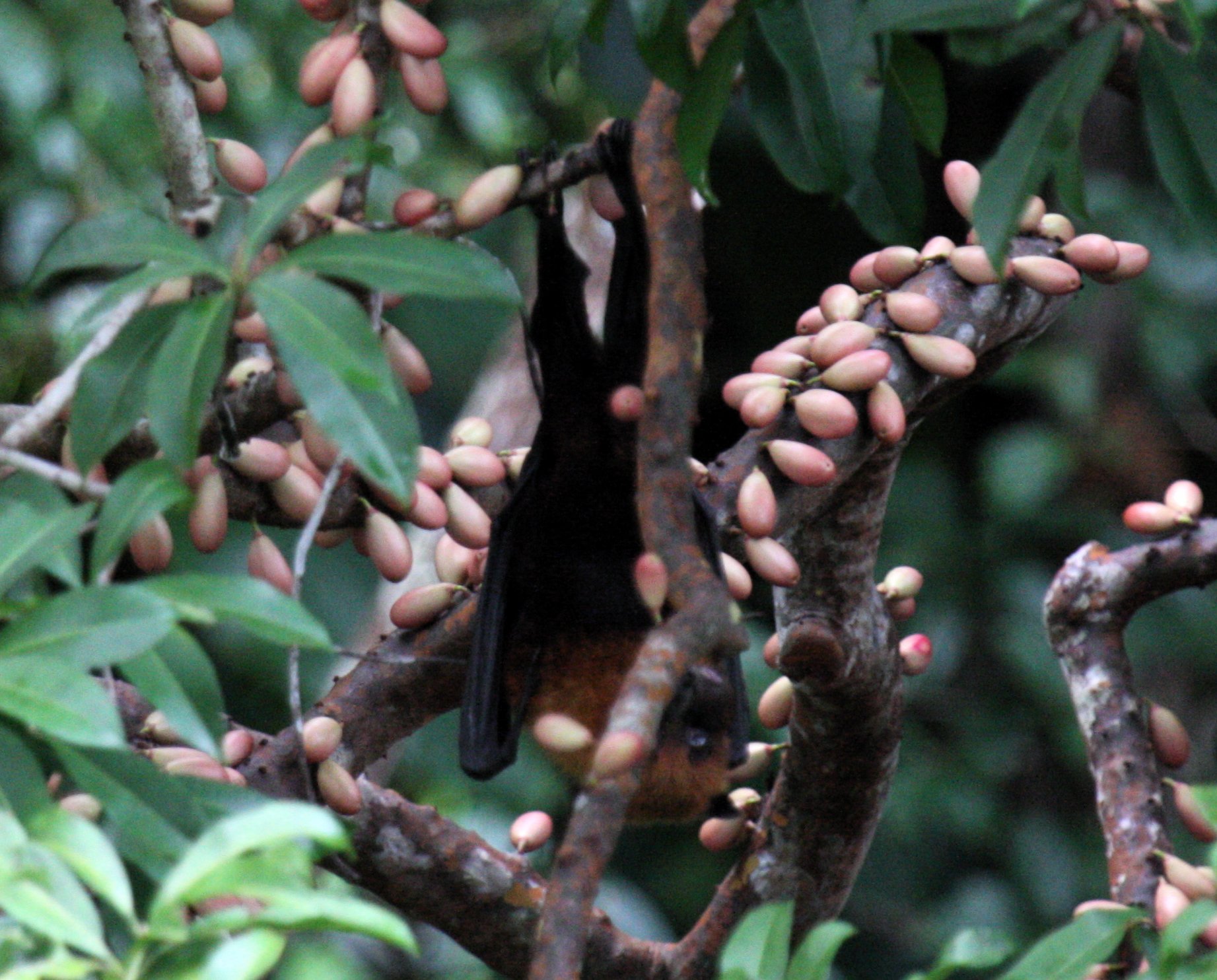
Moluccan flying fox. Image credit: Kai Bansner, Creative Commons
Most of the lowland forest has been converted to agriculture or secondary vegetation, with some remnant pockets still standing in sacred forests around Waedanga and Waenebu. Lowland savannas are maintained, in part, by repeated burning. Stands of mangrove hug the coast. Commercial logging of the lowland and foothill forests was intensive several decades ago, but the mid-elevation and montane forest continues to being degraded through selective logging that is punching roads into larger blocks of forest and removing larger trees that are important for forest regeneration. These road cause erosion and landslips, clogging freshwater streams. Access roads also facilitate settlers and swidden farming in formerly intact areas, and make it easier for hunters to get into the highlands. Logging roads are also routes for invasive rats that prey on native birds, reptiles, and invertebrates.
The largest block of remaining natural habitat is centered on the northwest highlands of Gunung Kepala Madang. The second largest block of contiguous habitat runs along the southeastern range, which is lower in elevation. The latter block has many incursions from logging, agriculture, and settlement presently. The northwest highlands have experienced large areas of deforestation on the southern slopes and eastern extension of the range, much caused by agricultural clearing and settlement after selective logging.
Buru’s protected area status remains confused. IUCN Protected Planet database denotes only a single protected area in the east of the southern range, the 65.5 km2 Masbait Wildlife Reserve. Two protected areas, Gunung Kelpat Muda (1,380 km2 in the northwest highlands) and Waeapo (50 km²) are mentioned by Wikramanayake et al. (2001), but these have not made their way into international protected area databases and their status remains uncertain. Five Key Biodiversity Areas have been identified in the Critical Ecosystem Partnership Fund Wallacea Biodiversity Hotspot Ecosystem Profile process: Gunung Kelpat Madang (‘Kelapatmada;, the NW highlands); Danau Rana (the central northern highlands); Leksula (the western sector of the southern range); Waemala (pockets of habitat on the SW coast, karst); and Teluk Kayeli (Buru’s largest mangrove).
Given the uncertain protection of the remaining natural habitat and the ongoing expansion of selective logging, swidden agriculture, and settlement, key conservation actions are to: 1) officially gazette and effectively manage sizeable protected areas in the northern highlands and southern ranges, with considerable mid-elevation forest included; 2) provide strict protection of babirusa and larger birds, such as Wallace’s megapode, and larger fruit bats (the international wildlife trade targets rare, endemic birds and reptiles/amphibians, making Buru a prime spot for illegal trafficking of wildlife); and 3) find solutions to curtail logging, as the island and remaining habitats are simply not large enough to sustain logging and its negative impacts on the fragile montane forests and biotas.
Citations
- BirdLife International. 2018. Endemic Bird Areas factsheet: Buru. Downloaded from http://www.birdlife.org on 14/04/2018.
- CEPF. 2015. Wallacea Biodiversity Hotspot Ecosystem Profile. Critical Ecosystem Partnership Fund, Washington DC. 353 pp.
- Hill, JK, KC Hamer, LA Lace, WMT Banham. 1995. Effects of selective logging on tropical forest butterflies on Buru, Indonesia. Journal of Applied Ecology 32:754-760

Subscribe to receive monthly updates on climate solutions, environmental heroes, and the profound beauty and wonder of our shared planet Earth.
