
Caqueta Moist Forests
The ecoregion’s land area is provided in units of 1,000 hectares. The conservation target is the Global Safety Net (GSN1) area for the given ecoregion. The protection level indicates the percentage of the GSN goal that is currently protected on a scale of 0-10. N/A means data is not available at this time.
Bioregion: Central Amazonian Forests (NT19)
Realm: Southern America
Ecoregion Size (1000 ha):
18,459
Ecoregion ID:
446
Conservation Target:
91%
Protection Level:
4
States: Colombia, Brazil
Currently listed as Vulnerable by the IUCN, the white-lipped peccary once occurred throughout Central and South America, moving through the forest to follow fruiting patterns of tree species in groups of up to 500 individuals. However, most of these huge herds have become broken apart as their population suffers from habitat degradation and fragmentation.
Both seed predator and seed disperser, the peccary is extremely important in maintaining the Caquetá Moist Forests and other rainforest ecosystems by maintaining tree species turnover in the long term. They also excavate (till) the leaf litter with their noses, looking for grubs and other food and, in doing so, turning over the leaves and roots to improve litter decomposition and aeration of the soil.
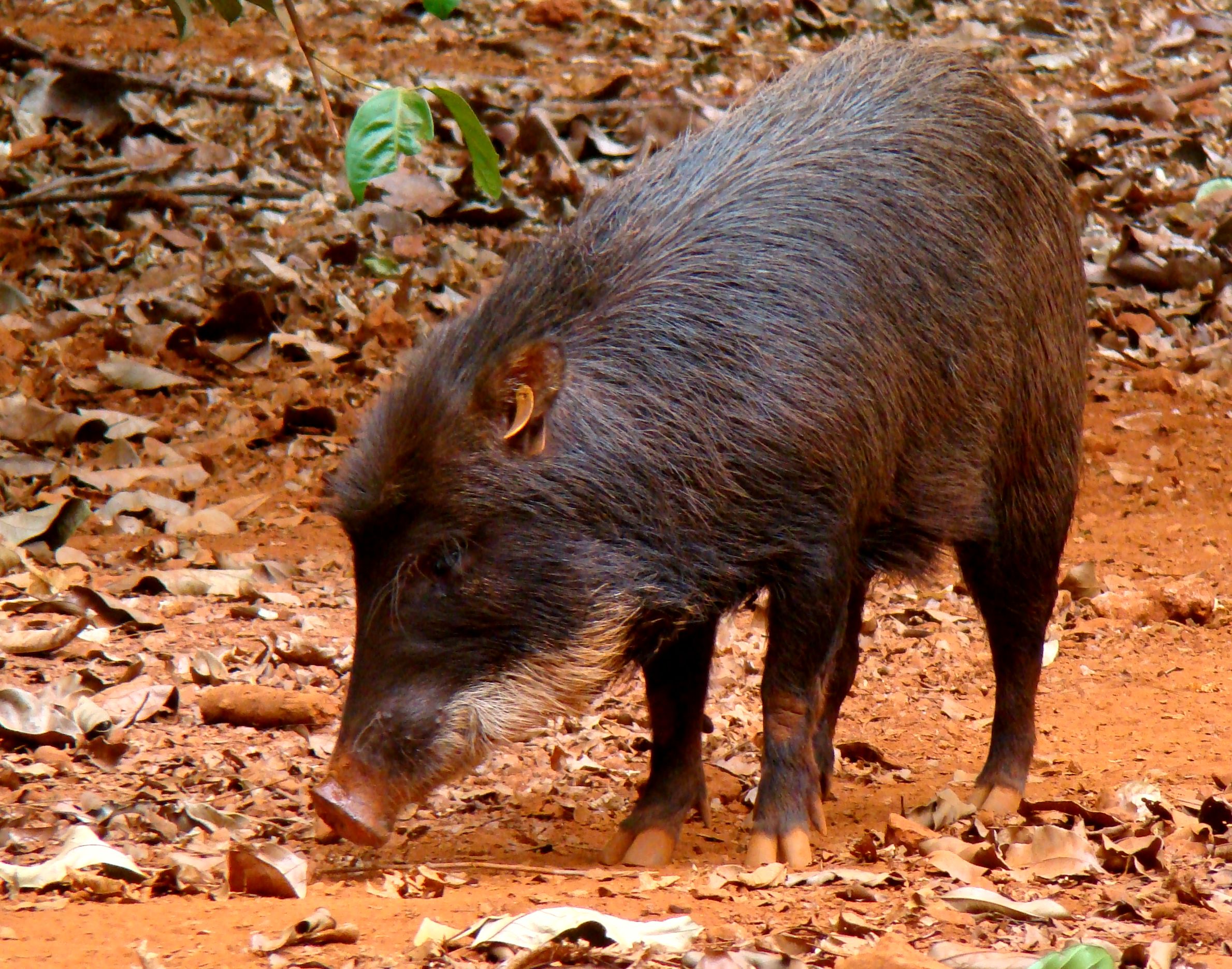
The flagship species of the Caqueta Moist Forests ecoregion is the white-lipped peccary (Tayassu pecari). Image credit: Que bicho é esse, Creative Commons
The Caquetá Moist Forest occurs in the Colombian Amazon. It is bound on the northeast by the Guainía, Guaviare, and Guayabero Rivers and on the western extreme by the small Rio Losada, south of the Serranía de la Macarena. The southern border of the region extends southeast from the headwaters of the Rio Caguan, which then converges with the Caquetá. The region extends east into Brazil.
The Caquetá Moist Forest is a transitional area between the floristic provinces of the Amazon Basin forests and the western Guayana Shield region. There are three structural types of forest found here. High forest is found on well-drained soils with a canopy height of 24 m and basal area of 32 m2/ha. The low forest is on poorly drained soils with a canopy of 10 m and a 17 m2/ha basal area. Permanent swamp forest is on poorly-drained soils dominated by palms such as moriche, with a canopy of 18 m and basal area of 27 m2/ha.
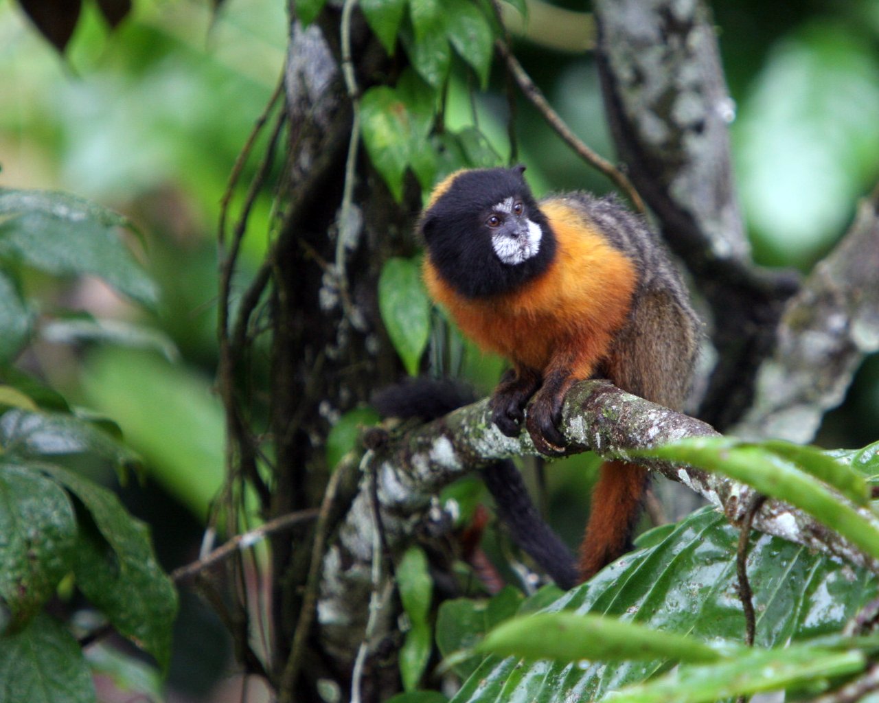
Golden-mantled tamarin. Image credit: lowjumpingfrog, Creative Commons
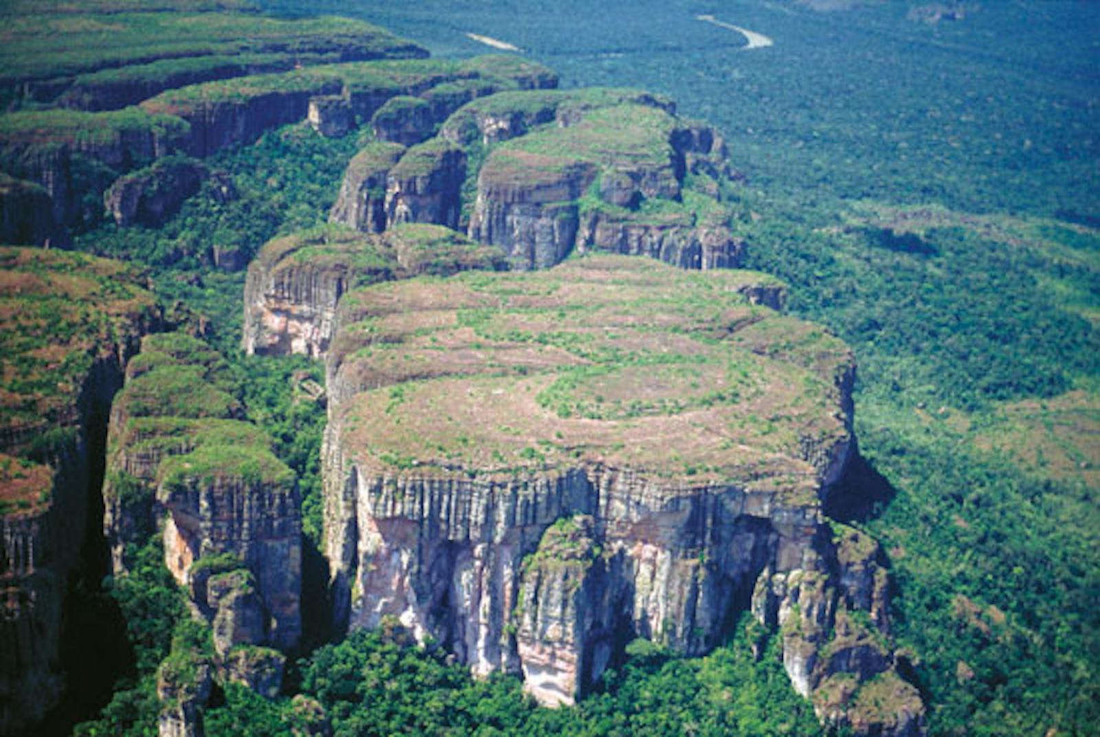
The first two types are characterized by the absence of dominant species or very high alpha diversity. The most important tree families are Leguminosae, Sapotaceae, Lauraceae, Chrysobalanaceae, Moraceae, and Lecythidaceae. Fifteen floral community types have been identified here, reflecting different drainage patterns, soil nutrients, and the influence of floods. Sierra de Chiribiquete, situated in the center of this ecoregion, has a plateau environment. Reaching up to 840 m, this landscape includes open dry vegetation, low forest, medium canopy forest, and savannah. The vegetation has the closest affinity to the Amazon region and secondly to the central Guayana region. The most common vascular plant families are Rubiaceae, Melastomataceae, Orchidaceae, Bromeliaceae, and Cyperaceae.
Among the 469 bird species found here, the Chiribiquete emerald and grey-legged tinamou are both endemic. Mammal diversity is high, with 189 species. Larger mammals include tapir, collared peccary, white-lipped peccary, and 13 primate species, including the night monkey, white-faced saki, and the endemic mottle-faced tamarin. Reptiles and amphibians are abundant, including the yellow-footed tortoise, iguana, tegus lizard, and different species of snakes, such as fer-de-lance, palm pit-viper, boa constrictor, coral, and bushmaster.
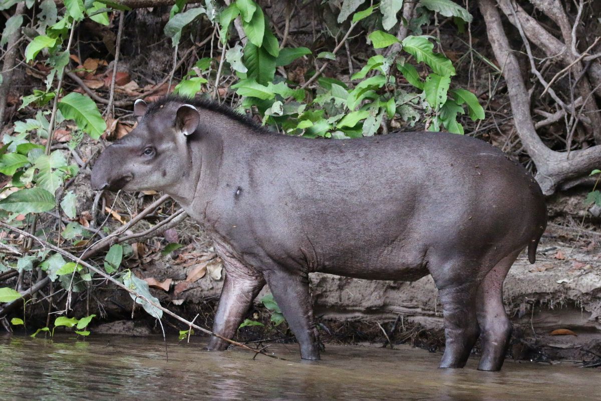
South American tapir. Image credit: Sharp Photography, Creative Commons
Large-scale cattle ranching in the western extreme of this ecoregion at the headwaters of the Vaupés River has resulted in the clearing of vast expanses of forest. A large triangle of deforestation has occurred, fanning out from the San Jose-Calamar road south of the Rio Guayabero. In the interior of the region, small settlements of indigenous people have little impact on the natural habitat.
Conversely, spreading populations from the city and suburban areas are now migrating down the Rio Negro, deforesting along the way for small-scale agriculture or cattle grazing. Large forested areas along the Vaupés and Apaporis Rivers are also falling to illegal coca production. The one protected area in this region is the 8,550 km2 Nukak Tuhahi National Reserve, in the central vicinity. The remaining intact forest is considered a threatened frontier forest that may eventually be degraded by ongoing human activity.
Deforestation for plantations and cattle pasture is the most severe threat to the natural rainforest habitat currently. Large quantities of ornamental fish, particularly arawana, are harvested for international trade, although the severity of this threat to potential species extinction remains unknown.
The priority conservation actions for the next decade will be to 1) strengthen the administration of national parks, especially Chiribiquete, 2) develop economic alternatives for coca production and cattle ranching for local communities, and 3) monitor and enforce against wildlife trafficking from the rivers and forests.
-
-
1. Sears, R. Marín, C. 2018. Northern South America: Southeastern Colombia into Brazil https://www.worldwildlife.org/ecoregions/nt0107 Accessed July 31, 2018.
2. Cortés-B., R.P. Franco-R., and J. O. Rangel-C. 1998. La flora vascular de La Sierra de Chiribiquete, Colombia. Caldasia 20: 103-141.
3. Duivenvoorden, J. F., and J. M. Lips. 1995. A Land-ecological Study of Soils, Vegetation and Plant Diversity in Colombian Amazonia. Wageningen, The Netherlands: The Tropenbos Foundation. -
Cite this page: Caqueta Moist Forests. Ecoregion Snapshots: Descriptive Abstracts of the Terrestrial Ecoregions of the World, 2021. Developed by One Earth and RESOLVE. https://www.oneearth.org/ecoregions/caqueta-moist-forests/
-

Subscribe to receive monthly updates on climate solutions, environmental heroes, and the profound beauty and wonder of our shared planet Earth.
