
Clipperton Island Shrub and Grasslands
The ecoregion’s land area is provided in units of 1,000 hectares. The protection goal is the Global Safety Net (GSN1) area for the given ecoregion. The protection level indicates the percentage of the GSN goal that is currently protected on a scale of 0-10.
Bioregion: Mexican Subtropical Islands (NT29)
Realm: Central America
Ecoregion Size (1000 ha):
3
Ecoregion ID:
568
Conservation Target:
0%
Protection Level:
N/A
States: France
The Clipperton land crab stands out both in its appearance and in sheer numbers; they are bright-orange and occur in the millions on their namesake island. Thanks to their large omnivorous population, historically recorded grassy and woody vegetation that once covered the Clipperton Island are no longer present after a tropical storm cleared the original vegetation and the crabs prevented its recovery. Today the crab eats mostly seaweed and other vegetation, but will opportunistically eat whatever organisms that have been washed ashore.
.JPG)
The flagship species of the Clipperton Island Shrub and Grasslands ecoregion is the Clipperton crab. Image credit: Creative Commons
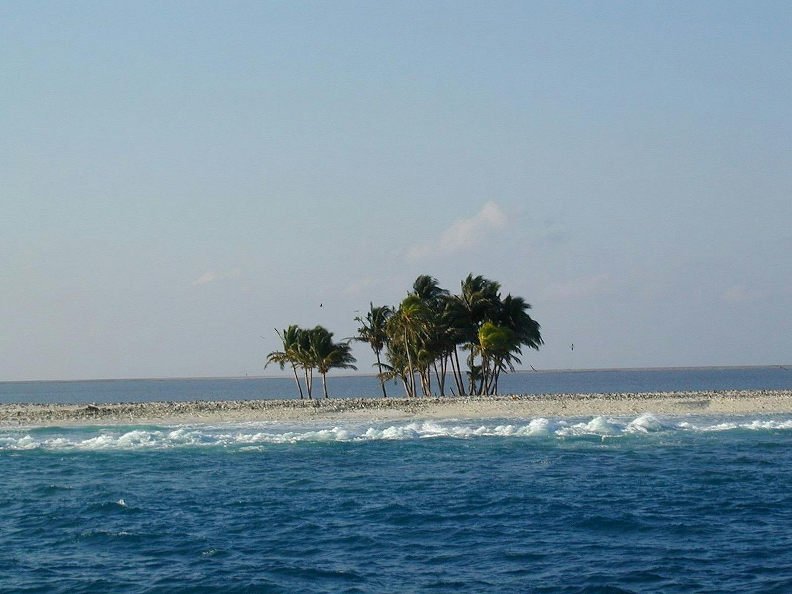
Clipperton Island, also referred to as “Ile de la Passion”, was named after a pirate and now falls under the jurisdiction of the Republic of French Polynesia. It is the only coral island in the eastern Pacific. Lying 965 km from Tejupan Point on Mancanilla Bay, Mexico it has a circular circumference of 8 km, completely enclosing a lagoon.
The island has a tropical climate, with average temperatures of 20–32°C and is subject to tropical storms. The vegetation is a sparse cover of spiny grass and low thickets, a creeping plant (Ipomoea), and stands of coconut palm. It is believed most of the current vegetation was introduced by humans, and possibly two sedges are native: salt heliotrope and common purslane.
The most common plants are spiny sandbar grass, Paddy's lucerne herb, and jute herb. They are intermixed with a taller species like the black mustard seed. The vegetation has been observed in parallel rows, alternating between dense taller plants and lower open species. It is assumed this resulted from previous mining efforts digging trenches throughout the landscape for phosphate.
Thousands of seabirds and millions of land crabs live here. Breeding seabirds (all listed as Least Concern by the IUCN) include white tern, masked booby, sooty tern, brown booby, brown noddy, black noddy, and great frigatebird. Ducks are reportedly common in the lagoon and migratory landbirds rest on Clipperton during winter trips to the southern hemisphere. Terrestrial fauna include a lizard (Emoia cyanura).
Clipperton is positioned at the edge of the Eastern Pacific Barrier, which is the world's largest deepwater barrier for the dispersal of marine shore organisms. It is an area with unusual assemblages of both Indo-Pacific and Panamic plant and animal species. It is possible that Clipperton is an important stepping stone for the connection between the two bioregions.
The abundant seabird excrement found throughout the island contains high levels of phosphate that could be processed into fertilizer. The mining of this natural resource, guano, began on the island in the late-1800’s, and in 1906 a settlement was even built specifically. In the late 19th century pigs were introduced to the island but were all removed by 1958 due to the significant damage they have done to vegetation, crabs, and the nesting bird species.
In the present, the island is no longer inhabited by human settlement and is considered one of the least disturbed systems in the Pacific. Despite many proposals, there is no current legal form of protection for the island.
The island is now visited primarily by the French Navy, infrequent scientific expeditions, and US tuna fishermen who may occasionally come ashore. In general, access to the island is difficult due to dangerous ocean swells. However, a 1994 research expedition recorded numerous abandoned boat anchors directly offshore and several tuna boats and yachts in nearby waters. There was a proposal for port construction on the lagoon, but it was dropped. Meteorological stations have operated on the island, and there is potential for the construction of a satellite observation post, which may result in further disturbance.
The priority conservation actions for the next decade are to: 1) pursue legal protection for the island as a scientific research site; 2) implement the proposed 2016 MPA around the island to restrict fisherman presence; and 3) remove non-native plant species, such as the coconut palm.
Citations
1. Trowbridge, L. 2018. Eastern Pacific Ocean, southeast of Mexico. https://www.worldwildlife.org/ecoregions/nt0705 Accessed November 27, 2018.
2. Sachet, M.H. 1962. Flora and vegetation of Clipperton Island. Proceedings of the California Academy of Sciences. 4th ser, v. 31, no. 10. The Academy, San Francisco.
3. UNEP/IUCN. 1988. Coral reefs of the world. Volume 3: Central and Western Pacific. UNEP Regional Seas Directories and Bibliographies. IUCN/UNEP, Gland, Switzerland, Cambridge, UK, and Nairobi, Kenya.

Subscribe to receive monthly updates on climate solutions, environmental heroes, and the profound beauty and wonder of our shared planet Earth.
