.png?auto=compress%2Cformat&w=300)
European Atlantic Mixed Forests
The ecoregion’s land area is provided in units of 1,000 hectares. The conservation target is the Global Safety Net (GSN1) area for the given ecoregion. The protection level indicates the percentage of the GSN goal that is currently protected on a scale of 0-10. N/A means data is not available at this time.
Bioregion: West European Coastal Mixed Forests (PA10)
Realm: Western Eurasia
Ecoregion Size (1000 ha):
38,614
Ecoregion ID:
664
Conservation Target:
28%
Protection Level:
7
States: France, Germany, Netherlands, Belgium, Denmark, Jersey, Belgium, Guernsey
A defining feature of this ecoregion are the far-reaching, uninterrupted coastal sand dunes, found harboring highly adapted plant communities. The Atlantic shoreline of southwestern France accommodates the longest coastal sand dune in Europe; approximately 240 km long. The sand belt separates the ocean from large coniferous forests, which are often planted to bind the sand and prevent dune drift. Rich in plant life, they are home to eleven endemics including Hieracium eriophorum (Asteraceae), a perennial herb with a dense hair cover that are adapted to a sand dune environment.
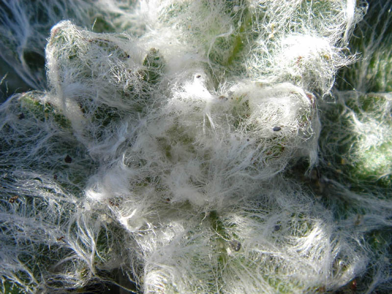
The flagship species of the European Atlantic Mixed Forests ecoregion is the Hieracium eriophorum. Image credit: Creative Commons
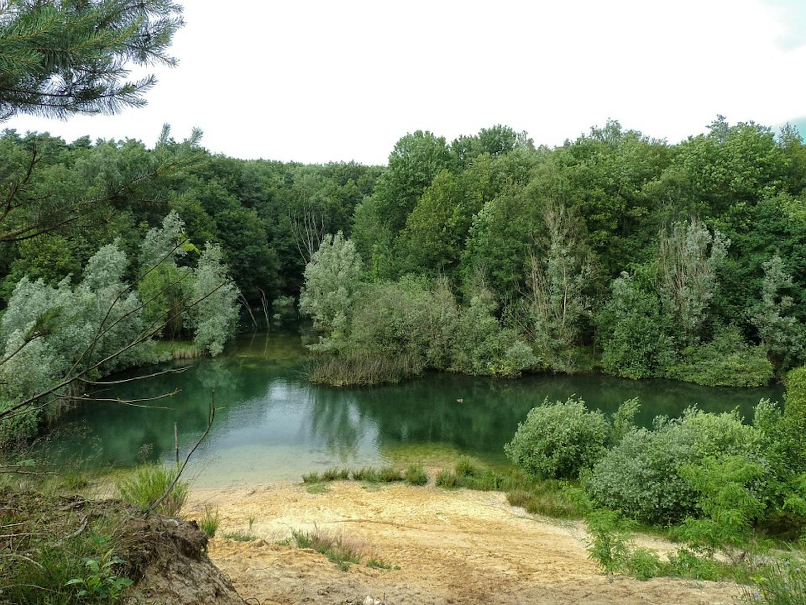
This ecoregion is located at the western coast of the Eurasian continent, extending from the south of France up to the northern most tip of Denmark. Long-term human activities have wiped out most evident signs of natural forests, so it is difficult to establish a definitive biogeographic boundary. The area is composed of flat lowlands except for the hills of Brittany. The climate is strongly influenced by the gulf stream bringing both warm and humid air from the Atlantic. Mean annual temperatures are between 9° and 12°C from north to south, and annual precipitation ranges from 700 to 1,000 mm.
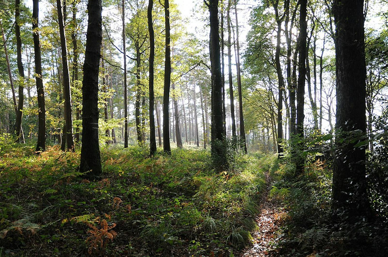
Several mixed oak forests are also found in the ecoregion and on the coastline, heathlands, adapted to local ecological conditions of wind and sea spray occur. In general, heathlands have replaced natural forests. Many forests are planted with Scots pine (and maritime pine further south) mainly on poor sandy soils.
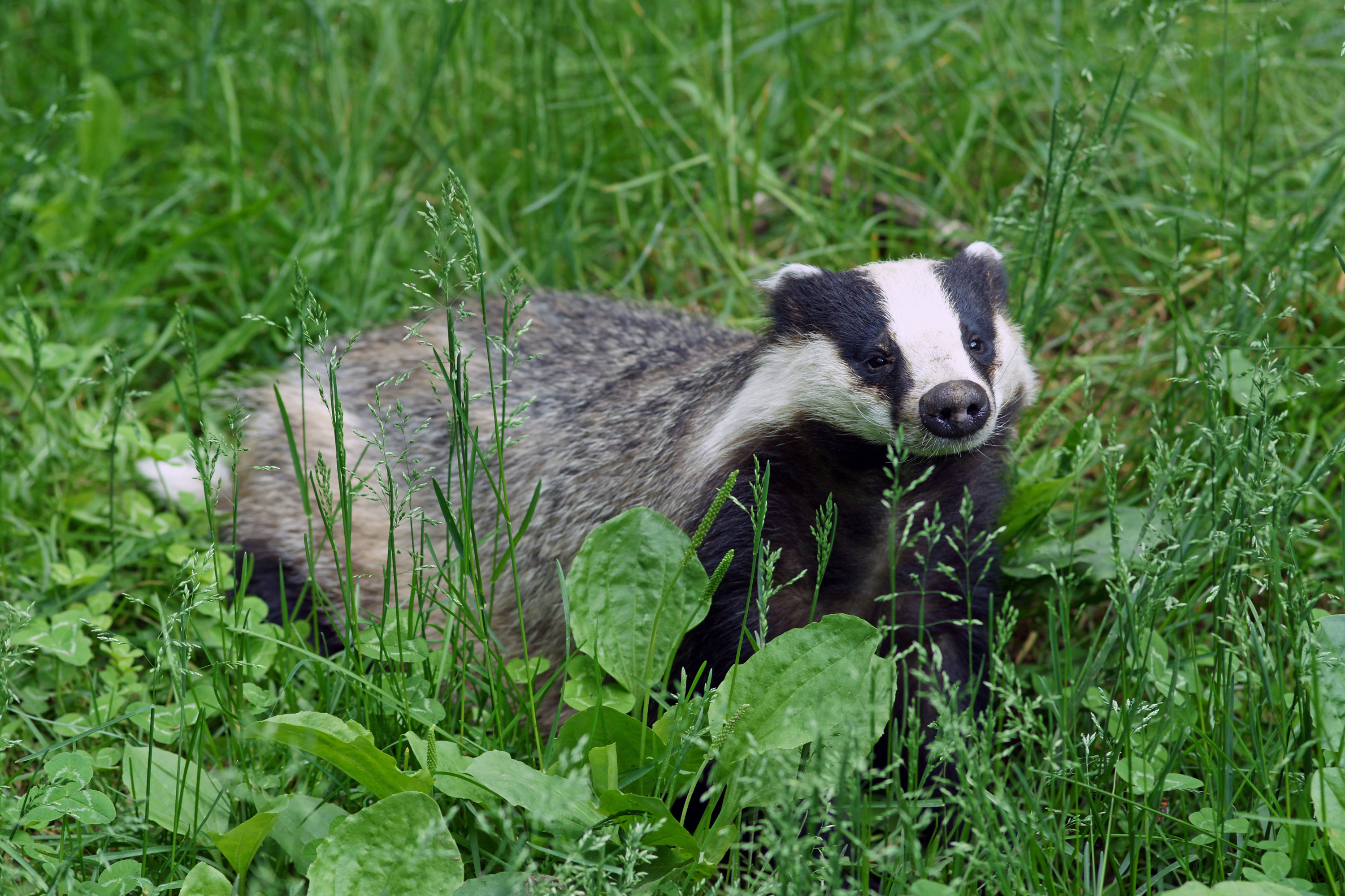
European badger. Image credit: Creative Commons
Large numbers and a high diversity of bird species use this ecoregion when on migration; sheltering in coastal vegetation before and after crossing the sea. Notable species of birds in this ecoregion include wryneck, red backed shrike, black grouse, Savi's warbler, and great reed warbler.
The mammal fauna of the ecoregion is mostly composed of species widespread throughout Europe: red deer, fallow deer, European roe deer, badger, stone marten, and pine marten. Several of the mammals found in the ecoregion are listed on the IUCN Red List, including the near threatened Eurasian otter, the critically endangered European mink, and several species of bat (Mediterranean horseshoe bat, Western barbastelle, and Bechstein’s myotis).
Only fragments of natural vegetation remain in this ecoregion, as most of the area was converted long ago into intensive agriculture (barley, wheat, sugar beets, and corn) or pasture. These agricultural lands include some of the most productive soils of western Europe.
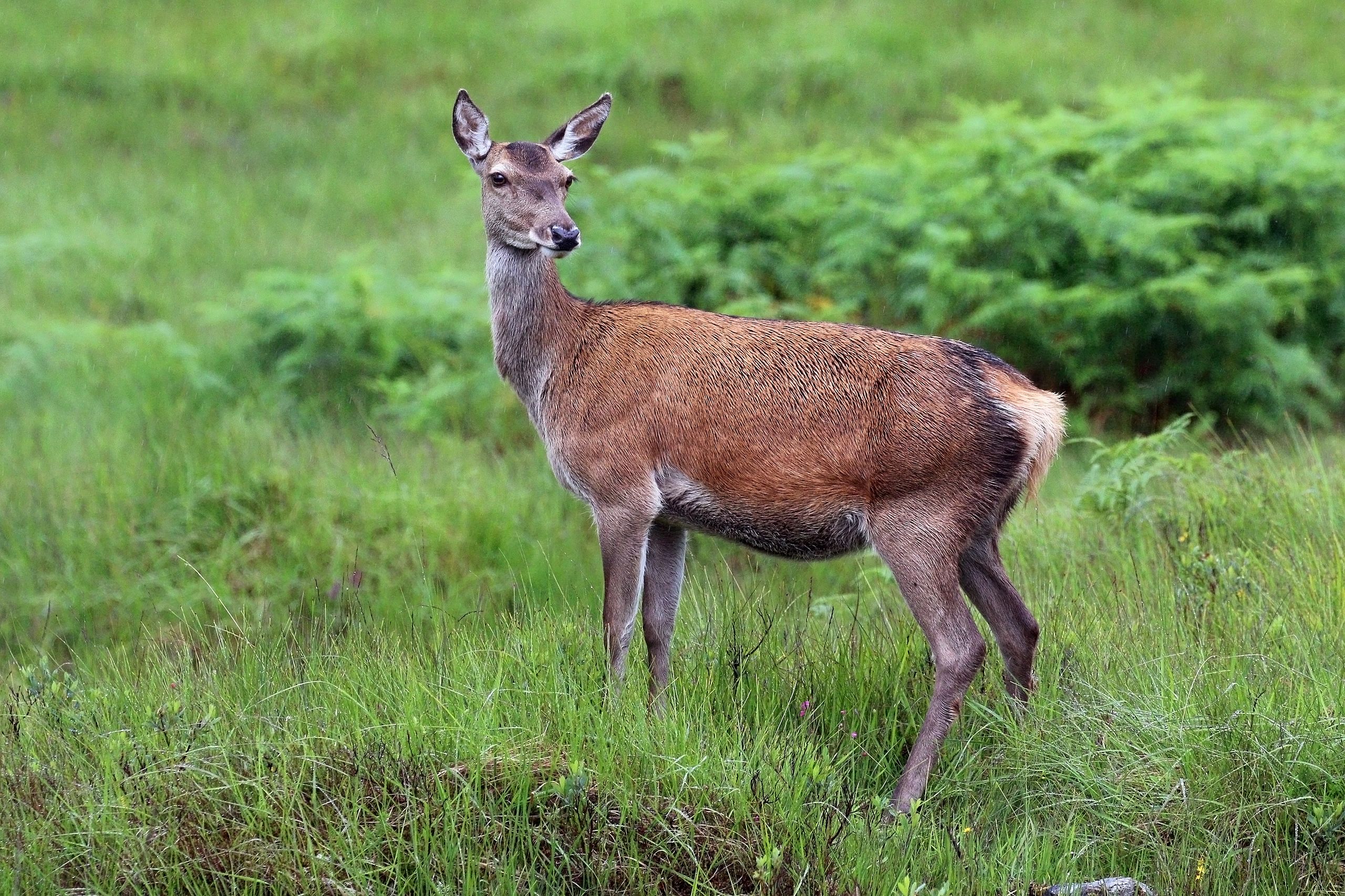
Female red deer. Image credit: Charles J Sharp, Creative Commons
There are several Important Bird Areas (IBAs) in the ecoregion: the Wadden Sea and Voordelta of the Netherlands, Baie de Quiberon and Archipel de Molène of France, Nissum Fjord and Ringkobing Fjord of Denmark, and the Lower Rhine area in Germany. Several special protection areas under the Birds Directive are found here, including the Basses Vallées du Cotentin et Baie des Veys in France serves and the Waddenzee Area in The Netherlands.
Agricultural expansion and intensification are the most serious threats affecting IBAs across Europe. Additionally, urbanization and industrialization accompanied by the pollution of air, water, and soil brings increased problems. Rivers bring large amounts of sediment, nutrients and pollution from their intensively used catchment areas into the coastal marine area, for example the Wadden Sea. Recreation and tourism, unsustainable exploitation, land reclamation and fragmentation, agricultural abandonment, and disturbance of wildlife are other major threats.
The priority conservation actions for the next decade will be to: 1) undertake afforestation on heath and dune landscapes; 2) stimulate sustainable agricultural production and facilitate nature management, prioritizing areas of high biodiversity; and 3) establish wetlands in agricultural areas to reduce the leaching of nutrients into the aquatic environment.
Citations
- European Environment Agency. 2002. Europe’s biodiversity – biogeographical regions and Seas. The Atlantic region. [Online]. [Accessed 7 April 2019]. Available from: https://www.eea.europa.eu/publications/report_2002_0524_154909
- The Danish Government. 2014. Danish Nature Policy. Our Shared Nature. [Online]. [Accessed 8 April 2019]. Available from: https://www.cbd.int/doc/world/dk/dk-nbsap-v2-en.pdf
- Frey, D., Arrigo, N., Granereau, G., Sarr, A., Felber, F. and Kozlowski, G. 2016. Parallel declines in species and genetic diversity driven by anthropogenic disturbance: a multispecies approach in a French Atlantic dune system. Evolutionary applications, 9(3), pp.479-488.

Subscribe to receive monthly updates on climate solutions, environmental heroes, and the profound beauty and wonder of our shared planet Earth.
