
Juruá-Purus Moist Forests
The ecoregion’s land area is provided in units of 1,000 hectares. The conservation target is the Global Safety Net (GSN1) area for the given ecoregion. The protection level indicates the percentage of the GSN goal that is currently protected on a scale of 0-10. N/A means data is not available at this time.
Bioregion: Central Amazonian Forests (NT19)
Realm: Southern America
Ecoregion Size (1000 ha):
24,309
Ecoregion ID:
474
Conservation Target:
98%
Protection Level:
4
States: Brazil
The Juruá-Purus Moist Forests ecoregion is mostly covered with evergreen tropical rain forests with dense high canopy. This area lies entirely along the Amazon River basin, and the terrain consists of flat forested plains dissected by large rivers and thousands of tiny streams, all of which flood annually. In the trees overhanging the water is where the endangered wattled curassow is often found. Here they forage in small groups for insects, fruit, and even small fish along the riverbanks. These large semi-terrestrial birds have conspicuous red “wattles” on their upper and low beak, which stand out against their otherwise dark plumage.
_resized.jpg)
The flagship species of the Juruá-Purus Moist Forests ecoregion is the wattled curassow. Image credit: Josh More, Creative Commons
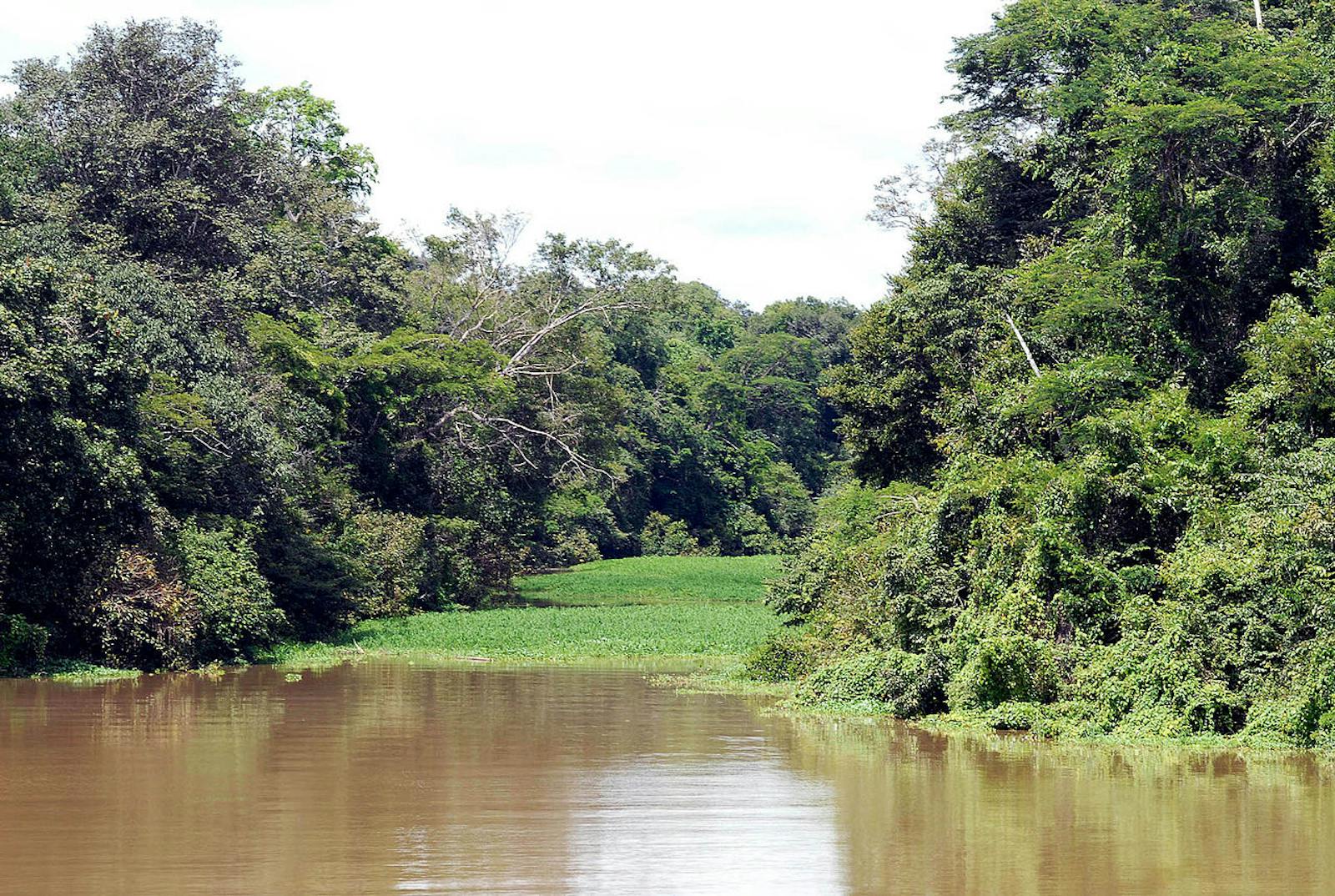
The Juruá-Purus Moist Forests ecoregion covers the valleys between the westernmost Amazon River to the Purus River. The southwestern limit is before the lowest elevations of the Carauari Arch. The ecoregion lies entirely on the low Amazon basin made up of soft sediments. Because these abundant rivers drain the relatively young and erodable lowland basin, they carry a load of suspended solids and are classified as whitewater rivers. This hot and humid tropical ecoregion receives, on average, between 2,500–3,500 mm of precipitation per year. The rain averages about 200–300 mm/month, with the driest month being July. Temperatures over the year average 26° to 27°C with negligible monthly variation.
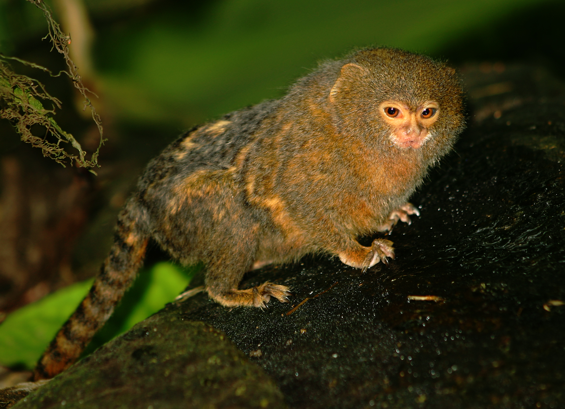
Pygmy Marmoset. Malene Thyssen, Creative Commons
The ecoregion is primarily evergreen tropical rain forests with dense high canopy, approximately 30 m in height, with emergent trees as high as 45 m. Most trees are of small diameter with very few stems growing to between 400 and 700 mm diameter, with only a few giants that have trunks up to 2,400 mm in diameter. The most important tree families in these forests are the legumes, evergreens, woody fruiting trees, fig trees, flowering trees, aromatic evergreens, and Nutmeg trees. Four palms are common here, one of them being the walking palm. The Jurua River basin represents the western limit to the natural occurrence of the Brazil nut tree.
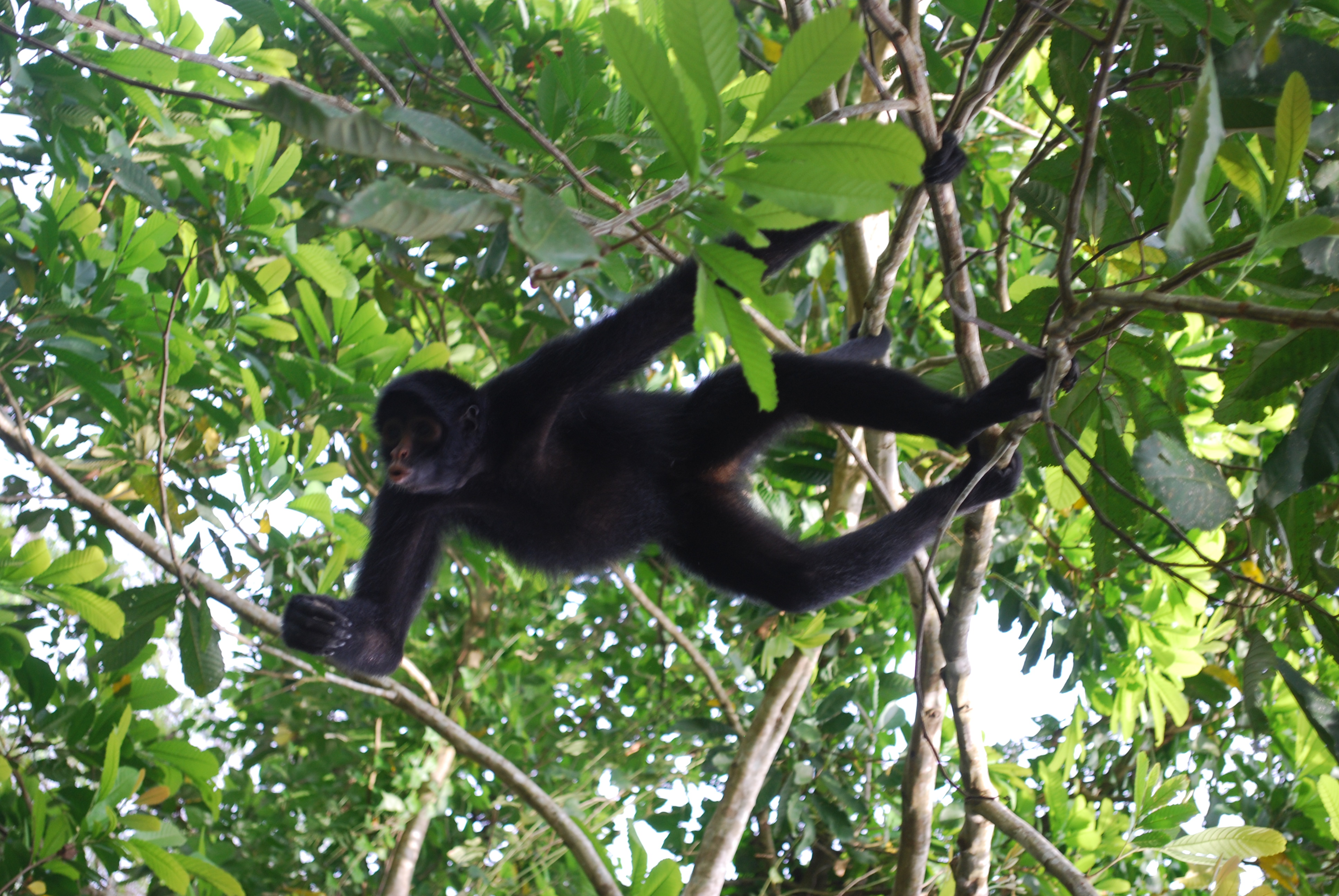
Peruvian spider monkey. Ivan Mlinaric, Creative Commons
The forests of this ecoregion have a super-high floristic diversity with tree richness of up to 250 species per hectare near Carauari. The diversity of members of the flowering tree family Sapotaceae is unequaled elsewhere in the Amazon lowlands, with 60 species present. There is a high diversity of timber species, with 15 commercial species identified in one area, occurring at low density.
The fauna is also very diverse, with a high occurrence of endemism. Of the 171 mammals recorded for this ecoregion, nearly 120 have been recorded at a single site at the headwaters of the Urucu River. Vagrant mammals that travel between flooded and non-flooded forests include squirrel monkeys, brown pale-fronted capuchins, woolly monkeys, and collared peccaries. Other species do not traverse the rivers, which separate subspecies of some primates and insects.
The avifauna boasts 554 species with seasonal migrant birds such as toucans, large Amazon parrots, and macaws, and locals including tanagers, woodcreepers, pavonine quetzals, curassows, and tinamous.
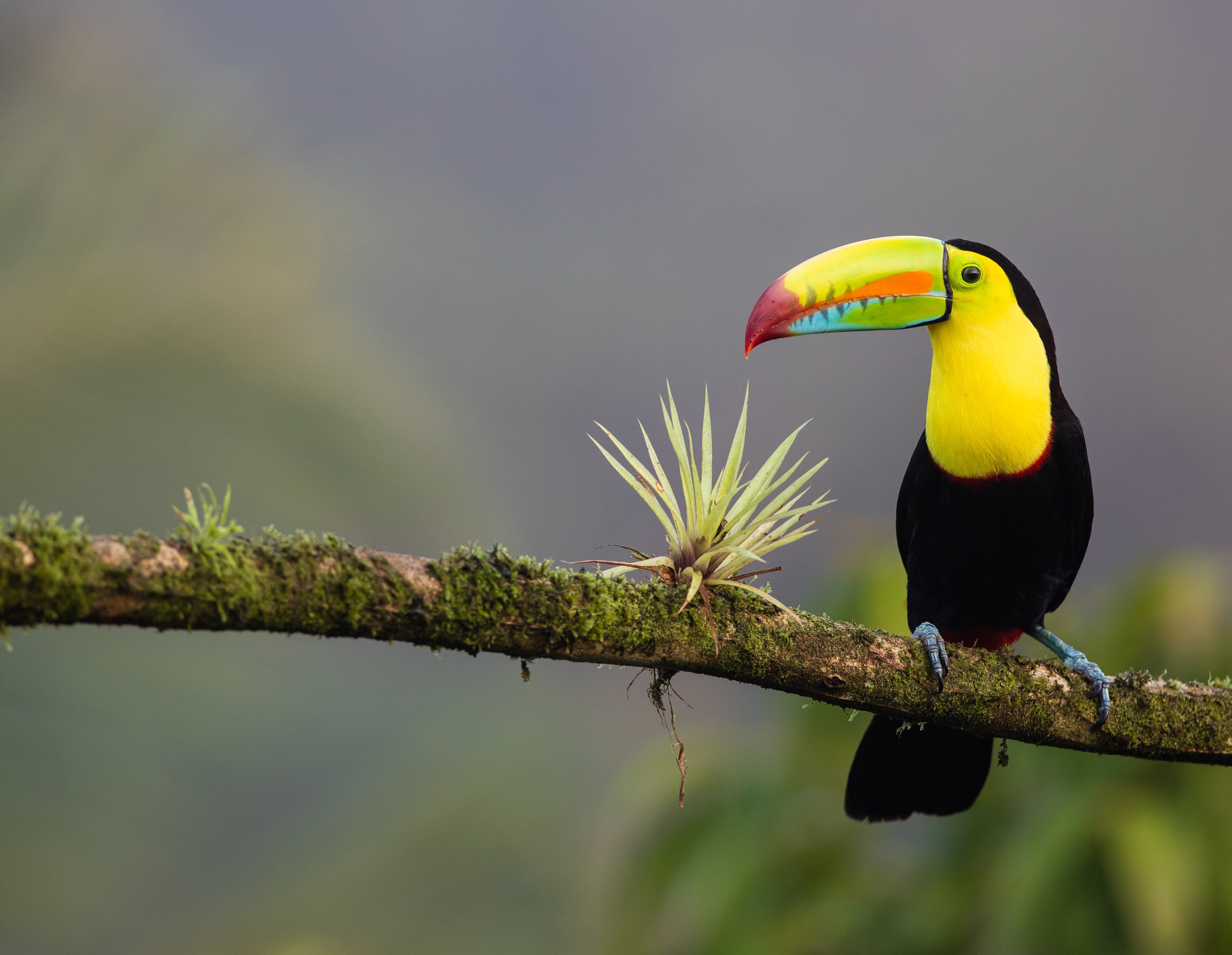
Toucan. Zdenek Machacek, Creative Commons
There are several protected areas within the ecoregion, including the Estação Ecológica De Jutaí-Solimões which expands nearly 3,000 square kilometers. The Trans-Amazon Highway also runs through this ecoregion and has resulted in extensive areas of land conversion, burning, and water pollution. The Brazilian company Petrobras had been prospecting for oil and natural gas in this ecoregion, regularly deforesting patches throughout the area. Near Tefé, a large patch of forest was removed for an experimental agriculture project, but it has returned to secondary forest.
Along the rivers, a few large urban centers and many small settlements of farmers have an impact on the forest environment. Presently, hunting and extractive logging put pressure on mammals such as tapir, peccaries, deer, and some primates, and several species of trees sought for timber. The expansion of small-scale cattle ranching also threatens the forest environment.
The priority conservation actions of the next decade are to 1) limit logging to subsistence use and promote reforestation, 2) promote sustainable farming practices, and 3) promote the practice of water treatment in upstream settlements.
-
-
1. Sears, R., 2018. South America: Amazon Basin, northwestern Brazil. https://www.worldwildlife.org/ecoregions/nt0133. 1 August 2018.
2. Peres, C. A. 1999. The structure of nonvolant mammal communities in different Amazonian forest types. Pages 564-581 in J. F. Eisenberg and K. H. Redford (editors), Mammals of the Neotropics: the Central Neotropics. Chicago: University of Chicago Press.
3. Silva, A.L.L. de, P.L.B. Lisboa, and U. N. Maciel. 1992. Diversidade florística e estructura em floresta densa da bacia do Rio Juruá-AM. Boletim do Museu Paraense Emílio Goeldi, Botânica 8: 203-258. -
Cite this page: Juruá-Purus Moist Forests. Ecoregion Snapshots: Descriptive Abstracts of the Terrestrial Ecoregions of the World, 2021. Developed by One Earth and RESOLVE. https://www.oneearth.org/ecoregions/jurua-purus-moist-forests/
-

Subscribe to receive monthly updates on climate solutions, environmental heroes, and the profound beauty and wonder of our shared planet Earth.
