
Mato Grosso Tropical Dry Forests
The ecoregion’s land area is provided in units of 1,000 hectares. The conservation target is the Global Safety Net (GSN1) area for the given ecoregion. The protection level indicates the percentage of the GSN goal that is currently protected on a scale of 0-10. N/A means data is not available at this time.
Bioregion: Southern Amazonian Forests (NT17)
Realm: Southern America
Ecoregion Size (1000 ha):
41,491
Ecoregion ID:
481
Conservation Target:
57%
Protection Level:
4
States: Brazil
The endangered white-cheeked spider monkey is native to the Mato Grosso Tropical Dry Forests ecoregion. These large primates are known for their dexterity, making use of their prehensile tail as an extra arm. Together with their nimble tail they can reach farther into the upper canopy to grab fruits, and their arms to swing and “brachiate” through the forest, which allows them to move very quickly from branch to branch. Their mobility also makes them a very important seed disperser. White-checked spider monkeys need large areas as fruiting trees can be seasonal and scattered across the forest, thus they are always on the move following learned canopy pathways to find food and other resources.
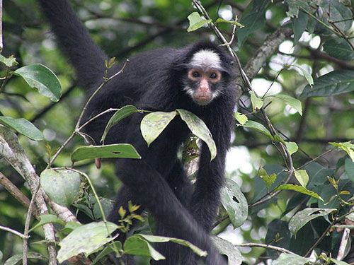
The flagship species of the Mato Grosso Tropical Dry Forests ecoregion is the white-cheeked spider monkey. Image credit: Creative Commons
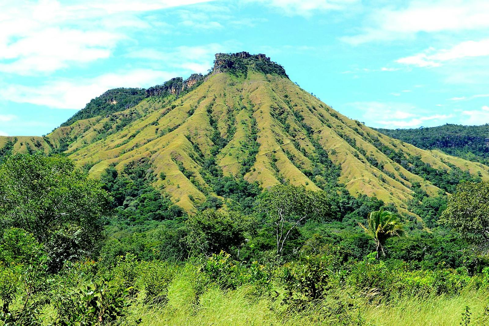
The Mato Grosso Tropical Dry Forests are in the Mato Grosso and Para provinces of central Brazil. This region is a transitional zone between the moist forests to the south and “cerrado” grassland savannas to the west. The ecoregion encompasses part of the Alto-Xingu, which constitutes the headwaters of the Xingu River. Mountains in the region include the Serra do Cachimbo, forming the northeastern arm, and the Serra dos Caiabis and Serra Formos forming the eastern arm of the region. The western Serras, or mountains, are well-drained savannas with 6-8 wet months a year.
The body of the ecoregion, including the patchy areas to the west, is tropical semi-evergreen season forest with 8-9 wet months a year and an average temperature of 23.5°C. During the flood season, from December to May, much of this area is under water and becomes a flooded forest/shrubland. These floods bring precious resources and nutrients to this region, and are essential in the lifecycles of many of its inhabitants.
The rest of the year is dry, and because the soil is porous, the wetlands and pools dry quickly to form massive flats and dry forest patches, as well as patches of savanna and moist forest. All together, these habitats blend to form a unique mosaic of forest, grass, and transitional habitat, all dependent on annual flooding cycles and periodic fires.
This ecoregion is found in a transitional area between the Amazon moist forest and the Planalto cerrado. The forests are not as lush as those found in the west, and the trees are relatively smaller, 10 to 15 m high. The flora includes forest species such as Bowdichia spp., Hymenaea spp., Machaerium spp., and Piptadenia incurialis. Some cerrado species include Curatella american (medicinal), Qualea spp. (timber), and Kielmeyera coriacea (medicinal). Serra do Cachimbo is composed of white sand, and has a large area of campo ruprestre, which is open vegetation occurring in rocky areas. It is unable to retain water and suffers drought despite the humid climate. Characteristic flora in this Serra includes Calea lutea and other desert vegetation.
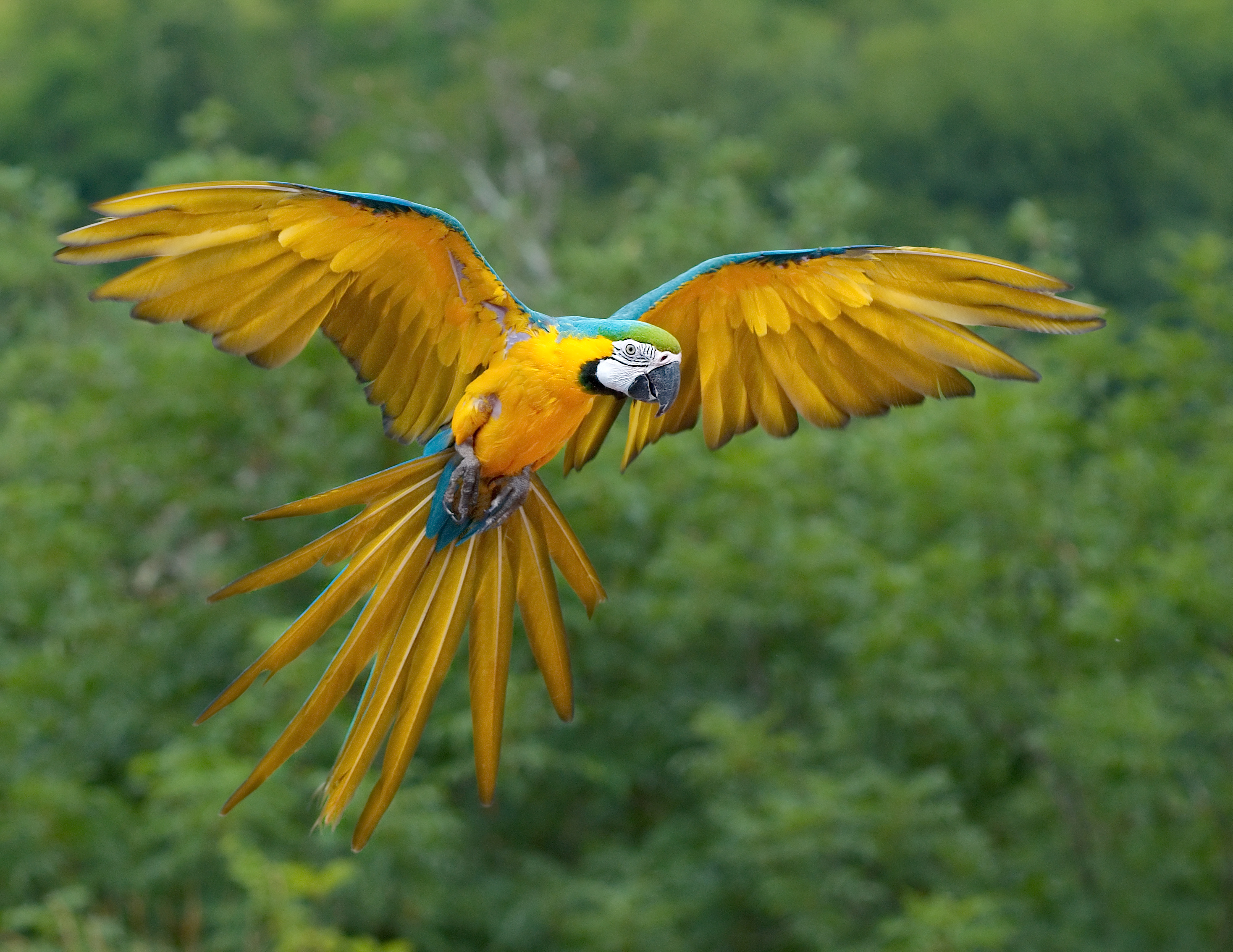
The strong seasonality and the range of habitat types in and around this ecoregion host diverse and abundant wildlife. There are 46 genera of rodents including the largest of all, the capybara, 52 genera of bats, 3 of marsupials, 11 edentates, and 161 birds; of which the Caatinga antwren has an isolated population in the Serra do Cachimbo. Endemism is high in both plants and animals, particularly among butterflies. An endemic reptile in the Serra do Cachimbo is Tropidurus insulanus, a ground lizard.
Blue and yellow macaw. Image credit: Luc Viatour, Creative Commons
One of the main protected areas in the region is Xingu National Park (26,420 km2). This is second largest National Park in Brazil, created in 1961 as an area of protection for indigenous tribes and as a natural reserve for fauna and flora. The Park contains various indigenous tribes who divided it into sixteen ethnic branches.
Some of the tribes of the upper Xingu are the Auetí, Meináco, Waurá, Kamaiura, Txikao, Trumái, Kalapalo, and Matipú.
The region was relatively isolated until the construction of the highway from Brazilia to Acre and the Cuiaba-Santarem Highway. The ever-increasing population in the area threatens the remaining natural habitats. Fast growing towns threaten even Xingu National Park. Gold mining and mercury pollution are severe threats. Mercury either ends up in the streams or as vapours that later fall with the rains as methyl mercury, a very toxic chemical. Other threats are the continuous expansion of agriculture and cattle ranching.
The priority conservation actions for the next decade are to: 1) install reclamation processes to offset damage from gold mining; 2) introduce Mercury Capture Systems to reduce pollution from gold shops; and 3) integrate natural resource management with agriculture and cattle ranching.
Citations
1. Locklin, C. 2018. South America: Brazil. https://www.worldwildlife.org/ecoregions/nt0140 Accessed July 25, 2018.
2. UNESCO. 1981. Vegetation Map of South America: explanitory notes. United Nations \ Educational, Scientific and Cultural Organization, Darantiere, France.
3. Villas Boas, O and C. Villas Boas. 1973. Xingu: The Indians, their Myths. K. S. Brecher, editor. Farrar, Straus and Giroux, N.Y.
4. Mittermeier, R.A., Boubli, J.-P. & Di Fiore, A. 2008. Ateles marginatus. The IUCN Red List of Threatened Species 2008: e.T2282A9390334. http://dx.doi.org/10.2305/IUCN.UK.2008.RLTS.T2282A9390334.en. Accessed July 25, 2018

Subscribe to receive monthly updates on climate solutions, environmental heroes, and the profound beauty and wonder of our shared planet Earth.
