
Mindanao Montane Rainforests
The ecoregion’s land area is provided in units of 1,000 hectares. The conservation target is the Global Safety Net (GSN1) area for the given ecoregion. The protection level indicates the percentage of the GSN goal that is currently protected on a scale of 0-10. N/A means data is not available at this time.
Bioregion: Philippines & Sulu Sea Tropical Forests (IM15)
Realm: Indomalaya
Ecoregion Size (1000 ha):
1,824
Ecoregion ID:
246
Conservation Target:
89%
Protection Level:
3
States: Philippines
The giant Philippine eagle, also known as the monkey-eating eagle, hunts in pairs. One acts as a decoy to distract monkeys and flying lemurs on the tall rainforest canopy, while the other swoops down on the excitable primates. This eagle ranks as one of the largest in the world, and is critically endangered. It is endemic to the islands of Luzon, Leyte, Samar, and Mindanao, and Mindanao harbors half the remaining population.
Recent genetic analyses shows that the Philippines eagle is unrelated to other large eagles, namely the harpy eagle of South America and the crowned eagle of Africa, and is in its own genus. But a similar hunting behavior has evolved independently among all these eagles in a process known as ‘convergent evolution’.

The flagship species of the Mindanao Montane Rainforests ecoregion is the giant Philippine eagle.
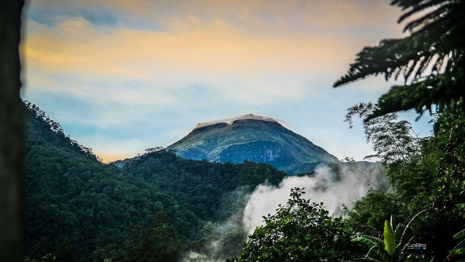
The Mindanao Montane Rainforests ecoregion covers the montane rainforests, above 1,000 m elevation, on Mindanao Island. The Philippines has a complex geologic history, with various tectonic movements, plate collisions and volcanic eruptions giving rise to the archipelago. Mindanao itself could be the result of the collision and fusion of the northwestern Palawan block with the eastern plate during the late Oligocene, about 25 million years ago. The climate is tropical. A July to November rainy season brings most of the 1,200 mm of rainfall. The average temperature hovers around 29°C with little annual variation.
The vegetation is primarily hill dipterocarp forests, with stunted, ‘elfin’ woodlands on the mountain summits. The hill forests have several canopy layers. The upper canopy trees are tall and big-buttressed, comprised of Shorea polysperma, S. mindanaensis, and Ficus spp. A forest dominated by the endemic Almaciga philippinensis occurs in the higher elevations, replacing Shorea as the dominant species. Other trees in this forest community include Agathis philippinensis, Cinnamomum mercadoi, Astronia cumingii, Ziziphus angustifolius, Lithocarpus philippinensis, L. mindanaensis and Mastixia premnoides.
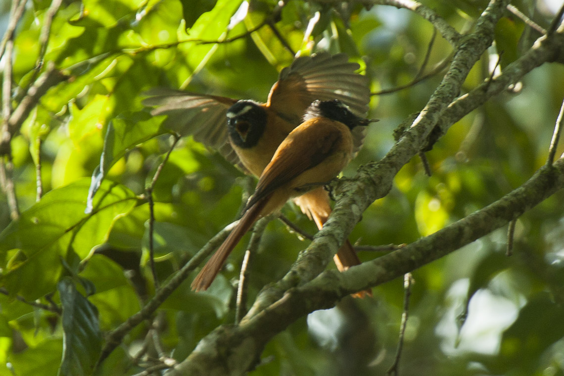
Black and cinnamon fantail. Image credit: Francesco Veronesi, Creative Commons
The upper montane forests are shorter, with a 35 m tall canopy and shrub layer. Cloud forests form above 1,700 to 2,000 m. Here, the trees are stunted and gnarled, shaped by wind and covered with mosses that weigh down branches. Prop roots adapt the trees to grow on steep slopes. The characteristic trees are Ascarina philippinensis, Xanthomyrtus diplycosifolium, Phyllocladus hypophyllus, Elaeocarpus calomala, and Dacrycarpus cumingii. A shrub layer with Rhododendron, Vaccinium, and Rubus grows below the canopy. Of the 21 species of pitcher plants Nepenthes in the Philippines, 13 are endemic to Mindanao.
Since the Pleistocene, the Mindanao faunal region has developed its own unique fauna, with several restricted to the higher elevations of the mountain ranges. For instance, the endemic Mindanao moonrat occurs only between 1,300 and 2,900 m along the mountain ranges. Most of the mammals are small species of moon rats, cloud rats, earthworm mice, and shrews. The ecoregion is within an Endemic Bird Area because of the restricted range bird species. The island also supports the second largest number of breeding bird species among the Philippine islands.
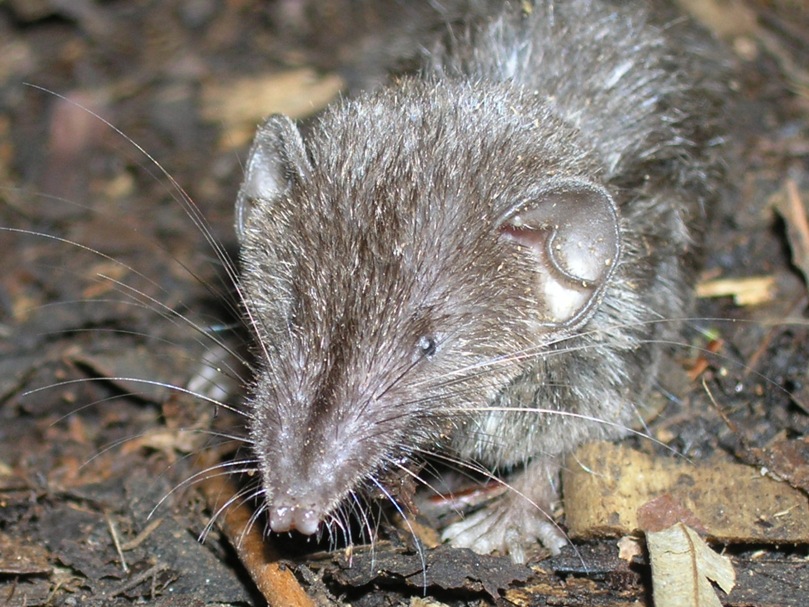
Common Mindanao shrew. Image credit: Creative Commons
About 25% of the ecoregion is protected, but the protected areas are under threat from illegal logging and conversion to other land use. Malaysian palm oil investors are now coming to Mindanao, which will result in large areas of remaining forests being cleared. Already, logging concessions have converted extensive forest areas, with consequent increases in floods and natural disasters. The 60% remaining forests is likely an overestimate, and includes rubber and other plantations.
Thus, the recommended priority conservation actions are to: 1) effectively manage the existing protected areas with engagement of local Moro communities; 2) include the unprotected Key Biodiversity Areas within a conservation network; and 3) conduct an ecosystem valuation of the montane forests and the role in flood and natural disaster prevention.
Citations
1. Philippine Biodiversity Strategy and Action Plan. 2015-2028. Department of Environment and Natural Resources. https://www.cbd.int/doc/world/ph/ph-nbsap-v3-en.pdf downloaded 16 March 16, 2018
2. Amoroso, C.B., Coritico, F.P. and Amoroso, V.B., 2013. Diversity and status of plants in three mountain ecosystems in southern Mindanao, Philippines. Asian Journal 0f Biodiversity, 3(1).
3. Wikramanayake, E, E. Dinerstein, et al. 2002. Terrestrial Ecoregions of the Indo-Pacific: A Conservation Assessment. Island Press.

Subscribe to receive monthly updates on climate solutions, environmental heroes, and the profound beauty and wonder of our shared planet Earth.
