
Northern Indochina Subtropical Forests
The ecoregion’s land area is provided in units of 1,000 hectares. The conservation target is the Global Safety Net (GSN1) area for the given ecoregion. The protection level indicates the percentage of the GSN goal that is currently protected on a scale of 0-10. N/A means data is not available at this time.
Bioregion: Irrawaddy & North Indochina Mixed Forests (IM11)
Realm: Indomalaya
Ecoregion Size (1000 ha):
43,797
Ecoregion ID:
256
Conservation Target:
39%
Protection Level:
2
States: China, Laos, Myanmar, Thailand, China
The Northern Indochina Subtropical Forests ecoregion straddles the intersection where the faunas of the northern Palearctic and the southern Indo-Malayan realms mix. In this ecotone, langurs from the south mix with red pandas from the north, and muntjac mingle with musk deer. It is also at the crossroads of the South Asian and East Asian floras, but includes species that have become trapped during the past turbulent geological events. They have now lost all taxonomic connections to their historical relations, and are thus considered evolutionary ‘relicts’.
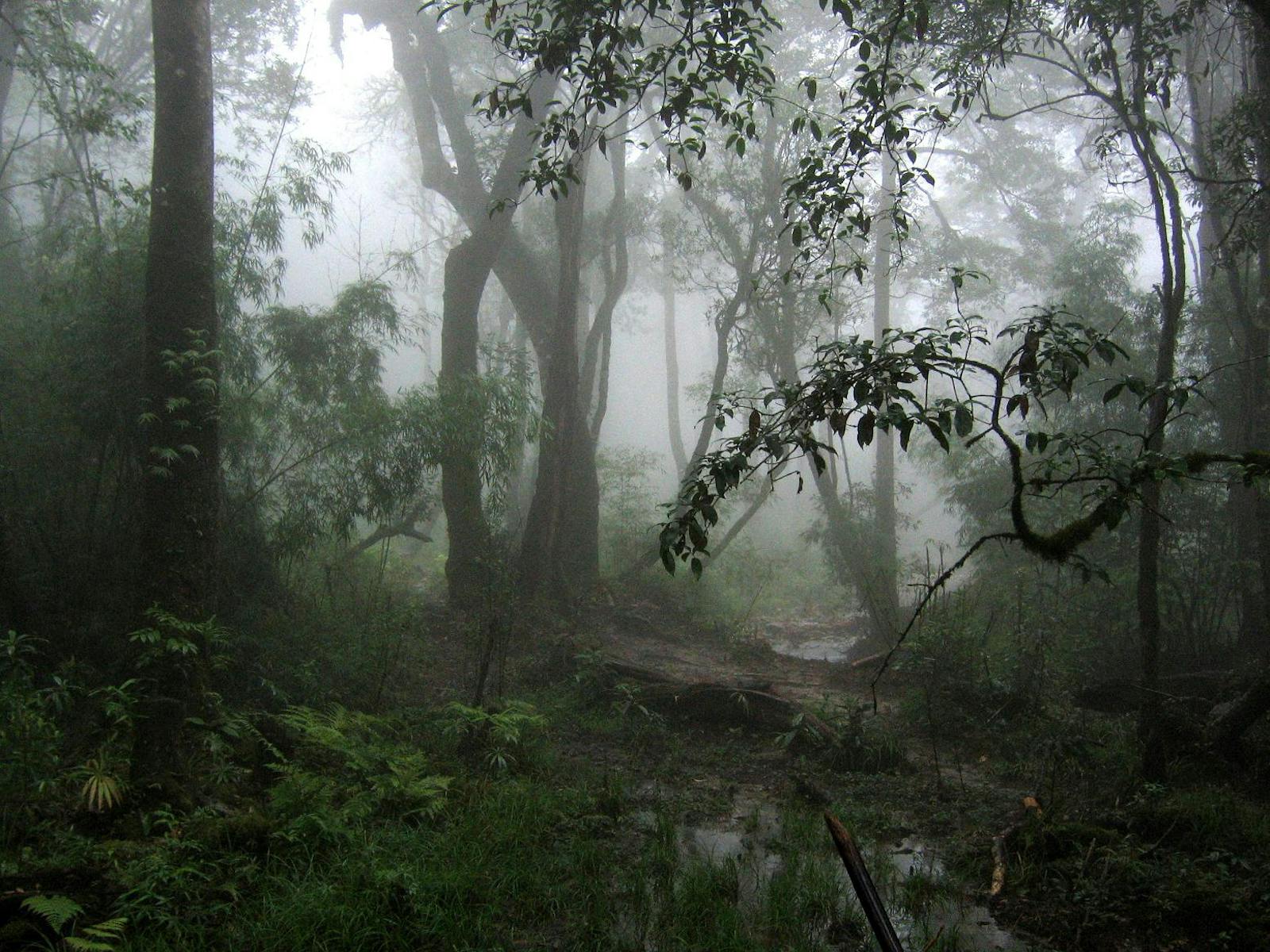
This vast ecoregion transcends five countries, covering the subtropical forests in the highlands of northern Myanmar, Laos, Vietnam, most of China’s Yunnan Province, and a sliver of northern Thailand. A highly incised and complex landscape of hills and river valleys extends south from the Yunnan Plateau into the middle catchments of the Red, Mekong, and Salween rivers. With the exception of a few peaks, the mountains seldom rise above 2,000 m, while the major river valleys descend to 200 to 400 m.

The flagship species of the Northern Indochina Subtropical Forests ecoregion is the Tonkin snub-nosed monkey. Image credit: Creative Commons
The climate is monsoonal, with 1,200 to 2,500 mm of annual rainfall, depending on the location and terrain that create complex rain shadows. The rain is fetched from the Bay of Bengal and the South China Sea during April to October. The temperature varies with elevation; the spring pre-monsoon period is the hottest time of the year, while January is the coldest.
The cool winter temperatures and high elevation at the edge of the tropical zone promotes a temperate montane flora with a distinct Himalayan component. In the lower elevations, the broadleaf forests, with a canopy rising to about 30 m, are represented by trees in the families of Betulaceae, Fagaceae, Hamamelidaceae, Lauraceae, Magnoliaceae, Sapotaceae, Elaeocarpaceae, and Theaceae. These species have Himalayan affinities and are also found in the montane evergreen forests further north in China.
At higher elevations, the montane evergreen forests take over to include several relict species. For example, the family Rhoipteleaceae is represented by a single species, Rhoiptelea chiliantha or horsetail tree, that is endemic to this ecoregion. Above 2,000 m, especially in the Fan Si Pan massif of northern Vietnam, the vegetation consists of a needle-leaf tree community of Tsuga dumosa (Hemlock) and Abies delavayi (Delavay's Fir), which is a unique forest in southeast Asia.
The fauna is rich. Over 180 mammal species are known from here, including globally important populations of the highly threatened Tonkin snub-nosed monkey and red panda. This ecoregion provides some hope to conserve the Indochinese tiger, which still holds on in northern Myanmar and Thailand. The bird fauna is even richer, with over 700 species, and includes several colorful and charismatic large birds, such as the Blyth’s tragopan, Temminck’s tragopan, ring-necked pheasant, Lady Amherst’s pheasant, blood pheasant, silver pheasant, Siamese fireback, plain-pouched hornbill, rufous-necked hornbill, and great hornbill.
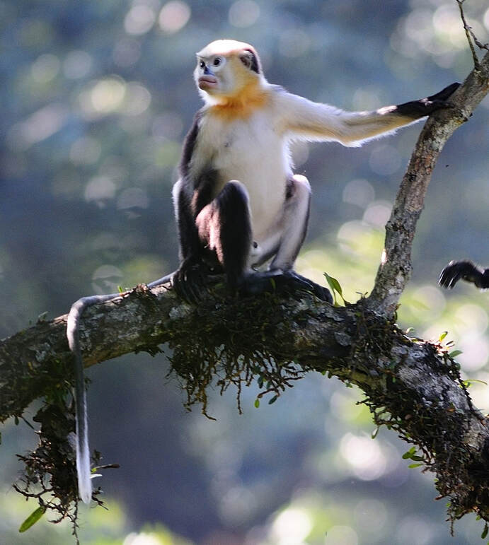
Tonkin snub-nosed monkey. Image credit: Creative Commons
Although a large extent of unprotected forests still remain, most forests are degraded due to widespread swidden agriculture that has been practiced for centuries. The fallow lands from swidden rotations take more than thirty years to regenerate into forest. If the degradation is extensive, the lands may not regenerate, and will instead remain as Imperata dominated sub-climax grasslands. Forests are also cleared for poppy cultivation and for timber. Hunting is rife and indiscriminate; all wildlife is hunted, irrespective of size or taxonomic group, for local consumption and for the commercial markets in China.
Thus, the recommended priority conservation interventions are to: 1) identify some of the intact old-growth forests for protection and conservation, and integrate into a landscape-scale conservation strategy; 2) include local tribal communities as conservation stewards through appropriate livelihood-related strategies; and 3) restrict hunting.
Citations
1. Wikramanayake, E, E. Dinerstein, et al. 2002. Terrestrial Ecoregions of the Indo-Pacific: A Conservation Assessment. Island Press.
2. Critical Ecosystems Partnership Fund. 2012. Ecosystem Profile. Indo-Burma Biodiversity Hotspot. 2011 Update. https://www.cepf.net/Documents/final.indoburma_indochina.ep.pdf Accessed Dec 2017.
3. Greater Mekong Subregion Atlas of the Environment. 2nd ed. Asian Development Bank. 2012. https://www.adb.org/sites/default/files/publication/30074/gms-atlas-environment-2nd-edition.pdf. Accessed Dec 2017.

Subscribe to receive monthly updates on climate solutions, environmental heroes, and the profound beauty and wonder of our shared planet Earth.
