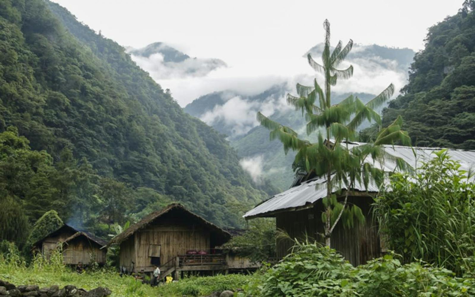

Northern Triangle Subtropical Forests
The ecoregion’s land area is provided in units of 1,000 hectares. The conservation target is the Global Safety Net (GSN1) area for the given ecoregion. The protection level indicates the percentage of the GSN goal that is currently protected on a scale of 0-10. N/A means data is not available at this time.
Bioregion: Arakan Mountains & Northern Triangle Forests (IM10)
Realm: Indomalaya
Ecoregion Size (1000 ha):
5,399
Ecoregion ID:
259
Conservation Target:
93%
Protection Level:
4
States: Myanmar
The Northern Triangle Subtropical Forests ecoregion is still revealing its biological secrets. In 1997, when biologist Alan Rabinowitz was exploring this remote northern region of Myanmar, he examined a carcass of a small deer which he initially took to be a juvenile muntjac. But subsequent DNA analyses revealed that it was an adult female of an entirely new species, which was known to the local people as putao, or ‘leaf deer’, because its body could be wrapped with a single large leaf.
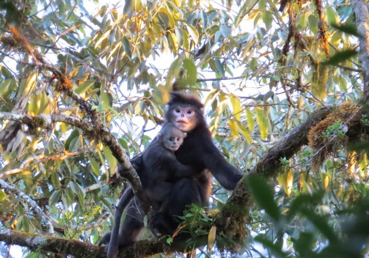
The flagship species of the Northern Triangle Subtropical Forests ecoregion is the Burmese snub-nosed monkey. Image credit: Creative Commons
This leaf deer was named Muntiacus putaoensis. In 2012, a biological survey team discovered a new species of primate from the high mountains of northeastern Kachin State. This Burmese snub-nosed monkey is geographically isolated from other snub-nosed monkeys by two major barriers, the Mekong and the Salween (Thanlwin) rivers. It is very likely that more new species discoveries can be expected from here.
The mountains were formed from the upheaval and uplift that followed the collision between the Deccan Plateau and the Laurasian mainland, which also created the Himalayas. These mountains extend as an offshoot of the eastern Himalayas. The elevation is generally over 1,500 m, with peaks rising above 3,000 m. The Chindwin, Mali Hka, and Mai Hka rivers originate in these mountains and converge in the lower reaches to form the Irrawaddy River.
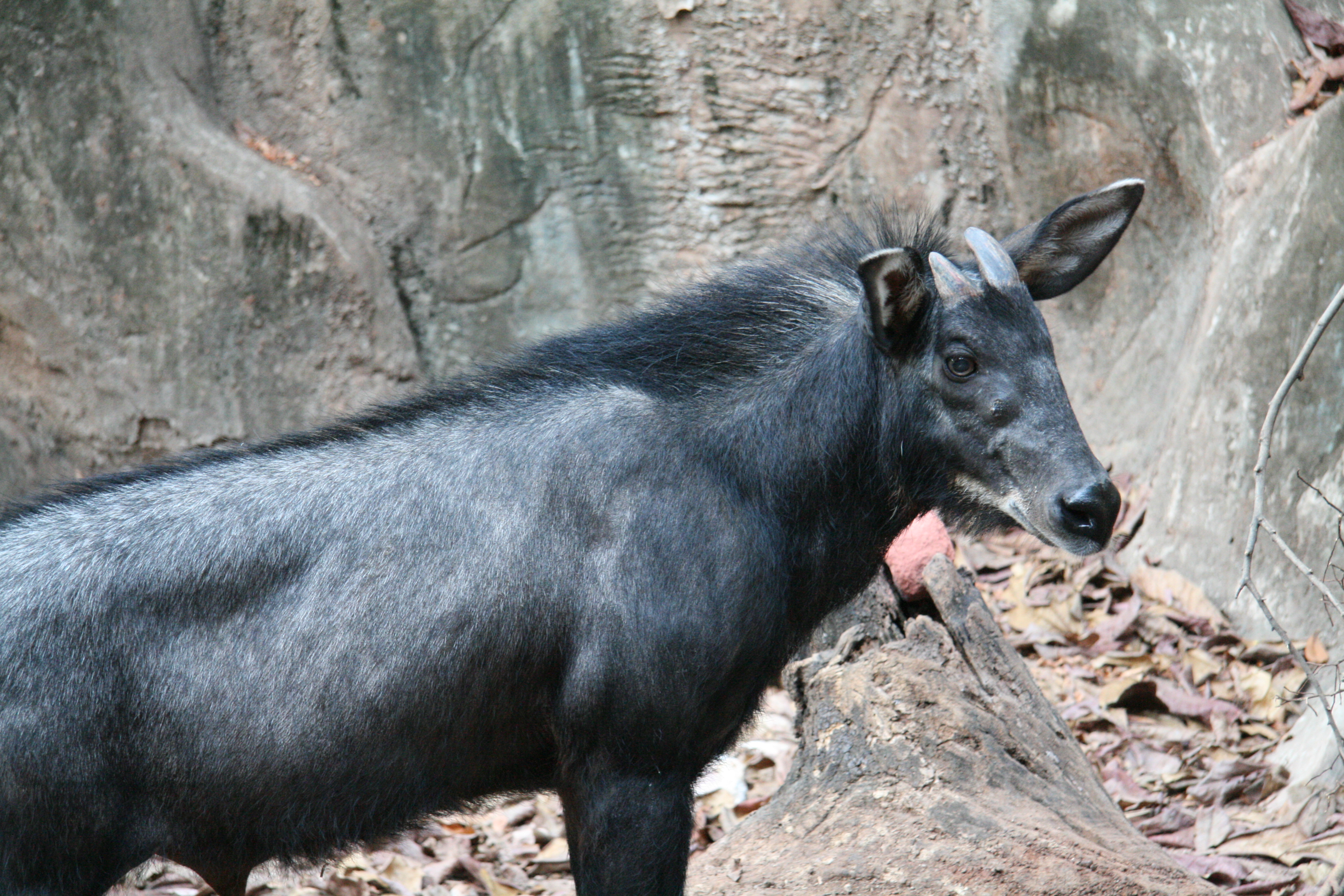
Serow. Image credit: Creative Commons
Floristically, this region is one of the most diverse in continental Asia. The varied topography and biogeographic location at the crossroads of the Assam-Indian, Eastern Himalayan, Indo-Malayan, and Chinese flora, as well as the ancient Gondwana relict refugees, contribute to the high floral diversity. A Pleistocene-era glaciation has influenced the distributions of these floras, with the tropical Indo-Malayan elements in the lower river valleys and the temperate Indo-Himalayan flora above.
The ecoregion’s sub-tropical broadleaf forests are distributed between 500 and 1,600 m. The main tree species belong to Magnoliaceae, Lauraceae, and Dipterocarpaceae families, with species of Fagaceae, Meliaceae, tree ferns, and climbing palms in the upper elevations. Smaller patches of temperate broadleaf forests and sub-alpine conifer forests occur in some higher elevation areas. For instance, the Ngawchang valley, in the western part of the ecoregion, has a pine-oak association that is characterized by Pinus kesiya, Quercus incana, Quercus serrata, and Quercus griffithii.

Red panda. Image credit: Peter Prokosch, Creative Commons
There are several endemic species in these forests, including the rare orchid, Paphiopedilium wardii, named after F. Kingdom Ward, [sic] a British naturalist and botanist who discovered this orchid in 1920 while conducting extensive botanical explorations in northern Burma and India.
About 140 mammal species are known from this ecoregion. Several threatened species of importance include the tiger, red panda, takin, Himalayan black bear, capped leaf monkey, and hoolock gibbon. The bird fauna is much richer, with over 370 species. Because of their need for mature forests and low thresholds for disturbance, some of the focal species for conservation includes Blyth’s tragopan, great hornbill, wreathed hornbill, and rufous-necked hornbill. This region of northern Myanmar is considered to be one of the richest in the world for butterfly diversity.
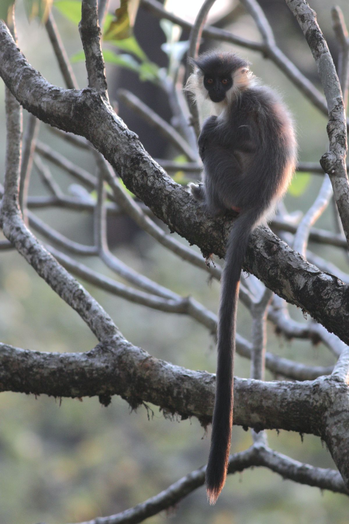
Capped langur. Image credit: Dibyendu Ash, Creative Commons
Because of the remoteness, the ecoregion still retains large areas of forests, providing an opportunity for proactive conservation planning. However, hill slopes are also being cleared for shifting cultivation. The demand for timber from China is also encouraging logging. Mining for gems and other minerals is also increasing.
Thus, the recommended priority conservation interventions are to: 1) develop a landscape-scale conservation plan and strategy before the forests become too fragmented and options are lost; 2) secure the protected areas with better protection and improve their capacities; and 3) engage local communities as conservation stewards.
Citations
1. Wikramanayake, E, E. Dinerstein, et al. 2002. Terrestrial Ecoregions of the Indo-Pacific: A Conservation Assessment. Island Press.
2. Critical Ecosystems Partnership Fund. 2012. Ecosystem Profile. Indo-Burma Biodiversity Hotspot. 2011 Update. https://www.cepf.net/Documents/final.indoburma_indochina.ep.pdf Accessed Dec 2017.
3. Rao, M., Rabinowitz, A. and Khaing, S.T., 2002. Status Review of the Protected‐Area System in Myanmar, with Recommendations for Conservation Planning. Conservation Biology, 16(2), pp.360-368.

Subscribe to receive monthly updates on climate solutions, environmental heroes, and the profound beauty and wonder of our shared planet Earth.
