
Okanogan Dry Forests
The ecoregion’s land area is provided in units of 1,000 hectares. The conservation target is the Global Safety Net (GSN1) area for the given ecoregion. The protection level indicates the percentage of the GSN goal that is currently protected on a scale of 0-10. N/A means data is not available at this time.
Bioregion: Northwest Intermountain Conifer Forests (NA14)
Realm: Northern America
Ecoregion Size (1000 ha):
5,257
Ecoregion ID:
362
Conservation Target:
46%
Protection Level:
1
States: Canada: BC
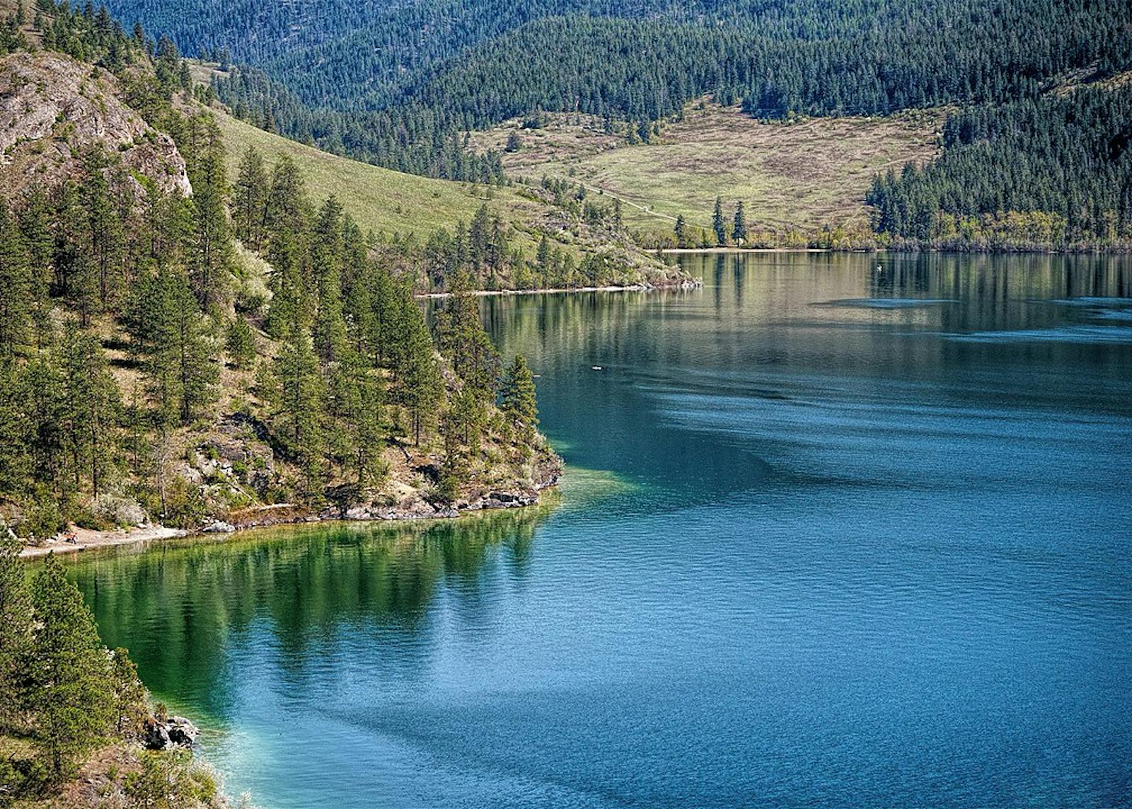
The relatively small Okanagan Dry Forests ecoregion in the southern interior of British Columbia is difficult to categorize. Unique in Canada, it is a complex mix of forest, grassland, and desert shrubland, and in its western portion, subalpine and alpine vegetation. It borders the Fraser Plateau and Basin Conifer Forests ecoregion to the north, the Northern Rockies Conifer Forests ecoregion to the east, the Palouse Prairie and North Cascades Conifer Forests ecoregions to the south, and the British Columbia Coastal Conifer Forests to the west.
Only 6% of this ecologically significant ecoregion is protected. With some 35% of the land outside of protected areas in relatively intact condition, opportunities to greatly enhance protection are available and should be vigorously pursued.
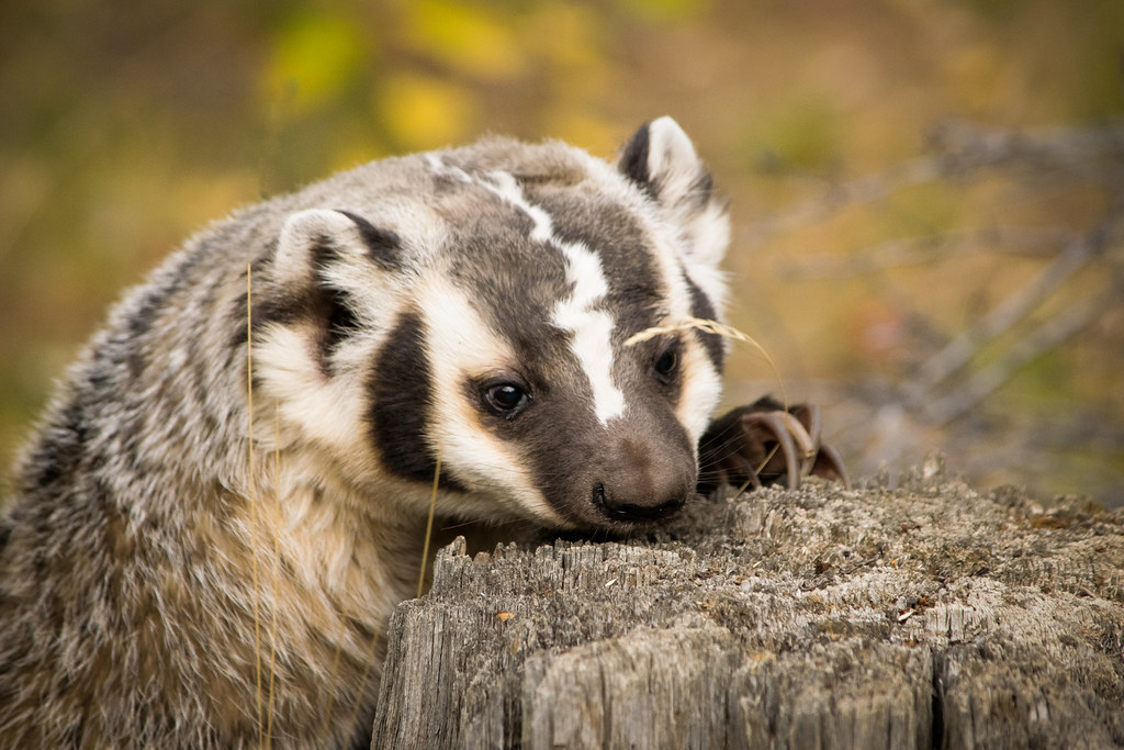
The flagship species of the Okanagan Dry Forests ecoregion is the American badger. Image credit: Courtesy of Jon Nelson, Flickr
Lying in the rain shadow of the Pacific Ranges of the Coast Mountains to the east, the climate of the Okanagan Dry Forests ecoregion is mostly much drier than the surrounding ecoregions. Winters are moderately cool with little snowfall, and summers are very warm to hot and dry. The average annual precipitation is 400 mm on the plateaus but ranges from 250 mm in the valley bottoms to over 1000 mm at high elevations. The mean annual temperature is around 7ºC, winter around -2.5ºC, and summer ranging from 15ºC to 16.5ºC.
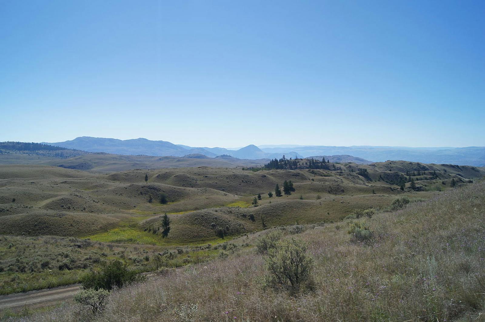
Given the variation in climatic regimes, the vegetation is correspondingly diverse. Valley bottoms are dominated by ponderosa pine woodlands, grasslands, and shrublands (shrub-steppe) with blue bunch wheatgrass, blue grass, June grass, big sagebrush, and antelope brush (bitterbrush). The shrub-steppe community, a “pocket desert,” is reminiscent of the Snake-Columbia shrub-steppe and Great Basin far to the south. More than 30 federally listed and 60 provincially listed species at risk occur here, the greatest concentration in British Columbia.
Among the rare grassland, shrubland, and woodland species are the sharp-tailed grouse, canyon wren, sage thrasher, yellow-breasted chat, flammulated owl, burrowing owl, white-headed woodpecker, American badger, spotted bat, pallid bat, western rattlesnake, night snake, spadefoot toad, and species of scorpions and cacti. Many of these are concentrated in the southern portion of the ecoregion, adjacent to and within the northern projection of Palouse Prairie into this ecoregion.
However, grasslands can be found scattered throughout the region. Short-horned lizards also inhabited the shrub-steppe but are now apparently extirpated due to development. On the plateaus, the characteristic vegetation is lodgepole pine with quaking aspen, white spruce, and Douglas-fir, the latter often accompanied by pine grass at mid-slope elevations. Engelmann spruce, subalpine fir, and lodgepole pine occupy the subalpine zone. Other natural communities include sedge meadows and lake and stream ecosystems.
. Image credit: Summer M. Tribble, Creative Commons")
Bobcat kittens (Lynx rufus). Image credit: Summer M. Tribble, Creative Commons
Mammals, other than the dryland species mentioned above, include gray wolf, black bear, fisher, marten, river otter, bighorn sheep, elk, mule deer, white-tailed deer, moose, coyote, bobcat, and puma. Additional birds include common loon, ruffed grouse, dusky grouse, Barrow’s goldeneye, and sandhill crane.
This ecoregion has several noteworthy protected areas, but they add up to only around 6% of the ecoregion. Agricultural activities, including livestock grazing and hydroelectric dams, have highly altered much of the landscape. One of the most important protected area opportunities in Canada is the proposed South Okanagan-Similkameen National Park Reserve in the southern portion of the ecoregion and overlapping into the Palouse Prairie ecoregion.
Priority conservation actions for the next decade are to 1) rapidly increase the designation of conservation lands, including the South Okanagan-Similkameen National Park Reserve; 2) improve forest and rangeland management with consideration on climate change impact mitigation and habitat connectivity for migrations, and reduce the rate of logging and the intensity of livestock grazing; and 3) increase the level of protection for species at risk throughout the ecoregion.
-
-
1. Ricketts, T.H. et al. 1999. Terrestrial Ecoregions of North America: A Conservation Assessment. Island Press, Washington, D.C.
2. Ecological Stratification Working Group. 1995. A National Ecological Framework for Canada. Environment Canada and other agencies, Ottawa.
3. Proposed South Okanagan-Similkameen National Park Reserve. https://www.pc.gc.ca/en/pn-np/cnpn-cnnp/okanagan -
Cite this page: Okanogan Dry Forests. Ecoregion Snapshots: Descriptive Abstracts of the Terrestrial Ecoregions of the World, 2021. Developed by One Earth and RESOLVE. https://www.oneearth.org/ecoregions/okanogan-dry-forests/
-

Subscribe to receive monthly updates on climate solutions, environmental heroes, and the profound beauty and wonder of our shared planet Earth.
