
Piney Woods Forests
The ecoregion’s land area is provided in units of 1,000 hectares. The conservation target is the Global Safety Net (GSN1) area for the given ecoregion. The protection level indicates the percentage of the GSN goal that is currently protected on a scale of 0-10. N/A means data is not available at this time.
Bioregion: Southern Mixed Forests & Blackland Prairies (NA28)
Realm: Northern America
Ecoregion Size (1000 ha):
15,257
Ecoregion ID:
363
Conservation Target:
38%
Protection Level:
1
States: United States: LA, TX, AR, OK
The Piney Woods ecoregion occupies the West Gulf Coastal Plain and encompasses eastern Texas (including the “Big Thicket”) as well as western Louisiana, southwestern Arkansas, and a small portion of southeastern Oklahoma. It is separated from the Southeast US conifer savannas ecoregion by the Mississippi Alluvial Valley (the Mississippi Lowland Forests ecoregion).
These two ecoregions, along with the Mid-Atlantic US Coastal Savannas ecoregion, are the largest and most characteristic ecoregions of the North American Coastal Plain, which in 2016 was formally recognized by the Critical Ecosystem Partnership Fund as the 36th global biodiversity hotspot. Species richness (number of species) and endemism (proportion of species found nowhere else) are particularly high among plants, freshwater fish, amphibians, reptiles, and several invertebrate groups.
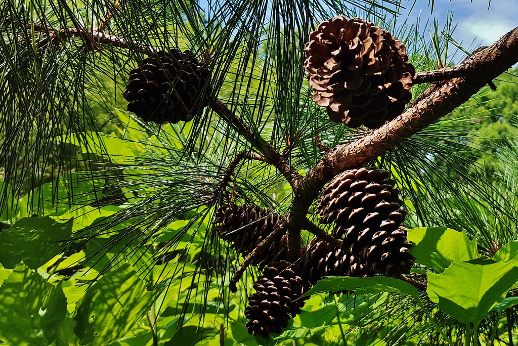
The flagship species of the Piney Woods Forests ecoregion is the loblolly pine. Image credit: Courtesy of Matthew Beziat, Flickr
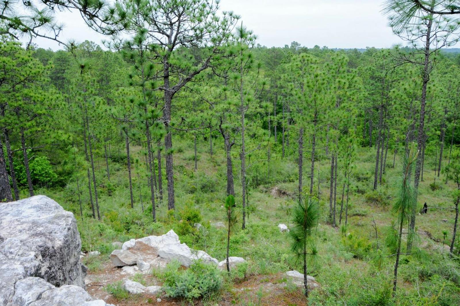
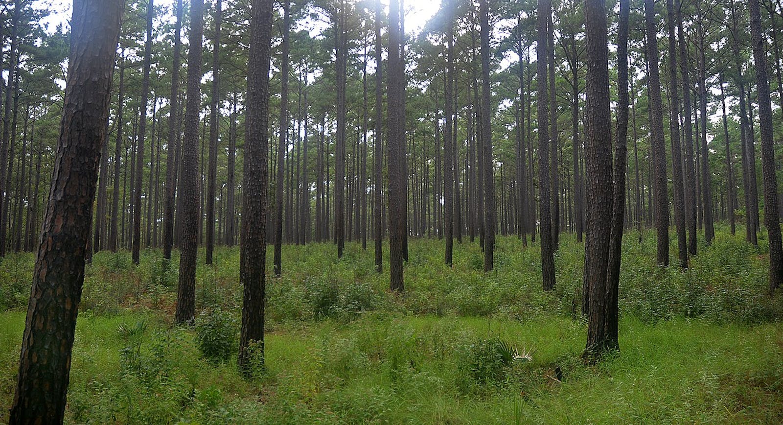
Similar to the Coastal Plain ecoregions to the east, the Piney Woods was distinguished by vast pine savannas and woodlands prior to European settlement. However, the generally hillier terrain produces somewhat longer fire intervals across most of the region than in the southeastern Coastal Plain; therefore tree density is generally higher, with often more hardwoods intermixed with the pines.
The climate of the Piney Woods ecoregion ranges from humid subtropical in the south to warm temperate further north. The western portion of the ecoregion is drier than the eastern portion. The geology shows a gradient from Pleistocene deposits of sands, silts, and clays in the south, to Miocene clays, mudstones, and sandstones in the central portion, to Eocene sands, silts, and clays in the northern portion.
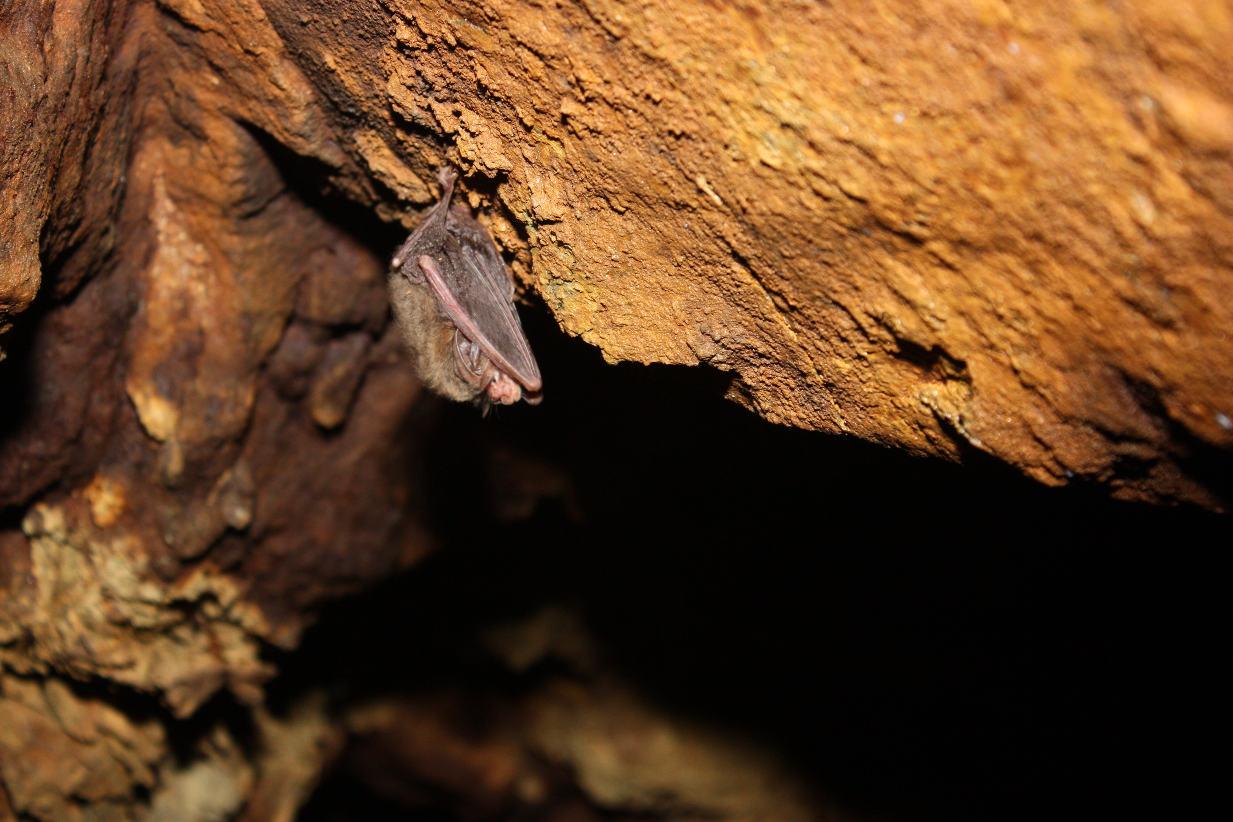
Big-eared bat. Image credit: USFWS, Creative Commons
The southern portion of the region has open longleaf pine savannas very similar to the communities in the southeastern Coastal Plain, with an extremely species-rich herb layer. Loblolly pine, however, is the most ubiquitous pine across the ecoregion, while shortleaf pine is abundant in the north. Pines in some areas are mixed with hardwoods such as several species of oaks, hickories, red maple, and sweetgum. The interaction of fire and soil moisture determines the structure and composition of the vegetation.
Other major natural communities include bottomland forests and bald cypress-tupelo swamps along rivers and beech-magnolia forests on ravine slopes and bottoms, especially on soils with high clay content in the southern portion of the ecoregion. Oak-dominated hardwood forests occur on sandier fire-protected sites.
Many of the rare and endemic plant species of this ecoregion occur in non-forest communities, including rocky outcrops, calcareous glades and prairies, Catahoula sandstone barrens, hillside seepage bogs, and saline barrens. The latter community is considered critically imperiled globally. Characteristic wildlife of the region includes the federally Endangered red-cockaded woodpecker in longleaf pine savannas, black bear, American alligators, and many others.
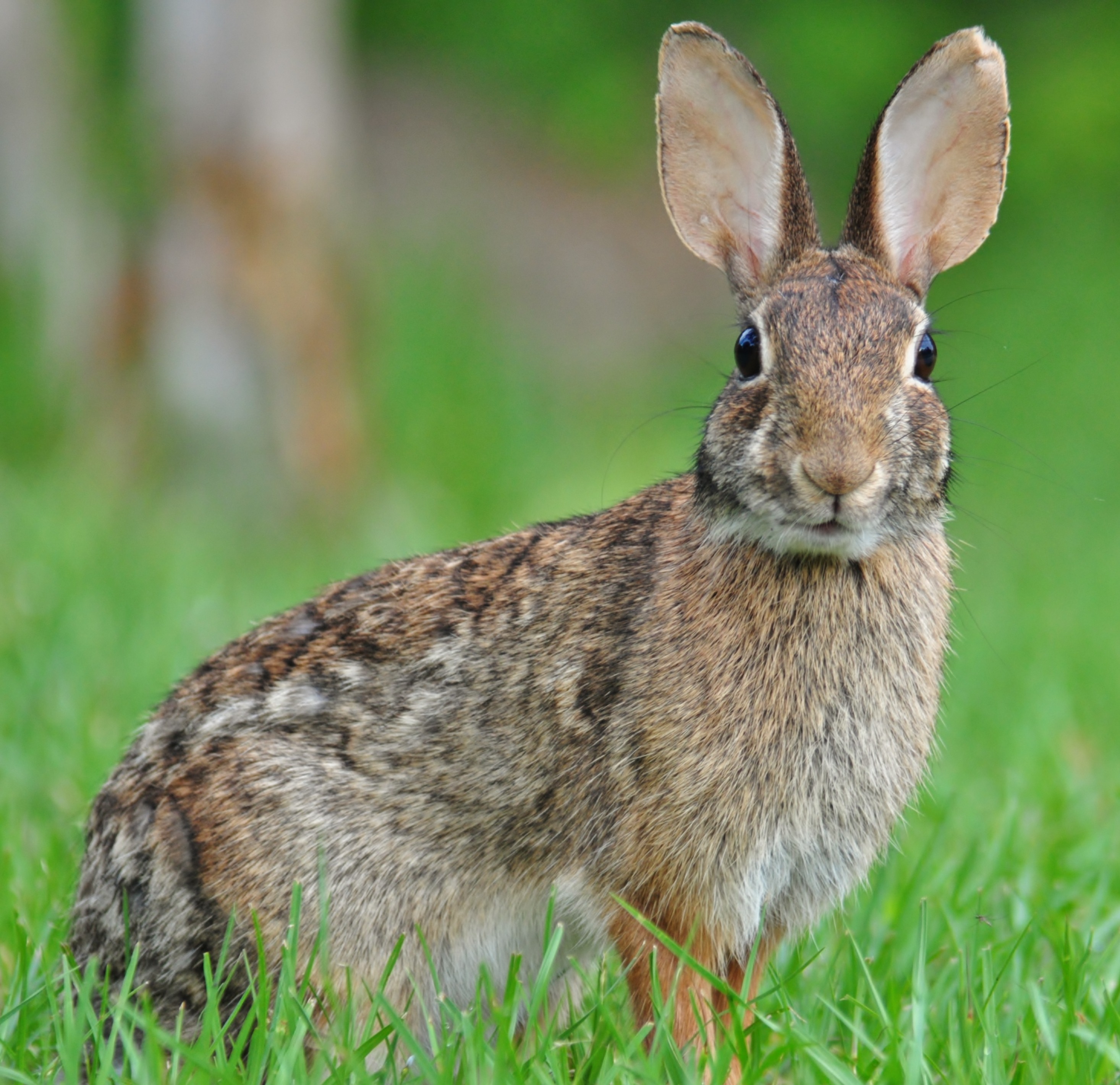
Eastern cottontail. Image credit: Gareth Rasberry, Creative Commons
Habitat loss in this ecoregion has been extensive, but not as severe as in the southeastern Coastal Plain. Although only 3% of the ecoregion is protected, 21% of the natural habitat remains outside of protected areas. Across the Coastal Plain as a whole, 86% of the vegetation is highly altered or converted, including 73% of forests, 96% of savannas and woodlands, and 98% of grasslands, marshes, and glades.
Many species, including endemics found nowhere else in the world, are on the brink of extinction. Human population growth rates are high in portions of the region, especially in the vicinity of Houston, leading to massive urbanization and habitat destruction.
Priority conservation actions for the next decade are to: 1) create strong incentives for population stabilization, especially through reduced immigration to the region, which is responsible for the vast majority of population growth; 2) greatly increase federal, state, and local acquisition of conservation lands; and 3) improve management of existing conservation lands, especially with respect to management of fire and water.
Citations
1. Poole, J.M., W.R. Carr, D.M. Price, and J.R. Singhurst. 2007. Rare Plants of Texas. Texas A&M University Press, College Station.
2. Sorrie, B.A., and A.S. Weakley. 2001. Coastal Plain plant endemics: phytogeographic patterns. Castanea 66:50-82.
3. Ricketts, T.H. et al. 1999. Terrestrial Ecoregions of North America: A Conservation Assessment. Island Press, Washington, D.C.

Subscribe to receive monthly updates on climate solutions, environmental heroes, and the profound beauty and wonder of our shared planet Earth.
