
Sierra Madre Oriental Pine-Oak Forests
The ecoregion’s land area is provided in units of 1,000 hectares. The conservation target is the Global Safety Net (GSN1) area for the given ecoregion. The protection level indicates the percentage of the GSN goal that is currently protected on a scale of 0-10. N/A means data is not available at this time.
Bioregion: Sierra Madre Forests & Mexican Drylands (NA29)
Realm: Northern America
Ecoregion Size (1000 ha):
6,547
Ecoregion ID:
327
Conservation Target:
44%
Protection Level:
7
States: Mexico: Chihuahua, Coahuila, Nuevo León, Durango, Zacartecas, Tamaulipas, San Luis Potosi, Guanajuato, Querétaro, Hidalgo. United States: NM, TX
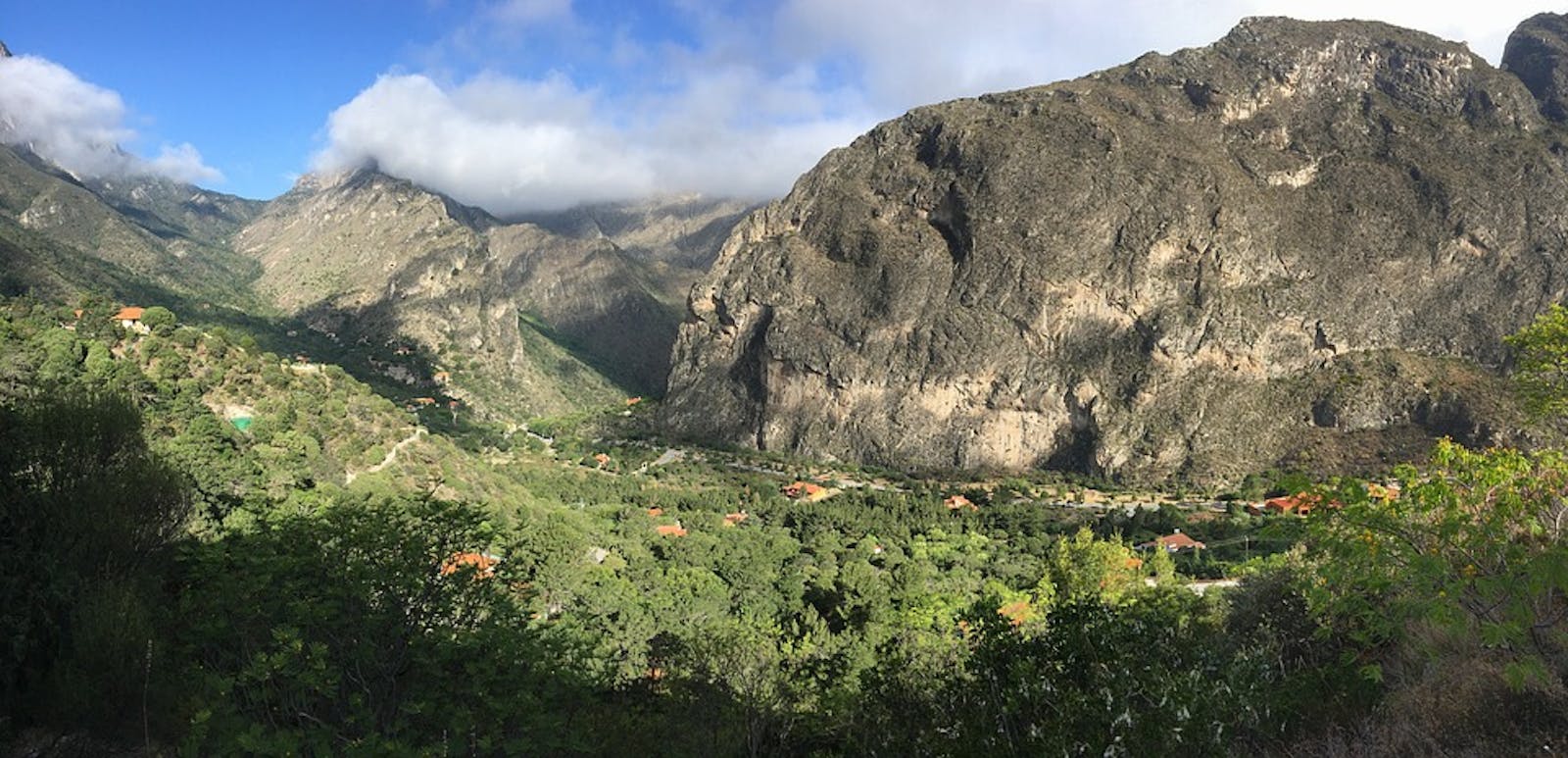
The Sierra Madre Oriental Pine-Oak Forests ecoregion extends from several isolated mountain ranges in the southwestern U.S., including the Davis and Chisos Mountains in the Big Bend area of Texas and the San Andres and Organ Mountains of southern New Mexico (near White Sands National Monument), south through several Mexican states to just northeast of Mexico City, where this ecoregion transitions to the Trans-Mexican Volcanic Belt Pine-Oak Forests ecoregion. The latter ecoregion serves as a connector between the Sierra Madre Oriental and the Sierra Madre Occidental.
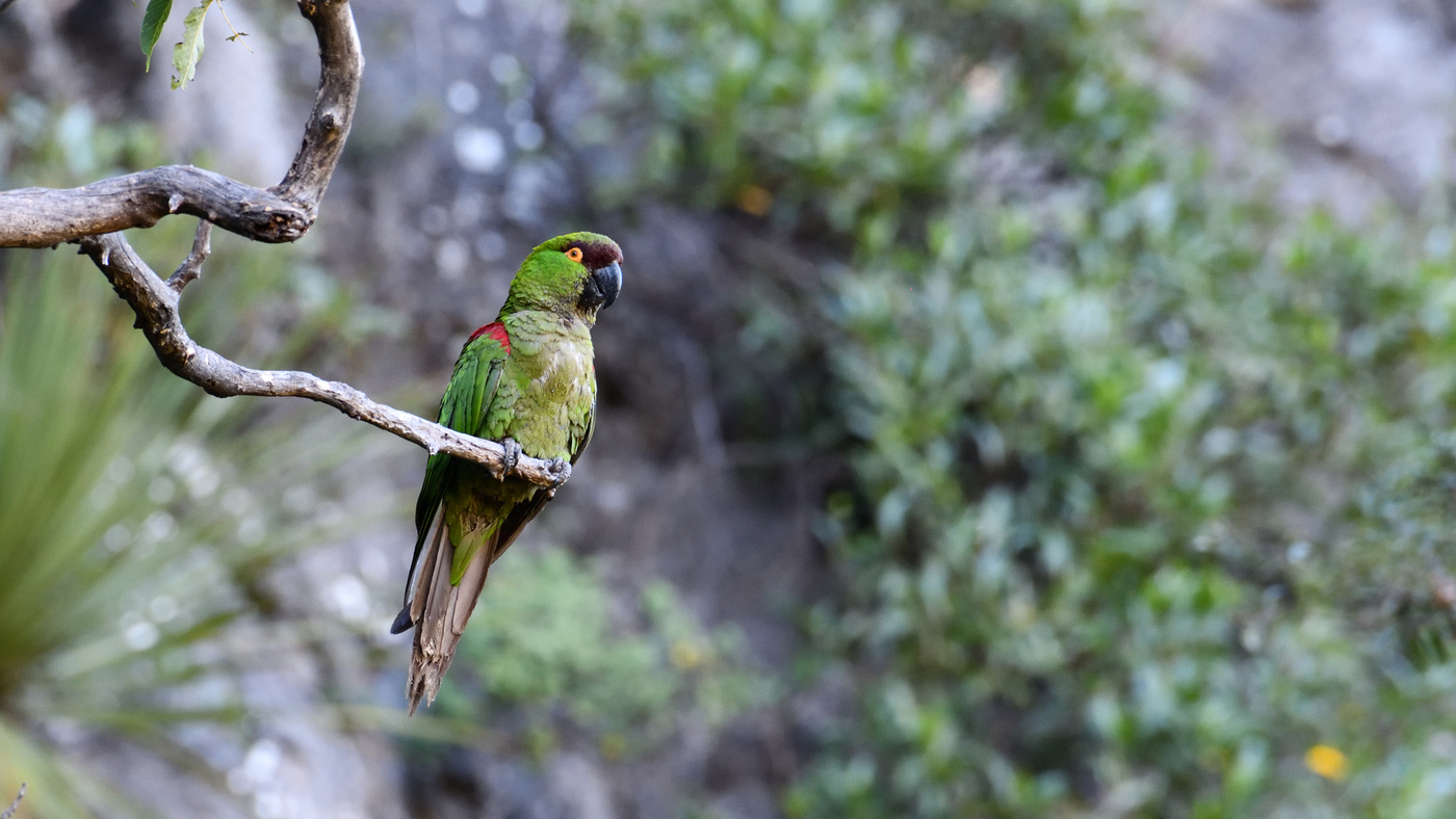
The flagship species of the Sierra Madre Oriental Pine-Oak Forests ecoregion is the maroon-fronted parrot. Image credit: Courtesy of Roberto González, iNaturalist
Along with the other mountain ranges dominated by pine-oak forests in Mexico and the southwestern U.S., this ecoregion is part of the Madrean Pine-Oak Woodlands Biodiversity Hotspot, one of 36 hotspots in the world.i Pines, oaks, and agaves reach their highest species richness globally in this hotspot. The terrain is rugged due to the abrupt upward folding of Cretaceous deposits. The tallest peaks are Potosi (3,625 m) and Peña Nevada (3,480 m) in Mexico.
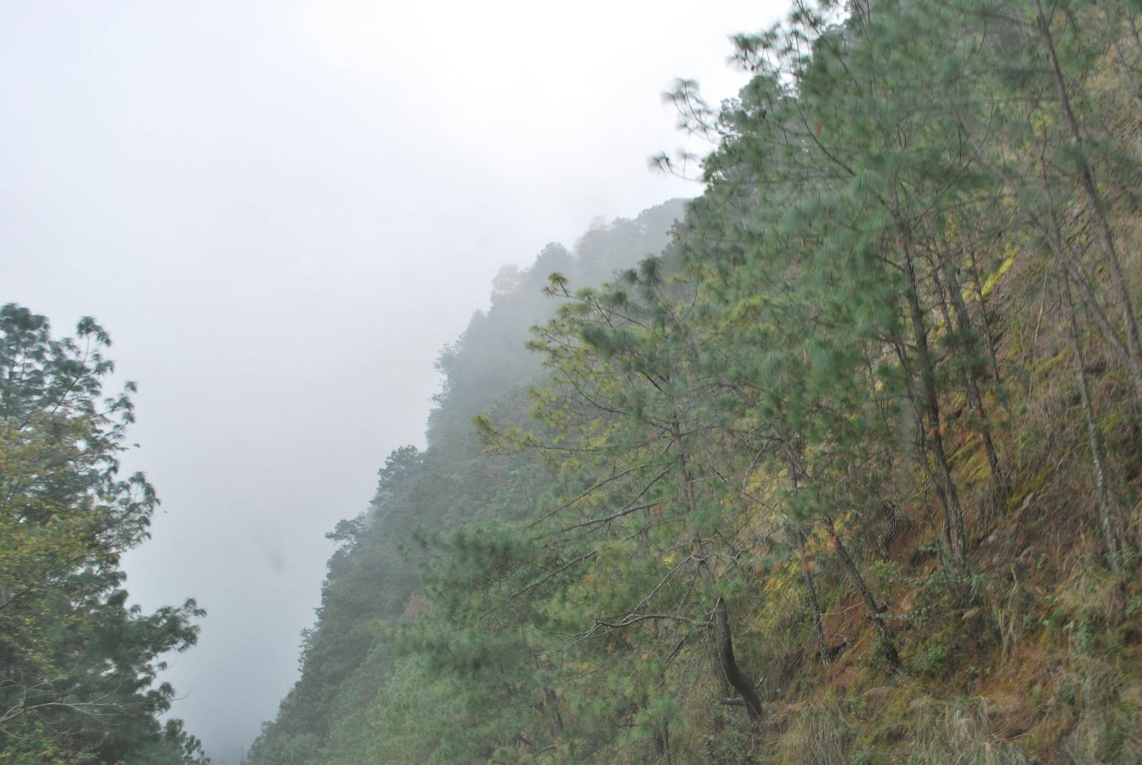
The climate of this ecoregion is considered humid on the northeastern slopes and subhumid on the western slopes and high peaks; however, the wettest peaks contain the northernmost cloud forests in Mexico (in Tamaulipas). These forests occur on soils derived from volcanic rocks and have a high proportion of organic matter. Average annual rainfall is 200-300 mm in the north in the vicinity of Big Bend National Park in Texas and 900-1,500 mm in the southern portions of the ecoregion near Nuevo León, Mexico.
This ecoregion is dominated by pine-oak forests between 1,000 and 3,500 m in elevation, with the dominant pines being Nelson’s pinyon pine (endemic to the ecoregion), Mexican pinyon pine, smooth-bark Mexican pine, Arizona pine, Mexican weeping pine, and the endemic Gregg’s pine. The major oak species are Quercus castanea and Q. affinis (both in the red oak group, but with no accepted common names). Mexican pinyon pine and alligator juniper are characteristic of wetter east-facing slopes, whereas the more xeric west-facing slopes have more of the endemic weeping pinyon.
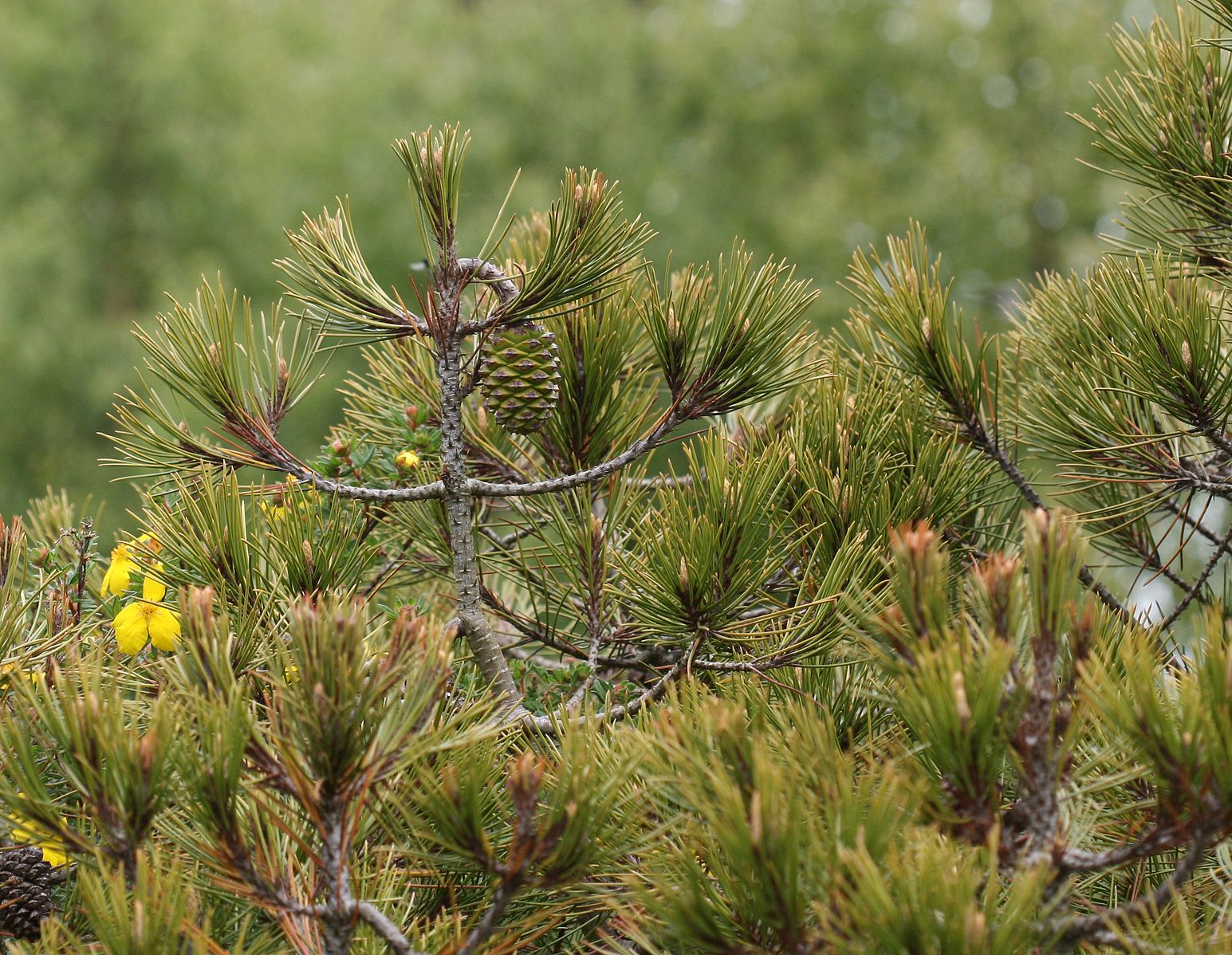
Nelson's pine. Image credit: Creative Commons
The birdlife of this ecoregion, along with the other Mexican pine-oak ecoregions, is so distinctive that it is recognized as a global Endemic Bird Area,ii with endemic species including the maroon-fronted parrot, bearded wood-partridge, Colima warbler (in the breeding season), and dwarf jay. Other birds include wild turkey, golden eagle, and peregrine falcon.
Characteristic mammals are mule deer, puma, jaguar, cliff chipmunk, collared peccary, and white-nosed coati. The pine-oak forests in the state of Coahuila are important migratory corridors for monarch butterflies, which have their largest wintering populations in the Trans-Mexican Volcanic Belt Pine-Oak Forests. The Bravo River has been identified as a key biological corridor between northeast Coahuila state and the Chisos Mountains in Texas. Moreover, the intermontane valleys and plains link the biotas of the Chihuahuan and Tamaulipan deserts.
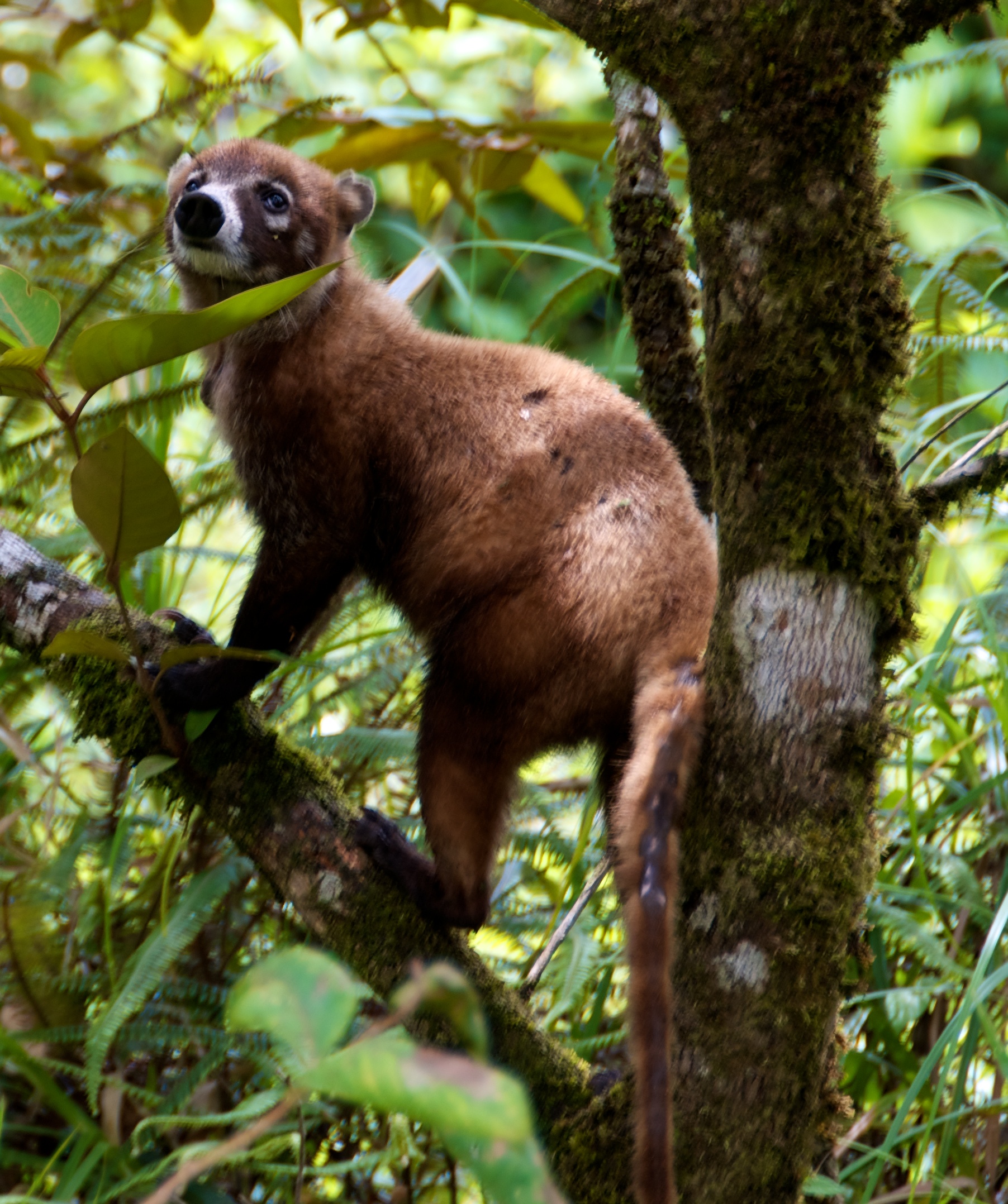
White nosed coati. Image credit: Bruce Harlick, Creative Commons
Logging pressure on pines and oaks has been responsible for extensive habitat loss since the late 19th century, and exclusion of fire has harmed these fire-dependent communities. Logging pressure, as well as hunting, livestock grazing, and road-building remain high. Fortunately, some 25% of the ecoregion is protected and around 40% of the natural habitat remains outside protected areas, providing opportunities for increased protection.
Priority conservation actions for the next decade are to: 1) establish additional protected areas, reduce logging, and restore native vegetation and natural fire regimes; 2) promote recovery of rare species, such as the jaguar; and 3) reduce hunting pressure.
Citations
1. Valero, A., J. Schipper, T. Alnutt, and C. Burdette. Undated. Southern North America: Eastern Mexico into Southwestern United States. World Wildlife Fund. https://www.worldwildlife.org/ecoregions/na0303
2. Perry, Jesse P. Jr., 1991. The Pines of Mexico and Central America. Timber Press, Portland, Oregon.
3. Rzedowski, J. 1978. Vegetación de Mexico. Editorial Limusa. Mexico, D.F., Mexico.

Subscribe to receive monthly updates on climate solutions, environmental heroes, and the profound beauty and wonder of our shared planet Earth.
