
Sulu Archipelago Rainforests
The ecoregion’s land area is provided in units of 1,000 hectares. The conservation target is the Global Safety Net (GSN1) area for the given ecoregion. The protection level indicates the percentage of the GSN goal that is currently protected on a scale of 0-10. N/A means data is not available at this time.
Bioregion: Philippines & Sulu Sea Tropical Forests (IM15)
Realm: Indomalaya
Ecoregion Size (1000 ha):
234
Ecoregion ID:
276
Conservation Target:
48%
Protection Level:
0
States: Philippines
The Sulu bleeding heart could very well be Asia’s dodo. This pigeon-sized bird with an iridescent green neck transitioning into a reddish-purple back and brown wings, and a distinctive bright orange-red patch in the middle of its white breast reminiscent of a bleeding heart, is endemic to the Sulu islands. It has not been sighted since 1891, after two specimens were collected.
Unconfirmed reports of its presence from 1995 provide some hope that the species still exists in some remote corner of the archipelago, but with rapid clearing of forests this hope is fading. Surveys in 2009 failed to find any birds. The Sulu bleeding-heart is only one of many endemic species that are under threat of extinction in this ecoregion because of habitat loss. Unfortunately, political instability in the area makes conservation a difficult proposition.
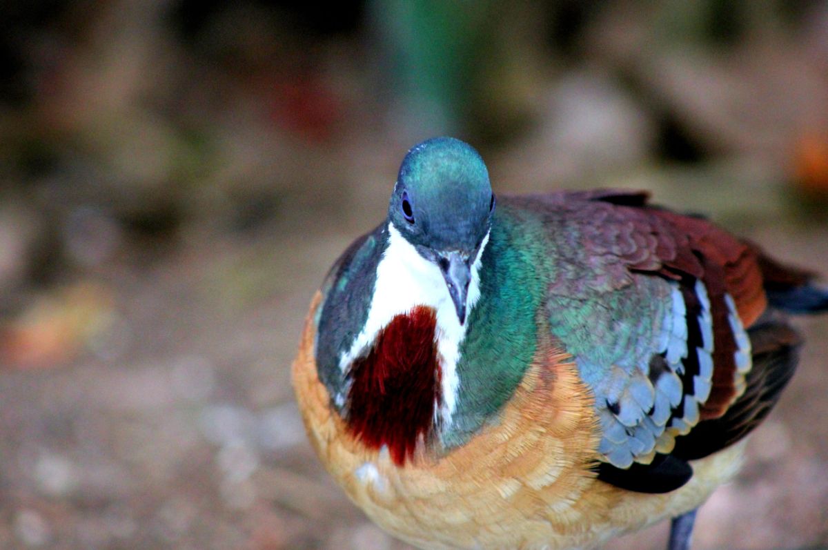
The flagship species of the Sulu Archipelago Rainforests ecoregion is the Sulu bleeding heart. Image credit: Creative Commons
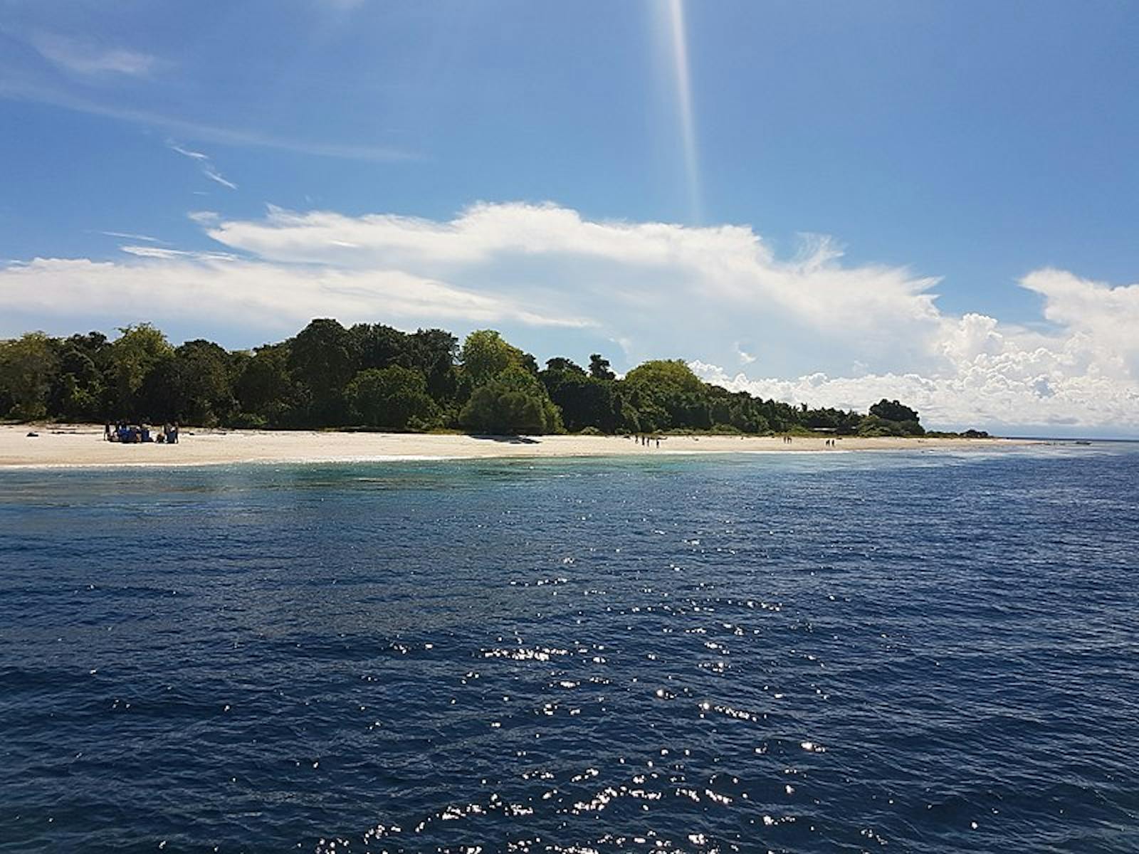
The Sulu Archipelago Rain Forests ecoregion represents a chain of islands between the large islands of Borneo and Mindanao, Philippines. Jolo and Tawitawi are the two larger islands of the archipelago. The genesis of the Philippines islands is complex, and began about 50 million years ago as island arcs resulting from complex and forceful tectonic interactions among the Philippine, Eurasian, Australian, and Pacific plates. The precursor to the Sulu archipelago was a series of undersea volcanoes that created the islands within the past 15 million years.
The climate is tropical, humid for most of the year but with only about 2,000 mm of annual rainfall, which is relatively little for tropical islands. The average temperature is constant through the year at around 27°C. The islands are located just south of the main track of frequent typhoons that have a huge influence on most islands of the Philippines.
Vegetation in the Sulu Archipelago is represented by beach forest, lowland rainforest, scrub forest, and mangroves. Beach forests are composed of species of Barringtonia, Caesalpinia, and Terminalia. Most of this forest has now been cleared for coastal development and coconut plantations. The lowland rainforests were dominated by species of Dipterocarpaceae, especially Anisoptera, Dipterocarpus, Hopea, and Shorea. Hardly any of the original scrub forests remain, and cannot be easily described. The mangrove community consists of species of Rhizophora, Ceriops, Brugueira, Sonneratia, Avicennia, and Nypa palms.
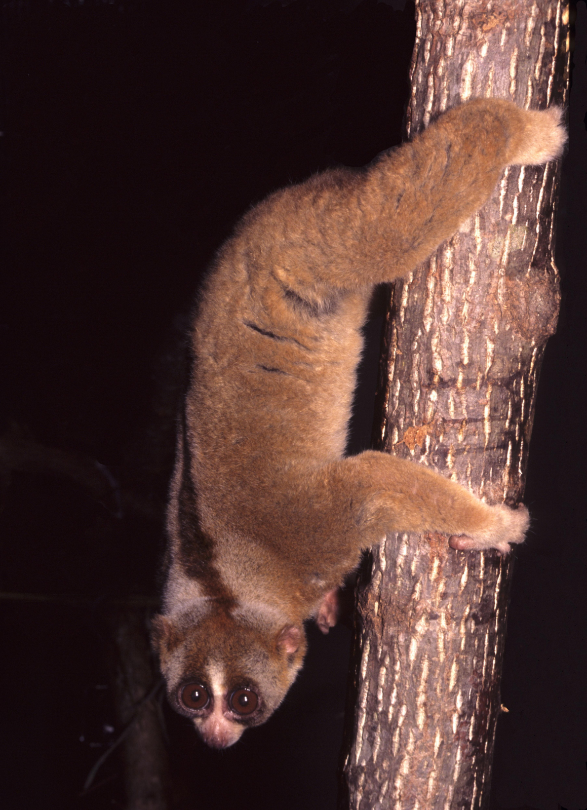
Sunda slow loris. Image credit: David Haring, Creative Commons
The Sulu islands are not on the shallow Sunda Shelf that includes mainland Asia, the islands of Sumatra, Java, Borneo, and Palawan. During the Pleistocene about 18,000 years ago, when the sea level dropped by about 120 m from present levels, all the islands on the Sunda Shelf were connected, allowing exchange and migrations of mammals and other terrestrial fauna.[iii] However, the Sulu archipelago remained unconnected to the main land mass; thus, the fauna is more similar to the Philippine fauna than to the Sundaic fauna. Unsurprisingly, the mammal fauna is not rich because the islands are small and isolated. The Tawitawi Island rat is the only endemic mammal.
Of the 189 species of birds known from this ecoregion and 22 are Philippines endemics. Five bird species are endemic to the ecoregion, namely the Tawitawi brown-dove, Sulu hornbill, blue-winged racket-tail, Sulu Boobook, and the Sulu bleeding-heart, assuming it is not already extinct. Several smaller endemic species, from small mammals to geckos, are still being scientifically described from the forests of these islands.
With the exception of one protected area on Basilan Island, the forests and biodiversity are unprotected and under threat from conversion. Illegal capturing and hunting of wildlife is also common. Thus, the recommended priority conservation actions are to bring additional forests into the protected areas network, especially the Key Biodiversity Areas on the larger islands; engage local communities as conservation stewards through culturally and politically appropriate strategies and integrate them into tourism development plans; andconduct comprehensive biological surveys to better inform conservation strategies.
Citations
1. Philippine Biodiversity Strategy and Action Plan. 2015-2028. Department of Environment and Natural Resources. https://www.cbd.int/doc/world/ph/ph-nbsap-v3-en.pdf downloaded 16 March 16, 2018
2. Heaney, L.R., 1985. Zoogeographic evidence for middle and late Pleistocene land bridges to the Philippine Islands. Modern Quaternary Research in Southeast Asia, 9, pp.127-144.
3. Wikramanayake, E, E. Dinerstein, et al. 2002. Terrestrial Ecoregions of the Indo-Pacific: A Conservation Assessment. Island Press.

Subscribe to receive monthly updates on climate solutions, environmental heroes, and the profound beauty and wonder of our shared planet Earth.
