
Ucayali Moist Forests
The ecoregion’s land area is provided in units of 1,000 hectares. The conservation target is the Global Safety Net (GSN1) area for the given ecoregion. The protection level indicates the percentage of the GSN goal that is currently protected on a scale of 0-10. N/A means data is not available at this time.
Bioregion: Western Amazonian Forests & Plains (NT18)
Realm: Southern America
Ecoregion Size (1000 ha):
11,519
Ecoregion ID:
512
Conservation Target:
89%
Protection Level:
2
States: Peru
The near-endemic, critically endangered yellow-tailed woolly monkey is a rare species, only found in the cloud forests and premontane forests of Ucayali and neighbouring ecoregions. Its limited distribution and narrow habitat preferences have resulted in several small isolated populations, which is further restricted by the loss of habitat from deforestation. The yellow-tailed woolly monkey’s diet primarily consists of fruit, but it is known to also practice “geophagy”—consuming earth and soil-like substrates—which benefits the animal by increasing iron intake, reducing intestinal parasites, and helping digestion.
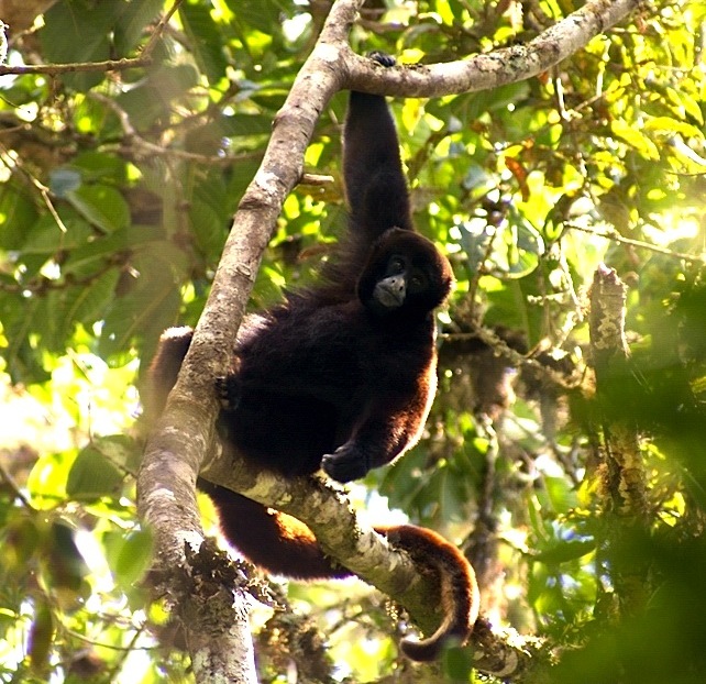
The flagship species of the Ucayali Moist Forests ecoregion is the yellow-tailed woolly monkey. Image credit: Creative Commons
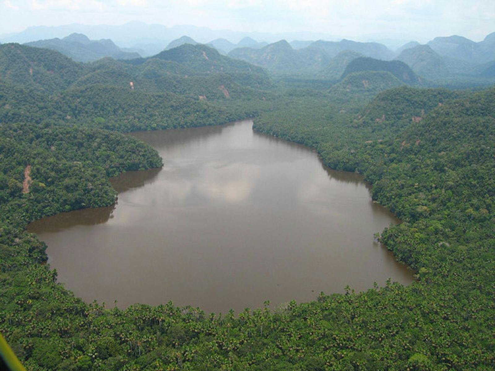
The ecoregion is located entirely within Peru at the foot of the Andes mountains and includes the basin west of the Ucayali river, a major branch of the Amazon river. The Cordillera Oriental mountain range runs North-South through the length of the region. The landscape is generally flat but is dissected with uplifted highlands and its elevations range from 200–1,100 m. Annual rainfall ranges between 1,600–2,500 mm.
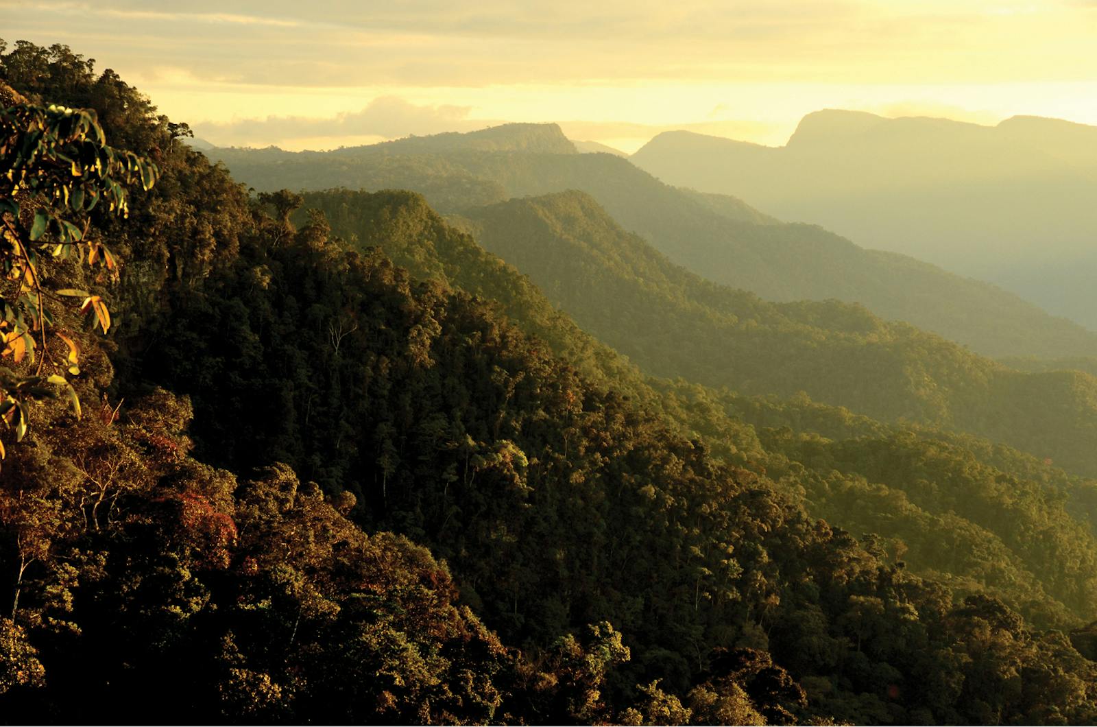
The vegetation is generally tall, moist evergreen tropical rainforests with a high diversity of tree species. The canopies reach 40 m, with some emergent trees up to 50 m. The most important tree families are Meliaceae, Arecaceae, Moraceae, Leguminosae, Myristicaceae, and Rubiaceae. Along the rivers, some stands are dominated by palms, especially moriche palm. In the lower elevations, these forests harbor plant species such as white guarango, Macrolobium acaciifolium, Cedrelinga catenaeformis, Erisma uncinatum, and Phragmotheca ecuadoriensis.
The region has very high palm diversity because it has elements of the Andean region, including high rainfall. Members of the widespread genera Bactris and Astrocaryum are common, and the most abundant single palm species is Iriartea deltoidea. Important timber species for locals are mahogany, tropical cedar, and kapok.
The Ucayali Moist Forest ecoregion has very high elevational variability and a number of outlying ridges and mountains of the main Andean chain. As such this region has a very high diversity of flora and fauna species. More than 600 bird species have been recorded here. Some bird species found in this region and in few others are golden-collared toucanets and Castelnau’s antshrikes, as well as many manakins, tanagers, cuckoos, hawks, eagles, owls, and herons.
There are 188 mammal species recorded. Notables are Hoffman’s two-toed sloth, brown throated sloth (three-toed), opossum, more than 100 bat species, and 11 primates including monk saki, red howler monkey, and yellow tailed woolly monkey. There is also a high diversity of amphibians, reptiles, and invertebrates. Further research in this ecoregion is necessary to better understand species composition, associations, and endemism.

Endangered Peruvian spider monkey. Image credit: Creative Commons
The Ucayali Moist Forests are at present fairly intact with some small-scale and medium-scale cattle pasture and agricultural farms cleared from the forest. The Tingo Maria National Park is located at 900 m elevation in the Cordillera region, while the Cordillera Azul National Park is located further north.
The most severe threats in this ecoregion are road construction and human settlement; forest habitats are also converted into cattle pastures and farms, or illegal exploited for logging and extractions. The priority conservation actions for the next decade will be to: 1) encourage locals to adopt natural resource integration into their agricultural practices; 2) encourage cattle grazing rotation so no one area become heavily degraded; and 3) allocate funding for greater management capacity and restrictions against illegal logging.
Citations
1. Sears, R., Schipper, J. 2019. Eastern South America: Central Peru https://www.worldwildlife.org/ecoregions/nt0174 Accessed May 25, 2019.
2. Instituto Geográfico Nacional. 1987. Ecoregiones del Peru. Map 1:5,000,000. Atlas del Peru, Lima, Peru.
3. Prance, G. 1987. Phytogeographic support for the theory of Pleistocene forest refuges in the Amazon Basin, based on evidence from distribution patterns in Caryocaracaceae, Chrysobalanaceae, Dichapetalaceae, and Lecythidaceaea. Acta Amazonica 3. Pp 5-28.
4. Cornejo, F., Rylands, A.B., Mittermeier, R.A. & Heymann, E. 2008. Lagothrix flavicauda. The IUCN Red List of Threatened Species 2008: e.T39924A10287914. http://dx.doi.org/10.2305/IUCN.UK.2008.RLTS.T39924A10287914.en. Accessed May 25, 2019.

Subscribe to receive monthly updates on climate solutions, environmental heroes, and the profound beauty and wonder of our shared planet Earth.
