
Xingu-Tocantins-Araguaia Moist Forests
The ecoregion’s land area is provided in units of 1,000 hectares. The conservation target is the Global Safety Net (GSN1) area for the given ecoregion. The protection level indicates the percentage of the GSN goal that is currently protected on a scale of 0-10. N/A means data is not available at this time.
Bioregion: Southern Amazonian Forests (NT17)
Realm: Southern America
Ecoregion Size (1000 ha):
26,682
Ecoregion ID:
518
Conservation Target:
64%
Protection Level:
5
States: Brazil
The vulnerable Amazonian manatee can be found throughout the inland Amazon basin and occupies many of the rivers found in this ecoregion. This large freshwater mammal is the smallest of the manatees and are known to move with the seasonal flooded forests to take advantage of fresh food sources. There is uncertainty of the population size due to their secretive nature, which makes them difficult to study, but they are internationally protected, and illegal hunting has decreased with demand. Although mostly remain submerged in often silty water, they can be spotted by a keen observer. along the banks, eating grasses and other sub aquatic vegetation.
_resized.jpg)
The flagship species of the Xingu-Tocantins-Araguaia Moist Forests ecoregion is the Amazonian manatee. Image credit: Dan Lundberg, Creative Commons
Located primarily between the Xingu and Lower Tocantins Rivers in Brazil, this ecoregion also includes the area around the Araguaia River. The landscape is relatively flat with flooded plains and many small rivers transecting the region. The Xingu and Tocantins Rivers are major tributaries to the mighty Amazon. The region extends southward into the uplands of the Brazilian Shield. The northern half of the region lies on the lowland Amazon Basin.
The forests are generally evergreen tropical rain forest on terra firme (non-flooded land). They grade from lowland Amazon forest (reaching 40 m in height) in the north to submontane dense forest and submontane open forest in the south. There are two dominant types of forest. The liana forests occupy most of the south/southeastern regions on richer soils, typically with a lower (25 m) and more open canopy with large wooden vines interspersed throughout the vegetation levels.
The most important vegetation family in liana forests is Bignoniaceae. The second forest type comprises stands of Brazil nut and babacu palm occurring together or alternately in different locales throughout the eastern portion of the region. The babacu palms are thought to be introduced by early humans.
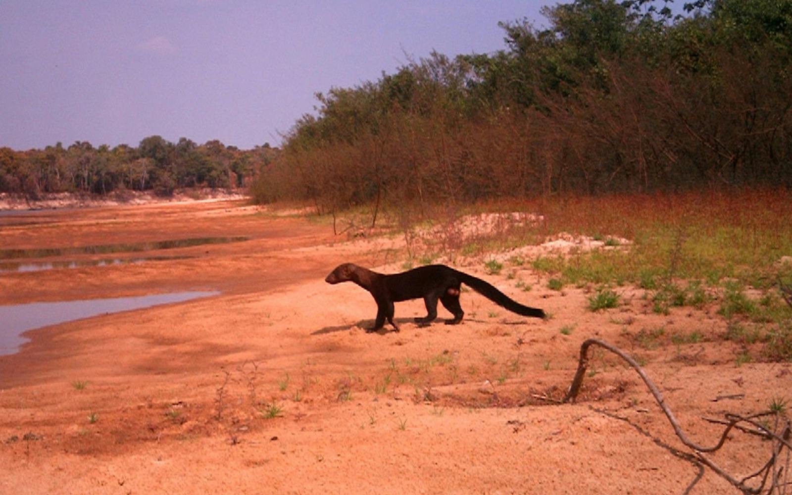
White nosed saki. Image credit: Rich Hoyer, Creative Commons
For Amazonia, this region is not exceptionally rich in mammal diversity, although there are still 153 species recorded. There are 8 primate species, including the endangered white-nosed saki. Other large mammals include white lipped and collared peccary, puma, jaguar, tapir, brocket deer, opossum, and seven-banded armadillo. 90 species of bat and 21 rodents have been recorded. Notable river wildlife includes spectacled and black caiman, river dolphin, manatee, and the vulnerable yellow spotted river turtle. At least 527 species of birds have been identified here. Many egrets, herons, hawks, and falcons grace the waterways and meadows.

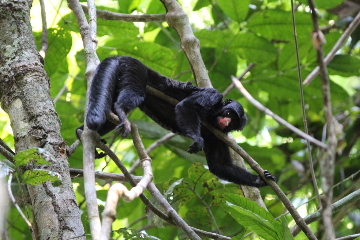
Broket Deer. Image credit: Creative Commons
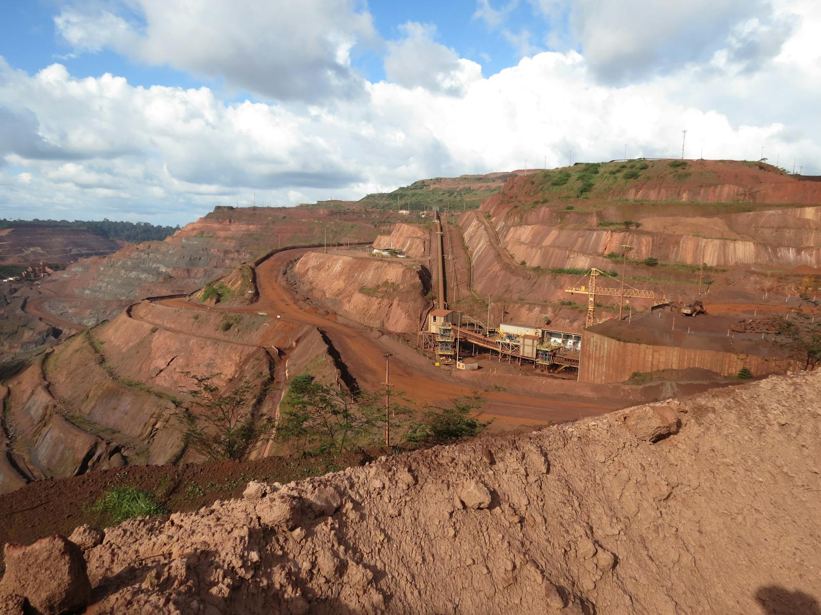
This ecoregion is one of the most deforested and degraded regions in Amazonia, second only to the Tocantins-Araguaia-Maranhão Moist Forest ecoregion to the east. Extensive deforestation occurs on the frontier with the drier, more populated zone to the south. Urban development radiates from the Amazonian cities of São Felix do Xingu on the Xingu River; Porto de Moz, Oeiras do Pará, and Gurupá on the Amazon; and Marabá on the Tocantins.
The Transamazon Highway traverses the middle of the region east to west and another highway flanks the Tocantins River. Most of the forest along these roads has been felled, burned, and replaced by cattle ranches, municipal infrastructure, or agricultural fields. Most of the valuable timber has been removed from the remaining forest. Many insects, birds, mammals, plants, and fish are locally extinct.
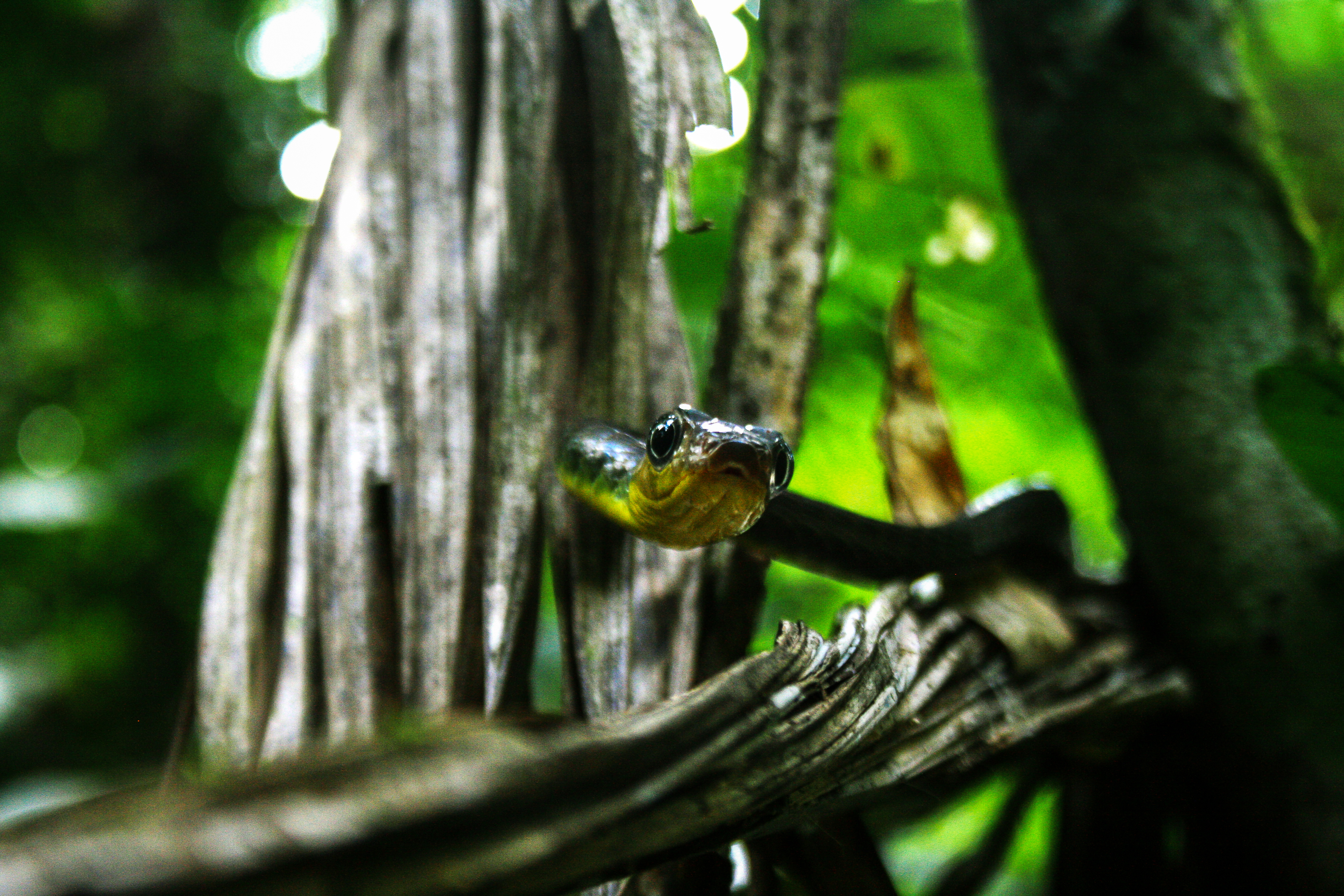
Snake of genus Chironius in Carajás. Image credit: Roberto Franco Junior, Creative Commons
The most severe threats follow the roads through this region in a path of deforestation and degradation. Commercial logging operations also provide inroads to the interior where cattle ranches and agricultural projects are then established. Slash and burn agricultural practices cause severe damage. Large-scale mining operations of the rich stores of mineral deposits near the city of Marabá and elsewhere have disrupted the natural vegetation. To run the smelters alone in Marabá requires wood supply from 2,000 km2 of forest each year.
The priority conservation actions for the next decade will be to: 1) integrate natural resource management and education to decrease the impact of agricultural practices to natural habitats; 2) advocate and incentivize sustainable timber harvest; and 3) increase the connectivity and number of protected areas in the region.
Citations
1. Sears, R. 2019. Eastern Amazonian – Brazil. https://www.worldwildlife.org/ecoregions/nt0180 Accessed May 15, 2019.
2. Gentry, A. H. 1991. The distribution and evolution of climbing plants. Pages 3-49 in J. Putz and H. Mooney, (editors), The Biology of Vines. Cambridge University Press, Cambridge.
3. Prance, G. T., and K. S. Brown Jr. 1987. The principle vegetation types of the Brazilian Amazon. Pages 30-31 in T. C. Whitmore and G. T. Prance (editors), Biogeography and Quaternary History in Tropical America. Clarendon Press, Oxford.
4. Marmontel, M., de Souza, D. & Kendall, S. 2016. Trichechus inunguis. The IUCN Red List of Threatened Species 2016: e.T22102A43793736. http://dx.doi.org/10.2305/IUCN.UK.2016-2.RLTS. T22102A43793736.en. Accessed May 15, 2019.

Subscribe to receive monthly updates on climate solutions, environmental heroes, and the profound beauty and wonder of our shared planet Earth.
