United Nations Development Programme | Mapping Essential Life Support Areas
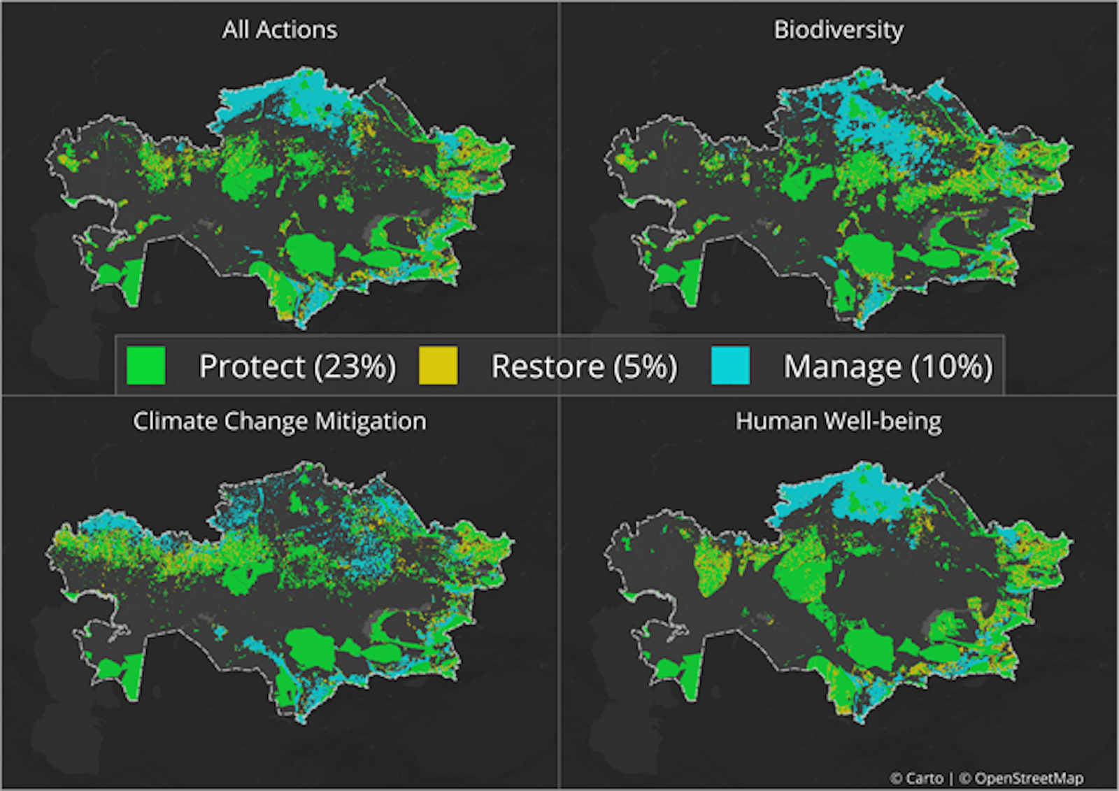
The Mapping Nature for People and Planet Partnership brings together scientists and policy experts to harness spatial data to support decision-makers by identifying priority places to take action to deliver on national priorities for biodiversity, climate, and sustainable development. To do this, the project works closely with countries to identify their essential life support areas (ELSAs), defined as areas where nature-based actions can safeguard key biodiversity and ecosystem services.
Together with national leaders in five pilot countries the partnership has created a scientific framework and decision support system to bring together national data in a central repository, to use systematic conservation planning to identify ELSAs that show where nature-based actions should be taken based on national priorities, and to monitor the impact of these actions. Our theory of change is that map-based, credible, high-quality information combined with capacity building at the national level will drive shifts in policy implementation and reporting to deliver on the 2030 Agenda and the Rio Conventions.

Subscribe to receive monthly updates on climate solutions, environmental heroes, and the profound beauty and wonder of our shared planet Earth.