
Central Canadian Shield Forests
The ecoregion’s land area is provided in units of 1,000 hectares. The conservation target is the Global Safety Net (GSN1) area for the given ecoregion. The protection level indicates the percentage of the GSN goal that is currently protected on a scale of 0-10. N/A means data is not available at this time.
Bioregion: Canadian Shield & Coastal Taiga-Forests (NA9)
Realm: Subarctic America
Subrealm: Canadian Boreal Forests
Ecoregion Size (1000 ha):
27,136
Ecoregion ID:
370
Conservation Target:
95%
Protection Level:
0
States: Canada: ON, QC
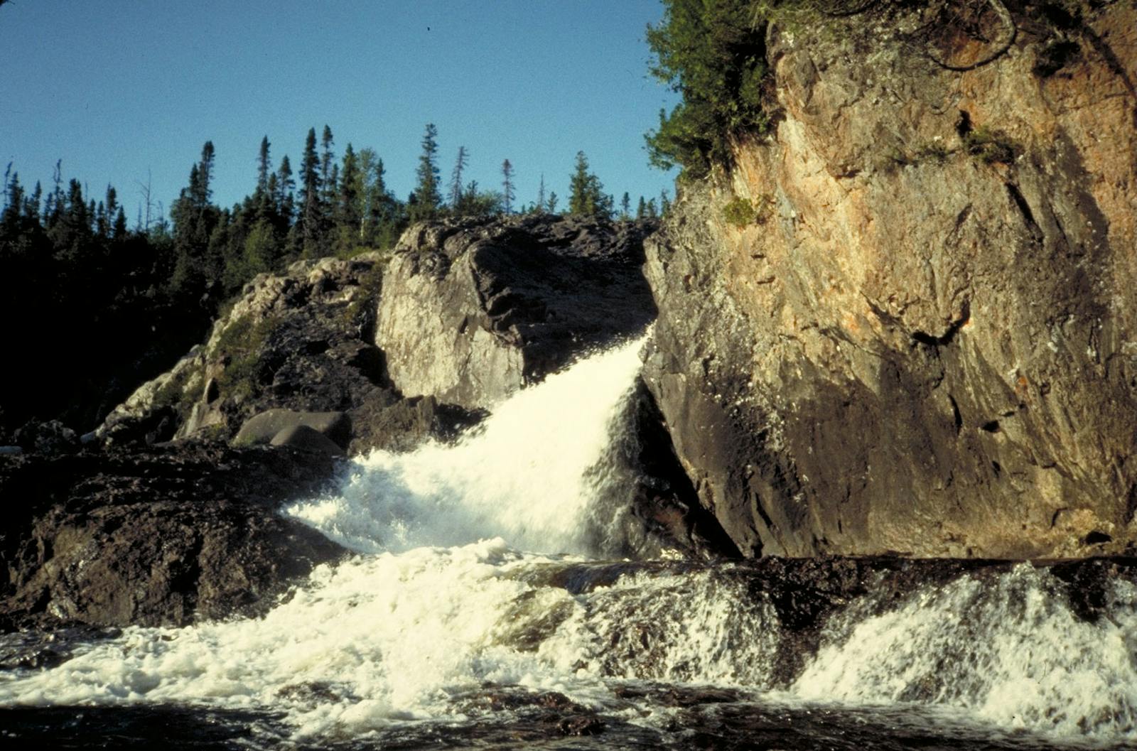
The Central Canadian Shield Forests ecoregion includes much of boreal northern Quebec and Ontario, north of the temperate-boreal transition forests, south of the taiga, and west to include the northeastern shore of Lake Superior. The defining geology of the ecoregion is entirely the Canadian (Precambrian) Shield, the huge mass of exposed Precambrian igneous and metamorphic rocks (especially granitic gneisses) that forms the ancient geological core of the North American continent, some 2.5-4.2 billion years old.
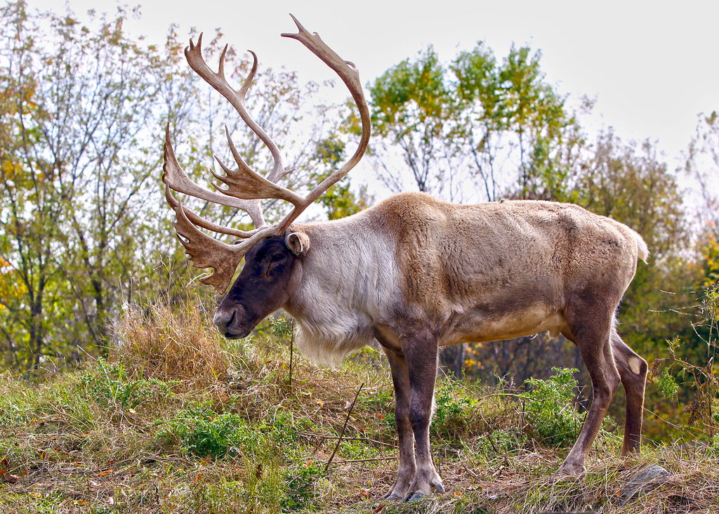
The woodland caribou (Rangifer tarandus caribou) is the flagship species of the Central Canadian Shield Forests ecoregion, located in the Canadian Shield & Coastal Taiga-Forests bioregion (NA9).
Glaciations strongly affected this ecoregion, which is still rising from post-glacial rebound (a rise in the land surface after retreat of the heavy ice sheets) after the last glaciation ended about 12,000 years ago. Outcrops of bedrock are mostly covered by calcium-rich, sandy to loamy till in the north and a thin, acidic, sandy till in the south. Most of the ecoregion is bounded to the north by Paleozoic bedrock of the Hudson Bay/James Bay Lowlands, towards which the density of wetlands on the landscape increases.
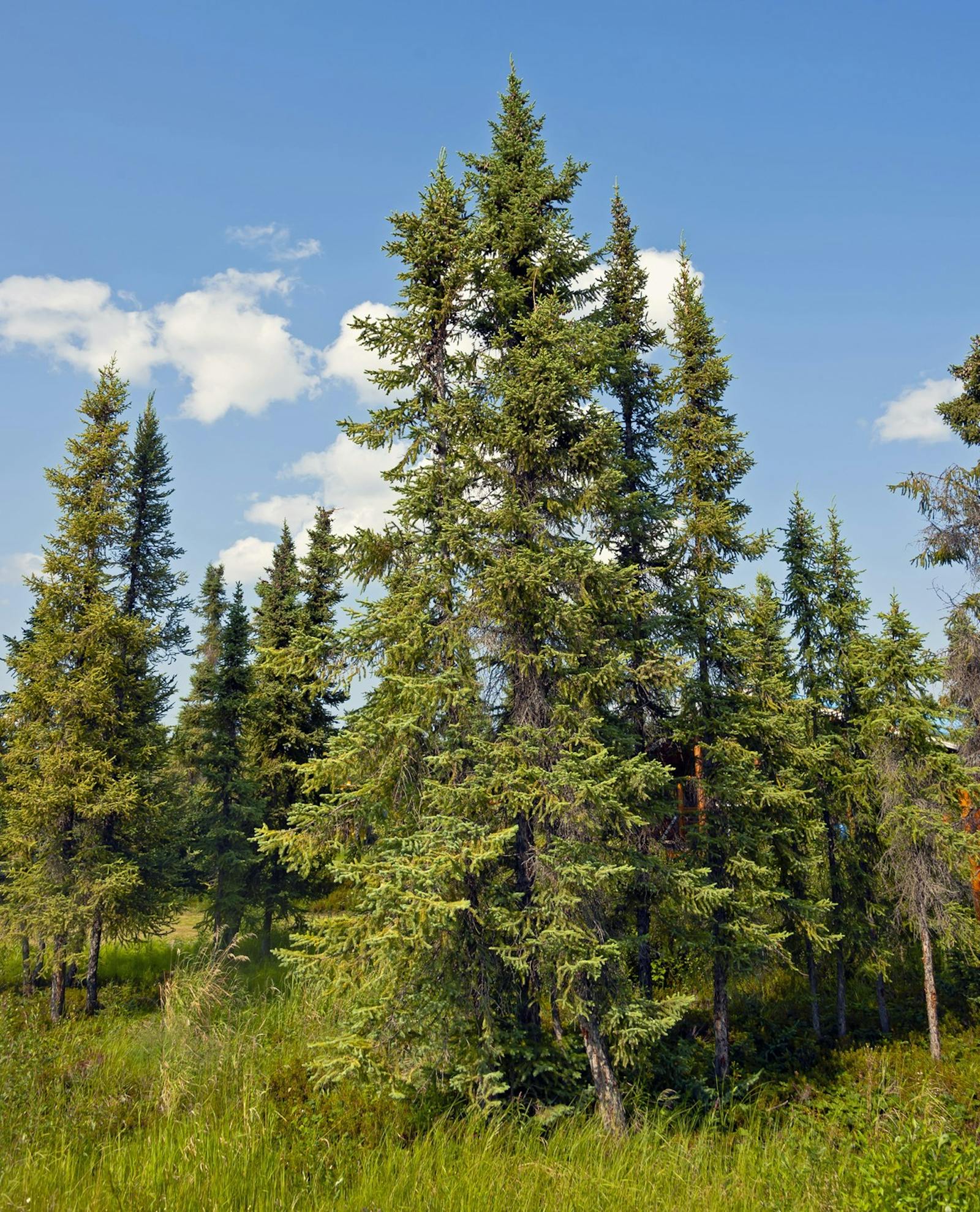
The climate of this ecoregion is humid mid- to high-boreal. The boreal forest of this ecoregion is dominated by black spruce in the north, which is controlled by frequent lightning fires that often cover tens of thousands of hectares or more. Stands of fire-adapted jack pine are also common, with some paper birch. Warmer areas of the north, such as south-facing slopes, have higher proportions of quaking aspen and paper birch, as well as white spruce and balsam fir.
Most of the southern part of the ecoregion is dominated by more diverse forests of white and black spruce, balsam fir, jack pine, quaking aspen, and paper birch. Fires, often very large and intense, are also common in the south. Portions of this ecoregion are rich clay plains, which support some of the most productive boreal forest ecosystems on the continent. The north shore of Lake Superior has many occurrences of disjunct (separated) arctic and western plant species.
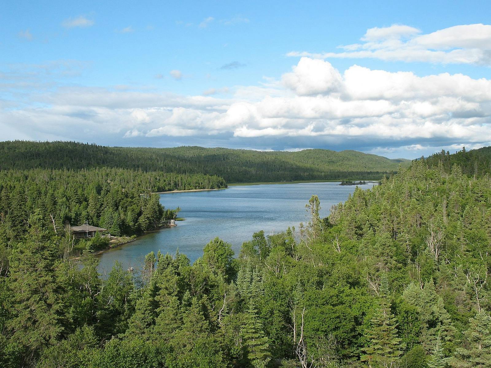
Pukaskwa National Park, on the northeast shore of Lake Superior, covers an area of 1,878 km2 and protects a significant portion of the longest undeveloped shoreline on the Great Lakes. This ecoregion marks the southernmost viable populations of woodland caribou remaining in North America. Other mammals include moose, black bear, lynx, snowshoe hare, wolf, and increasing reports of cougar.

Great horned owl (Bubo virginianus). Image credit: Courtesy of Greg Hume
This ecoregion has only 4% of its area protected, and more than half of the ecoregion has been logged; additional parts of the ecoregion have been scheduled for logging in the near future. Logging also exacerbates habitat fragmentation, as clear-cuts, logging roads and major transportation corridors decrease connectivity for migrating wildlife.
In addition, mining, mineral exploration, and hydro-electric development also threaten habitats in lowland Ontario and Quebec. There are additional disturbances to natural habitats from major oil, gas trunk lines, and hydro transmission corridors. Nevertheless, most of the region is wildland, with 64% of natural habitat remaining outside of protected areas.
Priority conservation actions for the next decade:
- Protect remaining intact blocks of natural vegetation, old growth, roadless areas, and undeveloped rivers and lakes.
- Greatly increase federal and provincial designation of conservation lands.
- Improve management of existing conservation lands, especially with respect to fire and carnivores (wolves, bears, lynx, cougar).
-
-
1. Ricketts, T.H. et al. 1999. Terrestrial Ecoregions of North America: A Conservation Assessment. Island Press, Washington, D.C.
2. Elliott-Fisk, D.L. 2000. The taiga and boreal forest. In M.G. Barbour and W.D. Billings, editors. North American Terrestrial Vegetation, 2nd edition. Cambridge University Press, Cambridge, U.K.
3. Noss, R.F., K. Bennett, E. Butterworth, C. Francis, A. Couturier, P. Paquet, and K. Vance-Borland. 2002. Conservation Biology for Canada’s Boreal Forest. A project of the Canadian Boreal Trust (Pew Charitable Trusts). Conservation Science, Inc. Corvallis, OR. -
Cite this page: Central Canadian Shield Forests. Ecoregion Snapshots: Descriptive Abstracts of the Terrestrial Ecoregions of the World, 2021. Developed by One Earth and RESOLVE. https://www.oneearth.org/ecoregions/central-canadian-shield-forests/
-

Subscribe to receive monthly updates on climate solutions, environmental heroes, and the profound beauty and wonder of our shared planet Earth.
