
Chao Phraya Lowland Moist Deciduous Forests
The ecoregion’s land area is provided in units of 1,000 hectares. The conservation target is the Global Safety Net (GSN1) area for the given ecoregion. The protection level indicates the percentage of the GSN goal that is currently protected on a scale of 0-10. N/A means data is not available at this time.
Bioregion: Indochina Mixed Forests & Peatlands (IM12)
Realm: Indomalaya
Ecoregion Size (1000 ha):
2,046
Ecoregion ID:
225
Conservation Target:
17%
Protection Level:
8
States: Thailand
The Chao Phraya Lowland Moist Deciduous Forests is another Southeast Asian ecoregion that has been degraded below the thresholds of conservation imperatives. Years ago, this ecoregion had supported some of the world’s most charismatic but now highly threatened species, from larger animals such as Asian elephant, tigers, banteng, gaur, and Siamese crocodile, to the smaller but equally charismatic species of Malayan sunbear, Asiatic wild dog, and pileated gibbon, just to name a few. But intense anthropogenic activities have converted most of the natural habitats these species depended on and several species have since been extirpated.
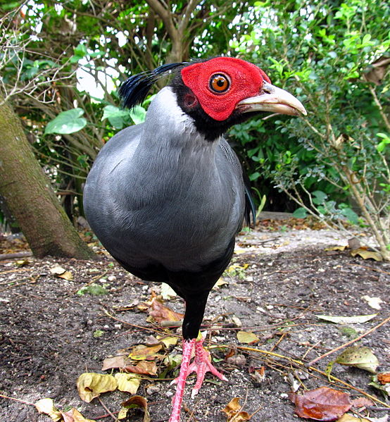
The flagship species if the Chao Phraya Lowland Moist Deciduous Forests ecoregion is the Siamese fireback. Image credit: Creative Commons
The seasonal, monsoonal climate has a great influence on the vegetation. At lower elevation, the average annual rainfall is around 1,000 mm in the west and increases to about 1,300 mm in the east. Closer to the Cardamom and Elephant Mountains, warm, moisture-laden winds from the ocean are forced up by high mountains into the cool upper layers to extract the moisture as rain, a process known as ‘orographic’ precipitation. The annual rainfall here thus reaches about 3,000 to 4,000 mm. About 80 percent of rains occur during the southwest monsoon from May to October. The mean maximum and minimum temperatures are 34°C and 23°C respectively.
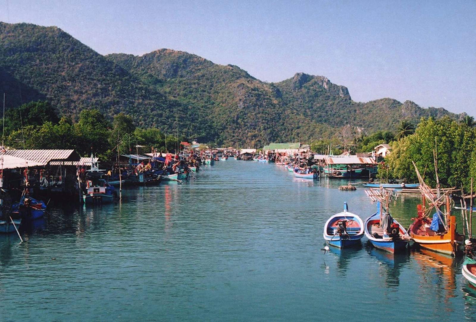
This ecoregion occurs as two disjunct areas on either side of the Chao Phraya river basin’s lower reaches, representing a transitional forest at the nexus of freshwater swamp forests, dry forests, and rainforests. Thus, the vegetation is not homogeneous but a matrix of vegetation types with affinities to the neighboring ecoregions and includes species from each.
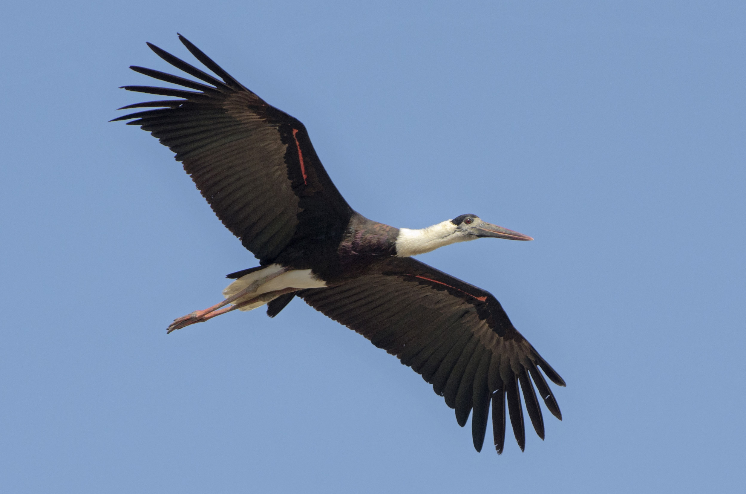
Woolly necked stork. Image credit: Creative Commons
The forests to the west of the river grades into the Tenasserim–South Thailand Semi-Evergreen Rain Forests ecoregion in the wetter areas closer to the coast and into the Central Indochina Dry Forests ecoregion in the drier areas further inland. The section of the ecoregion to the east of the Chao Phraya has more affinities with the Southeastern Indochina Dry Evergreen Forests ecoregion. Limestone karst formations are found in the plains around Ratchaburi and Phetchaburi of Thailand. These formations are able to retain some of these forests because the soil is less suitable for agriculture.
Information on biodiversity can only be garnered from refuge populations in the few reserves and from overall distribution of species. In addition to large species such as banteng and a small population of Siamese crocodiles that cling on to existence in the reserves, there are some interesting birds such as Siamese fireback, plain-pouched hornbill, Indochinese magpie, scaly-crowned babbler, pompadour pigeon, and green imperial pigeon.
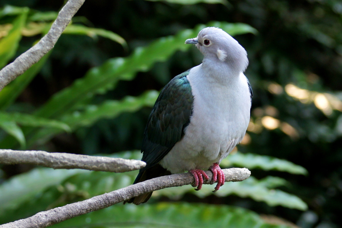
Green imperial pigeon. Image credit: Creative Commons
The existing protected areas cover about 14% of the ecoregion’s area, but there is hardly any scope for expansion because of extensive forest conversion. Two Key Biodiversity Areas have been identified in this ecoregion, and Khao Sam Roi Yot—meaning “mountain with three hundred peaks" in reference to the series of limestone hills—along the southwestern coast of Thailand is already a protected area. This area was designated because it harbors the only known population of the tree Wrightia lanceolata, which grows on limestone areas up to 300 m tall. Another Key Biodiversity Area, the Mae Klong Basin, extends into this ecoregion from the neighboring freshwater swamp forests ecoregion.
The recommended priority conservation actions are to: 1) strengthen protection measures in the Khao Sam Roi Yot Reserve and its endemic species and the biodiversity of the existing protected areas; 2) establish habitat corridors between protected areas to reduce fragmentation and improve connectivity for wildlife; and 3) develop and implement regulations to monitor and reduce forest conversion in the area.
Citations
1. Wikramanayake, E, E. Dinerstein, et al. 2002. Terrestrial Ecoregions of the Indo-Pacific: A Conservation Assessment. Island Press.
2. Critical Ecosystem Partnership Fund. Ecosystem Profile. Indo-Burma Biodiversity Hotspot. 2011 Update. Oct 2012. https://www.cepf.net/Documents/final.indoburma_indochina.ep.pdf Accessed 15 December 2017.
3. Tordoff, A.W., Baltzer, M.C., Fellowes, J.R., Pilgrim, J.D. and Langhammer, P.F., 2012. Key biodiversity areas in the Indo-Burma Hotspot: process, progress and future directions. Journal of Threatened Taxa, 4(8), pp.2779-2787.

Subscribe to receive monthly updates on climate solutions, environmental heroes, and the profound beauty and wonder of our shared planet Earth.
