
Guayaquil Flooded Grasslands
The ecoregion’s land area is provided in units of 1,000 hectares. The conservation target is the Global Safety Net (GSN1) area for the given ecoregion. The protection level indicates the percentage of the GSN goal that is currently protected on a scale of 0-10. N/A means data is not available at this time.
Bioregion: Ecuadorean Dry Coastal Forests & Flooded Grasslands (NT10)
Realm: Southern America
Ecoregion Size (1000 ha):
294
Ecoregion ID:
582
Conservation Target:
2%
Protection Level:
10
States: Ecuador
The endangered equatorial dog-faced bat can be spotted sallying insects as it flies over the flooded grasslands of Guayaquil. It has only two populations, both within this ecoregion and both severely affected by conversion of grasslands to agriculture and aquaculture. Due to its rarity, the equatorial dog-faced bat is understudied, and the impacts of numerous threats are not entirely understood.
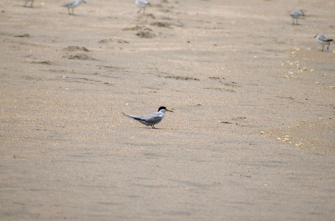
The flagship species of the Guayaquil Flooded Grasslands ecoregion is the Peruvian Tern. Image credit: Monics Paredes, Creative Commons
The ecoregion is in the provinces of El Guayas, Los Ríos, and El Oro in Ecuador. The region is associated with over 20 water basins, but the most important is the Guayas River Basin. The basin has a wide variety of climates, topography, soils, and vegetation. The southern section of the basin also encompasses an alluvial flood plain. The ecoregion is surrounded by moist forests to the north and west and dry forests to the east.
To the south it blends into coastal mangrove habitat. The soils in the basin belong to two large groups: alluvial and sedimentary. The alluvial soils are derived from various mineral materials and are located along the large rivers. In the northwestern and western portions of the Basin, the soils have developed from sedimentary rocks found in plateaus and low hills of the Balzar, Chongón, and Colonche Ranges.
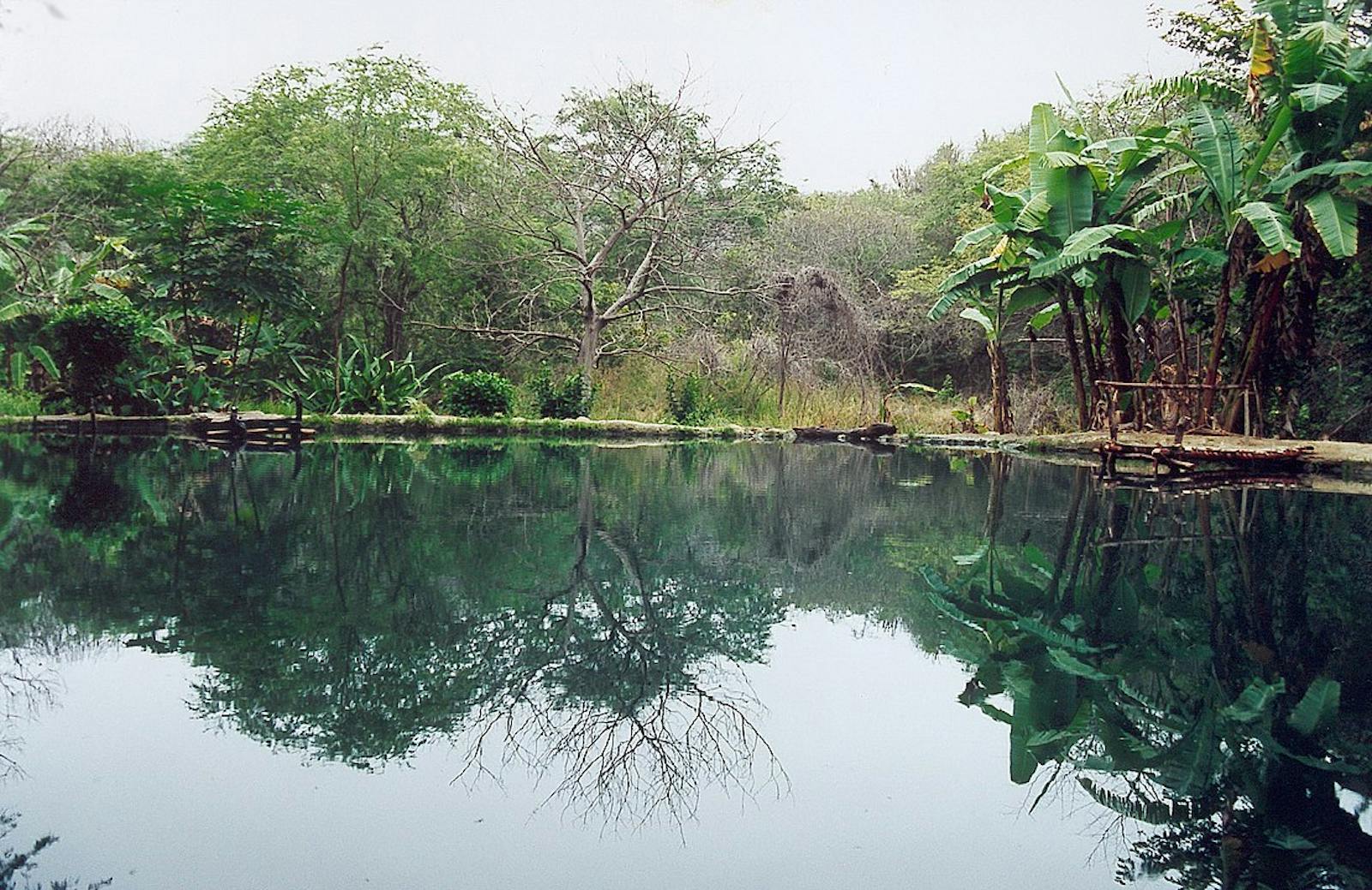
The vegetation consists of flooded grasslands, found throughout the ecoregion and interspersed with elements of the nearby tropical dry forests. The Guayas River basin also has tropical dry forest in its central section that receives an average annual precipitation of 1,500 mm. Flooded savannas can be mixed with tree savannas at higher altitudes.
Some of the aquatic grasses include the common water hyacinth, tropical pickerelweed, kidney-leaved mud-plantain, Cuban cigar, and Heliconia marginata. Land grasses include Echinodorus bracteatus, Alternanthera publiflora, hogvine, Luffa operculate, and yellow leafbract. Some of the trees are balsa, Jamaica cherry, west Indian elm, guacimilla, trumpet, and beldaco.
The flora and fauna of this ecoregion show low endemism and moderate biodiversity. The ecoregion still contains small remnants of natural flooded grasslands. These areas are characterized by aquatic plants that increase in number during the rainy season from January to March. Noteworthy bird species include yellow-bellied seed eater, the endangered Peruvian stern, and wetland species such as rufescent tiger-heron, horned screamer, and wood stork.
The ecoregion receives relatively little protection. Rapid environmental deterioration is ongoing as a direct result of a growing human population. Also, the region experiences extreme vulnerability to climatic phenomena such as El Niño. The basin of the Guayas River is the target site for large agricultural development programs, including rice plantations converted from natural habitats. Crayfish and tilapia aquaculture has been developed in the area without great success due to the lack of a marketing infrastructure.
Because of all these factors and more, the ecoregion has been listed as “Critical/Endangered”. All the lowlands of the Guayas watershed should be considered priority conservation areas in order to stop the conversion of land use to perennial crops. The original aquatic ecosystems that are being lost constitute important habitat for waterfowl and were proposed as a Ramsar Site of important wetland areas.
The priority conservation actions for the next decade are to: 1) introduce key protected areas to prevent the remaining habitats from being further converted for short term agriculture; 2) restrict development by zoning or establishing no-go zones where important biodiversity remains to counteract the sprawl from expanding cities; and 3) encourage and subsidize sustainable aquaculture.
Citations
1. Bonifaz de Elao, C. 2018. Western South America: Western Ecuador. https://www.worldwildlife.org/ecoregions/nt0905 Accessed September 5, 2018
2. UNESCO. 1980. Vegetation map of South America. Map 1:5,000,000. Institut de la Carte Internationale de Tapis Vegetal. Toulouse, France
3. Tirira, D. 2016. Molossops aequatorianus. The IUCN Red List of Threatened Species 2016: e.T13638A22109325. http://dx.doi.org/10.2305/IUCN.UK.2016-1.RLTS.T13638A22109325.en. Accessed September 5, 2018

Subscribe to receive monthly updates on climate solutions, environmental heroes, and the profound beauty and wonder of our shared planet Earth.
