

Madagascar Dry Deciduous Forests
The ecoregion’s land area is provided in units of 1,000 hectares. The conservation target is the Global Safety Net (GSN1) area for the given ecoregion. The protection level indicates the percentage of the GSN goal that is currently protected on a scale of 0-10. N/A means data is not available at this time.
Bioregion: Madagascar Island (AT6)
Realm: Afrotropics
Ecoregion Size (1000 ha):
15,241
Ecoregion ID:
32
Conservation Target:
18%
Protection Level:
2
States: Madagascar
The cat-like, swiftly moving fossa weave its way through the forests, climbing up and down giant tropical trees with its semi-retractable claws to hunt lemurs and wild pigs. As the island’s largest predator, the fossa is also endemic to the tropical forests of Madagascar. This highly diverse and endemism-rich ecoregion also hosts two endangered Malagasy species of baobab trees and the endemic golden-crowned sifaka.
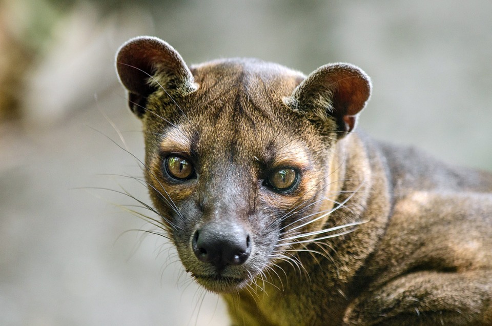
The flagship species of the Madagascar Dry Deciduous Forests ecoregion is the fossa. Image credit: Creative Commons
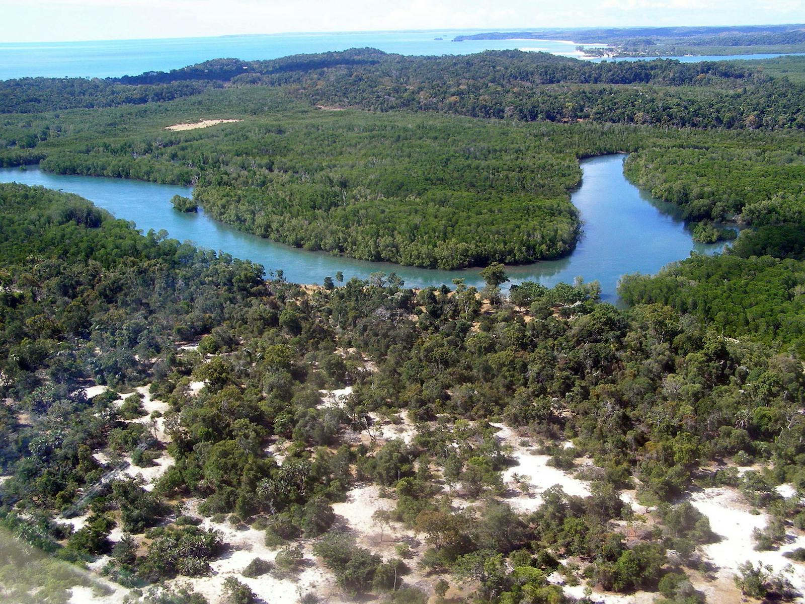
The ecoregion occurs in two separate geographic regions. The first is on the western side of Madagascar from the Ampasindava Peninsula in the north to Belo-sur-Tsiribihina and Maromandia in the south. The second is in the northern part of the island, excluding Mount Amber above 1,000 m. Elevation rises gradually from sea level at the western edge to around 600 m at the eastern edge, where it meets the margin of the central highlands.
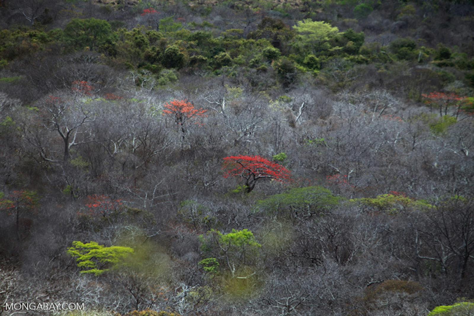
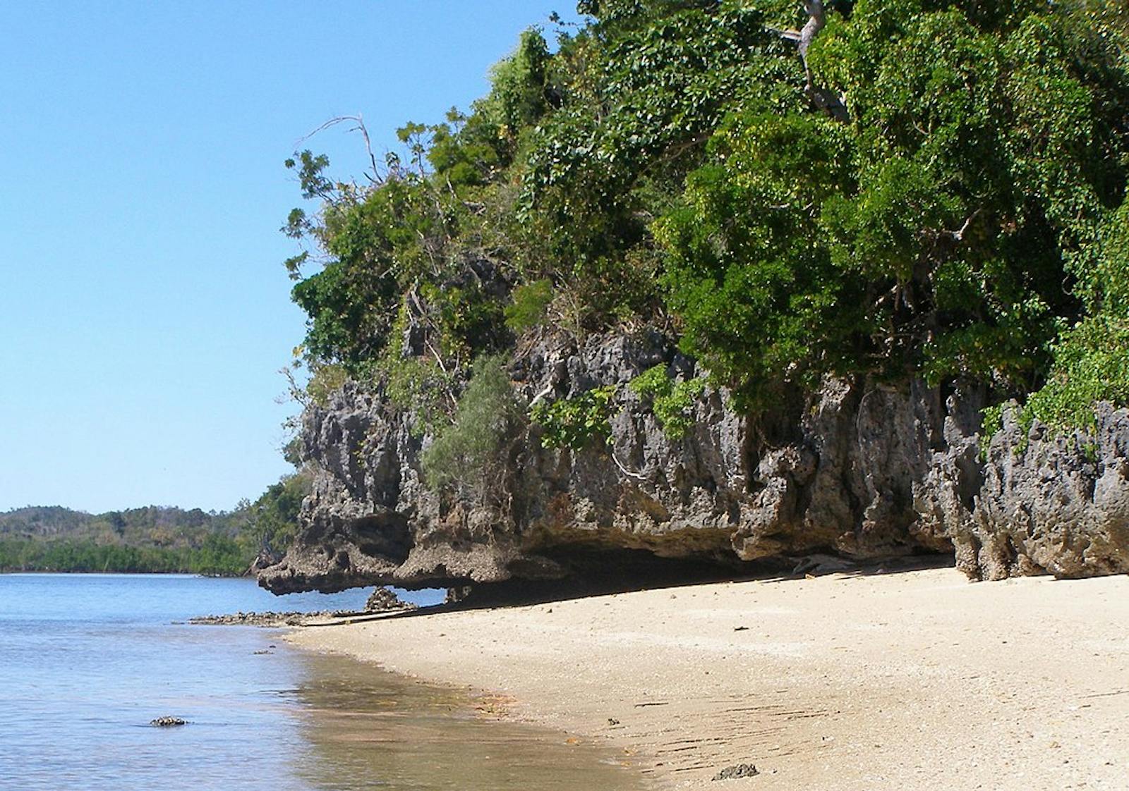
There is significant topographic variation, such as the limestone massifs of Ankarana, Namoroka, and Bemaraha, and the volcanic cone of Mount Amber. The climate of the ecoregion is tropical, with temperatures ranging from a mean maximum of 30° to 33ºC and a mean minimum of 8° to 21ºC. The ecoregion occupies the rainshadow on the western side of the central highlands and has a relatively long dry season. Most of the rain falls from October to April, with an annual average of around 1,500 mm in the north to around 1,000 m in the south. The forest is essentially deciduous with most trees losing their leaves during the dry season (May to October).
Trees include the flamboyant tree, several species of baobabs, and Pachypodium spp. on the drier, calcareous soils of the west. The tsingy massifs support Dalbergia and Cassia spp. (Leguminosea), Ficus spp. (Moraceae), and Adansonia madagascariensis. In the scrub layer, there are diverse liana species of the Asclepiadaceae family and shrubs of the Leguminosea and Rubiaceae families. The herb layer is sparse, although some forests have a carpet of Lissochilus orchids. The tsingy plateau includes excellent habitat for drought-adapted succulents. Species found on Ankarana include Pachypodium decaryi, Adenia neohumbertii, and several species ofEuphorbia.
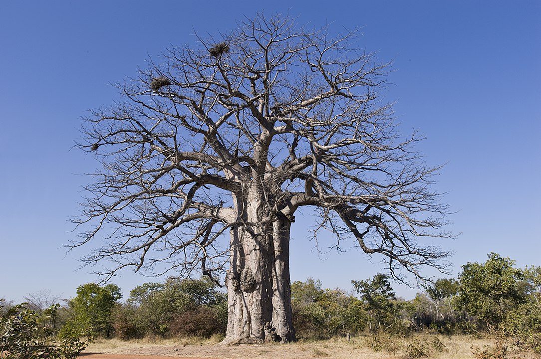
Baobab tree. Image credit: Alfred Weidinger, Creative Commons
The forest forms a major part of the western center of endemism in Madagascar. While plant species diversity is not as high as in the moist eastern forests, levels of endemism are higher: an estimate of 70 percent of the plant species found are endemic to this ecoregion. This includes pachycaul tree of Adansonia, Moringa, and Delonix hildebrandtii. Some of the plants are threatened by extinction, including two of the six Malagasy endemic baobab species. Endemic mammal species include the golden-crowned sifaka, mongoose lemur, western forest rat, and the golden-brown mouse lemur.
The ecoregion contains important habitats for terrestrial bird species listed for Madagascar. Several of these species are associated with lakes and rivers of the region, including Bernier’s teal, Madagascar fish-eagle, Humblot’s heron, and the Sakalava rail. Some of these species also use the fringes of the mangroves on the western coast of Madagascar.
A number of chameleon species are endemic to this ecoregion, including Namoroka Leaf and Decary’s Leaf chameleon. New species of plated lizard have also been recently described from the ecoregion—Zonosaurus bemaraha in the southern portion and Z. tsingy in the northern portion. The rivers and lakes are important habitats for the endemic Madagascar sideneck turtle and the scrubland and bamboo forests support the endemic ploughshare tortoise.
The main areas of intact forest are located near the western coast, and the areas closest to the central highlands are already composed of secondary grassland. Many of the isolated blocks of the remaining primary forest (mostly in small fragments of 35 km2 or less) are found in a number of protected areas including Ankarafantsika National Park (1,350 km2), Tsingy de Bemaraha World Heritage Site (1,520 km2), and Tsingy de Namoroka National Park (221 km2). Other special reserves include Ankarana (253 km2), Analamerana (420 km2), Bemarivo (121 km2), and Bora (41 km2).
The major threat to the forests is destruction and fragmentation through intentional burning to clear land for grazing and agricultural lands (slash-and-burn), and through wildfires sparked by burning adjacent secondary grasslands. Selective logging and the removal of large trees pose additional threats to forest habitat degradation. Several species of diurnal lemurs are hunted for food, and this may adversely affect the regeneration of the forests.
Lakes and wetland habitats are also being destroyed through rice paddy cultivation, overfishing, and invasive species (e.g. water hyacinth). Another more recent threat is large-scale oil exploration which also occurs in protected areas. Climate change is predicted to reduce and shift species’ ranges which will mean that there is reduced overlap between current protected areas and forest, and species’ habitat. This will increase the cost of conservation planning and management.
The priority conservation actions for the next decade will be to 1) implement management plans to protect baobab trees; 2) establish locally managed protected areas, prioritizing land which is multiple species habitat; and 3) maintain and restore connectivity between existing protected areas to create ecological corridors.
Citations
1. Burgess, N., Hales, J.A., Underwood, E., Dinerstein, E., Olson, D., Itoua, I., Schipper, J., Ricketts, T. and Newman, K. 2004. Terrestrial ecoregions of Africa and Madagascar: a conservation assessment. Island Press.
2. Waeber, P.O., Wilmé, L., Ramamonjisoa, B., Garcia, C., Rakotomalala, D., Rabemananjara, Z.H., Kull, C.A., Ganzhorn, J.U. and Sorg, J.P. 2015. Dry forests in Madagascar: neglected and under pressure. International Forestry Review. 17(S2), pp.127-148.
3. CEPF. 2014. Ecosystem Profile: Madagascar and Indian Ocean Islands. [Online]. [Accessed 2 February 2018]. Available from: https://www.cepf.net/sites/default/files/ecosystemprofile_madagascar_en.pdf
4. Busch, J., Dave, R., Hannah, L.E.E., Cameron, A., Rasolohery, A., Roehrdanz, P. and Schatz, G. 2012. Climate change and the cost of conserving species in Madagascar. Conservation Biology. 26(3), pp.408-419.

Subscribe to receive monthly updates on climate solutions, environmental heroes, and the profound beauty and wonder of our shared planet Earth.
