
Marajó Várzea
The ecoregion’s land area is provided in units of 1,000 hectares. The conservation target is the Global Safety Net (GSN1) area for the given ecoregion. The protection level indicates the percentage of the GSN goal that is currently protected on a scale of 0-10. N/A means data is not available at this time.
Bioregion: Amazon River Estuary (NT16)
Realm: Southern America
Ecoregion Size (1000 ha):
8,890
Ecoregion ID:
480
Conservation Target:
81%
Protection Level:
8
States: Brazil, French Guiana
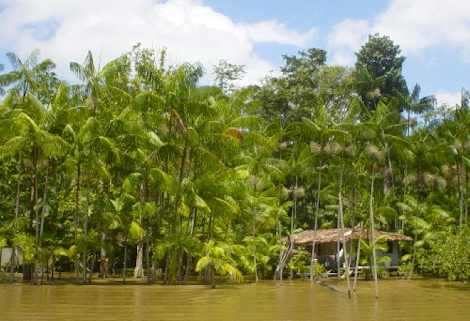
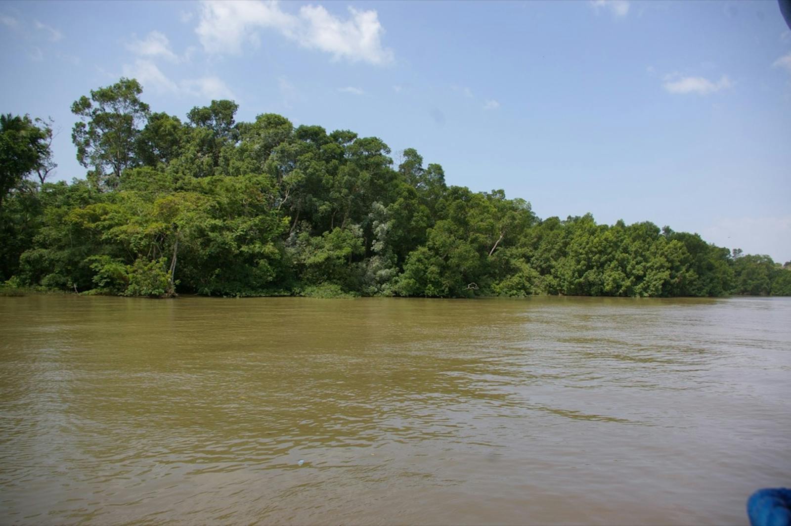
The Marajó Várzea ecoregion is a flooded forest complex that occurs in and around Marajó Island, which lies at the mouth of the Amazon River and largely separates the Atlantic Ocean from the inland rivers. Having completed its 6,500 km journey, the Amazon River passes through this ecoregion as it reaches the sea. This creates a highly dynamic ecosystem where salt and freshwater mix, and where forests can be underwater much of the year.
Not all species can tolerate these extreme conditions, but the Caribbean manatee is right at home. They thrive in the convergence zone where they have ample seagrass and lots of access to food and safety in the rivers and flooded forests.
.jpg)
The flagship species of the Marajó Várzea ecoregion is the Caribbean manatee. Image credit: Darryl Stansbury, Creative Commons
This várzea ecoregion comprises the entire Marajó Island, many smaller channel islands, and the surrounding mainland on both the northern and southern banks of the Amazon. It reaches west to the mouth of the Xingú River where the Amazon starts to widen its mouth. A small portion occurs in French Guiana. The climate is characterized as equatorial, with monsoon rainfall. Average annual temperatures are about 28°C. The entire area is characterized by poorly drained heavy mottled clay soils.
The floodwaters of the Amazon River are laden with suspended mineral sediments that settle out onto the landscape when the water flow slows. This area is called “region of the islands” because of the intricate labyrinth of sedimentary islands and channels. The várzea forest performs critical ecological functions by rapidly cycling nutrients, hosting a great diversity of freshwater fish and aquatic mammals, stabilizing the flooded soils and landscapes, and perhaps providing a source of new taxa that colonize the surrounding terra firme.
The várzea forest has a lower canopy, less species diversity, and a predominance of palms when compared to lowland forest outside of the flood plain. Large areas are dominated by pure stands of the economically important buriti palm and acai-palm. Trees common to the tidal várzea include important timber species such as baboonwood, Tornillo, kapok tree, capirona, and other species of large trees such as Ficus spp., money tree, chew stick, ant tree, and Ducke. On the banks of the rivers, the shrub manatee bush forms long, dense thickets.

Red Brocket. Image credit: Bernard Dupont, Creative Commons
On Marajó, Caviana, and Mexican Islands, there are over 690 known species of birds. There is a wide variety of aquatic birds including herons and egrets, ducks, ibis, and rosette spoonbills. Birds found here and in only few other places include white-bellied seedeaters, grassland yellow-finches, chalk-browed mockingbirds, tropical peewees, rufous-throated antbirds, black-breasted puffbirds, and plain-bellied emeralds.
Scientists have reported almost 100 mammal species in this ecoregion, such as the short-tailed opossum, and other near-endemic mammal species of armadillo, bats, primates such as marmosets, tamarins, and night monkeys, and savanna foxes. The vulnerable Caribbean manatee subspecies can also be found here. Very large fish live in the estuary and roam through the flooded forest eating and dispersing fruits from the floodplain trees. These include serrasalmid fish, tambaqui, pirarucu, and dusky narrow hatchfish.
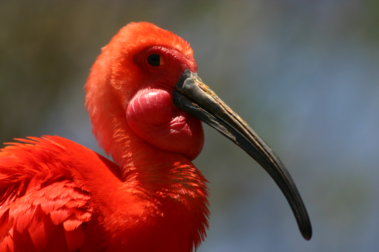
Scarlet Ibis. Image credit: Charles J Sharp, Creative Commons
Lying at the mouth of the Amazon’s “superhighway,” this region is greatly affected by human activities. Both the natural habitat and native biodiversity of the Marajó Várzea have suffered severe degradation from large-scale agricultural, forestry, and ranching operations. Notable protected areas in this region include the Marajó Archipelago Environmental Protection Area.
The most severe threat to this ecoregion is human-induced habitat loss. The majority of degraded land is the result of cattle and water buffalo ranching. Large-scale commercial logging on and around Marajó Island removed most native vegetation, except for certain valuable native species such as trees in the mahogany and chinaberry families. As ranching activities expand, habitat for various fauna species on flooded savannas and gallery forests is lost.
The priority conservation actions for the next decade are to: 1) establish strict-use protected areas to control of hunting and extractive activities to maintain populations of timber, fish, and mammals; 2) preserve flooded forests for fruit-eating fish; and 3) promote small-scale management of valuable timber species.
Citations
1. Sears,R. 2018. Northern Brazil at the mouth of the Amazon River. https://www.worldwildlife.org/ecoregions/nt0138. 7 August 2018
2. Daly, D. C., and J. D. Mitchell. 2000. Lowland vegetation of tropical South America. Pages 391-453 in D. L. Lentz, editor, Imperfect Balance: Landscape transformations in the Precolumbian Americas. New York, Columbia University Press.
3. Ferreira, L.V. 2001. A distribuição das unidades de conservação no Brasil e a identificação de áreas prioritárias para a conservação da biodiversidade nas ecorregiões do bioma Amazônia. Ph.D. Dissertation, INPA/UA.

Subscribe to receive monthly updates on climate solutions, environmental heroes, and the profound beauty and wonder of our shared planet Earth.
