
Midwest Canadian Shield Forests
The ecoregion’s land area is provided in units of 1,000 hectares. The conservation target is the Global Safety Net (GSN1) area for the given ecoregion. The protection level indicates the percentage of the GSN goal that is currently protected on a scale of 0-10. N/A means data is not available at this time.
Bioregion: Canadian Shield & Coastal Taiga-Forests (NA9)
Realm: Subarctic America
Subrealm: Canadian Boreal Forests
Ecoregion Size (1000 ha):
75,547
Ecoregion ID:
377
Conservation Target:
98%
Protection Level:
1
States: Canada: MB, SK, AB
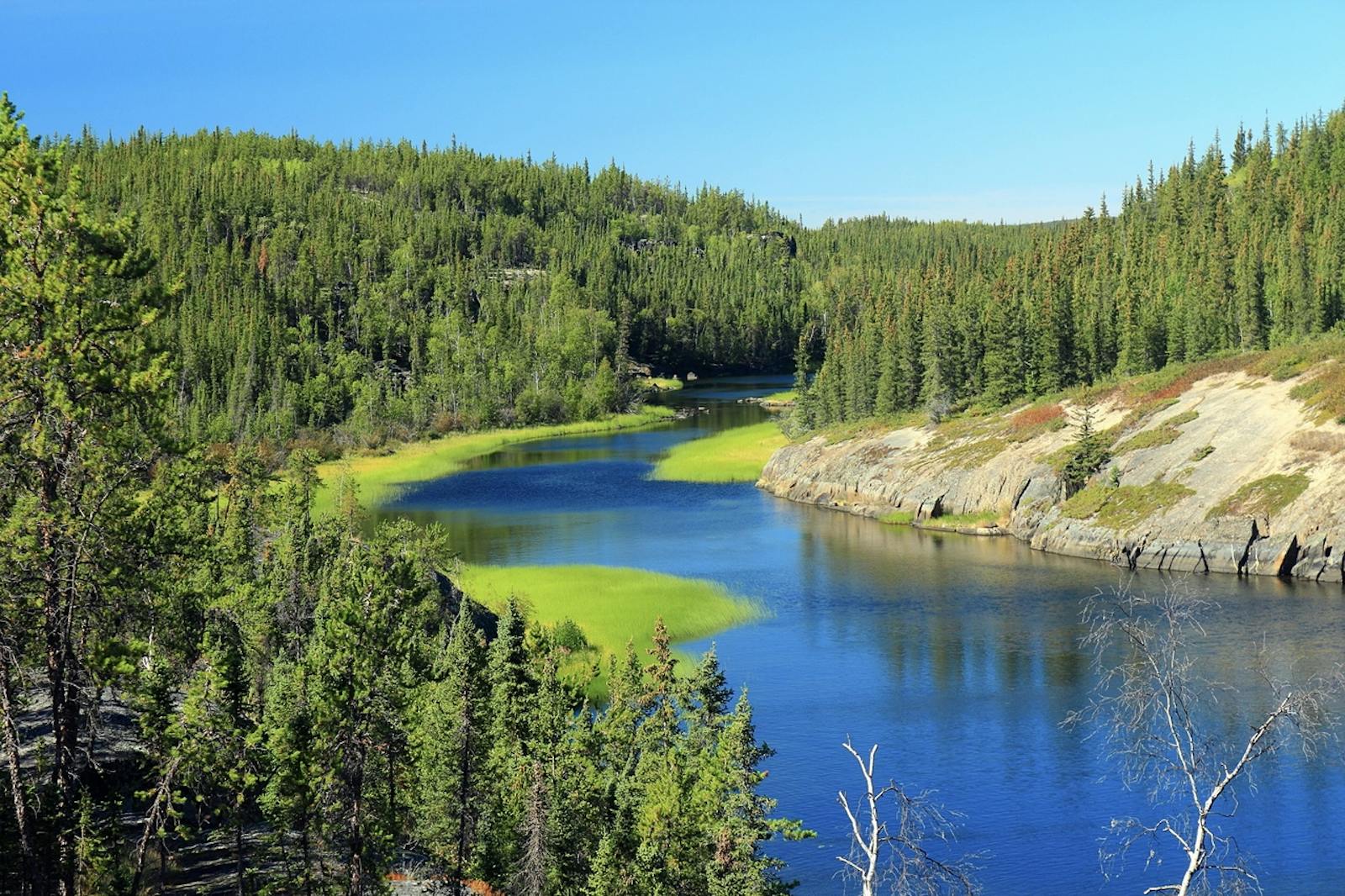
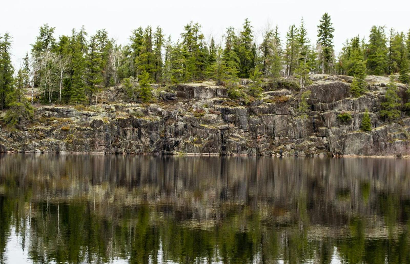
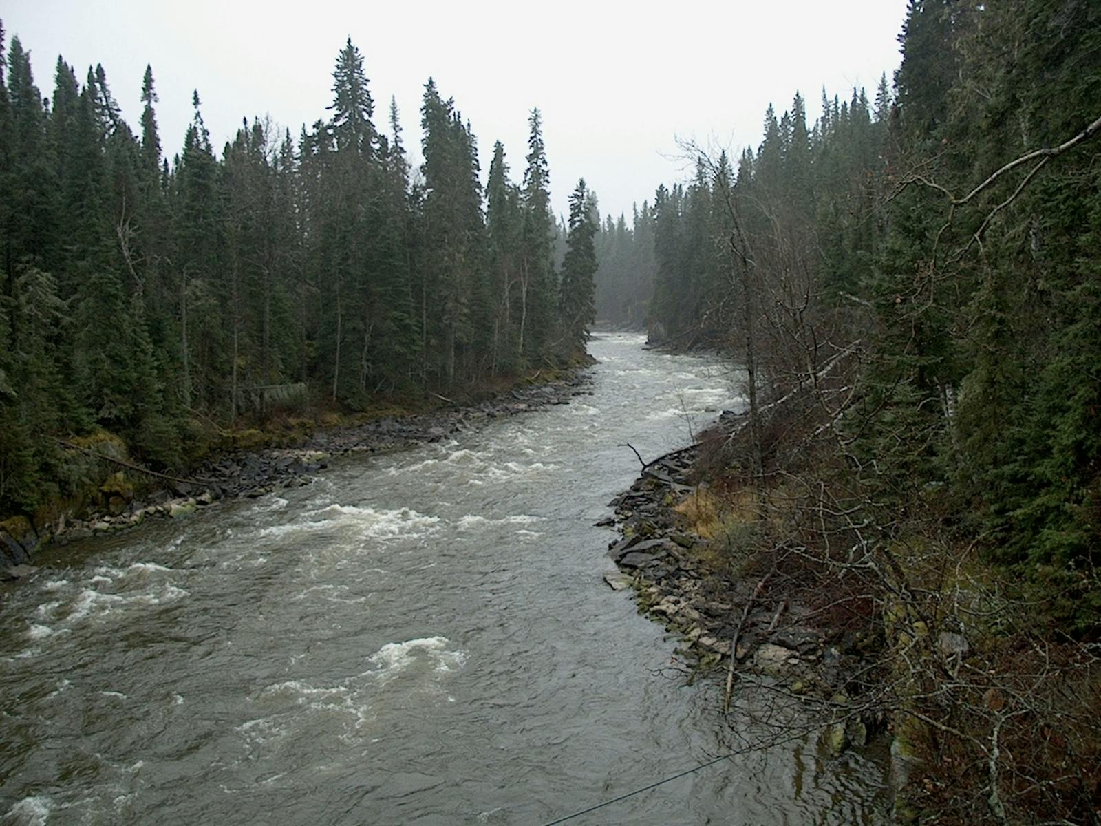
The Midwest Canadian Shield Forests ecoregion is an immense area stretching from the north shore of Lake Superior in Ontario northwestward through western Ontario and central Manitoba to the south shore of Lake Athabasca in northern Saskatchewan and Alberta. Besides Lake Athabasca, other large lakes included within or bordering this ecoregion are Lake Nipigon in Ontario, Lake Winnipeg in Manitoba, and Reindeer Lake in Manitoba and Saskatchewan.
The geology of this ecoregion is defined by the Canadian (Precambrian) Shield, the huge mass of exposed Precambrian igneous and metamorphic rocks (especially granitic gneisses) that forms the ancient geological core of the North American continent, some 2.5–4.2 billion years old. Glaciations strongly affected this ecoregion, which is still rising from the post-glacial rebound (a rise in the land surface after the retreat of the heavy ice sheets) after the last glaciation ended about 12,000 years ago. The ancient bedrock is mostly covered by sediments deposited in lakes and streams formed from melting Pleistocene glaciers, with occasional bedrock ridges and knolls.
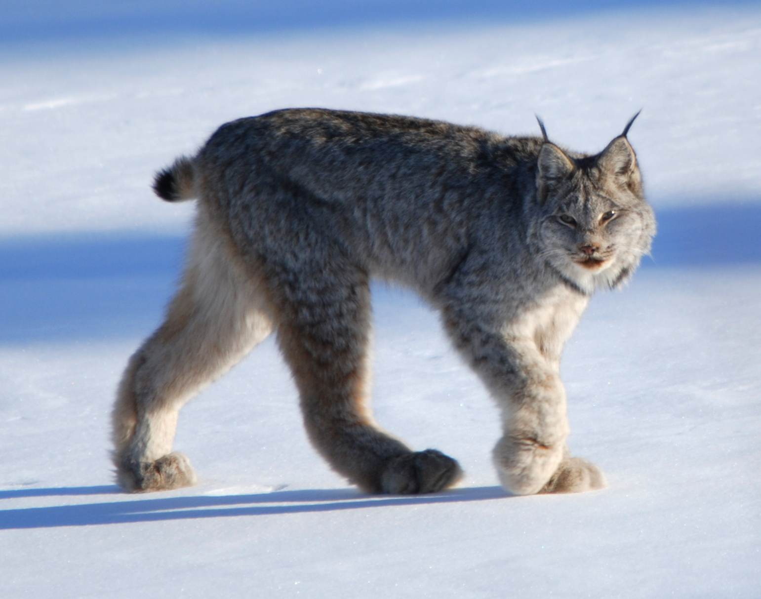
The Canadian lynx is the flagship species of the Midwest Canadian Shield Forests ecoregion, located in the Canadian Shield & Coastal Taiga-Forests bioregion (NA9)
The Athabasca Sand Dunes, formed around 8,000 years ago toward the end of the last glacial period, are one of the northernmost active sand dune complexes on Earth and the largest in Canada. These dunes are of extraordinary conservation value because of the presence of ten endemic plants (i.e., found nowhere else in the world), including two composites, one grass, one pinweed, four willows, one pink, and one leadwort.
Endemic species are extremely rare this far north due to the youth of the landscape, but the unique habitat conditions and isolation of these dunes provided the right conditions for the rapid evolution of new species, subspecies, and varieties.
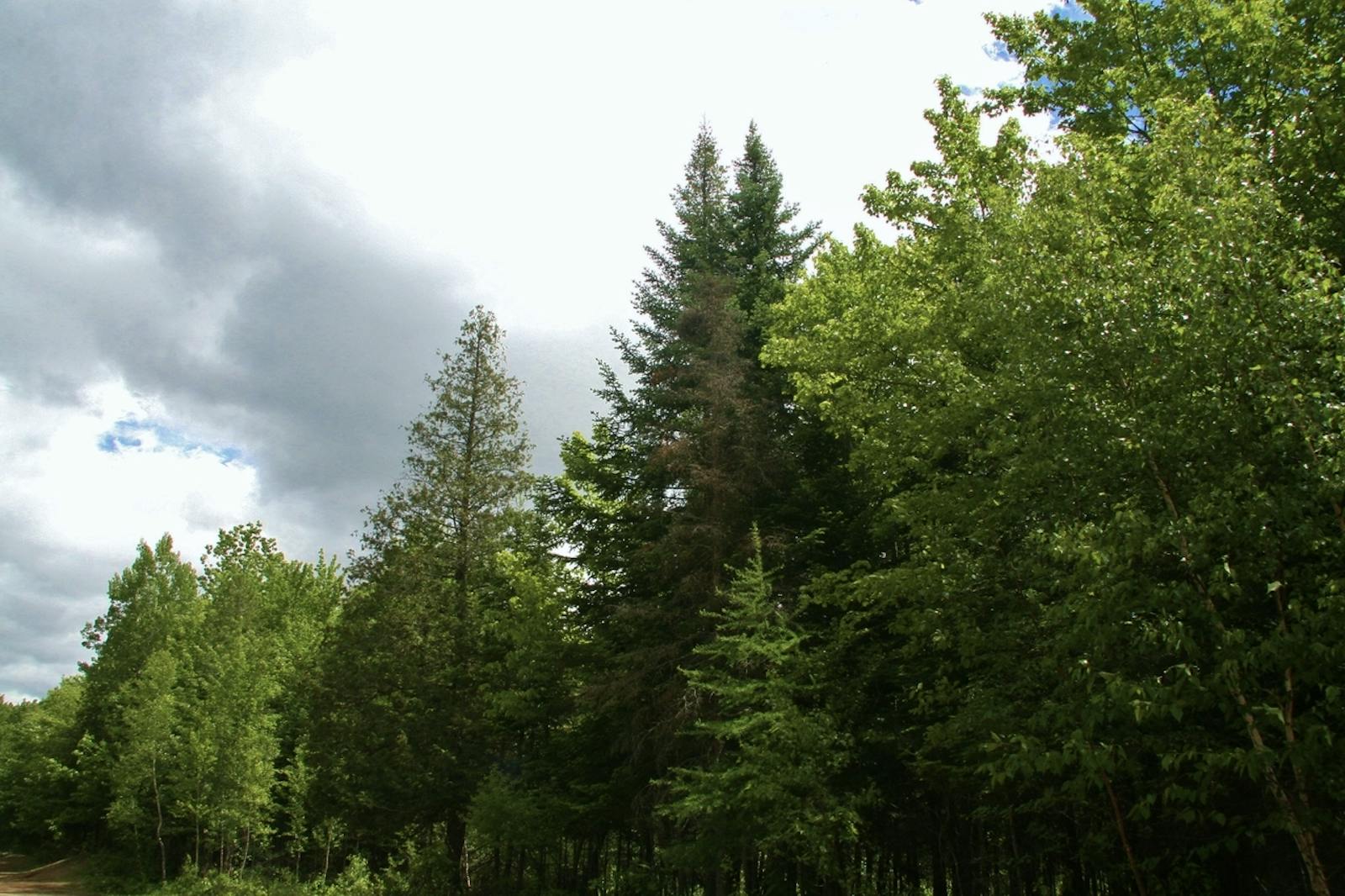
The climate of this ecoregion is sub-humid mid- to high-boreal. Summers are warm to cool, and winters are very cold. Permafrost occurs sporadically throughout much of the ecoregion. The boreal forest of this ecoregion is dominated by black spruce and jack pine, with a shrub layer of plants in the heath family and a ground layer of mosses and lichens.
This community is well adapted to the frequent lightning fires that often cover tens of thousands of hectares or more, especially on dry, relatively flat areas such as the Athabasca Plain. Quaking aspen, paper birch, white spruce, balsam poplar, and balsam fir also cover significant areas. Poorly drained areas are occupied by bogs and fens, typically dominated by black spruce.
.jpg)
Woodland caribou. Image credit: Courtesy of Breezer, Flickr
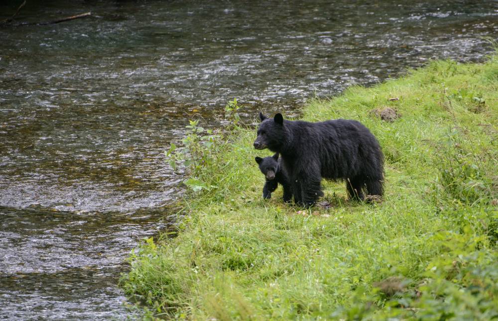
Mammals that can be found in this ecoregion include moose, woodland caribou (for which there is an important winter range in the Athabasca Plain), barren-ground caribou, black bear, Canadian lynx, wolf, beaver, snowshoe hare, otter, marten, and other mammals in the weasel family.
The number of breeding bird species, and species strongly dependent on the boreal forest, in this ecoregion and adjacent ecoregions to the west, is the highest in the entire Canadian boreal zone. Non-forest communities, including lakes, open wetlands, and the Athabasca Sand Dunes mentioned above, contribute substantially to the biodiversity of this ecoregion.
This ecoregion has 9% of its area protected. Most of the region is wildland, with 88% of the natural habitat remaining outside protected areas. Threats include rapidly expanding logging, mineral exploration, mining, acid deposition related to mining and oil and gas activity, and flooding from hydroelectric development.
Priority conservation actions for the next decade:
- Protect remaining intact blocks of natural vegetation, roadless areas, and undeveloped rivers and lakes.
- Greatly increase federal and provincial designation of conservation lands.
- Improve management of existing conservation lands, especially with respect to fire and carnivores (wolves, bears, lynx, weasel family).
-
-
1. Ricketts, T.H. et al. 1999. Terrestrial Ecoregions of North America: A Conservation Assessment. Island Press, Washington, D.C.
2. Elliott-Fisk, D.L. 2000. The taiga and boreal forest. In M.G. Barbour and W.D. Billings, editors. North American Terrestrial Vegetation, 2nd edition. Cambridge University Press, Cambridge, U.K.
3. Noss, R.F., K. Bennett, E. Butterworth, C. Francis, A. Couturier, P. Paquet, and K. Vance-Borland. 2002. Conservation Biology for Canada’s Boreal Forest. A project of the Canadian Boreal Trust (Pew Charitable Trusts). Conservation Science, Inc. Corvallis, OR. -
Cite this page: Midwest Canadian Shield Forests. Ecoregion Snapshots: Descriptive Abstracts of the Terrestrial Ecoregions of the World, 2021. Developed by One Earth and RESOLVE. https://www.oneearth.org/ecoregions/midwest-canadian-shield-forests/
-

Subscribe to receive monthly updates on climate solutions, environmental heroes, and the profound beauty and wonder of our shared planet Earth.
