
Mitchell Grass Downs
The ecoregion’s land area is provided in units of 1,000 hectares. The conservation target is the Global Safety Net (GSN1) area for the given ecoregion. The protection level indicates the percentage of the GSN goal that is currently protected on a scale of 0-10. N/A means data is not available at this time.
Bioregion: North Australian Tropical Savannas (AU8)
Realm: Australasia
Ecoregion Size (1000 ha):
47,420
Ecoregion ID:
187
Conservation Target:
53%
Protection Level:
0
States: Australia
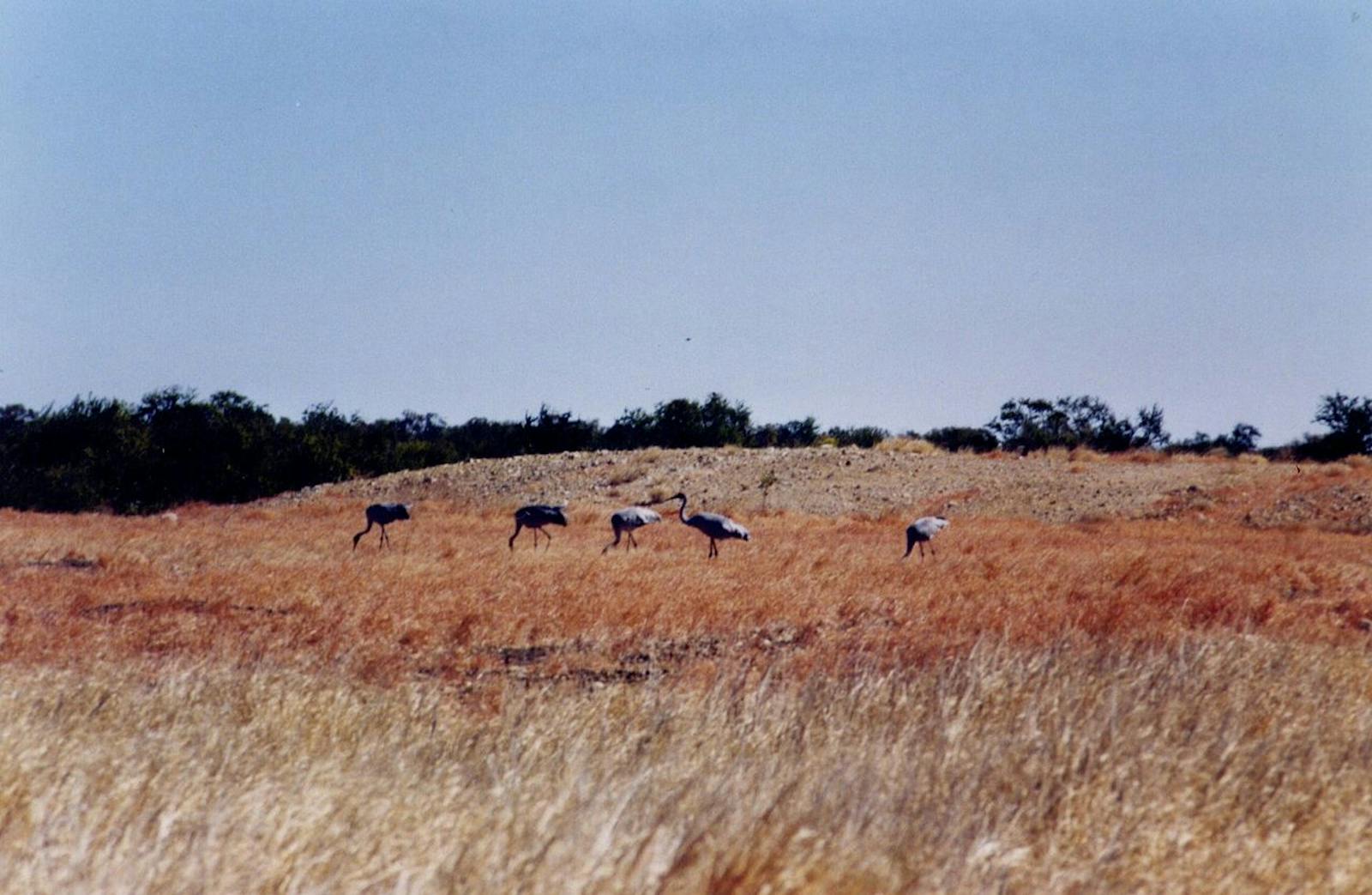
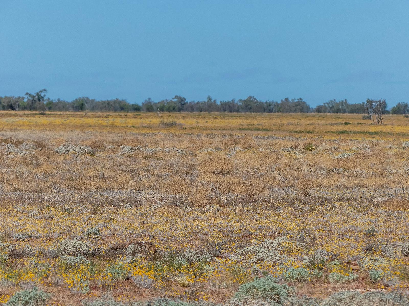
Mitchell grasses (Astrebla spp.) dominate vast treeless, rolling plains that stretch from central west Queensland into the Barkly Tableland on the northeast fringe of Australia’s central deserts. Pronounced variation in seasonality and rainfall are hallmarks of this ecoregion that transitions the drier interior of the continent to the humid lowlands of the northeast. Migratory waterbirds and shorebirds occasionally flock to ephemeral lakes after heavy rains. Some species, like the flock bronzewing pigeon (Phaps histrionica) and the long-haired rat (Rattus vilosissimus) respond to times of profuse rains through irruptions where large numbers of individuals aggregate to take advantage of abundant food in boom and bust cycles.
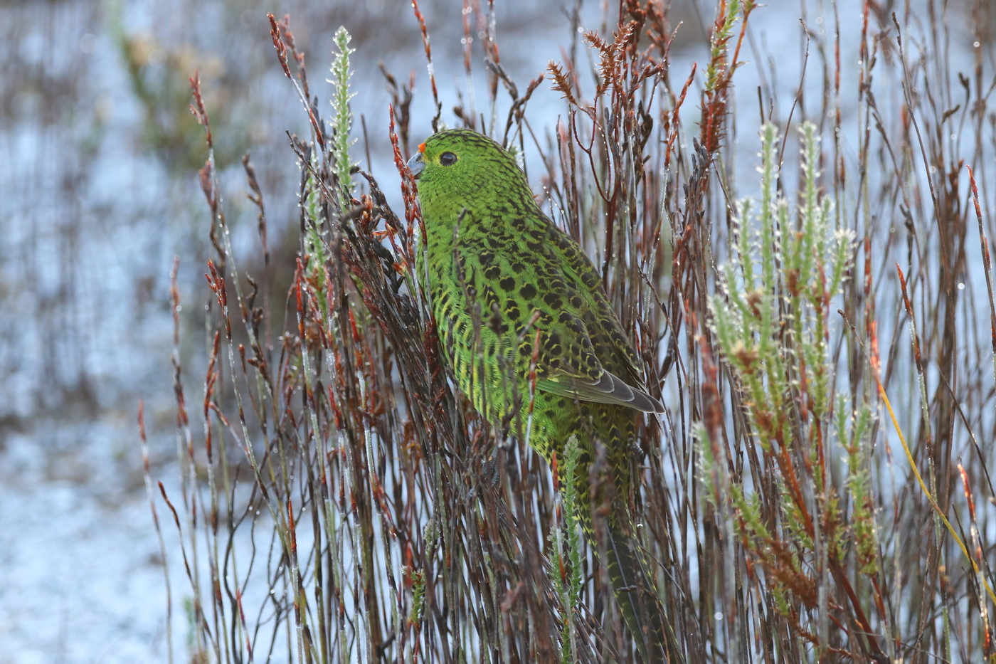
The flagship species of the Mitchell Grass Downs ecoregion is the night parrot. Image credit: Courtesy of Tas47, iNaturalist
Mitchell grasses (Astrebla spp.) are the dominant vegetation, scattered with patches of acacia woodlands dominated by gidgee (Acacia cambagei). Raised mesas are vegetated by lancewood (Acacia shirleyi) and low eucalypt communities with a spinifex (Triodia spp.) groundcover. Gidgee and brigalow (Acacia harpophylla) woodlands separated by Mitchell grasses occur in the southeastern part of the region. Eucalyptus populnea, E. melanophlia, and E. similas dominate the desert uplands woodlands. The area around Mount Isa features low open woodlands dominated by snappy gum (E. leucophloia), Cloncurry box (E. leucophylla), and silver box (E. pruinosa). The Queensland part of the ecoregion alone contains 1,732 native plant species. Mitchell grasslands support ten endemic plant species, such as the E. Leucophylla, E. whitei, and Lawrencia buchananensis.
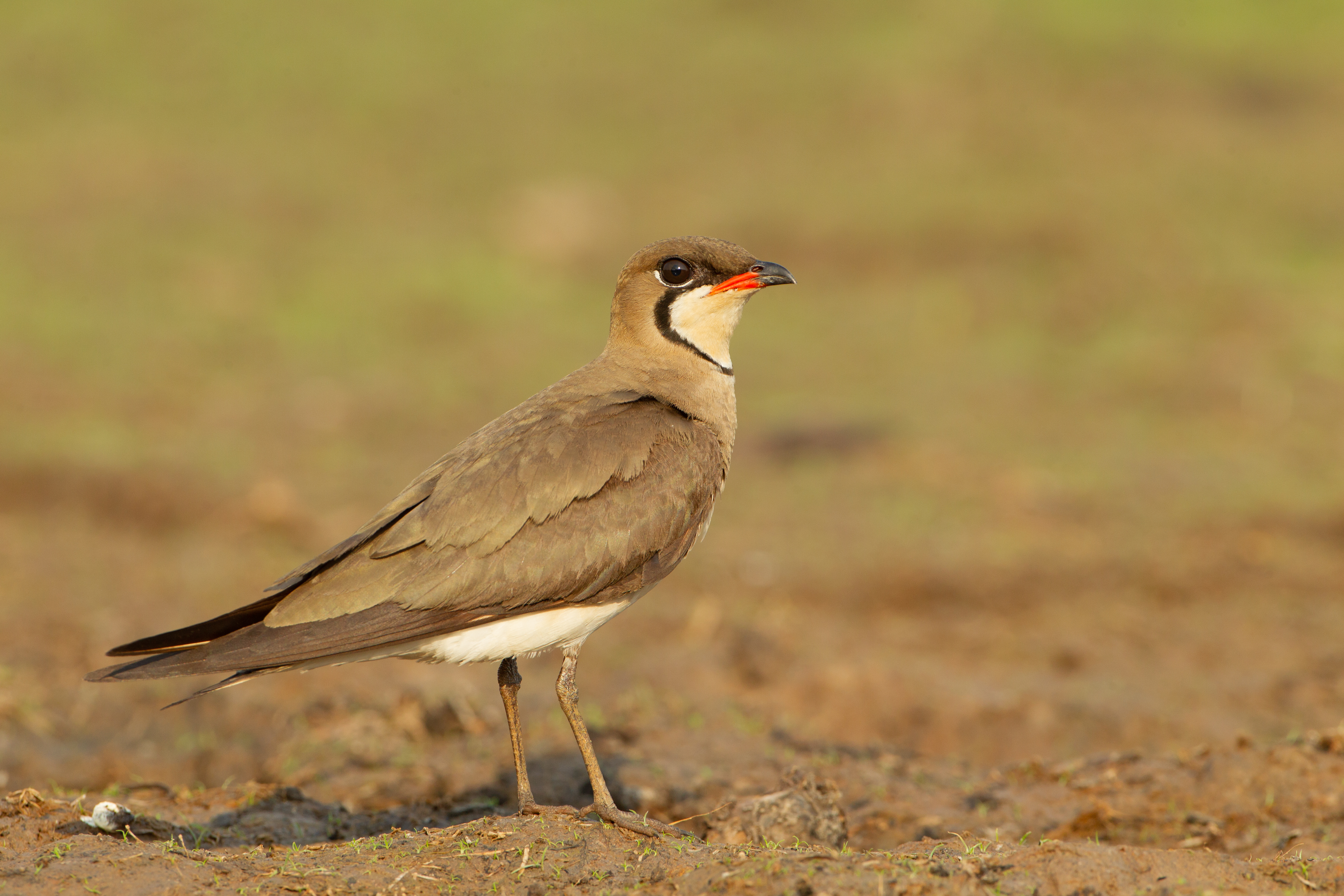
Oriental pratincole. Image credit: JJ Harrison, Creative Commons
Six endemic reptiles occur here, including the gecko Gehyra minuta, skinks (Ctenotus schevilli, C. agrestis, and C. joanae), and an agamid lizard Pogona henrylawsoni. The ecoregion is also the notable for several large venomous elapid snakes (Pseudonaja guttata, P. ingrami, and Pseudechis colletti) and a rich lizard fauna. Seventy-five mammals have been recorded, including the Carpentarian Antechinus (Pseudantechinus mimulus), the long-tailed planigale (Planigale ingrami), and the stripe-faced dunnart (Sminthopsis macroura), the latter living in the deep fissures. The desert rat-kangaroo, lesser stick-nest rat, and western quoll are extirpated. The ecoregion has the largest range of the endangered night parrot, one of the most elusive and mysterious birds in the world (Geopsittacus occidentalis). The ecoregion is a hotspot for Australian ant diversity.
Astrebla Downs National Park is the largest in the ecoregion at 1,740 km2. There are 5 DIWA Nationally Important Wetlands and 8 National Parks. Among the three small protected areas (556 km2), only the Connell’s Lagoon Conservation Reserve is managed as an IUCN category I-IV reserve. The Mount Isa Inlier region supports vulnerable species such as Petrogale purpureicollis, Macroderma gigas, and other rare flora, yet very little of it is protected in the National Parks.
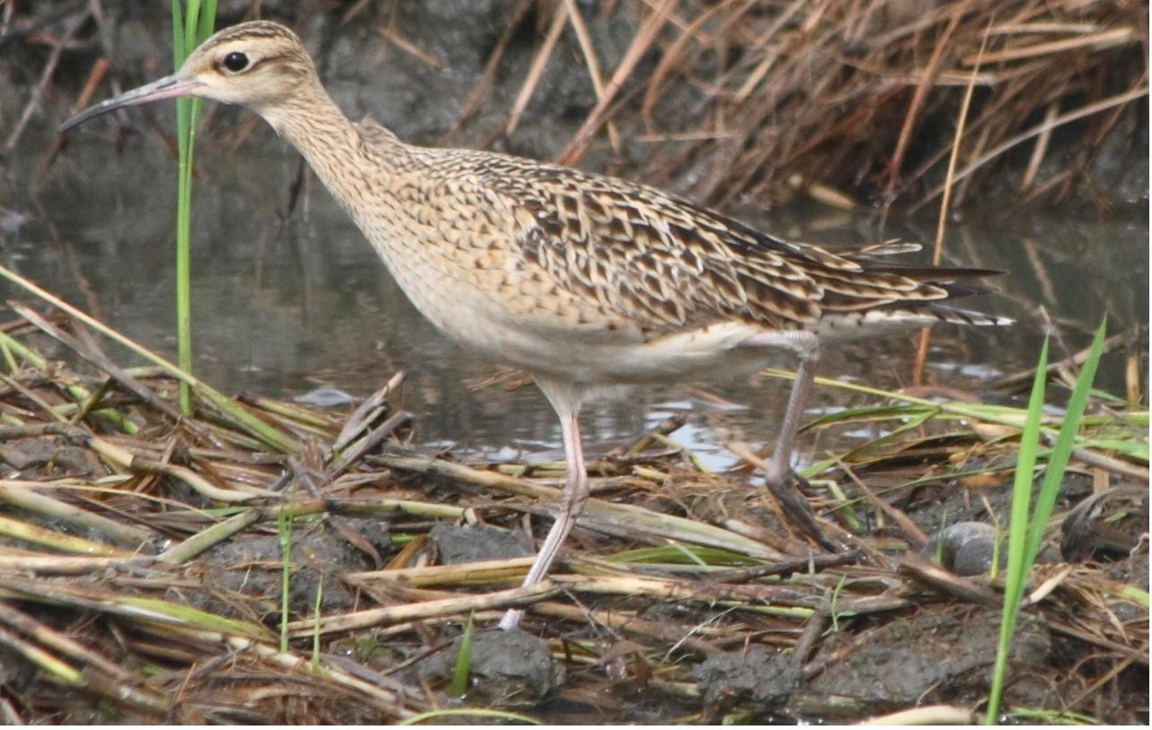
Little curlew. Image credit: Wayne Cheng, Creative Commons
The unprotected Lake Sylvester system is a Key Biodiversity Area supporting endemic species, such as Bergia barklyana and Goodenia cylindrocarpa, as well as up to 65 species of waterbirds including 3,000 pairs of glossy ibis and 1,000 pairs of great and intermediate egrets. Rates of land clearance for grazing in the Jericho Shire in the Desert Uplands is among the highest in Australia. Cattle are causing degradation of limited riparian and wetland habitats. Increasing number of weed, such as prickly acacia (Acacia nilotica), alter vegetation structure and composition, infesting over 5,000 km2.
The key conservation actions for the next decade are to: 1) protect and manage the Lake Sylvester and Tarrabool Lake-Eva Downs Swamp Systems; 2) discourage the use of exotic fodder species which spread into and degrade natural habitats; and 3) target feral cat and pig eradication efforts around key sites for threatened species.
Citations
- Baker, B., Fisher, A., and Woinarski, J. 2002. Mitchell Grass Downs, Northern Territory. Retrieved from https://www.researchgate.net/publication/238723990_Mitchell_Grass_Downs_Northern_Territory
- Department of the Environment and Energy. (2008). Rangelands 2008 — Taking the Pulse- Mitchell Grass Downs bioregion [Ebook]. Retrieved from https://www.environment.gov.au/system/files/resources/a8015c25-4aa2-4833-ad9c-e98d09e2ab52/files/bioregion-mitchell-grass-downs.pdf
- Fisher, A. 2001. Mitchell grasslands: biogeography and conservation. PhD thesis. Northern Territory University, Darwin.

Subscribe to receive monthly updates on climate solutions, environmental heroes, and the profound beauty and wonder of our shared planet Earth.
