
Motagua Valley Thornscrub
The ecoregion’s land area is provided in units of 1,000 hectares. The protection goal is the Global Safety Net (GSN1) area for the given ecoregion. The protection level indicates the percentage of the GSN goal that is currently protected on a scale of 0-10.
Bioregion: Central American Mixed Forests (NT25)
Realm: Central America
Ecoregion Size (1000 ha):
234
Ecoregion ID:
605
Conservation Target:
75%
Protection Level:
0
States: Guatemala
The endemic Motagua Valley beaded lizard searches among the thorny plants for nests and their favorite food, eggs. With less than 200 individuals remaining in the wild, it is one of the most endangered lizards in the world. Although some consider this a subspecies of the Mexican beaded lizard, the populations in this ecoregion are small and isolated. Unfortunately, this species’ uniqueness also contributed to one of its greatest threats: their over-collection for the illegal pet trade. Urgent conservation actions are needed to prevent their extinction.
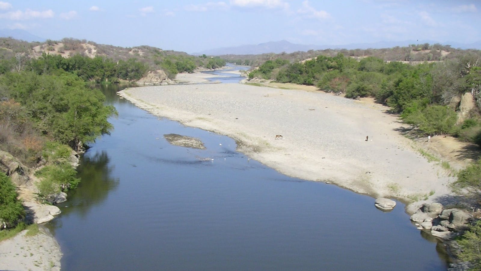
The Motagua Valley is situated in northeastern Guatemala along the border of Honduras. It lies on the fracture zone of the North American and Caribbean continental plates, which have been moving apart since the Cenozoic period 60 million years ago. It is among the smallest ecoregions in Mesoamerica at approximately 2,000 km2, and its composition is heavily influenced by a single large river, the Motagua River, which flows into the Atlantic Ocean.
.%20Image%20credit%20Matthijs%20Kuijpers%2C%20Dreamstime.jpeg "Motagua Valley beaded lizard (Heloderma charlesbogerti),")
The Motagua Valley beaded lizard (Heloderma charlesbogerti), also known as the Guatemalan beaded lizard, is the flagship species of the Motagua Valley Thornscrub ecoregion. Image credit: © Matthijs Kuijpers, Dreamstime
The Motagua Valley Thornscrub ecoregion is one of the driest areas of Central America, and the valley is subjected to high temperatures, up to 41°C. Surrounded by mountains that reach up to 3,000 m on the northern side and 2,000 m on the south, the valley receives less than 500 mm of precipitation annually. The valley experiences a short growing season, with most rain falling from June to August. The dry climate and its extended dry season contrast sharply with the bordering mountaintop cloud forests, which receive rainfall up to 10 times as much.
Vegetation is limited by the dry climate and sandy soil. Plants in the Motagua Valley are dominated by spiny species, like cacti and acacia, and thorny shrubs that are well-adapted to the limited water available in the region. A few river valleys with permanent water support relatively rich evergreen, riparian forests that greatly contrast with the rest of the area.
.%20Image%20credit%20Mdf%2C%20CC%20BY%20SA%203.0.jpg "Tyrant flycatcher (Tyrannidae)")
Tyrant flycatcher (Tyrannidae). Image credit: Mdf, CC BY SA 3.0
Only 75 bird species are known to occur in the valley, with pigeons, doves, tyrant flycatchers, finches, and other songbirds sufficiently abundant in the upper valley. This valley is the only known location of russet-crowned motmot, a species found nowhere else in the world. It is also home to a number of threatened lizards, including the Guatemalan spiny-tailed iguana and the Motagua Valley beaded lizard.
No protected areas exist within the valley, and current land use trends will inevitably eliminate much of the native biodiversity. However, there is an effort by a national conservation group, Defensores de la Naturaleza, to extend the nearby Sierra de las Minas Biosphere Reserve into the Motagua Valley. The success of this initiative is critical to the future of this ecoregion.
Human development seriously threatens the integrity of all components of the Motagua. The valley floor has been almost entirely converted to irrigated cropland and subsistence agriculture. Only about 200–300 km2 (10–15% of the total) remain as relatively intact natural habitat. Riparian habitats of the smaller feeder rivers have largely been converted to a mixture of fruit trees and small patches of irrigated annuals, like corn and beans. The lower, drier hillsides are used for livestock ranching, including cattle, goat, and sheep, while hillsides higher in the valley are planted with coffee and cardamom.
Priority conservation actions for the next decade:
- Create protected areas within Motagua Valley.
- Reduce land conversion.
- Support sustainable development initiatives.
-
-
1. Powell, G., and S. Palminteri. 2018.. Guatemala. https://www.worldwildlife.org/ecoregions/nt1312. Accessed June 14, 2018.
2. Dix, M.A. 1997. Sierra de las Minas Region and Biosphere Reserve, Guatemala. In WWF and IUCN, Centres of plant diversity. A guide and strategy for their conservation.
3. Land, H. C. 1970. Birds of Guatemala. Wynnewood, PA: Livingston.
4. Ariano-Sánchez, D., Campbell, J. & Muñoz-Alons, A. 2013. Corytophanes percarinatus. The IUCN Red List of Threatened Species 2013: e.T197475A2488093. http://dx.doi.org/10.2305/IUCN.UK.2013-2.RLTS.T197475A2488093.en. Downloaded on 30 August 2018. -
Cite this page: Motagua Valley Thornscrub. Ecoregion Snapshots: Descriptive Abstracts of the Terrestrial Ecoregions of the World, 2021. Developed by One Earth and RESOLVE. https://www.oneearth.org/ecoregions/motagua-valley-thornscrub/
-

Subscribe to receive monthly updates on climate solutions, environmental heroes, and the profound beauty and wonder of our shared planet Earth.
