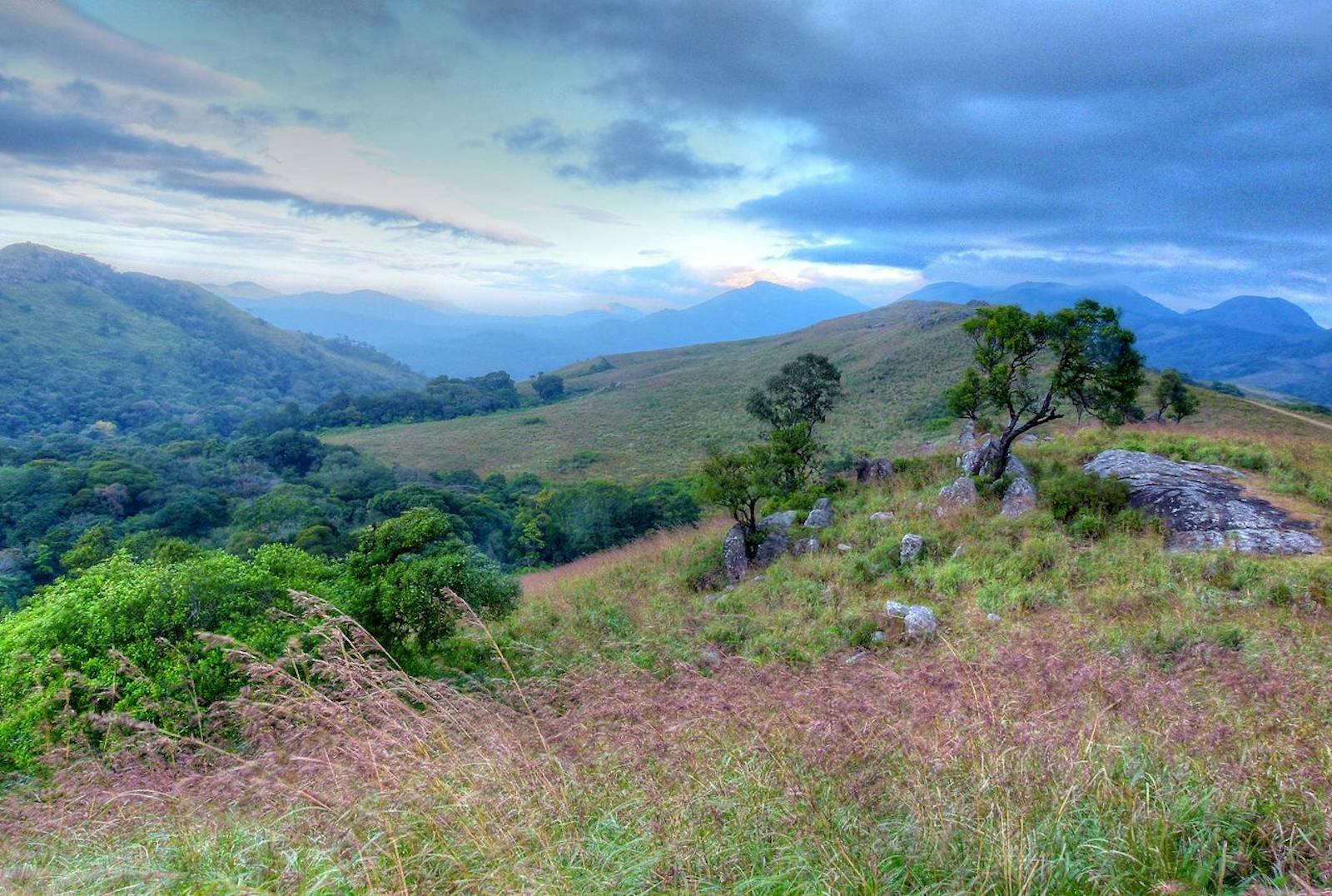

Narmada Valley Dry Deciduous Forests
The ecoregion’s land area is provided in units of 1,000 hectares. The conservation target is the Global Safety Net (GSN1) area for the given ecoregion. The protection level indicates the percentage of the GSN goal that is currently protected on a scale of 0-10. N/A means data is not available at this time.
Bioregion: Indian Dry Deciduous Forests (IM3)
Realm: Indomalaya
Ecoregion Size (1000 ha):
17,026
Ecoregion ID:
296
Conservation Target:
5%
Protection Level:
9
States: India
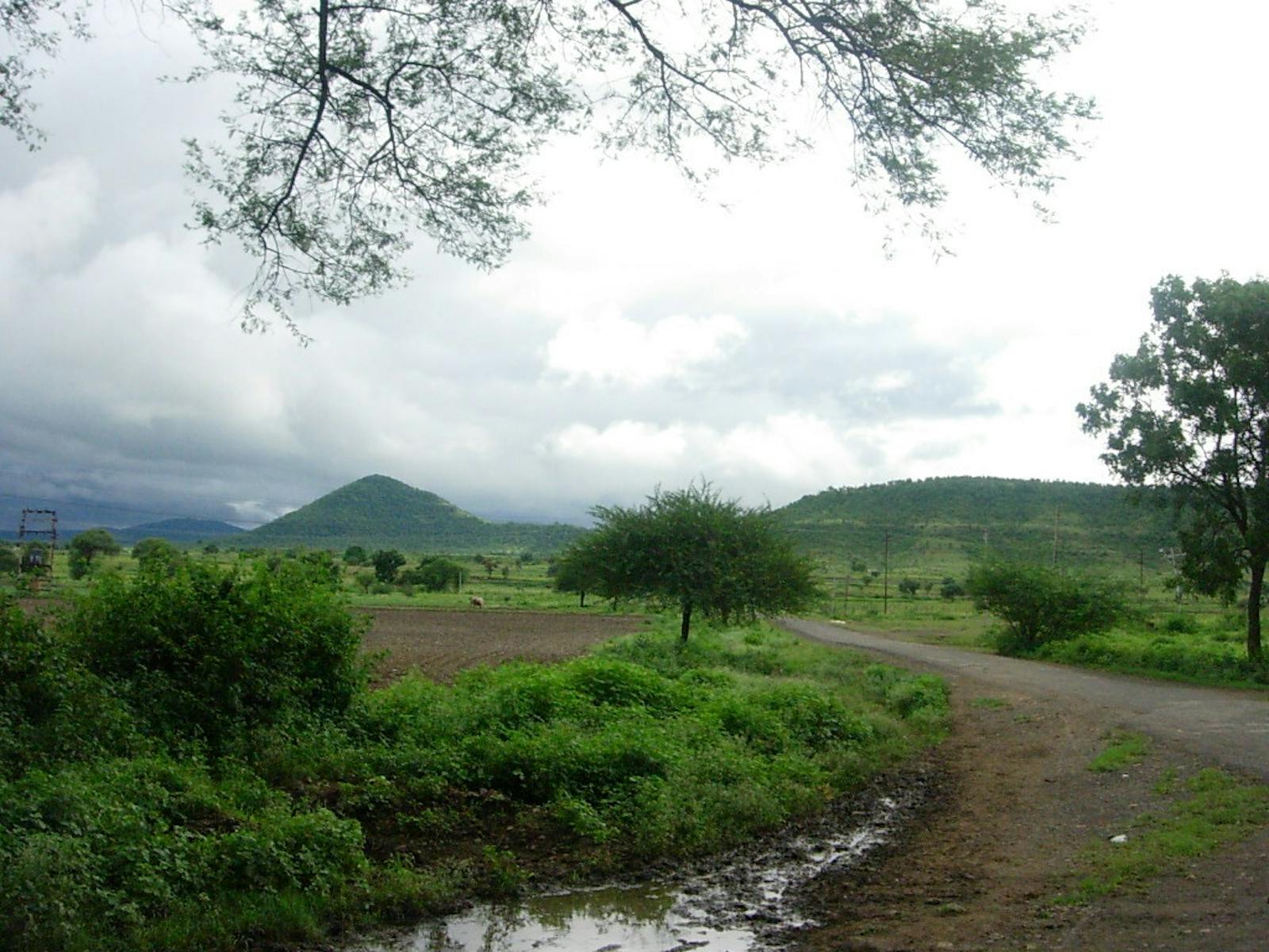
The Narmada Valley Dry Deciduous Forests ecoregion is the site of India’s most contentious hydro-project to build a series of 30 dams along Narmada River: India’s fifth longest river, and the third longest that flows entirely within India. Over 150 km of river length below the main Narmada Dam is now dry for most of the year, and that single reservoir has inundated 400 km2 of prime wildlife habitat for tiger, common leopard, sloth bear, and Indian wolf, all species that require large areas of connected habitat.
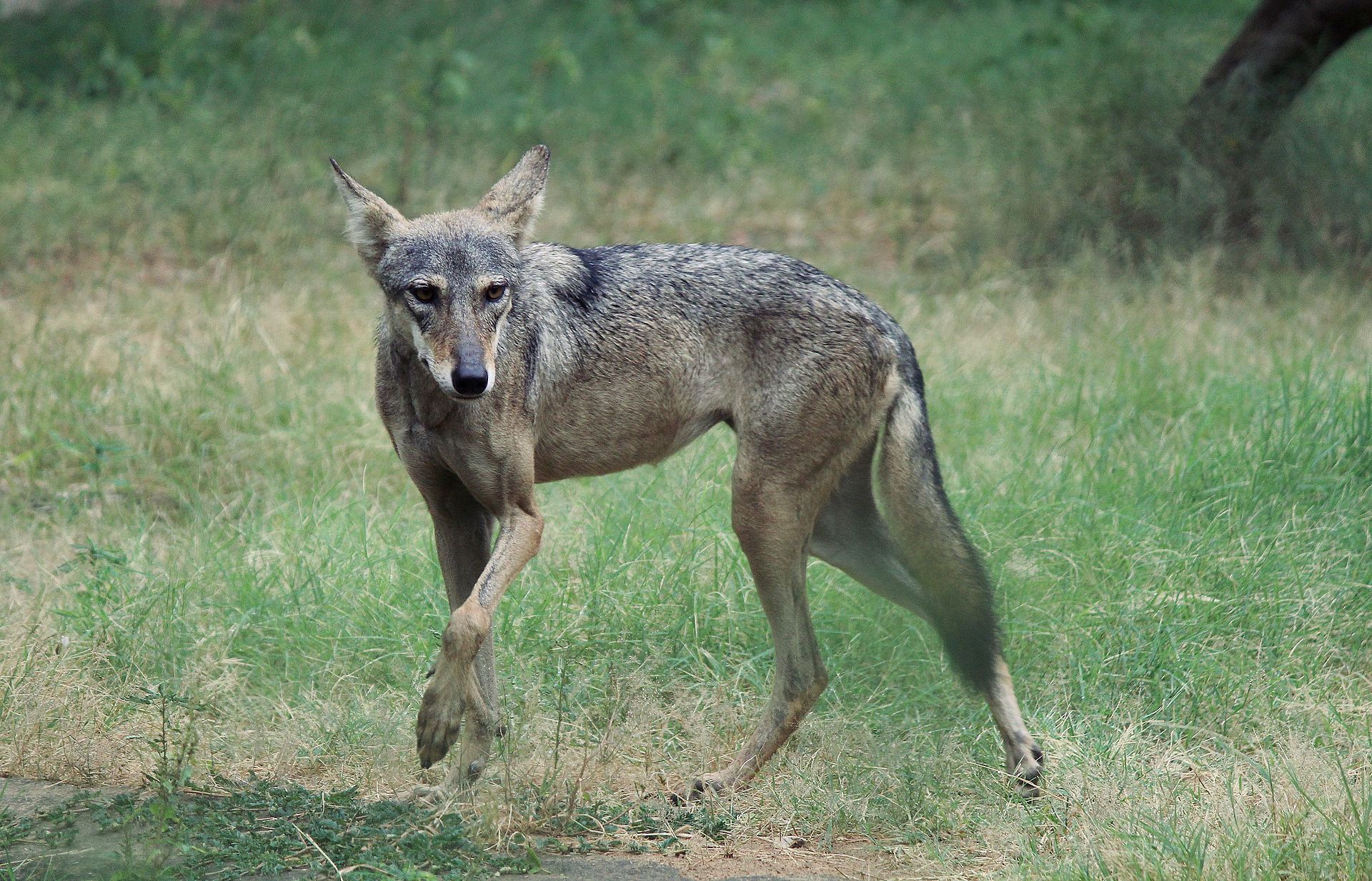
The flagship species of the Narmada Valley Dry Deciduous Forests ecoregion is the Indian wolf. Image credit: Creative Commons
The ecoregion represents the dry forests along the Narmada River Valley, a rift valley situated in a fault zone marking the boundary of northern India and the Indian Peninsula. The river originates in the Amarkantak Plateau where the two mountain ranges, Vindhya and Satpura, that flank the river valley converge in the central Indian State of Madhya Pradesh. From there, it flows west for over 1,300 km before draining into the Arabian Sea in Gujarat State.
The peninsula has paleogeological roots to the ancient supercontinent, Gondwanaland. The fossilized bones of a carnivorous dinosaur, Rajasaurus narmadensis or ‘Regal reptile from Narmada’, discovered from the valley confirms the Gondwana origins, since this dinosaur is closely related to another discovered from Madagascar.
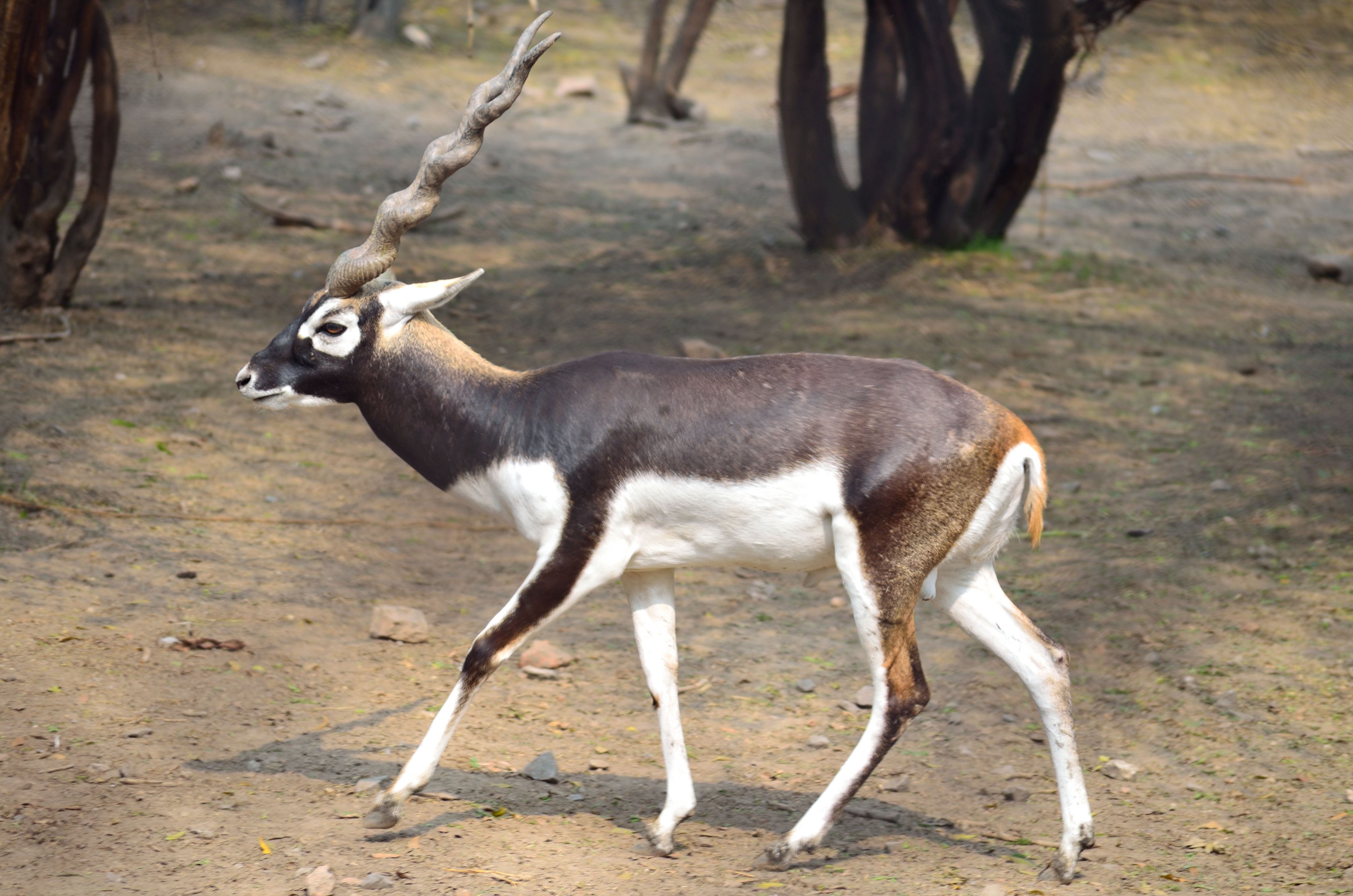
Blackfuck. Image credit: Creative Commons
The climate is mildly seasonal. The 7-8 month dry season is interrupted by the southwest monsoon from June to September, which brings about 1,200 to 1,500 mm of rainfall. Temperatures can range from around 17–20ºC in the winter to 30–33ºC in the summers. The vegetation is influenced by this seasonality.
The forests are dominated by teak, a highly prized timber tree. Other common trees include species of Diospyros (East Indian ebony), Lagerstroemia, Terminalia, and Hardwickia, all typically found in Indian dry forests.[ii] The riparian trees along the river banks are different, comprising of Terminalia arjuna, Syzygium spp. and Salix spp. (Indian willow).
_Found%20in%20ec0296-CC-Sharp%20Photography-2017_resized.jpg)
Bengal tiger. Image credit: Courtesy of Sharp Photography
Although not exceptional in endemism or species richness—the known number of mammals is only 76 species—the ecoregion is important for the conservation of the subcontinent’s large vertebrates, especially the mammals. The ecoregion still retains large, connected blocks of habitat for many of India’s large animals, such as the tiger, common leopard, gaur, wild dog, sloth bear, and blackbuck.
Throughout most of their ranges, these species are being increasingly confined to small forest fragments that do not offer much hope for long-term survival. Genetic studies of tigers in this and adjoining ecoregions have clearly shown that fragmenting habitats tend to isolate populations and cause genetic degradation. Thus, it is important to safeguard these large habitat areas where they exist. The bird fauna is richer, with 276 species, including the globally threatened lesser florican and the endangered Indian bustard.

Lesser florican in flight. Image credit: Andgad Achappa, Creative Commons
Most of the natural forests have been cleared, but forests still exist, especially along the Satpura and Vindhya Ranges. Seventeen protected areas cover about 7,600 km2, a sizable extent if connectivity is maintained. But the threats of forest clearing and conversion remain constant, requiring constant vigilance.
Thus, the priority conservation actions should be to: 1) maintain corridors between protected areas to allow for species dispersal, especially with tigers; 2) strengthen vigilance against encroachment into protected areas, especially as the dams along the river are being built and the reservoirs begin to displace people; and 3) strengthen protected areas management.
Citations
1. Verma, P., Rao, M.R. and Patnaik, R. 2011. Vegetation and Climate of Narmada Hominins. 2011.In: Asian Perspectives on Human Evolution, Chapter: Vegetation and Climate of Narmada Hominins, Publisher: Macmillan Publishers India Ltd., Editors: D. S. Singh and N.L. Chhabra, pp.142-147
2. Wikramanayake, E, E. Dinerstein, et al. 2002. Terrestrial Ecoregions of the Indo-Pacific: A Conservation Assessment. Island Press.
3. Sharma, S., Dutta, T., Maldonado, J.E., Wood, T.C., Panwar, H.S. and Seidensticker, J., 2013. Forest corridors maintain historical gene flow in a tiger metapopulation in the highlands of central India. Proceedings of the Royal Society of London B: Biological Sciences, 280(1767), p.20131506.

Subscribe to receive monthly updates on climate solutions, environmental heroes, and the profound beauty and wonder of our shared planet Earth.
