Northern Canadian Shield Taiga
The ecoregion’s land area is provided in units of 1,000 hectares. The conservation target is the Global Safety Net (GSN1) area for the given ecoregion. The protection level indicates the percentage of the GSN goal that is currently protected on a scale of 0-10. N/A means data is not available at this time.
Bioregion: Canadian Shield & Coastal Taiga-Forests (NA9)
Realm: Subarctic America
Subrealm: Canadian Boreal Forests
Ecoregion Size (1000 ha):
63,056
Ecoregion ID:
379
Conservation Target:
99%
Protection Level:
1
States: Canada: MB, SK, AB, NT, NU
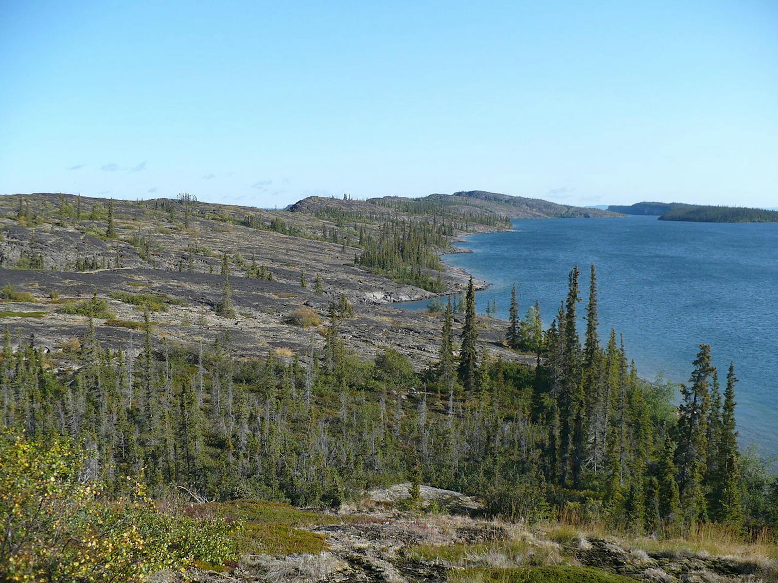
The huge Northern Canadian Shield Taiga ecoregion stretches from the eastern shore of Great Bear Lake in Northwest Territories, southeastward through the eastern half of Great Slave Lake, through the northeastern corner of Alberta (where it borders Wood Buffalo National Park), across northern Saskatchewan and the north shore of Lake Athabasca, eastward to southern Nunavut and northern Manitoba.
It is bordered by the Canadian Low Arctic Tundra ecoregion on the north and east, the Southern Hudson Bay Taiga ecoregion on the southeast, the Midwest Canadian Shield Forests ecoregion on the south, and the Muskwa-Slave Lake Taiga and Northwest Territories Taiga ecoregions on the west. The Northern Canadian Shield Taiga is noteworthy for containing nearly one-quarter of the linear extent of the tree line—the transition from taiga to tundra—in North America.

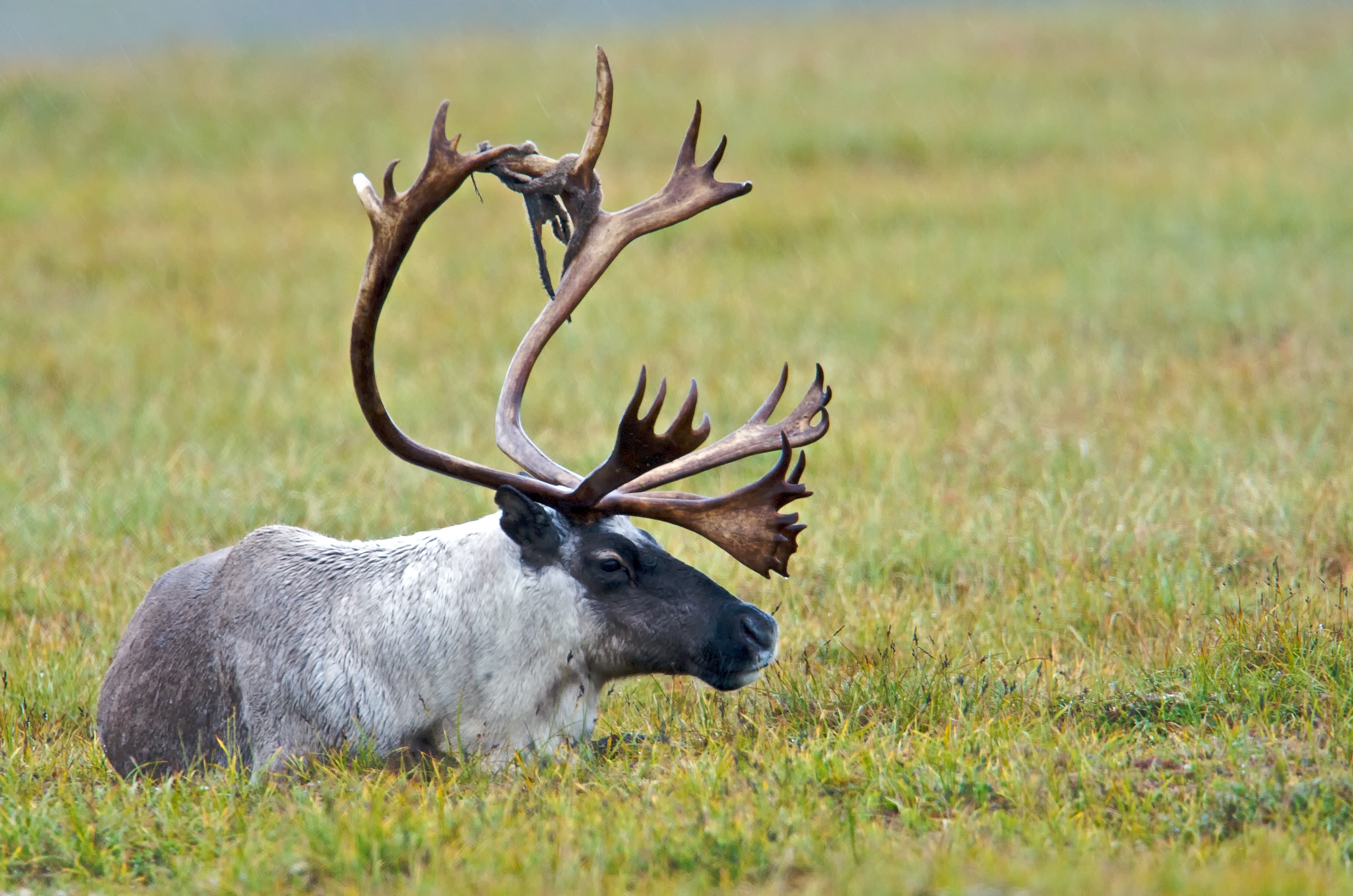
The bathurst barren-ground caribou (Rangifer tarandus groenlandicus) is the flagship species of the Northern Canadian Shield Taiga ecoregion, located in the Canadian Shield & Coastal Taiga-Forests bioregion (NA9).
The climate of this ecoregion is low to high subarctic, characterized by short, cool summers and very cold winters. Yellowknife, Northwest Territories, on the north shore of Great Slave Lake, has the lowest mean annual temperature of any major city in Canada: -5ºC. More generally, the average annual temperature in the ecoregion ranges from -8ºC to -5ºC, average winter temperature from -24.5ºC to -21.5ºC, and average summer temperature 8ºC to 11ºC. Permafrost is discontinuous to continuous. Average annual precipitation ranges from 200 mm to 400 mm.
The geology of this ecoregion is defined by the Canadian (Precambrian) Shield, the huge mass of exposed igneous and metamorphic rocks (especially granitic gneisses) that forms the ancient geological core of the North American continent, some 2.5–4.2 billion years old. The ecoregion was strongly affected by multiple glaciations and is still rising from post-glacial rebound (a rise in the land surface after retreat of the heavy ice sheets) after the last glaciers retreated. Glacial features such as lakes and eskers (sinuous ridges of gravel and sand that were created by streams flowing within and under glaciers) are abundant.
As a broad transitional area from boreal forest to tundra, this ecoregion is dominated by sparse and stunted stands of black spruce, with white spruce on better drained sites and a shrub and ground layer of dwarf birch, ericaceous shrubs (in the heath family), cottongrass, lichens, and mosses. The most poorly drained sites feature a tussock vegetation of sedges, cottongrass, and sphagnum moss.
The Tazin Lake Uplands, north of Lake Athabasca in the northwestern corner of Saskatchewan, are characterized by taller and more closed stands of quaking aspen and balsam poplar with white spruce, balsam fir, and black spruce occurring in later stages of succession after lightning fire, the dominant agent of natural disturbance. Such fires can cover tens of thousands of hectares or more. The strongly fire-adapted tree, jack pine, which has mostly closed (serotinous) cones that open with the heat of fire, reaches its northernmost distribution in this ecoregion and the adjacent Northwest Territories Taiga.
Characteristic birds of the Northern Canadian Shield Taiga are willow ptarmigan, rock ptarmigan, sandhill crane, osprey, raven, spruce grouse, and many waterfowl. Nine species of colonial water birds breed on Great Slave Lake, at 614 m the deepest lake in North America. These birds are California gull, herring gull, common tern, mew gull, Arctic tern, Ring-billed gull, Caspian tern, parasitic jaeger, and Bonaparte’s gull, in addition to black tern in nearby marshes. The Great Slave Lake is the only location in North America where these 10 species occur together.

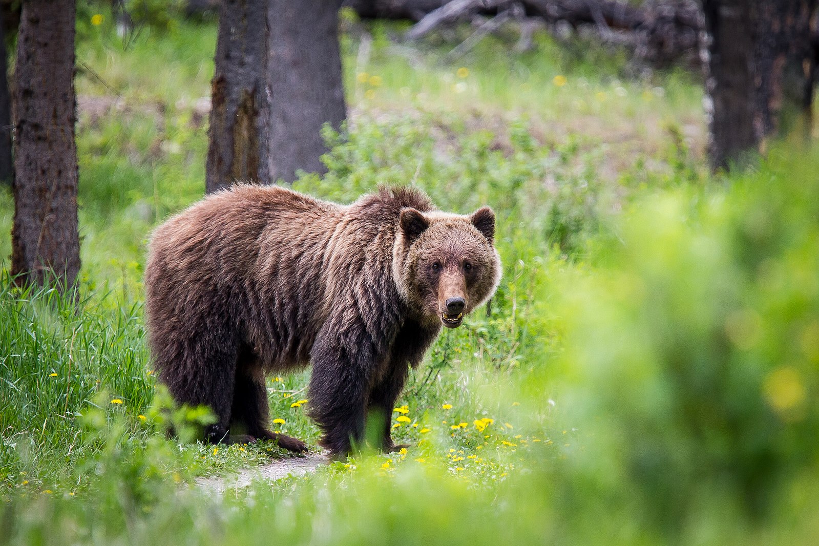
Grizzly bear (Ursus arctos horribilis). Image credit: Dwayne Reilander, Creative Commons
Mammals in this ecoregion include moose, barren-ground caribou, grizzly bear, wolf, wolverine, short-tailed weasel, mink, muskrat, otter, beaver, snowshoe hare, brown lemming, red-backed vole, and others. The Bathurst herd of barren-ground caribou, which winter in this ecoregion and have their calving ground around Bathurst Inlet in the Canadian Low Arctic Tundra ecoregion to the north, is of great concern. Numbering around 472,000 in 1986, the herd declined to 8,200 animals by 2018. The reasons for the decline are unclear, with both natural factors and over-harvest likely involved. All harvest for the herd has been suspended.
Only 5% of the ecoregion is protected, and 8% of habitat outside of protected areas remained intact. The need to increase protection is relatively urgent, as permanent and winter roads are increasing for mining and other uses.
Priority conservation actions for the next decade:
- Protect remaining intact blocks of forest, roadless areas, and undeveloped rivers and lakes.
- Greatly increase federal and provincial designation of conservation lands.
- Geduce the extent of mining, hunting, and other human activities outside protected areas.
-
-
1. Ricketts, T.H. et al. 1999. Terrestrial Ecoregions of North America: A Conservation Assessment. Island Press, Washington, D.C.
2. Elliott-Fisk, D.L. 2000. The taiga and boreal forest. In M.G. Barbour and W.D. Billings, editors. North American Terrestrial Vegetation, 2nd edition. Cambridge University Press, Cambridge, U.K.
3. Noss, R.F., K. Bennett, E. Butterworth, C. Francis, A. Couturier, P. Paquet, and K. Vance-Borland. 2002. Conservation Biology for Canada’s Boreal Forest. A project of the Canadian Boreal Trust (Pew Charitable Trusts). Conservation Science, Inc. Corvallis, OR. -
Cite this page: Northern Canadian Shield Taiga . Ecoregion Snapshots: Descriptive Abstracts of the Terrestrial Ecoregions of the World, 2021. Developed by One Earth and RESOLVE. https://www.oneearth.org/ecoregions/northern-canadian-shield-taiga/
-


