
Orinoco Delta Swamp Forests
The ecoregion’s land area is provided in units of 1,000 hectares. The conservation target is the Global Safety Net (GSN1) area for the given ecoregion. The protection level indicates the percentage of the GSN goal that is currently protected on a scale of 0-10. N/A means data is not available at this time.
Bioregion: Guianan Forests & Savanna (NT21)
Realm: Southern America
Ecoregion Size (1000 ha):
2,821
Ecoregion ID:
488
Conservation Target:
91%
Protection Level:
6
States: Venezuela, Guyana
The Orinoco Delta Swamp Forests consist of a diverse matrix of coastal and lowland vegetation types along the river delta and surrounding regions of north-western Venezuela and north-eastern Guyana. The critically endangered Orinoco crocodile is an important member of the animal and plant community in these flooded forests.
This large crocodilian is unique among other species in that it primarily feeds on fish, although it is also opportunistic and will eat others food when available. They were once extensively hunted for their skin during the 1940s to 60s; today, the main threats to their survival include live animal trade, pollution, habitat degradation and competition with another, smaller, crocodilian, the spectacled caiman.
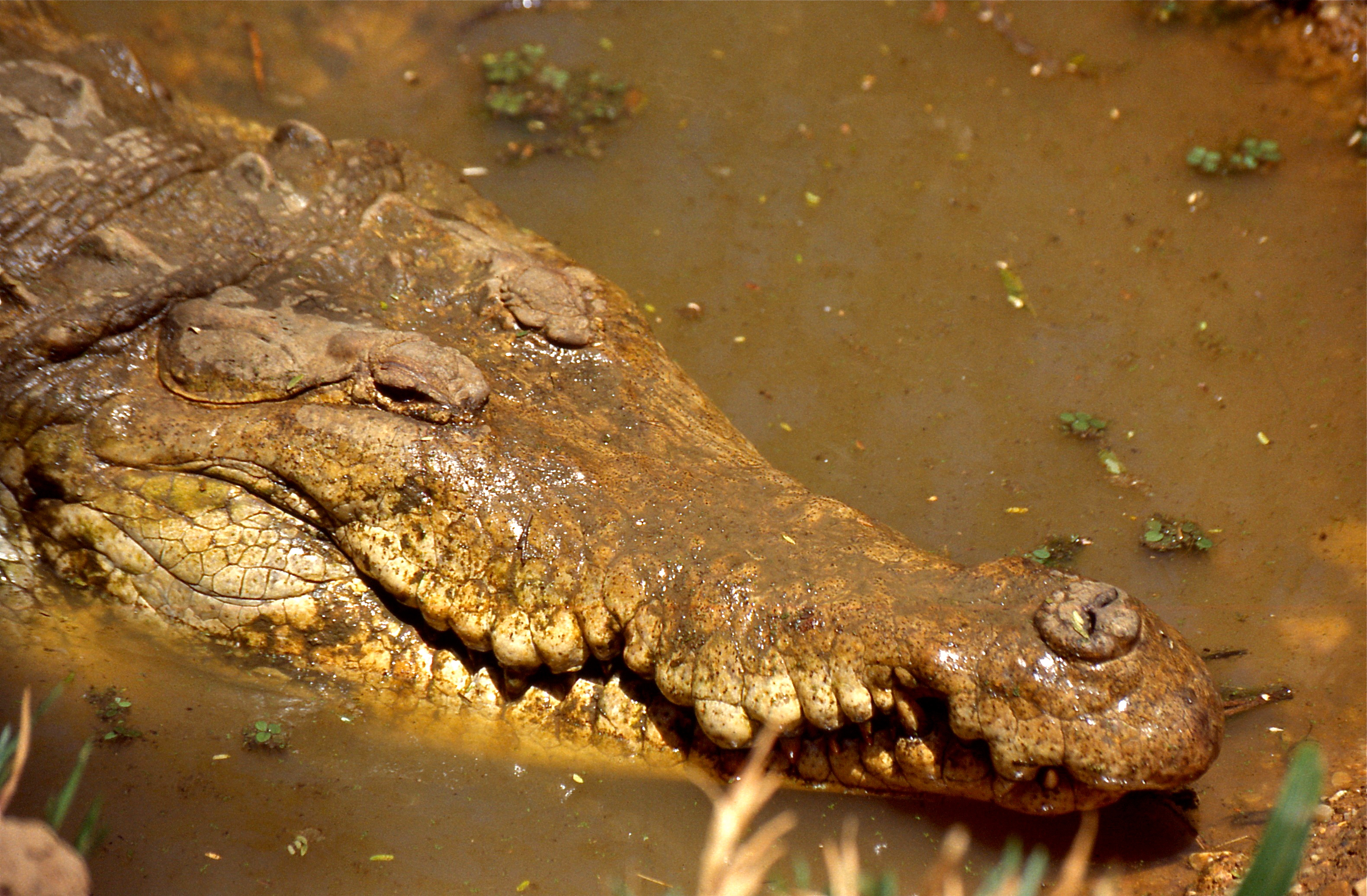
The flagship species of the Orinoco Delta Swamp Forests ecoregion is the Orinoco crocodile. Image credit: Bernard Dupont, Creative Commons
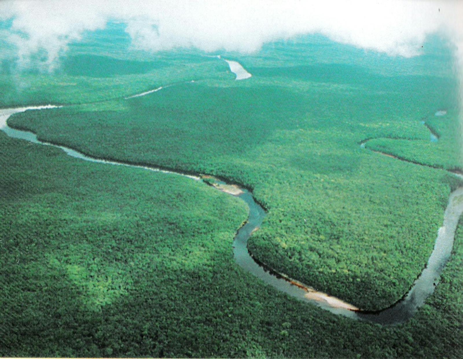
The Orinoco Delta Swamp Forests ecoregion occurs in a continuous expanse of flooded forests and wetlands, occurring from the southern reaches of the Paria Peninsula in northern Venezuela, extending southwards along the Orinoco Delta to the Waini River in Guyana. The climate in the delta is classified as perhumid tropical. Precipitation varies from 500–2,000 mm in the north and can reach as high as 8,000 mm in the south. There are two distinct dry and wet seasons. Temperatures average 26˚C, with a relative humidity of approximately 70%.
These swamp forests are characteristically full of river systems and hosts a great diversity of riparian features including permanent wetlands and marshes, large rivers, oxbows lakes, small gallery streams, levies, and the typical delta alluvial fan. The predominant vegetation in this region is abundant with water pollinated trees and palms, with abundant epiphytes and scattered herbaceous layer.
Common hardwood trees include guiana chestnut, mahogany, kapok, wild pigeon plum, shimbillo, greenheart, padauk, and billygoat plum. Numerous palms occur here as well, including açaí palm, troolie palm, and moriche palm.
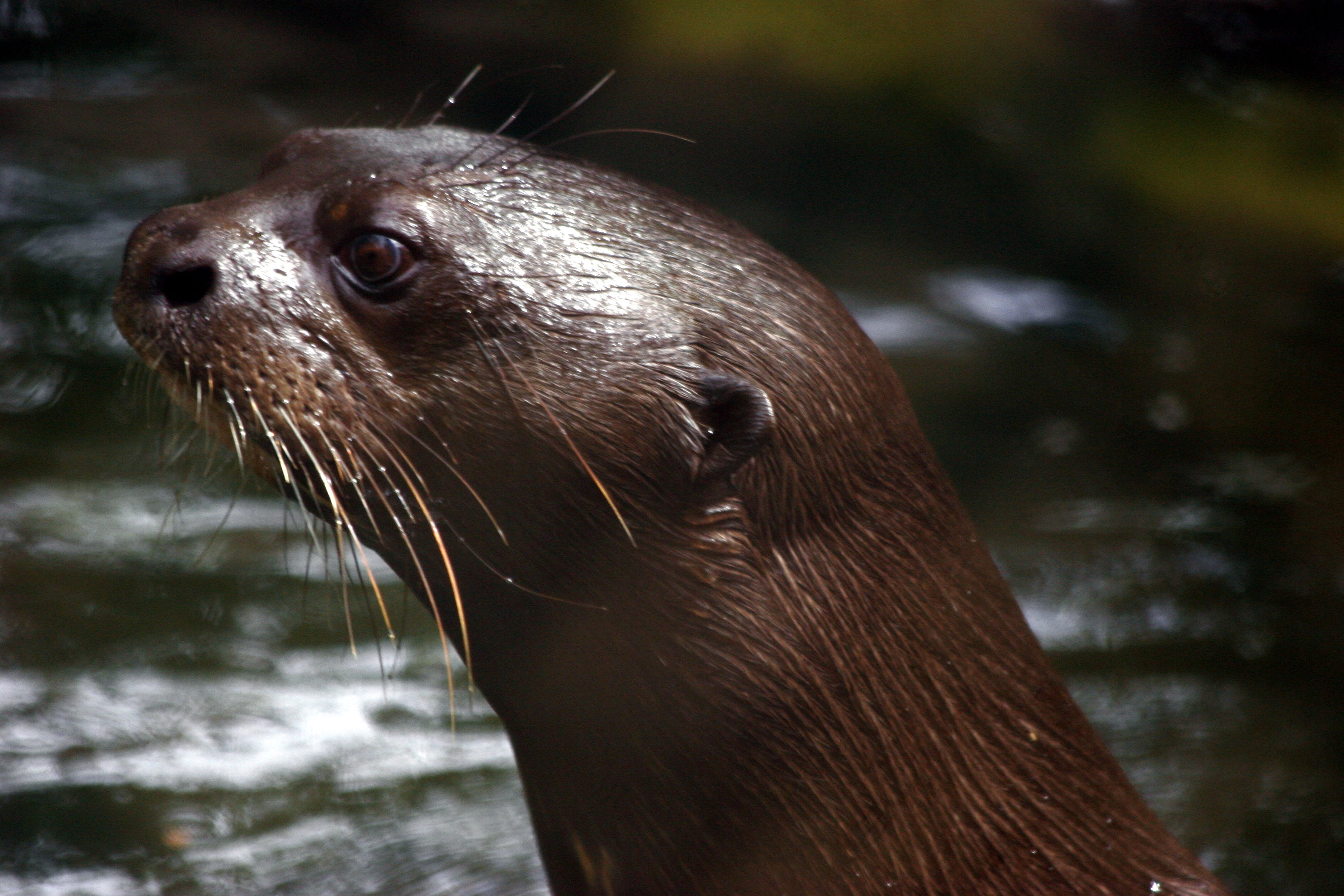
Giant Otter. Image credit: David Monniaux, Creative Commons
The delta region itself has a rich bird fauna, with over 175 species identified, including 39 species of aquatic birds and 13 species of wading birds such as scarlet ibis and roseate spoonbills. These swamp forests provide important habitat for a number of threatened and endangered species such as the Orinoco crocodile, Amazon river dolphin, jaguar, bush dog, giant river otter, Orinoco goose, and the harpy eagle.
The swamp forests of eastern Venezuela, as a whole, are relatively intact. Heavy regional exploitation is a threat in the northern areas where population pressures are higher. Three protected areas exist which protect portions of this ecoregion; Delta del Orinoco National Park, the 726 km2 Turuépano National Park in the north of the ecoregion and the 2,650 km2 Mariusa National Park. These include the Delta del Orinoco Biosphere Reserve and . Two indigenous areas also are also designated, but they offer less protection to natural habitats and are readily exploited. In Guyana the protected areas consist of the Guianan mangroves, Guianan moist forests, and the Orinoco wetlands.
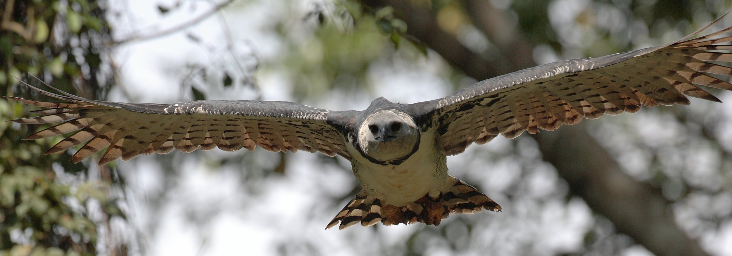
Harpy eagle. Image credit: Creative Commons
The greatest threat to this region is currently oil exploration and extraction. The threats are multifaceted, from habitat destruction to settlements of human population to hunting, small scale forest clearing, and displacement of the indigenous Warao peoples. Constructions that results in water diversion and containment also disrupt the seasonal cycles of the Orinoco River and its tributaries. A flood control program initiated in the 1960s had the Caño Mánamo dammed, and as a result water levels now rise and fall by 1–2 m daily. This has caused the dramatic increase of salinity levels and disrupt the flora and fauna that inhabit these swamp forests.
The priority conservation actions for the next decade are to: 1) regulate and even prevent with legislation further oil exploration in this area; 2) monitor and prevent the disposal of contaminants into the rivers in upstream communities; and 3) incentivize and promote sustainable practices in local communities.
Citations
1. Schipper, J. 2018. Northern South America: Northeastern Venezuela and northwestern Guyana. https://www.worldwildlife.org/ecoregions/nt0147. 13 August 2018.
2. Conde, J.E. 2001. The Orinoco River Delta, Venezuela. Pages 60-70 in U. Seeliger and B. Kjerfve (editors), Ecological Studies Vol. 144: Coastal Marine Ecosystems of Latin America. Springer-Verlag, Berlin.
3. Hilton-Taylor C. 2000. The IUCN red list of threatened species. Gland, Switzerland and Cambridge, U.K.

Subscribe to receive monthly updates on climate solutions, environmental heroes, and the profound beauty and wonder of our shared planet Earth.
