
Ozark Highlands Mixed Forests
The ecoregion’s land area is provided in units of 1,000 hectares. The conservation target is the Global Safety Net (GSN1) area for the given ecoregion. The protection level indicates the percentage of the GSN goal that is currently protected on a scale of 0-10. N/A means data is not available at this time.
Bioregion: Ozarks Mixed Forests (NA22)
Realm: Northern America
Ecoregion Size (1000 ha):
10,659
Ecoregion ID:
340
Conservation Target:
48%
Protection Level:
1
States: United States: AR, OK, MO, KS
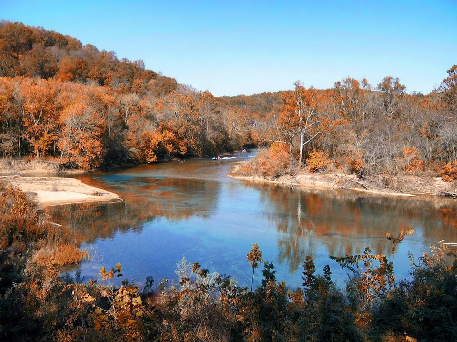
The Ozark Highlands Mixed Forests ecoregion constitutes the western portion of the central hardwoods forest region of the United States, but as a transitional region between forest and prairie it also contains many types of grassland. The ecoregion encompasses portions of Missouri (two-thirds of the ecoregion), Arkansas, Oklahoma, and a small part of the southeastern corner of Kansas. The Ozark Mountains Forests ecoregion (specifically, the Boston Mountains) forms the southern border of this ecoregion.
To the southeast lies the Mississippi Lowland Forests ecoregion, with the Central US Forests-Grasslands Transitions ecoregion to the northeast and north and the Central Tallgrass Prairie ecoregion to the west. The terrain is rolling to highly dissected with a maximum elevation of around 1,000 m. This is an important ecological transition ecoregion that has a low level of protection at present.
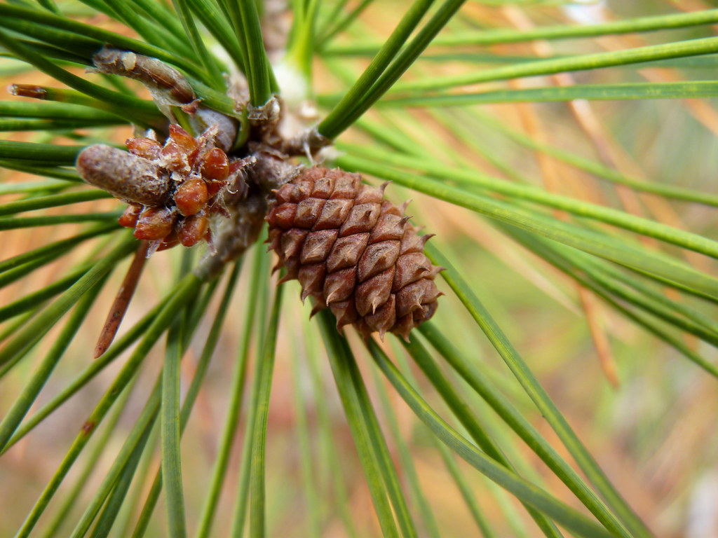
The flagship species of the Ozark Highlands Mixed Forests ecoregion is the shortleaf pine. Image credit: Creative Commons
The climate of the Ozark Highlands is humid warm temperate with hot summers and cool winters. The U.S. Environmental Protection Agency recognizes 11 Level IV ecoregions within the Ozark Highlands: Springfield Plateau, Dissected Springfield Plateau-Elk River Hills, White River Hills, Central Plateau, Osage/Gasconade Hills, St. Francis Knobs and Basins, Meramec River Hills, Current River Hills, Eastern Ozark Border, Black River Hills Border, and Prairie Ozark Border. This subdivision reflects differences in geology, topography, and corresponding vegetation. The only Level IV ecoregion that occurs in all four states is the Springfield Plateau, making this the predominant subdivision.
The Springfield Plateau is underlain by cherty Carboniferous limestones. Sinkholes, caves, perennial spring-fed streams, and other karst features are common. The dominant native vegetation is oak-hickory and oak-hickory-pine, but with many fire-maintained patches of prairie and oak savanna. Major tree species include white oak, red oak, black oak, bitternut hickory, and shagbark hickory, with flowering dogwood, sassafras, and hophornbeam in the understory.
Wetter sites often contain American elm, tuliptree, and sweetgum. The Dissected Springfield Plateau-Elk River Hills is similar but is hillier with thinner and more rocky soils and more shortleaf pine. Limestone/cedar glades also occur. These glades are more abundant in the White River Hills, a highly dissected portion of the Salem Plateau underlain by cherty Ordovician dolomite and limestone. The Central Plateau is less rugged and is now strongly dominated by agriculture, but originally had oak-hickory and oak-hickory-pine forests and savannas. The Osage/Gasconade Hills, underlain by sandstone as well as limestone and dolomite with thin soils, is more densely forested but with some small limestone and sandstone glades.
The oldest geology of the ecoregion is found in the St. Francis Knobs and Basins. Here, igneous knobs of Precambrian granite and other rocks emerge above basins underlain by Cambrian limestones with some sandstone. This is the only portion of the ecoregion with virtually no karst topography. Native vegetation includes scrub oak, post oak, and blackjack oak woodlands and glades, with some prairie in the basins.
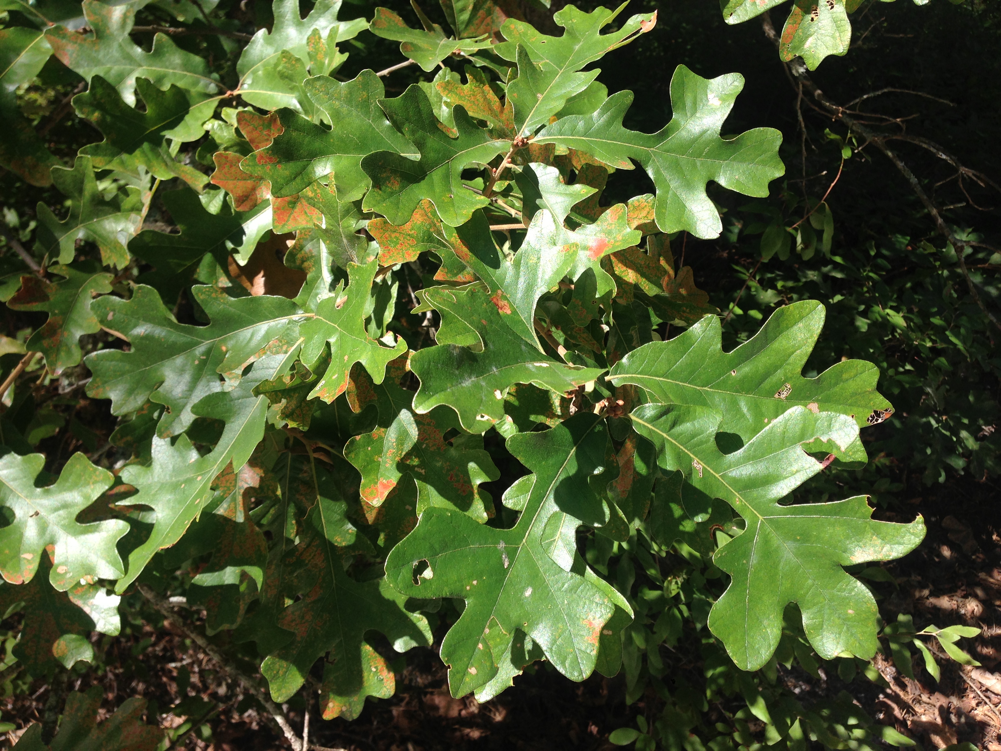
Post oak. Image credit: Creative Commons
The remaining subregions (Level IV ecoregions) are largely transitional in vegetation but are dominated by shortleaf pine-oak forest and woodland, with prairies, savannas, and glades as significant inclusions. The entire central hardwoods region contains relatively few tree species but some 2,527 species of herbaceous plants and shrubs. Many endemic species occur in the Ozark Highlands, especially in the Current River Hills and in karst features in several subregions, where Salem cave crayfish, bristly cave crayfish, southern cavefish, grotto sculpin, grotto salamander, and other endemics are found.
While only 4% of the Ozark Highlands Mixed Forests ecoregion is protected, some 43% of the vegetation outside protected areas is largely intact. Priority conservation actions for the next decade are: 1) greatly increase federal, state, and local acquisition of conservation lands; 2) restore connectivity among remaining blocks of natural habitat; and 3) increase awareness of the natural history and conservation needs of this ecoregion among the local people.
Citations
1. Nelson, P.W. 2005. The Terrestrial Natural Communities of Missouri. Missouri Department of Natural Resources, Jefferson City.
2. Ozark Highlands. https://en.wikipedia.org/wiki/Ozark_Highlands_(ecoregion)#Springfield_Plateau_(39a)
3. Ricketts, T.H. et al. 1999. Terrestrial Ecoregions of North America: A Conservation Assessment. Island Press, Washington, D.C.

Subscribe to receive monthly updates on climate solutions, environmental heroes, and the profound beauty and wonder of our shared planet Earth.
