.jpg?auto=compress%2Cformat&w=1600)
.jpg?auto=compress%2Cformat&w=1600)

Puget Lowland Forests
The ecoregion’s land area is provided in units of 1,000 hectares. The conservation target is the Global Safety Net (GSN1) area for the given ecoregion. The protection level indicates the percentage of the GSN goal that is currently protected on a scale of 0-10. N/A means data is not available at this time.
Bioregion: Pacific Northwest Coastal Forests (NA15)
Realm: Northern America
Ecoregion Size (1000 ha):
3,615
Ecoregion ID:
364
Conservation Target:
35%
Protection Level:
3
States: United States: WA. Canada: BC
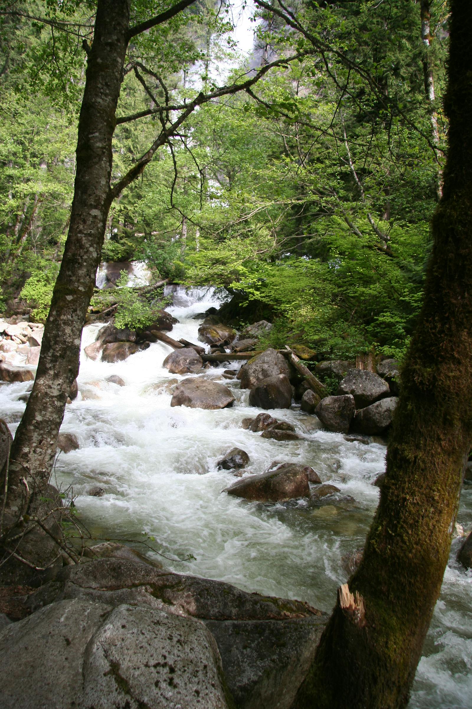
The Puget Lowland Forests ecoregion is centered on a north-south depression, the Puget Trough, between the Cascade Range and the Olympic Peninsula in Washington, including Seattle. A continental ice sheet covered the Puget Trough during portions of the Pleistocene, allowing coarse, excessively drained, nutrient-poor soils to develop largely on glacial drift and outwash.
The ecoregion extends north to encompass the San Juan Islands, the Strait of Juan de Fuca, the southern and eastern one-third of Vancouver Island and a thin strip of coastal mainland British Columbia, including the lower portion of the Fraser River Valley and the city of Vancouver.
Its southern edge abuts the Willamette Valley Oak Savanna ecoregion within the Temperate Grasslands, Savannas & Shrublands biome, and indeed the Puget Lowland Forests ecoregion could have been placed just as legitimately within that biome as within Temperate Coniferous Forests, as it naturally consists of a mosaic of prairies, oak savannas, conifer forests, and wetlands. Grasslands are especially dominant in its southern portion. Today, because this ecoregion includes the most densely populated portions of Washington and British Columbia, little natural habitat remains.
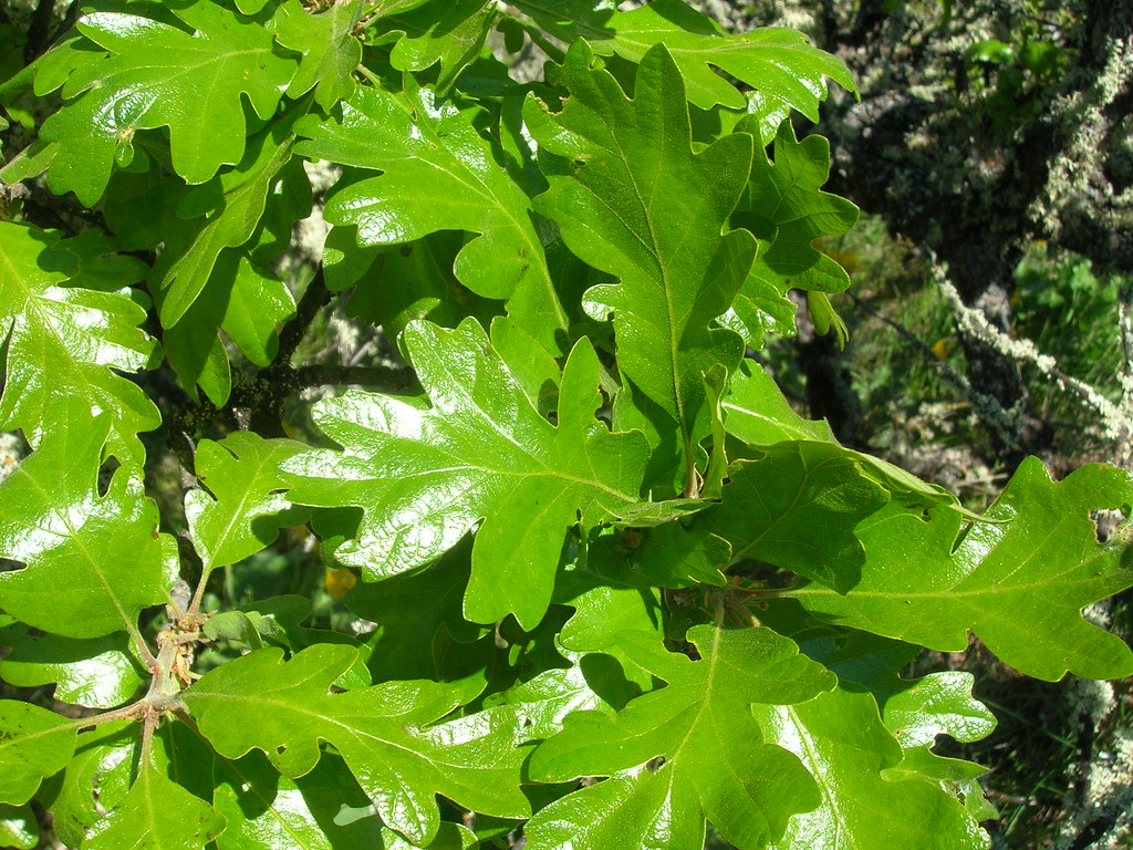
The flagship species of the Puget Lowland Forests ecoregion is the Garry oak. Image credit: Creative Commons
The climate of the Puget Lowlands is characterized by warm, dry summers and mild, wet winters. Annual precipitation generally ranges from 800 to 900 mm, but may be as high as 1,530 mm. In the San Juan Islands and the northeastern part of the Olympic Peninsula, in the rain shadow of the Olympic Mountains, annual rainfall can be as low as 400 mm, almost qualifying as semi-desert.
Forests on drier sites include mixed stands of Douglas-fir with some Garry oak (also known as Oregon white oak), Pacific dogwood, Pacific madrone, and/or ponderosa pine. Moist sites support stands of western hemlock and western red cedar, whereas intermediate sites are dominated by Douglas-fir, western red cedar, and western hemlock. The coastal Douglas-fir stands in British Columbia are considered the most imperiled forest type in the province.
Dry sites experienced frequent fire, whereas centuries-long fire-return intervals were typical of moister forest types. The driest sites were often grasslands or Garry oak savannas. The Tacoma Prairie and the Wier Prairie, near Olympia, Washington, were two of the largest prairies. The two main factors in the origin and maintenance of these prairies were probably 1) the gravelly, droughty soils derived from glacial outwash coupled with low summer precipitation and rain shadow effects, and 2) frequent burning of the prairies by Indians, possibly early white settlers, and occasional natural causes.
The dominant grass in remaining prairie remnants is Idaho fescue, with the intervening space between grass clumps covered by a thick moss layer. The plant species composition suggests high soil water content during the winter and early spring. Lodgepole pine and relict stands of ponderosa pine occur as a mosaic with prairie on the coarse soils. Mima mounds of uncertain origin up to 2.1 m in height and averaging 12.2 m in diameter are found on some of the prairies. Since settlement these grasslands have declined greatly due to fire exclusion, heavy grazing, and invasion by Douglas-fir and Garry oak.
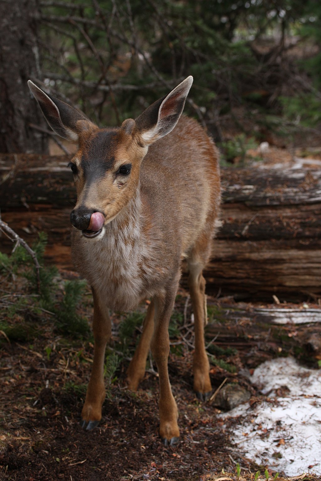
Black-tailed deer. Image credit: Creative Commons
Characteristic wildlife of this ecoregion includes sea otter, harbor seal, mink, raccoon, cougar, coyote, black-tailed deer, bald eagle, blue grouse, and numerous seabirds, shorebirds, and waterfowl. For unknown reasons, the largest concentration of cougar attacks in the United States and Canada is on Vancouver Island, apparently mostly within this ecoregion because this is where humans are concentrated.
This ecoregion contains millions of people, and is still growing, and therefore has lost most of its natural habitat. Urban sprawl is prevalent throughout most of the region. Priority conservation actions for the next decade are to: 1) increase federal, state, provincial, and local acquisition of conservation lands; 2) protect remaining remnants of natural vegetation—especially imperiled communities such as grasslands and coastal Douglas-fir—and restore as much as possible; and 3) improve land use planning and regulations to limit the expansion of human footprint and urban sprawl.
Citations
1. Franklin, J.F., and C.T. Dyrness. 1973 (plus 1988 Supplement). Natural Vegetation of Oregon and Washington. Oregon State University Press, Corvallis.
2. Ricketts, T.H. et al. 1999. Terrestrial Ecoregions of North America: A Conservation Assessment. Island Press, Washington, D.C.
3. Nuszdorfer F.C., Klinka K., and Demarchi D.A., 1990. Coastal Douglas- fir Zone. In: Ecosystems of British Columbia. Ministry of Forestry, Victoria, B.C., Special Rep. 6, p. 81–93.

Subscribe to receive monthly updates on climate solutions, environmental heroes, and the profound beauty and wonder of our shared planet Earth.
