
Sierra De Los Tuxtlas
The ecoregion’s land area is provided in units of 1,000 hectares. The protection goal is the Global Safety Net (GSN1) area for the given ecoregion. The protection level indicates the percentage of the GSN goal that is currently protected on a scale of 0-10.
Bioregion: Yucatan & Veracruz Mixed Forests (NT27)
Realm: Central America
Ecoregion Size (1000 ha):
391
Ecoregion ID:
501
Conservation Target:
64%
Protection Level:
6
States: Mexico
The critically endangered Veracruz pygmy salamander is endemic to this region, preferring the forest habitats in the higher reaches of this diverse ecoregion. They favour moist areas, often seeking out crevices, leaf litter, underside of rocks and logs, as well as shade grown coffee plantations (a more sustainable form coffee growing).
As a master of defence, the salamander employs several different techniques to ward off predators, including an autonomous tail end (dropping off), noxious skin secretion, and aposematic skin coloration. Unfortunately, extensive habitat loss by deforestation and mining has pushed this little salamander towards the brink of extinction; its only remaining single population occupies an area of 72 km2.
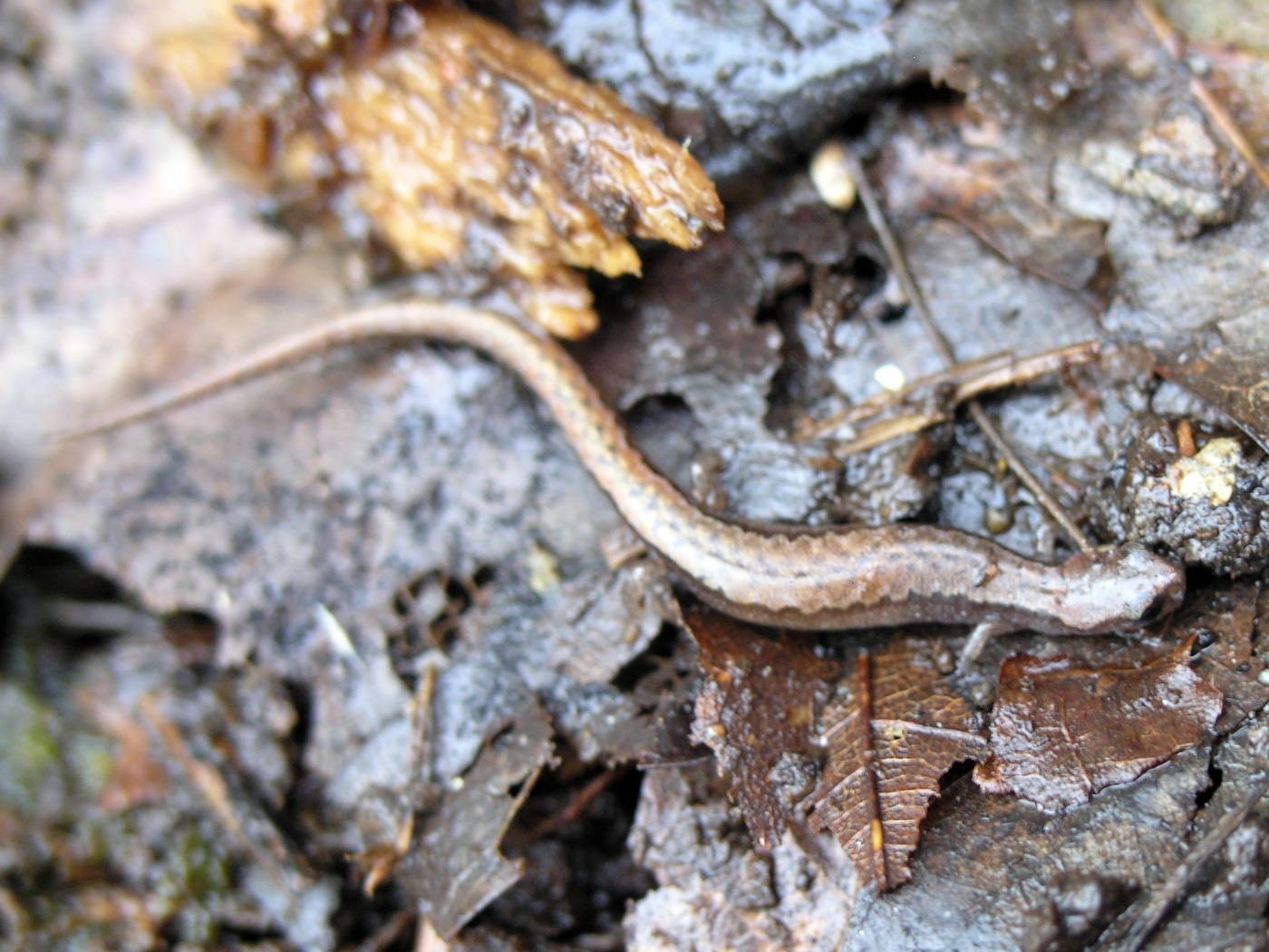
The flagship species of the Sierra De Los Tuxtlas ecoregion is the Veracruz pygmy salamander. Image credit: Wildscreen Exchange
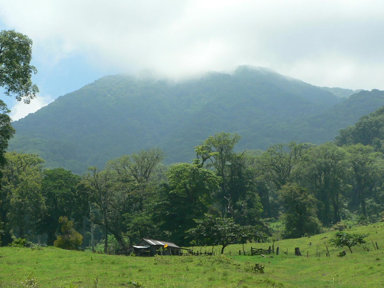
Volcanic activity in the Tertiary period (65–2.6 million years ago) created a compound of seven volcanoes that make up the present form of Sierra de los Tuxtlas ecoregion in Veracruz, Mexico. The San Martín Tuxtla Volcano is the highest (1,780 m) in the sierra, and lies to the northwest, separated from the second highest, Santa Marta Volcano (1,660 m), to the southeast by Catemaco Lake. Various lagoons have been formed by the volcanic activity. A mountain range of 80 km in length isolates the volcanoes from the sedimentary basin surrounding the lower marsh lands. The climate is tropical, with heavy rains in the summer (4,700 mm/year).
Soils are young and derived from volcanic ash in the western portion of the sierra, but in the eastern portions along the coast are older and of sedimentary origin. Forests of kapok and fig tree (Ficus yoponensis, F. tecolutensis) along with palms are common between 160–350 m here. From there the coronil tree and the fruit bearing Nectandra lundellii dominate up to 700 m. Higher elevations typically have steeper terrain favoring shorter trees like Juglans olanchana and Mexican elm.
Sierra de los Tuxtlas constitutes the largest and northernmost intact portion of moist forests in Mexico. Its geographical position contributes to a unique combination of Nearctic and Neotropical flora and fauna. Los Tuxtlas is one of three areas in Mexico with the highest richness and endemic species. There are 940 species of plants (including 80 pteridophytes—vascular plants dispersing spores), over 1,200 species of insects, 122 reptiles and amphibians, over 440 birds, and approximately 115 mammals.
High levels of endemism are applied to the mammals as well, of especial concern with 19 species under threat, including the Volcán San Martin rainfrog, Craugastor vulcani. The herpetofauna has been recognized as highly endemic, mostly due to the diversity of species that live in the small isolated areas of montane forest in los Tuxtlas. The ecoregion is considered an important reproductive zone for many bird species, especially migrants, due to the Nearctic and Neotropical species converging.
Vast portions of the Sierra de los Tuxtlas moist forests have been eliminated over the last 30 years. Two protected areas cover this ecoregion, including Los Tuxtlas Biosphere Reserve. However, both areas are highly fragmented and the forest’s regeneration rates are very low. The only large tracts of forested land that remain intact are in the moist forest ecoregion to the west towards the San Martín Volcano.
The ecoregion is severely threatened by human exploitation. Accelerated deforestation is the main threat to all taxa inhabiting regions of moist forests in los Tuxtlas. Habitat loss in cultivable lands and to road openings make many species vulnerable to animal and human predation. Native villagers extract exotic species from the forest, contributing to the loss of biodiversity. It is estimated that if the current rates of deforestation continue, the long-term consequence will be complete loss of the plant coverage of Sierra de los Tuxtlas, and therefore the complete loss of its native biodiversity.
The priority conservation actions for the next decade will be to: 1) create a biological corridor to connect the San Martín Volcano with the southeast portion near where the Los Tuxtlas Biological Station is located; 2) reinforce laws that control illegal trade of wildlife; and 3) lead and promote awareness workshops for locals on the values of biodiversity.
Citations
1. Valero, A. Schipper, J. Allnut, T. 2019. Sierra de los Tuxtlas https://www.worldwildlife.org/ecoregions/nt0161 Accessed June 21, 2019.
2. Dirzo, R. 1991. Rescate y restauración ecológica de la selva de Los Tuxtlas. Ciencia y Desarrollo 17:33-45
3. Martín-Del Pozzo, A.L. 1997. Geología. Pages 25-32 in E. González-Soriano, R. Dirzo, and R.C. Vogt (editors), Historia Natural de Los Tuxtlas. IBUNAM, CONABIO & IEUNAM, México.

Subscribe to receive monthly updates on climate solutions, environmental heroes, and the profound beauty and wonder of our shared planet Earth.
