
Southern Atlantic Brazilian Mangroves
The ecoregion’s land area is provided in units of 1,000 hectares. The conservation target is the Global Safety Net (GSN1) area for the given ecoregion. The protection level indicates the percentage of the GSN goal that is currently protected on a scale of 0-10. N/A means data is not available at this time.
Bioregion: Brazilian Atlantic Moist Forests (NT14)
Realm: Southern America
Ecoregion Size (1000 ha):
1,008
Ecoregion ID:
616
Conservation Target:
38%
Protection Level:
7
States: Brazil
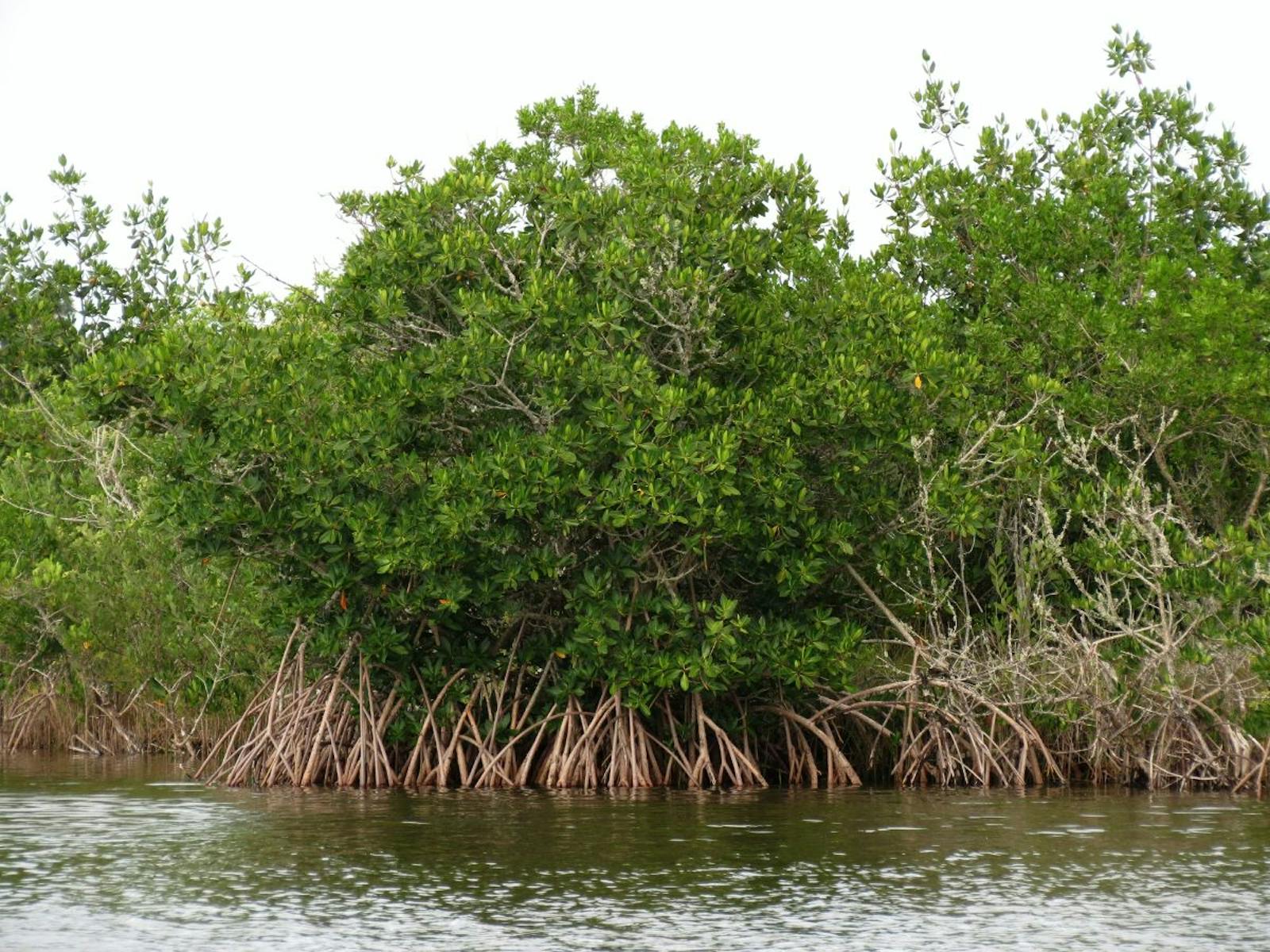
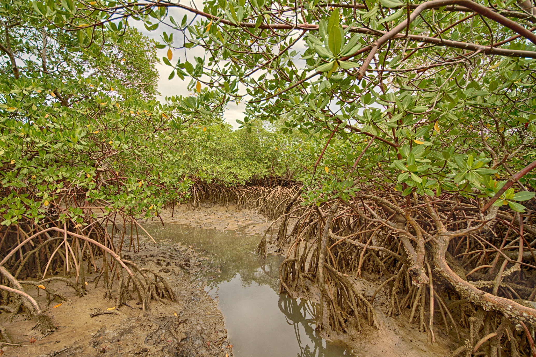
The red mangrove tree, which form one of the structural and functional foundations of this and other mangrove ecoregions, is a uniquely adapted plant that thrives at the interface between land and sea. Red mangrove grows up to 10 m tall, supported by many stilt roots that anchor the tree in shifting sand soil. These stilt roots in turn become the habitat and sheltering place for an ecosystem of co-dependent species.
Another adaptation of the red mangrove tree to cope with salinity is their ability to store excess salt in their old leaves and shedding them. Globally, red mangroves provide one of the most important ecosystem services around coastal settlements, as they protect coastal residents from massive storm surges, hurricanes, and typhoons.
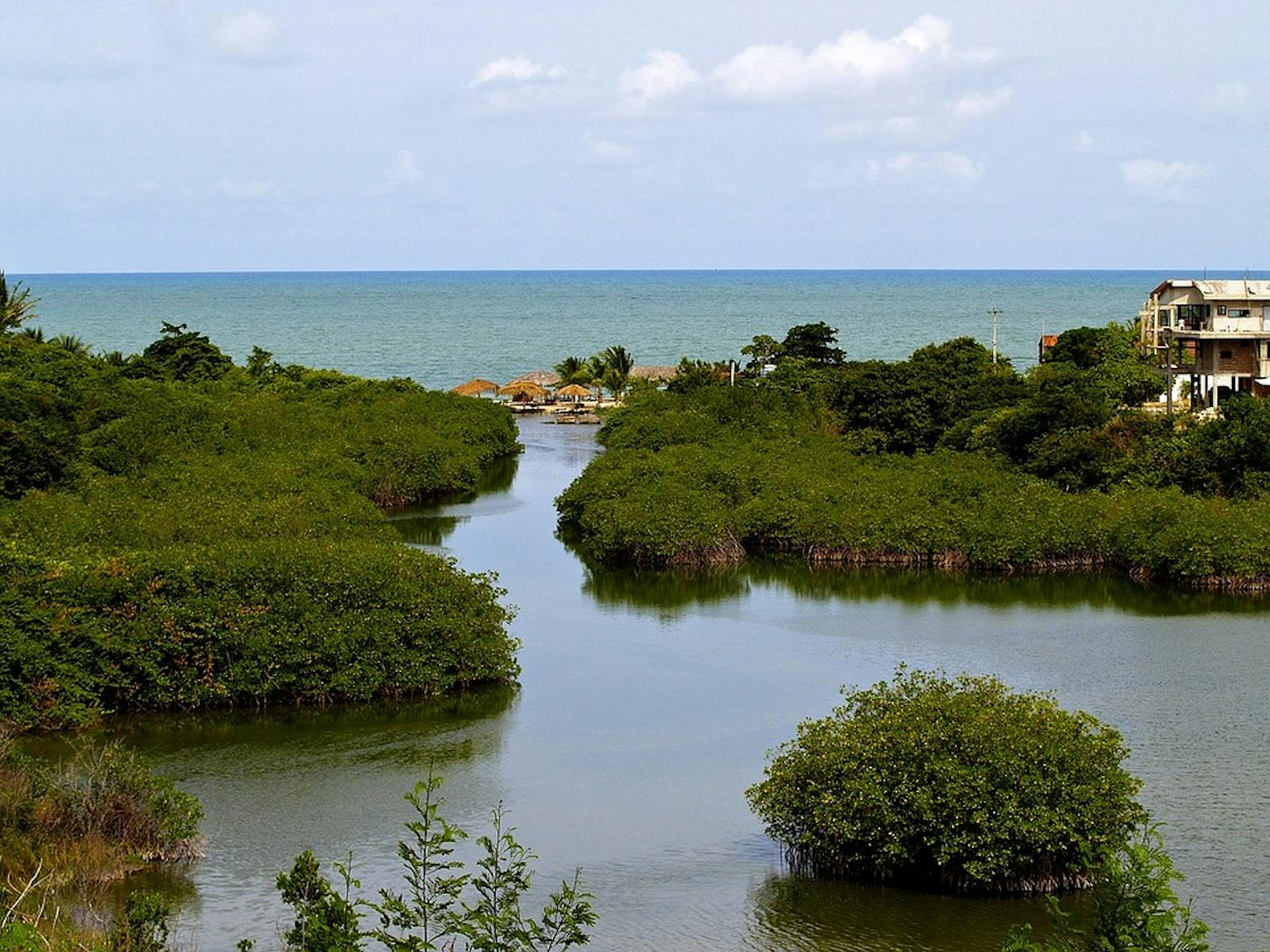
The Southern Atlantic Brazilian Mangroves ecoregion comprises four subecoregions:
- Ilha Grande mangroves, a series of isolated patches extending from the estuary of the Paraíba do Sul River, near São João da Barra, to the island of Santa Catarina, Florianópolis. The climate is tropical humid without any dry months. The annual average rainfall ranges from 1,500 to 2,500 mm and the average temperature from 15° to 24°C.
- Bahia mangroves associated with estuaries of small rivers, extending from the region of the Recôncavo, State of Bahia, to the estuary of the River Doce, Espírito Santo. The average annual rainfall ranges from 1,750 to 2,115 mm and the average temperature from 24° to 26°C.
- Rio São Francisco Mangroves consisting of a series of semi-continuous patches in northeastern Brazil extending southward from Maceío to Salvador Bay. This subecoregion covers a large length of coastline. In the north of the region, climate is tropical semi-humid with a dry season of 4–5 months. In the south, the dominant climate is tropical humid without a dry season. Annual rainfall is 1,250 to 1,500 mm.
- Rio Piranhas mangroves extending from the Rio Tinto southward to Maceió, just south of Rio Largo. The climate is tropical humid with 1 to 2 dry months. Annual average rainfall is 1,800 to 2,100 mm. The characteristic vegetation for the mangroves of the entire ecoregion include Avicennia schaueriana, white mangrove, and red mangrove, and their height ranges from 9 to 20 m. The presence of these three species and the structure of the vegetation varies among sites, the age of the mangrove group, and local environmental factors.
The flagship species of the Southern Atlantic Brazilian Mangroves ecoregion is the red mangrove. Image credit: Ricardo Solar, Creative Commons
Ilha Grande mangrove provide refuge and nursery habitat for juvenile fish, crabs, shrimp, and mollusks. Mangroves of this region are key ecosystems for several migrant birds moving seasonally along the Brazilian Coast. Their biodiversity is exemplified by sampled sites around Santos and Bertioga in São Paulo: a total of 36 bird, 21 crustacean, 58 fish, and 16 mollusk species can be found in the mangroves. There is little data gathered about the biodiversity of Bahia mangroves.
Five species of sea turtle species possibly use this region’s mangroves as feeding sites. Detail biological information is also lacking for the Rio São Francisco mangroves. However, the habitat is crucial to several long-distance bird migrants, and to the sea turtle species that nest in the beaches of this region. The Rio Piranhas have the only known population of the west Indian manatee along the eastern Brazilian Coast. An Endemic Bird Area falls in the north of this region and migrant birds use it for feeding and resting. Several snail species found in this region are also collected by local communities as important sources of food and income.
Ilha Grande mangroves are in the most densely populated region of Brazil. Consequently, most of the original vegetation has been modified. Bahia Mangroves are under strong human pressure; their larger areas coincide with densely populated areas along the coast of northeastern Brazil. The most critical areas are those around Salvador and Ilhéus.
Protected areas were established along this region, but several of them lack implementation and management, allowing for continued degradation. The Rio São Francisco Mangroves have several protected areas in critical mangrove habitats, including the Areas of Environmental Protection of Piaçabuçu (91 km2), Mangue Seco (34 km2), and the Biological Reserve of Santa Isabel (27 km2). Part of the Rio Piranhas mangroves near the Mamanguape river and around Ilha de Itamaracá are protected and harbor most of their original biodiversity, but mangroves located near the major cities Recife, João Pessoa, and Maceió are threatened.
Most of the mangroves of this ecoregion have previously been disturbed and are currently threatened by urban expansion, timber exploration, and industrial pollution. The priority conservation actions for the next decade will be to: 1) strengthen protected area management and capacity; 2) restrict urban expansion and the timber industry; and 3) educate local communities on mangrove biodiversity benefits.
Citations
1. Silva, J. 2018. Southern South America: Southern Brazil https://www.worldwildlife.org/ecoregions/nt1415 Accessed August 8, 2018
2. Silva, J. 2018. South America: Brazil, mainly in the state of Bahia https://www.worldwildlife.org/ecoregions/nt1404 Accessed August 8, 2018.
3. Silva, J. 2018. Eastern South America: Northern Brazil https://www.worldwildlife.org/ecoregions/nt1433 Accessed August 8, 2018
4. Silva, J. 2018. Eastern South America: Northeastern Brazil https://www.worldwildlife.org/ecoregions/nt1432 Accessed August 8, 2018

Subscribe to receive monthly updates on climate solutions, environmental heroes, and the profound beauty and wonder of our shared planet Earth.
