Southern New Guinea Freshwater Swamp Forests
The ecoregion’s land area is provided in units of 1,000 hectares. The conservation target is the Global Safety Net (GSN1) area for the given ecoregion. The protection level indicates the percentage of the GSN goal that is currently protected on a scale of 0-10. N/A means data is not available at this time.
Bioregion: New Guinea & Surrounding Islands (AU13)
Realm: Australasia
Ecoregion Size (1000 ha):
10,014
Ecoregion ID:
154
Conservation Target:
76%
Protection Level:
1
States: Papua New Guinea, Indonesia
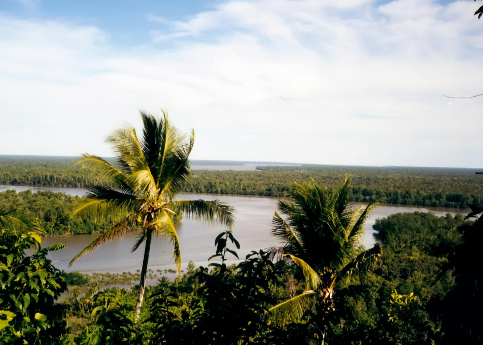
Sago palms and giant black and red palm cockatoos are emblematic of this swampy ecoregion. The ecoregion is a mosaic of swamp grassland, swamp forests, savanna, gallery forests, and lakes (including the large Lake Murray). The extensive wetlands are important for both resident waterfowl and for those migrating from Australia.
")
The flagship species of the Southern New Guinea Freshwater Swamp Forests ecoregion is the western crowned-pigeon. Image credit: Wikipedia, Turpiturpi (CC by 4.0)
Much of the ecoregion encompasses the freshwater swamp forests associated with low-gradient river systems (Purari and Fly rivers) along the southern coast of New Guinea. The ecoregion consists of a large extent in south-central New Guinea and a smaller, disjunct patch along the southern coast of the Vogelkop Peninsula in West Papua. The climate of the ecoregion is tropical wet, which is characteristic of this part of Melanesia, located in the western Pacific Ocean north of Australia. Although the rainfall here is lower than in most parts of New Guinea, the area's low relief and large rivers draining the nearby Central Ranges result in this ecoregion's inundation during the wet season.
")
Black lory. Image credit: Wikipedia, Crisco 1492 (CC by 4.0)
Habitat types include herbaceous swamp vegetation, Leersia grass swamp, Saccharum-Phragmites grass swamp, Pseudoraphis grass swamp, mixed swamp savanna, Melaleuca swamp savanna, mixed swamp woodland, sago swamp woodland, pandan swamp woodland, mixed swamp forest, Campnosperma swamp forest, Terminalia swamp forest, and Melaleuca swamp forest. The ecoregion is roughly 32 percent freshwater swamp forest, 28 percent grasslands, and 13 percent peat swamp forests, with the rest being dryland forests or cleared land. Characteristic trees are sago palm and species of pandanus, Campnosperma, Terminalia canaliculata, Nauclea coadunata, and Myristica hollrungii. Swampy areas are seasonally inundated. The lowland tree kangaroo, dusky pademelon, and the critically endangered Fly River leptomys are three of the larger members of the 50 mammal species. Six are largely unique to the ecoregion. Of the 339 bird species in the ecoregion, 11 are endemic and near-endemic. The Fly River grassbird and the greater bird-of-paradise are two of the many charismatic species.
The Pulau Dolok Wildlife Reserve protects the largest area of the ecoregion, but clearing and burning for palm oil within this reserve is presently extensive. Lorentz National Park also protects a large landscape from the sea to the highlands, including the swamp forests in the lower reaches that are adjacent to the mangroves. The small Danau Bian Wildlife Reserve protects some habitat around a reservoir in the Fly River region.
")
Greater bird of paradise. Image credit: Wikipedia, Andrea Lawardi (CC by 2.0)
Though natural habitat predominates in much of the ecoregion, it is being rapidly altered for palm oil plantations in regions including the Pulau Dolok Peninsula, the southern Vogelkop area, the Timika region west of Lorentz National Park, and the Fly River basin, potentially causing massive loss of habitat over the coming decades. Mine discharge from the Ok Tedi mine in the Central Highlands has damaged much of the lowland swamp forests. Other mine discharges alter water flow, inundate habitats with sediment, and introduce toxins such as mercury. Some areas are being converted to wetland rice for growing population centers in Irian Jaya (Indonesia side of the island). Expansion of traditional agriculture continues to alter habitat in the lower and central Fly River basin. Introduced rusa deer damage the habitat unused to larger herbivores.
Priority conservation actions for the next decade
- Protect larger blocks of swamp habitats from palm oil expansion.
- Maintain water flows within natural regimes.
- Engage indigenous community members for protected area and resource management planning.
-
-
- Adams VM, VI Tulloch, HP Possingham. 2017. Land-sea conservation assessment for Papua New Guinea. A report on the work undertaken to fulfil the terms of the project Review and Integration of the Terrestrial and Marine Program of Works on Protected Areas. PNG CEPA, University of Queensland, Global Environment Facility, UNDP, Brisbane. 75 pp.
- Beehler BM, TK Pratt. 2016. Birds of New Guinea Distribution, Taxonomy, and Systematics. Princeton University Press, Princeton.
- Davis SD, VH Heywood, AC Hamilton (eds). 1994-1997. Centres of plant diversity: a guide and strategy for their conservation. World Wide Fund for Nature (WWF) and ICUN - World Conservation Union, Cambridg
-
Cite this page: Southern New Guinea Freshwater Swamp Forests. Ecoregion Snapshots: Descriptive Abstracts of the Terrestrial Ecoregions of the World, 2021. Developed by One Earth and RESOLVE. https://www.oneearth.org/ecoregions/southern-new-guinea-freshwater-swamp-forests/
-

Subscribe to receive monthly updates on climate solutions, environmental heroes, and the profound beauty and wonder of our shared planet Earth.
