
Tonle Sap-Mekong Peat Swamp Forests
The ecoregion’s land area is provided in units of 1,000 hectares. The conservation target is the Global Safety Net (GSN1) area for the given ecoregion. The protection level indicates the percentage of the GSN goal that is currently protected on a scale of 0-10. N/A means data is not available at this time.
Bioregion: Indochina Mixed Forests & Peatlands (IM12)
Realm: Indomalaya
Ecoregion Size (1000 ha):
2,945
Ecoregion ID:
286
Conservation Target:
7%
Protection Level:
2
States: Cambodia, Vietnam
Today, the Tonle Sap–Mekong Peat Swamp Forests are a mere vestige of what it used to be; vast areas of forests have been converted and modified, and the wetlands drained for human uses. This conversion is also changing the hydrological dynamics of the lake and river system, causing severe socio-ecological consequences both locally and far away, in the lower reaches of the Mekong River.
.jpg)
The flagship species of the Tonle Sap-Mekong Peat Swamp Forests ecoregion is the white-shouldered ibis. Image credit: Courtesy of USAID Biodiversity and Forestry, Flickr
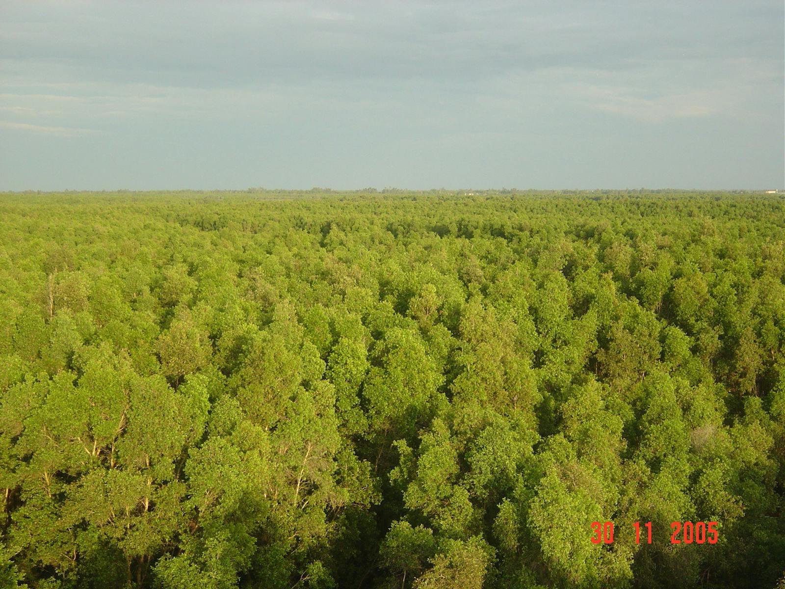
This ecoregion represents the forests that are permanently inundated with shallow fresh- water around the Tonle Sap Lake and River, Southeast Asia’s largest natural lake and its river, located in central Cambodia. The peat swamp forests also extend into the Haut Chhlong and Blao regions of Vietnam. The ecoregion more or less forms an outer ring around the freshwater swamp forests that are inundated under a deeper water column, but also have better water flows and aeration because of the proximity to the lake and river. The poor drainage and stagnant, shallow water further out create anoxic conditions that retard decomposition of the organic matter and cause peat buildup.
Several formations of swamp forests have been described. The most widespread is characterized by the dominance of the palm Livistona cochinchinensis that grows to over 30 m in height. The associated canopy trees are species of Eugenia, Elaeocarpus, and Calophyllum, and these have evolved stilt roots or pneumatophores that enable them to breathe while growing in the anoxic shallow water, much like mangrove trees.
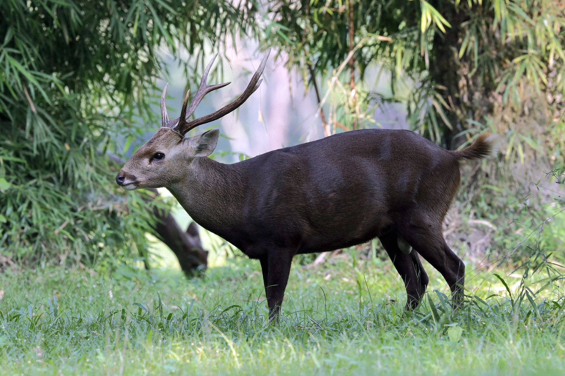
Indochinese hog deer. Image credit: Creative Commons
The ecoregion also includes large areas of grass and sedge wetlands, dominated by tall grasses such as Phragmites karka, Saccharum arundinaceum, and Coix gigantean. Because these wetlands are on fertile alluvial clay sediments, many have also been converted into agricultural lands. The brackish and freshwater wetlands immediately behind the mangrove areas in Cambodia and the Mekong delta in Vietnam are dominated by dense stands of Melaleuca leucadendron, also known as paperbark swamps because of the trees’ wafer-thin bark layers that begin to peel and resemble paper.
These swamps used to cover vast areas of the Mekong delta region but have now been extensively cleared, removing the important ecosystem functions they perform, such as reducing water flows in the wet season, minimizing flooding, reducing soil acidification, and promoting biodiversity.
-CC-Hari%20Krishnan-2019.jpg)
Black-headed ibis. Image credit: Creative Commons
Many of the mammals that used to inhabit this ecoregion have now been extirpated. These include highly threatened species such as the wild water buffalo, Eld’s deer, Indochinese hog deer, and banteng. But smaller, endangered species like the hairy-nosed otter, the rarest and least known of the five species of otters in Asia, still survive in this ecoregion. This species, restricted to Southeast Asia and once believed to be extinct, is now known from several parts of Southeast Asia, including Cambodia, where the Tonle Sap wetlands is a site flagged for its conservation.
The reed beds of the ecoregion are also critically important habitats and feeding grounds for threatened birds such as the eastern sarus crane, giant ibis, white-shouldered ibis, and black- headed ibis.
CC-Charles%20J%20Sharp-2017.jpg)
Sarus crane. Image credit: Charles J Sharp, Creative Commons
Large areas of the ecoregion have been drained and cultivated, but some have also been subsequently abandoned, providing potential for restoration. Up-river development and land conversion are threatening the persistence of the ecological dynamics that sustain the Tonle Sap hydrological system.
Thus, the priority recommended conservation interventions are to: 1) support an Integrated Water Resources Management (IWRM) process to plan and implement projects for socio-ecological sustainability of the lake and surrounding watershed ecosystems; 2) develop conservation and species recovery plans for the threatened and endangered species; and 3) initiate an action plan to identify, project, and restore potential habitats in the ecoregion.
Citations
1. Kummu, M., Sarkkula, J., Koponen, J. and Nikula, J., 2006. Ecosystem management of the Tonle Sap Lake: an integrated modelling approach. International Journal of Water Resources Development, 22(3), pp.497-519
2. Wikramanayake, E, E. Dinerstein, et al. 2002. Terrestrial Ecoregions of the Indo-Pacific: A Conservation Assessment. Island Press.
3. Critical Ecosystems Partnership Fund. 2012. Ecosystem Profile. Indo-Burma Biodiversity Hotspot. 2011 Update. https://www.cepf.net/Documents/final.indoburma_indochina.ep.pdf Accessed Dec 2017.

Subscribe to receive monthly updates on climate solutions, environmental heroes, and the profound beauty and wonder of our shared planet Earth.
