
Uatumã-Trombetas Moist Forests
The ecoregion’s land area is provided in units of 1,000 hectares. The conservation target is the Global Safety Net (GSN1) area for the given ecoregion. The protection level indicates the percentage of the GSN goal that is currently protected on a scale of 0-10. N/A means data is not available at this time.
Bioregion: Northern Amazonian Forests (NT20)
Realm: Southern America
Ecoregion Size (1000 ha):
47,321
Ecoregion ID:
511
Conservation Target:
92%
Protection Level:
7
States: Brazil, Guyana, Suriname
The pied tamarin, a small agile primate, is endemic to the Uatumã-Trombetas Moist Forests ecoregion, located just north of Manaus, Brazil. Tamarins are smaller than most New World monkeys and have modified claws, rather than nails, that help them climb. The pied tamarins are omnivorous and feed on flowers, fruits, insects, frogs, lizards, and other prey items. They live in extended family groups of up to 15 members, typically with only one female breeding at a time. These tamarins are excellent jumpers and can easily cross many of the gaps formed by the interwoven creeks. However larger rivers can separate populations and even species since they are not able to cross them otherwise (except by accident and only rarely).
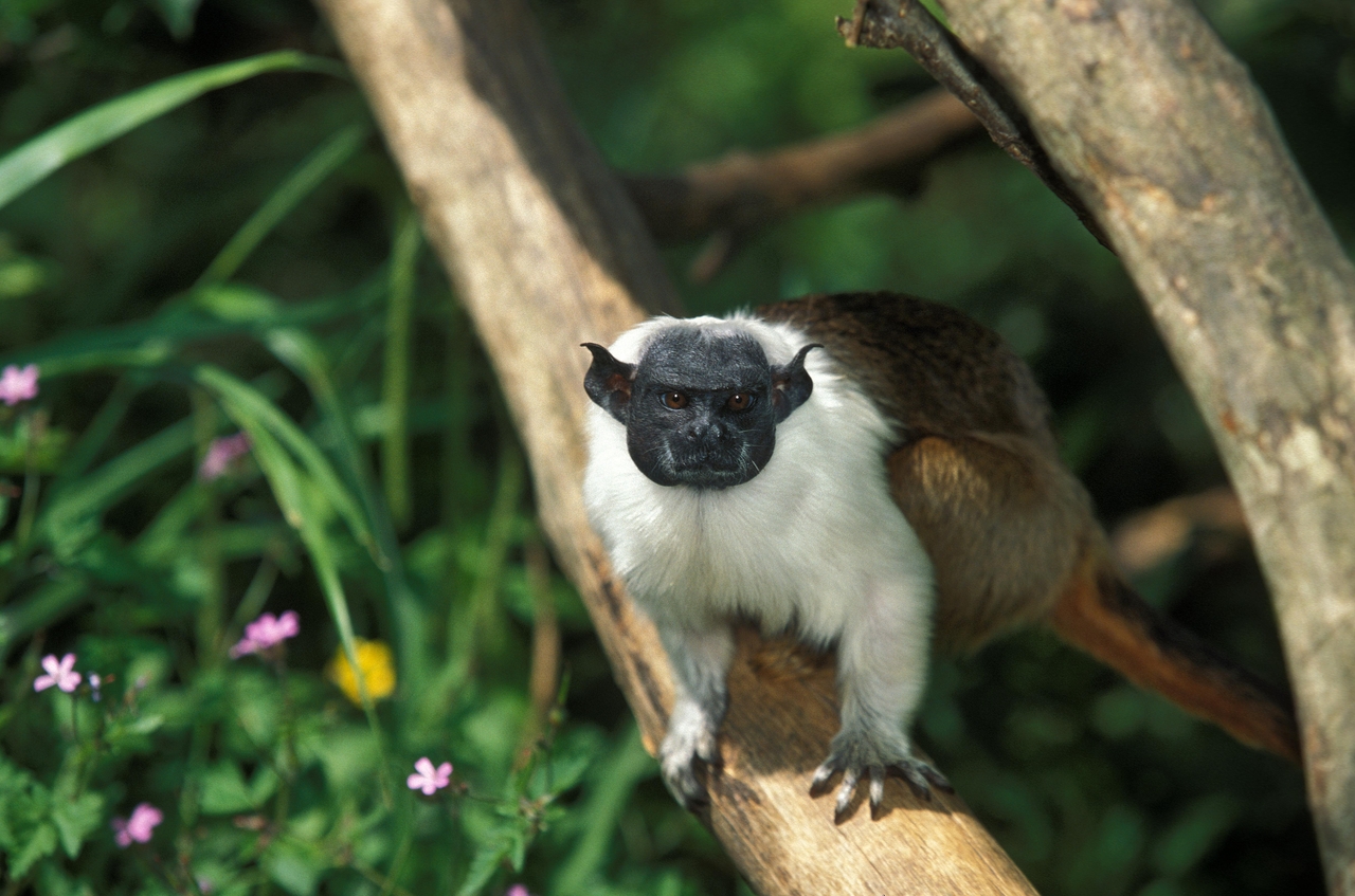
The flagship species of the Uatumã-Trombetas Moist Forests ecoregion is the pied tamarin.
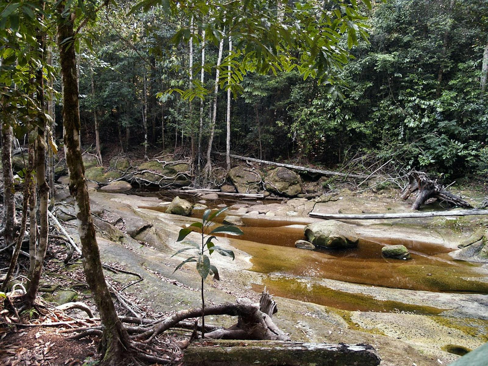
Uatumã-Trombetas moist forests comprise the vast region north of the Amazon River in the eastern portion of Brazil, extending almost to the Atlantic coast and upwards to Guyana and Suriname. The ecoregion spans the geological transitions from the ancient crystalline uplands of the Guiana Shield to the comparatively recent sedimentary of the Amazon Basin. Beside the Rio Negro, Rio Branco, and the Amazon Rivers which delimit two sides of this ecoregion, the moist forests are bisected by blackwater rivers. These rivers are slow moving and lower in nutrients than whitewaters. The climate is hot and humid and annual rainfall ranges from 1,700–3,000 mm.
In the west the vegetation is dense with small-medium tree diameters (< 600 mm) and reach a canopy height of 20–30m. North of Manaus, prominent tree species include bulletwood, pincel-de-macaco, and Eschweilera coriacea. In the east, both the Brazil nut and the Dinizia excelsa tree, characteristically giant, are abundant but not as typically large. The wacapou is an endemic timber species restricted to the eastern portion of the ecoregion as well.

Jaguar. Image credit: Charles J Sharp, Creative Commons
This ecoregion contains the forests north and east of Manaus, which have some of the highest levels of local diversity in the world. They harbor a high number of endemic species of plants, animals and insects. North of Manuas, the forests contain up to 235 species of trees in a single hectare with only a few being dominant. Mammals include 175 species, more than 80 of which are bats. Notable primates present in the ecoregion include howler monkey, red-handed tamarin, vulnerable red-faced spider monkey, endangered pied tamarin, and critically endangered black bearded saki.
The 482 bird species found here include tinamous, parrots, macaws, cookoss, pootoos, and tanagers. There are 62 snake species, including pit-vipers, bushmasters, and boa constrictors. Some 23 species of lizards present are composed of gekkos and iguanas. There have been 42 species of frog reported.
Much of the interior of this region remains intact, but considerable deforestation occurs along the major rivers and roads, particularly between Óbidos and Monte Alegre along the Amazon River, around Manaus, and north along the road to Nova Paraiso. Several protected areas and biological research stations have been established near Manaus, and the Rio Trombetas Biological Reserve covers dense tropical forest, riverine forest, and lake vegetation along with the Jari Ecological Station further east. The Balbina Dam in the southwest of this region, along the Rio Uatumã, has drowned thousands of acres of upland forest.
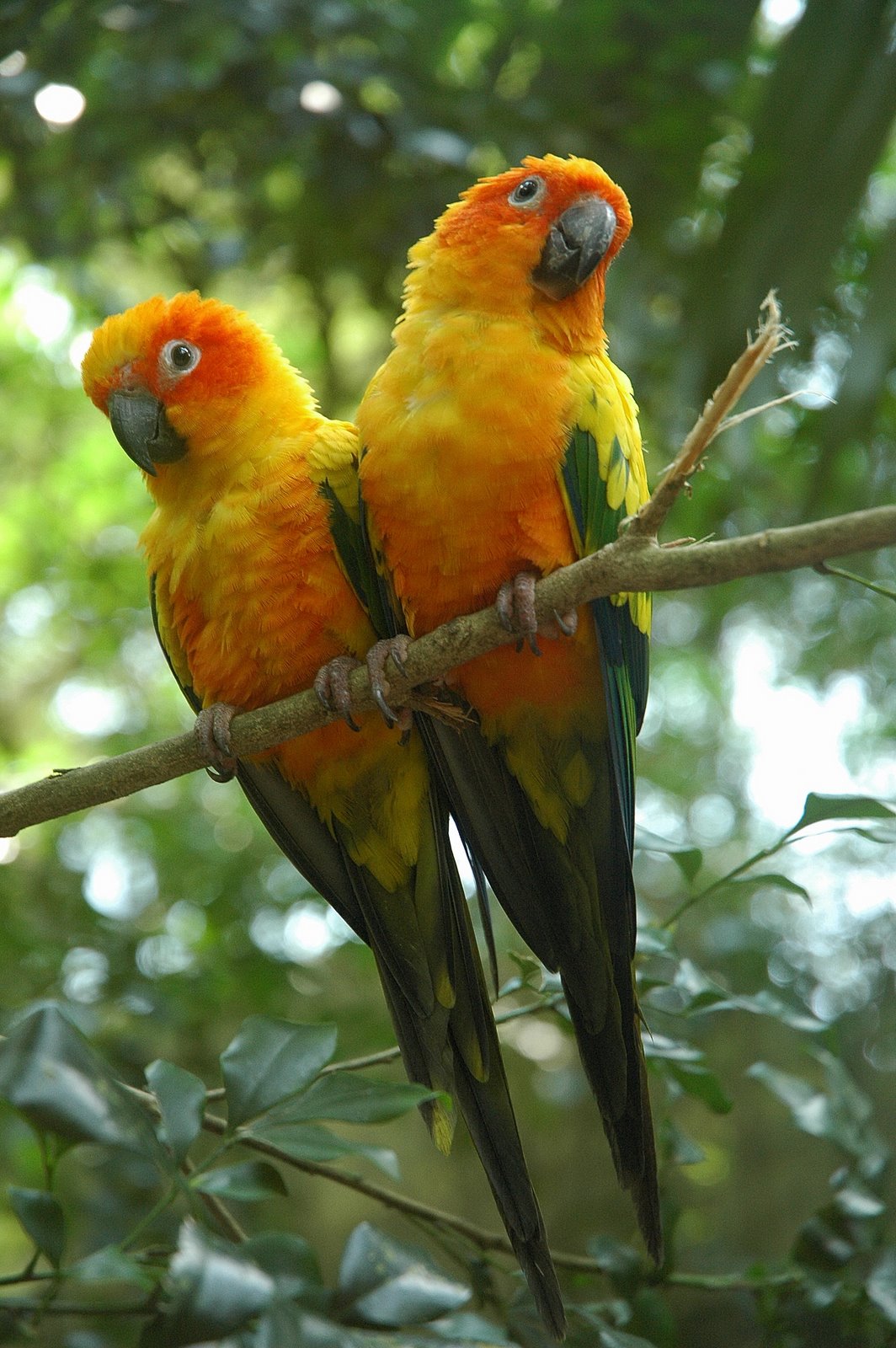
Sun parakeets. Image credit: Wayne Deeker, Creative Commons
Development along the roads and rivers poses a major threat to the native habitat and species. Mining operations destroy upland areas and pollute the rivers. Urban sprawl around Manaus and other cities continues to cut into the natural landscape. Large expanses of forest have been eliminated by cattle ranchers, failed industrial plantation projects (Jari), and large-scale forestry projects in the eastern portion of this region. Wildlife trade, hunting, and selective logging also have potential impact and threaten some species.
The priority conservation actions for the next decade will be to: 1) encourage natural resource integration into local agriculture through educational workshops; 2) develop programs to provide economic incentives to reduce development sprawl; and 3) increase the number and connectivity of protected areas.
Citations
1. Sears, R. 2019. Northern South America: Northeastern Brazil, into southern Guyana and Suriname https://www.worldwildlife.org/ecoregions/nt0173 Accessed June 9, 2019.
2. Ducke, A., and G. A. Black. 1953. Phytogeographical notes on the Brazilian Amazon. Anais da Academia Brasileira de Ciências 25: 1-46.
3. Daly, D. C., and J. D. Mitchell. 2000. Lowland vegetation of tropical South America. Pages 391-453 in D. L. Lentz (editor), Imperfect Balance: Landscape transformations in the Precolumbian Americas. New York: Columbia University Press.
4. Mittermeier, R.A., Boubli, J.-P., Subirá, R. & Rylands, A.B. 2008. Saguinus bicolor. The IUCN Red List of Threatened Species 2008: e. T40644A10348136. http://dx.doi.org/10.2305/IUCN.UK.2008.RLTS.T40644A10348136.en. Accessed June 9, 2019.

Subscribe to receive monthly updates on climate solutions, environmental heroes, and the profound beauty and wonder of our shared planet Earth.
