Global Safety Net v3 offers a new way to monitor nature worldwide
- Nature Conservation
- Land Conservation
- Ecosystem Restoration
- Wildlife Connectivity
- Biodiversity
- Science & Technology
- Indigenous Tenure

Around the world, governments have committed to protecting more of the planet for nature. But reaching a percentage target is only part of the challenge. What matters just as much is which places are conserved, what condition they are in, and whether the ecosystems people depend on remain intact over time.
A new generation of the Global Safety Net is designed to help answer those questions.
Launched by One Earth and the Nature Data Lab in collaboration with an international group of scientists and conservation organizations, the Global Safety Net v3 (GSN3) provides a detailed global view of lands and inland waters that are important for biodiversity, ecosystem services, and climate stability.
Building on earlier versions of the Global Safety Net, which identified priority areas for conservation, GSN3 introduces a more detailed and regularly updated system for tracking natural lands, inland waters, and conservation status over time.
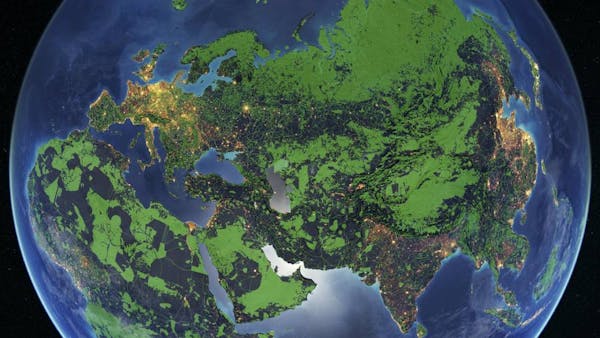
The freely accessible online platform brings together satellite imagery, advanced machine learning and AI, land-cover data, conservation records, and other global datasets to show where ecologically important natural areas remain, how they are being conserved, and where they are being lost or degraded.
For the first time, the Global Safety Net is designed to monitor these changes through annual updates.
Seeing where nature remains
Knowing how much natural land remains on Earth sounds straightforward. In practice, it has been remarkably difficult to measure.
Different datasets classify forests, grasslands, wetlands, agricultural areas, and other land-cover types in different ways. A landscape may appear forested from above, for example, but actually be a timber plantation rather than a naturally biodiverse forest.
GSN3 addresses this challenge by combining 13 datasets that identify ecologically important areas, collectively known as Areas of Importance for Biodiversity and Ecosystem Services (AIBES). Areas that have been converted to intensive human uses are then removed using the Human Modification time series developed by scientists at The Nature Conservancy.
The result is a more detailed picture of ecologically important natural lands and inland waters across the planet.
"Recent advancements in computer vision and AI modeling allow us to monitor the conversion of natural land over time. We can now measure and compare how well various countries are doing in protecting and conserving their most ecologically important areas, tracking their progress over time." —Karl Burkart, Director of the Global Safety Net initiative.
Tracking progress toward protecting 30% of the planet
The platform arrives at a pivotal moment for global conservation.
In 2022, 196 Parties to the Convention on Biological Diversity adopted the Kunming-Montreal Global Biodiversity Framework, including a commitment to effectively conserve and manage at least 30% of the world’s terrestrial and inland water areas by 2030.
Known as the 30x30 target, the commitment represents a major global effort to conserve nature at scale.
But protecting 30% of the planet does not automatically guarantee that the most important places for biodiversity and climate are included.
GSN3 provides an independent way to examine where conservation efforts overlap with ecological priorities and where significant gaps remain. It can show the extent of ecologically important land under conservation within a country, state, or other region, while also highlighting natural areas that remain unprotected.
With regularly updated data, the platform can also help reveal whether countries are maintaining their remaining natural ecosystems or continuing to lose them.
Three ways to understand the landscape
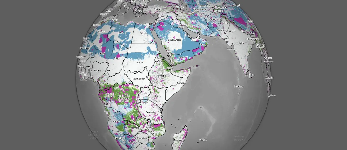
The Global Safety Net viewer organizes its data into three primary views, allowing users to explore the same landscape from different perspectives:
- Ecological Group maps natural areas according to five broad ecological priorities: Rare & Threatened Species, High Biodiversity Areas, Large Mammal Assemblages, Wild & Intact Areas, and additional Climate Stabilization Areas. Together, these layers reveal different landscapes matter, from sustaining threatened species and intact wildlife communities to storing carbon and helping stabilize the climate.
- Land Cover Class adds another level of detail by intersecting ecological data with the European Space Agency’s land-cover time series. It categorizes ecologically important areas into 13 major land types. The interactive map also allows users to explore the extent of inland surface water within a country, state, or region.
- Conservation Status shows which ecologically important places are protected or conserved and where gaps remain. It includes strictly protected areas, other protected areas, Other Effective Area-Based Conservation Measures, or OECMs, and documented conservation areas that may not yet appear in international protected-area databases. It also maps formally recognized Indigenous and Traditional Territories.
Making Indigenous stewardship visible
Indigenous Peoples and local communities steward many of the world’s most ecologically important landscapes, yet their role is not always visible in conventional maps of protected areas.
Including Indigenous and Traditional Territories helps provide a more complete picture of the people and communities already conserving nature.
"The Global Safety Net gives us something we urgently need: a clearer picture of where nature remains, where it is under threat, and where conservation can have the greatest impact. Importantly, it also makes visible the critical role Indigenous Peoples and local communities play in stewarding many of the world's most biodiverse landscapes. This kind of clarity can help move greater attention and resources toward the people and places protecting the living world." —Justin Winters, Founder and Executive Director, One Earth.
Turning global data into local insight
Although the Global Safety Net covers the entire planet, its value becomes especially clear when users zoom in.
A government agency can examine how much of its most ecologically important land is conserved. A philanthropic organization can identify regions where important ecosystems remain unprotected and conservation funding may be needed. Companies can better understand the ecological context of landscapes connected to their operations and supply chains.
Researchers, conservation groups, and the public can explore the same information without specialized geospatial software. The platform requires no login and allows users to move from a global picture to individual countries, states, and regions through an interactive map.
Behind the viewer, large-scale geospatial calculations are processed using Google Earth Engine, while the interactive application was developed by UK-based technology firm Octophin.
A living picture of the planet
Maps have long helped conservationists identify where nature is concentrated. GSN3 adds another dimension: time.
By tracking changes in natural land cover and conservation status over time, the Global Safety Net can help show not only where the world's remaining natural ecosystems are today, but whether they are still there tomorrow.
That distinction will become increasingly important as countries work toward their 2030 biodiversity commitments.
Protecting a percentage of the planet is measurable. Protecting the places that matter most, and ensuring they remain intact, requires knowing where they are and watching what happens to them.
The Global Safety Net is designed to make that picture clearer.
Explore the Global Safety Net v3 interactive map to discover the ecologically important places in your region and see how they are being conserved.
Explore similar content

Subscribe to receive monthly updates on climate solutions, environmental heroes, and the profound beauty and wonder of our shared planet Earth.