Innovative mapping tool for Indigenous communities

Today is World GIS Day, an annual celebration of how geographic information and technology are applied in the service of humankind. And on this GIS day, Digital Democracy is celebrating with the public launch of Mapeo, thanks to a $525,000 grant.
For the past four years, we have been working directly with Indigenous communities in the Amazon to test and prototype tools for mapping and territorial monitoring. This investment is the first step for us to scale so that our tool can reach more communities. This support is critical for us to achieve our vision for Mapeo to be used by communities all over the world.
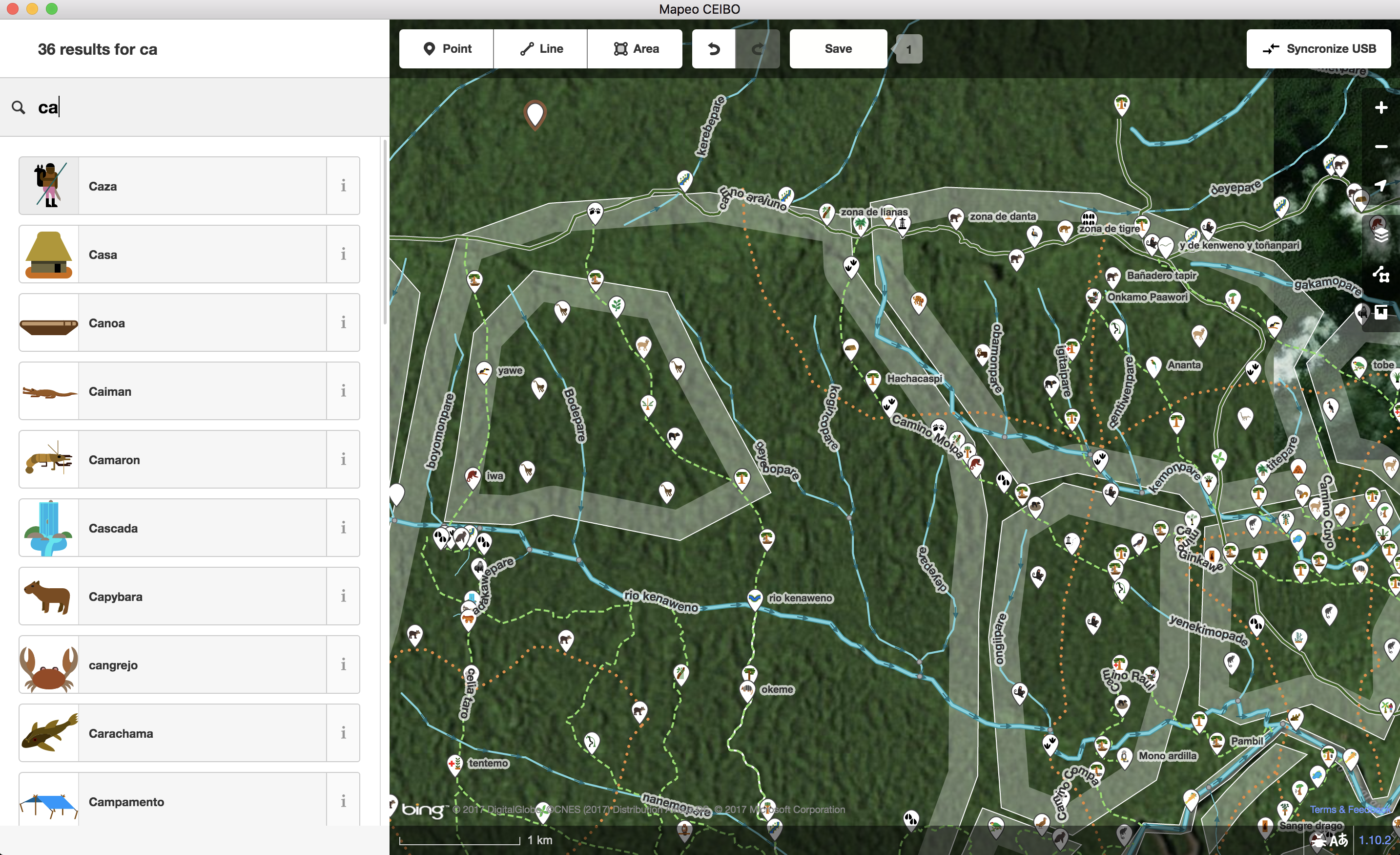
Screenshot of Wao data on Mapeo
Our team is seeking matching support from other foundations and individual donors for 2018. Over the next few years, Digital Democracy aims to acquire multi-million dollar investments for the technical development of Mapeo mobile app and desktop suite. We are also seeking support to pilot Mapeo with additional community partners in new regions outside of the Amazon.
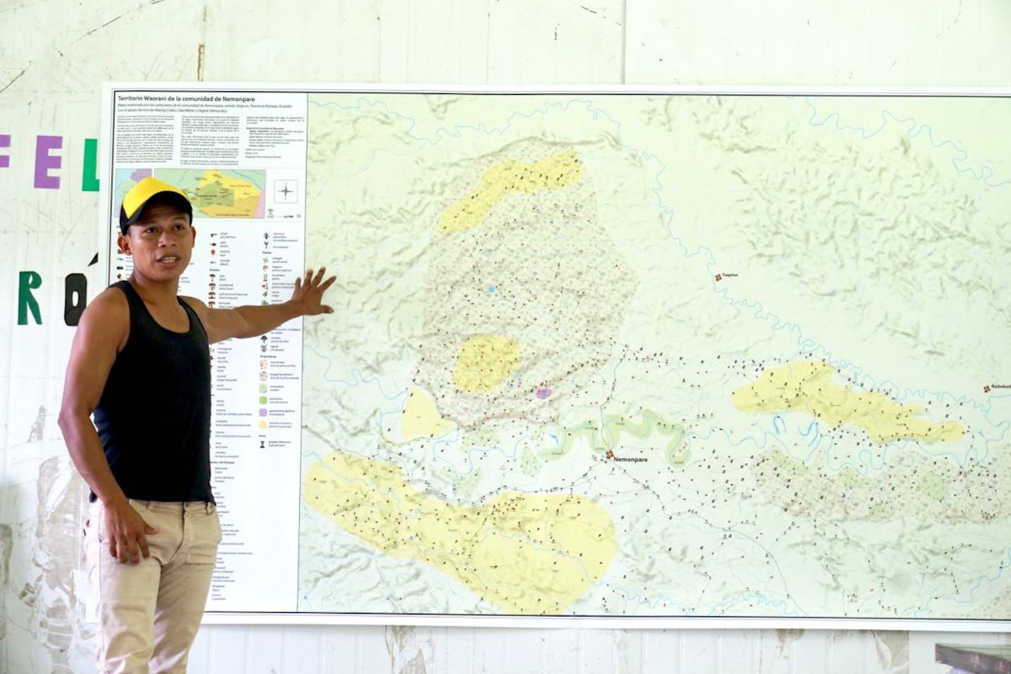
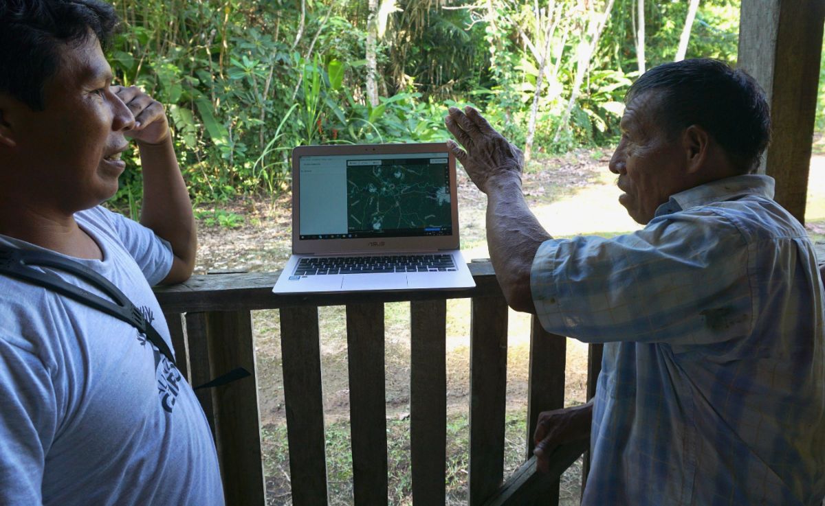
Working with Indigenous peoples and other marginalized communities across the globe, the Digital Democracy team builds mapping and documentation technology to equip local groups with tools they need to protect their territory from threats including illegal mining and deforestation. We are currently prototyping tools with partners across the Amazon region and have specifically piloted Mapeo with partners Amazon Frontlines and Alianza Ceibo in the Ecuadorian Amazon. Members of the Waorani Nation working with Alianza Ceibo are using Mapeo to map and defend their ancestral territory of 800,000 hectares (two million acres) of Amazon rainforest.
Worldwide, there are more than 5,000 indigenous peoples whose traditional territories encompass 80% of the world’s remaining biodiversity. However, only 10% of that land is legally recognized. We believe Mapeo is a critical tool to help these communities map their territory, gain legal title over their land, and protect their biodiverse territories.
Drawing the community maps in Damointaro, the first step in the process
For us, the technology behind Mapeo is not the solution, but rather how it enables communities to collaborate and document the world around them. With Mapeo local communities will be able to manage their own information, create their own maps, and use both to stop environmental and human rights abuses,
Explore similar content

Subscribe to receive monthly updates on climate solutions, environmental heroes, and the profound beauty and wonder of our shared planet Earth.