
Alberta-British Columbia Foothills Forests
The ecoregion’s land area is provided in units of 1,000 hectares. The conservation target is the Global Safety Net (GSN1) area for the given ecoregion. The protection level indicates the percentage of the GSN goal that is currently protected on a scale of 0-10. N/A means data is not available at this time.
Bioregion: Mid-Canada Boreal Plains & Foothill Forests (NA8)
Realm: Subarctic America
Ecoregion Size (1000 ha):
12,135
Ecoregion ID:
345
Conservation Target:
51%
Protection Level:
0
States: Canada: AB, BC
The Alberta-British Columbia Foothills Forests ecoregion is an ecotone or transitional region between the Rocky Mountains to the west and the Mid-Canada Boreal Plains to the east, but also between the Boreal Forests/Taiga biome to the north and the Temperate Conifer Forests biome to the south. As such, it contains a complex mix of temperate and boreal, mountain and plains species and communities.
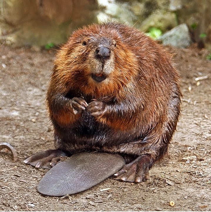
The flagship species of the Alberta-British Columbia Foothills Forests ecoregion is the American beaver. Image credit: Creative Commons
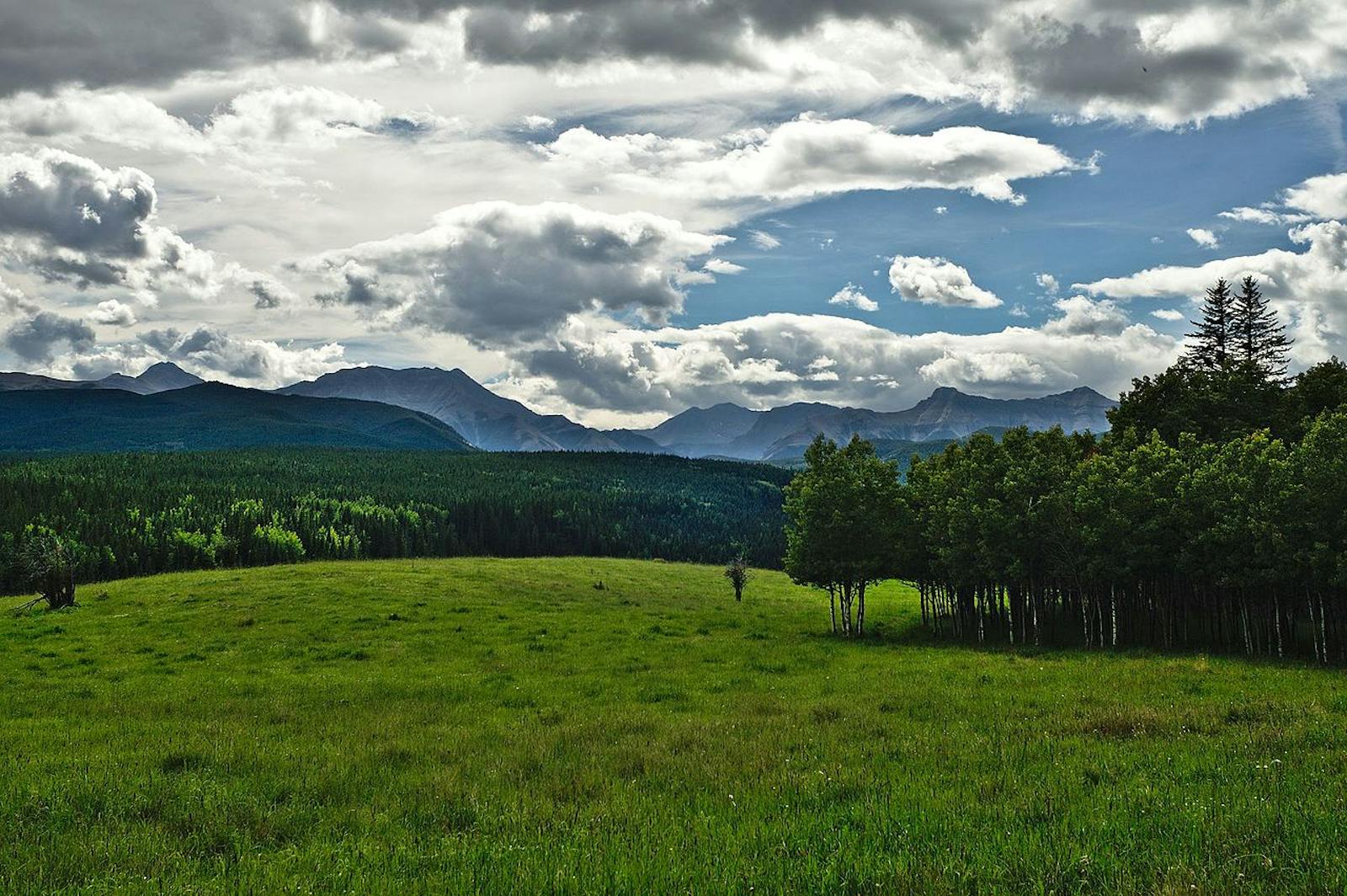
This relatively small ecoregion lies mostly within Alberta and partly within British Columbia, with disjunct northern and southern sections. The southern tip of the ecoregion lies adjacent to Calgary, Alberta (in the Canadian Aspen Forests and Parklands ecoregion) to the east and several national and provincial Rocky Mountain parks to the west. The Clear Hills in the northern section of the ecoregion are generally steeper than most of the other foothills. Unfortunately, this ecoregion has been heavily altered and very little of it (ca. 1%) is in protected status.
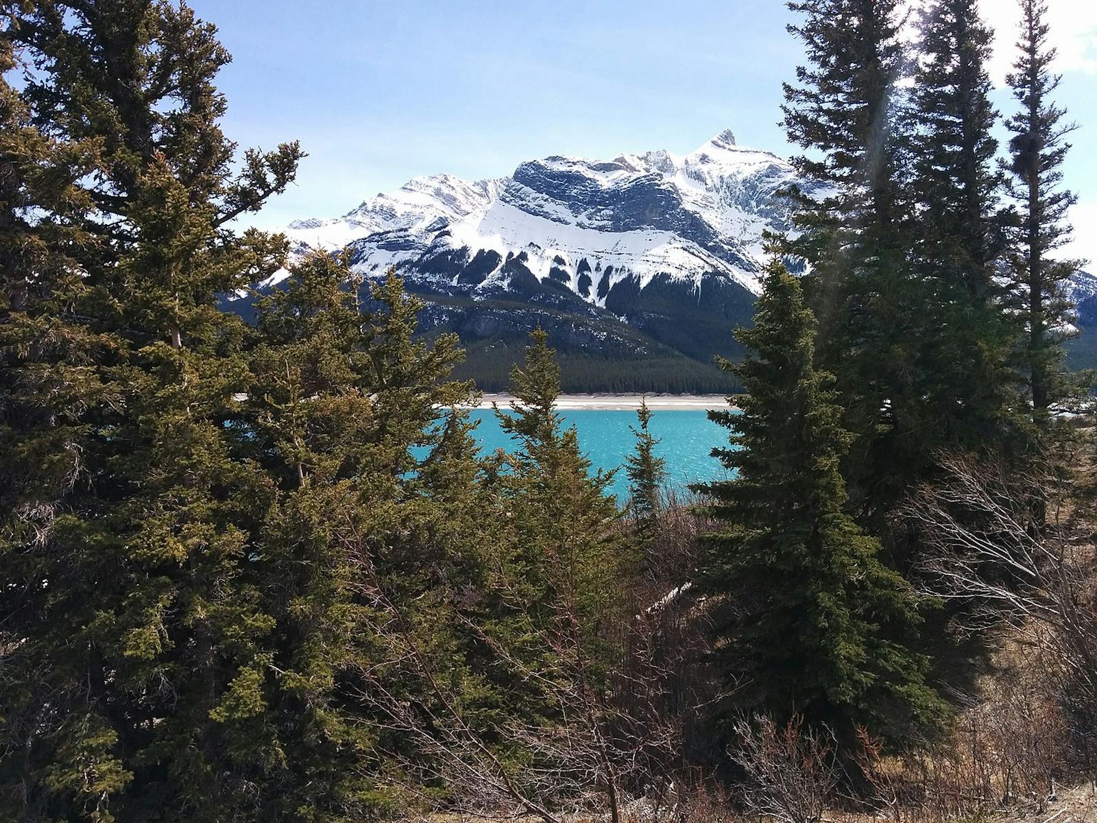
The climate of the Alberta-British Columbia Foothills Forests is subhumid cold temperate to low boreal, with warm, short summers and long, cold winters. Summers range from 13ºC in the north to 15ºC in the south, with mean winter temperatures ranging from -17.5 to -10ºC. Annual precipitation is relatively even across the ecoregion and within the 400-600 mm range. The topography is foothills rising from the plains as predominantly linear ridges and plateau remnants with broad valleys. The higher elevations are mostly 700–1,500 m. The Clear Hills Upland in the north ranges from 550 to 1,050 m with steep slopes, some plateau remnants, and gently undulating valleys.
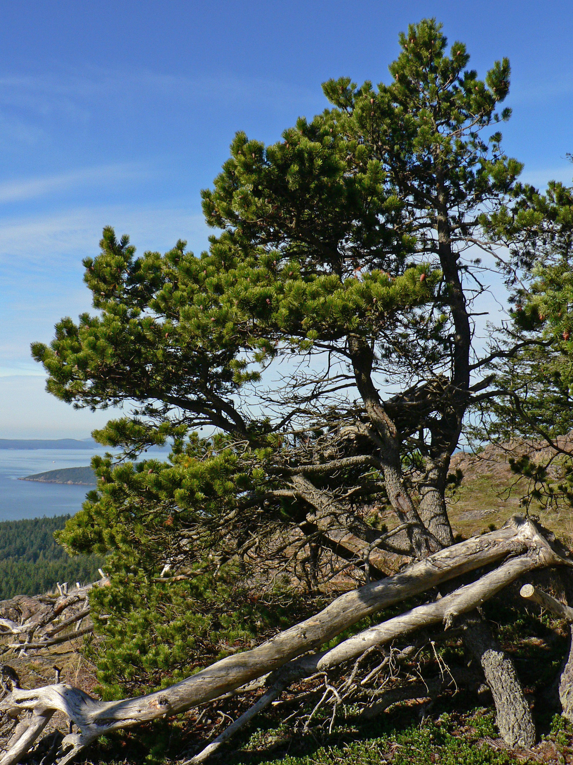
Lodgepole pine. Image credit: Walter Siegmund, Creative Commons
The dominant vegetation in this ecoregion is mixed forests of lodgepole pine, quaking aspen, jack pine, and white spruce. Balsam poplar, paper birch, and balsam fir are also common. Drier sites are characterized by open stands of aspen and lodgepole pine, whereas wetter sites feature black spruce and tamarack. All of this vegetation can be considered transitional between boreal and temperate mountain (Cordilleran) forests. Fire is the most important factor in the natural disturbance regime, although vegetation is also affected by seasonal and inter-annual variation in precipitation.
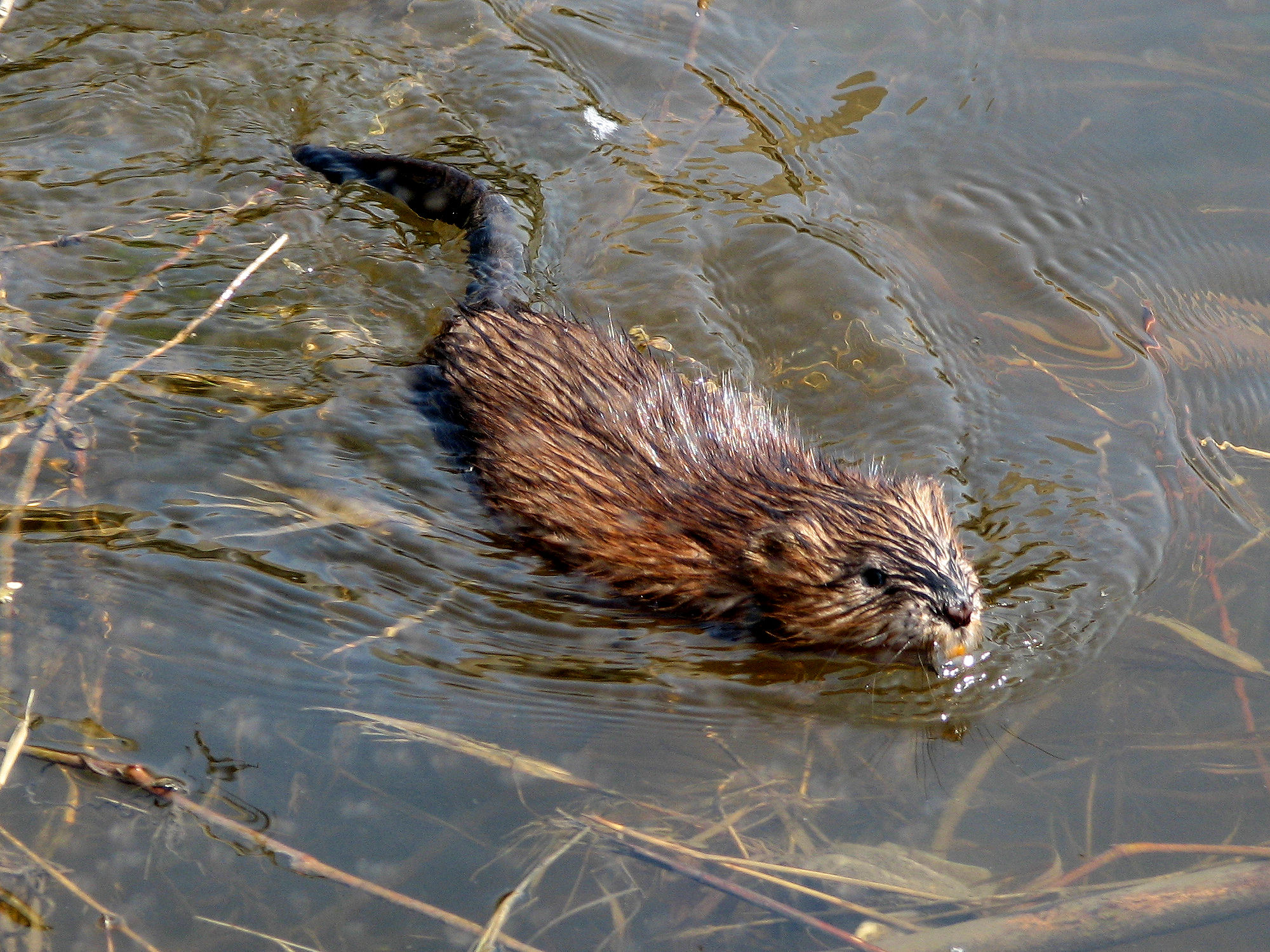
Muskrat swimming. Image credit: Gordon E. Robertson, Creative Commons
This ecoregion contains what may be the largest herds of moose in North America, consisting of both the smaller Shiras moose of the Rocky Mountains and the larger western moose of lower areas. Other characteristic mammals include American beaver, muskrat, snowshoe hare, wolf, and two subspecies of black bear: the cinnamon bear of the Rocky Mountains and the eastern black bear of the Canadian taiga. Distinctive birds include sandhill crane, ruffed grouse, spruce grouse, and many species of waterfowl and wood-warblers.
Protected areas are limited in this ecoregion but include the ecologically significant (though small) Goose Mountain Ecological Reserve and Whitecourt Mountain Natural Area, both in western Alberta. Goose Mountain is in the Swan Hills, the highest region of Alberta, and features subalpine vegetation and 16 plant species considered rare in Alberta, including kneeling angelica, bent sedge, goldthread, mountain bladder fern, northern beech fern, the pohlia moss, small twisted stalk, and false miterwort.i Whitecourt Mountain is best known for its Whitecourt meteor impact crater.
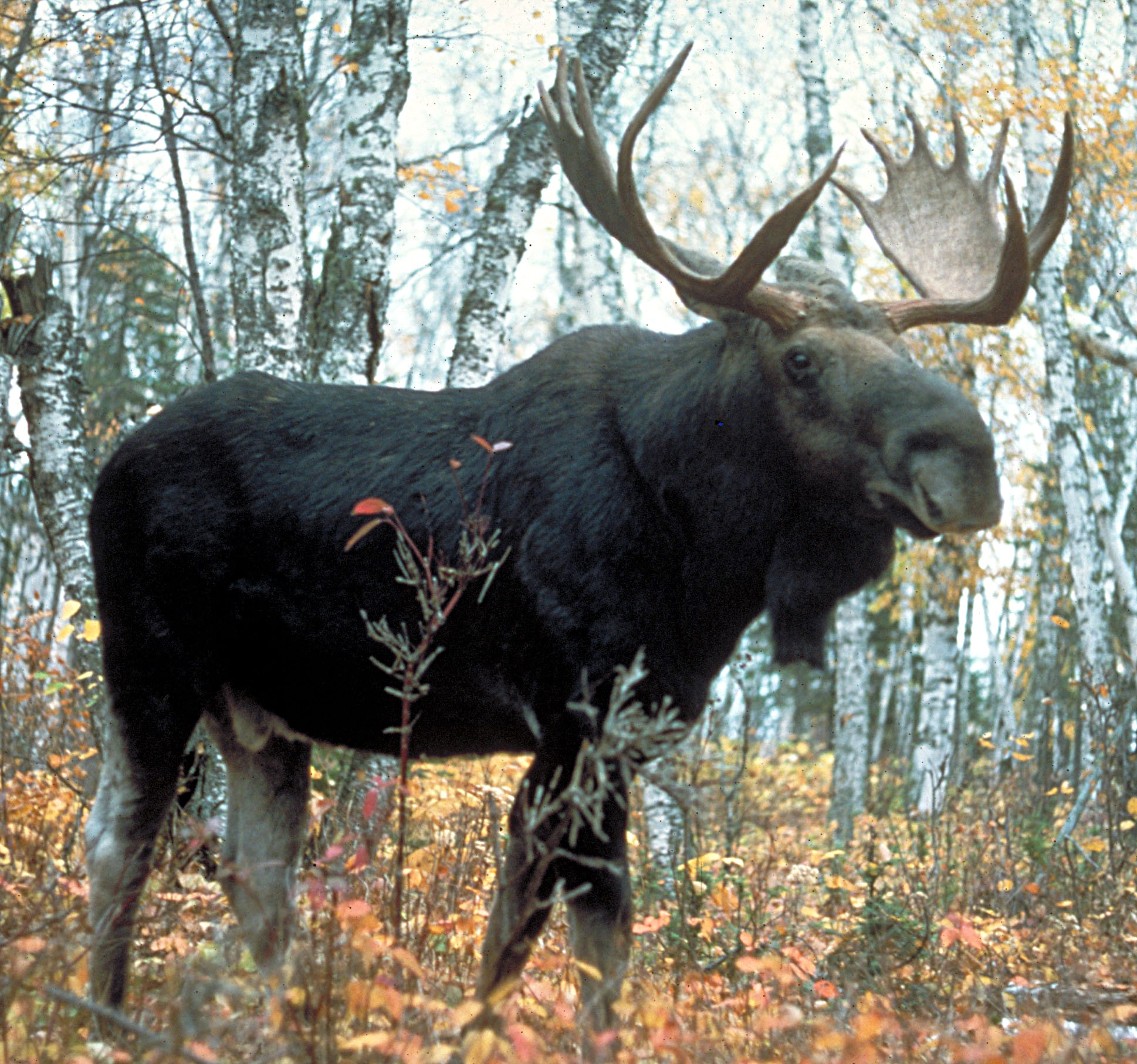
Western moose. Image credit: USDA Forest Service, Creative Commons
Agriculture, road-building, logging, and oil and gas production have heavily altered the Alberta-British Columbia Foothills Forests ecoregion. Priority conservation actions for the next decade are: 1) acquire additional protected areas to better represent the full range of ecosystem types and provide enhanced connectivity among reserves; 2) improve management of existing conservation lands as well as private lands, for example by reducing or stopping predator control; and 3) reduce agricultural expansion, logging, and oil and gas development.
Citations
1. Ricketts, T.H. et al. 1999. Terrestrial Ecoregions of North America: A Conservation Assessment. Island Press, Washington, D.C.
2. Alberta-British Columbia Foothills Forests. https://en.wikipedia.org/wiki/Alberta-British_Columbia_foothills_forests
3. Ecological Stratification Working Group. 1995. A National Ecological Framework for Canada. Environment Canada and other agencies, Ottawa.

Subscribe to receive monthly updates on climate solutions, environmental heroes, and the profound beauty and wonder of our shared planet Earth.
