

Albertine Rift Montane Forests
The ecoregion’s land area is provided in units of 1,000 hectares. The protection goal is the Global Safety Net (GSN1) area for the given ecoregion. The protection level indicates the percentage of the GSN goal that is currently protected on a scale of 0-10.
Bioregion: Victoria Basin & Albertine Rift Forests (AT12)
Realm: Afrotropics
Ecoregion Size (1000 ha):
15,150
Ecoregion ID:
1
Conservation Target:
46%
Protection Level:
3
States: Democratic Republic of the Congo, Uganda, Burundi, Rwanda, Tanzania
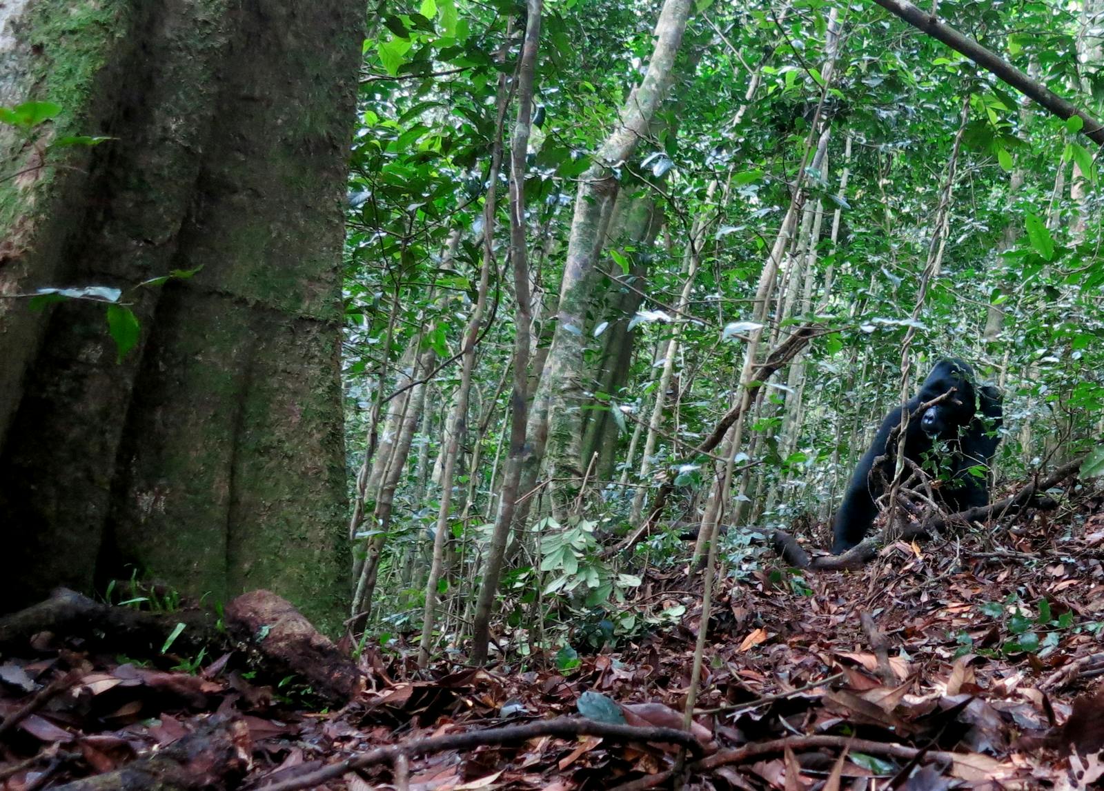
The Albertine Rift Montane Forests contain the highest levels of faunal endemism in Africa and harbors the mountain gorilla, one of the rarest animals in Africa. Formed from diverging tectonic plates, the ecoregion is now partly filled by lakes, including the world’s second-deepest and second-largest freshwater lake in volume, Lake Tanganyika.
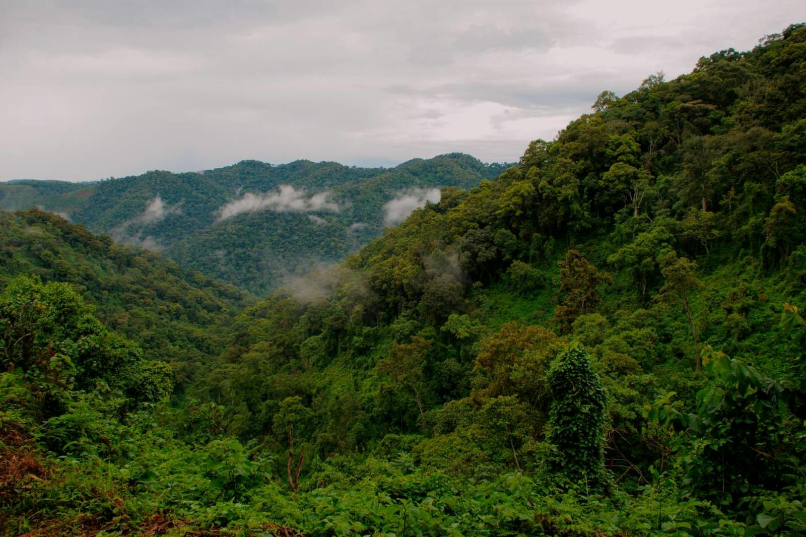
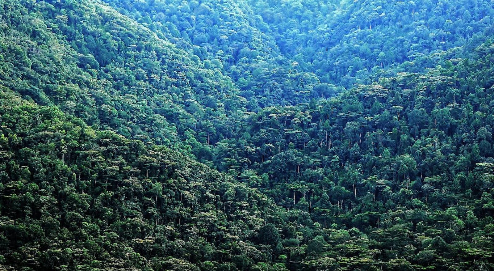
The ecoregion comprises a major mountain range running from the Lendu Plateau in the Democratic Republic of Congo (DRC) in the north, through mountains further south on the border between Uganda and eastern DRC into western Rwanda and Burundi, and to some isolated massifs in Tanzania and DRC on either side of Lake Tanganyika. The highest peaks in the Albertine Rift are found in the Rwenzori Mountains at 5,110 m.
The topographic complexity of the Albertine Rift has resulted in a diversity of climatic regimes. While the Rift is located in the center of tropical Africa, the high mountains have an essentially temperate climate. Average rainfall across the range is typically between 1,200 and 2,200 mm per annum, although it reaches 3,000 mm per annum on the western slope of Rwenzori.
The habitats of the ecoregion is mostly tropical moist broadleaf forest biome, with the higher altitude portions of the mountains separated into another ecoregion (Rwenzori-Virunga Montane Moorlands). The vegetation is commonly represented by species from the families Euphorbiaceae, Rubiaceae, and Meliaceae, although the composition changes depending on the altitude along the mountain slope and volcanoes, from dense forests on the lower elevation to montane forests covered with moss and ferns to zones of giant bamboos and moorland on the highest peaks.
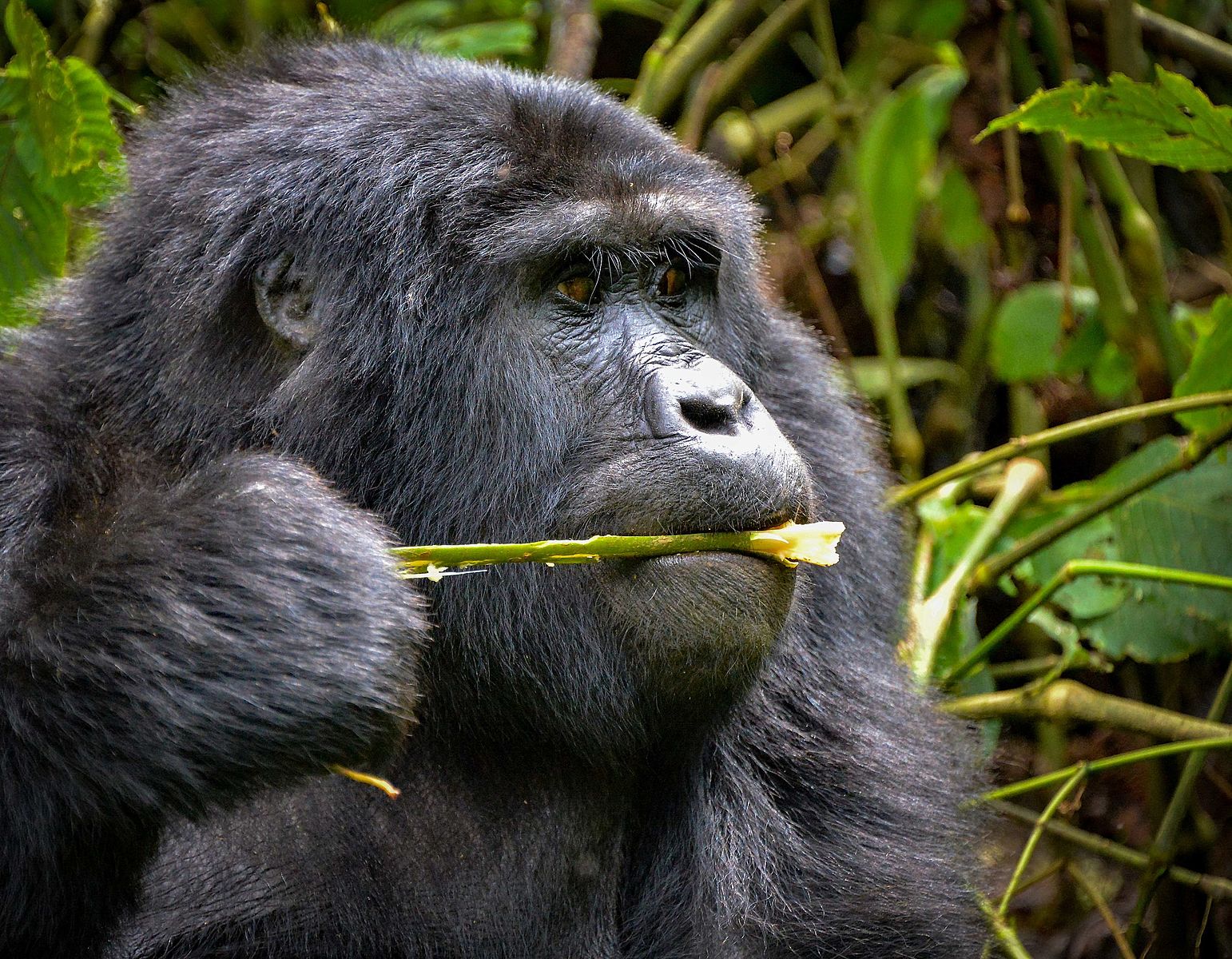
The flagship species of the Albertine Rift Montane Forests ecoregion is the mountain gorilla.
This ecoregion contains exceptionally high species richness due to its central location within Africa, juxtaposition of habitats, and considerable altitudinal zonation. Among vertebrates, birds are represented by at least 37 endemic species—it is designated an Endemic Bird Area by BirdLife International. Amphibians also possess exceptional endemism, with 34 strict endemic species, concentrated in the reed frogs, screeching frogs, river frogs, and clawed toads.
The endemic mammalian community contains 34 strictly endemic species, including the Ruwenzori otter shrew, one of only two species of the family Tenrecidae found on mainland Africa. The near-endemic Ruwenzori duiker is also found in the upper parts of the Rwenzori range. Threatened primate species include a subspecies of owl-faced monkey, golden monkey, eastern lowland gorilla, chimpanzee, and mountain gorilla, which is only found in this ecoregion. There are known to be 117 strict endemic butterflies in the ecoregion.
Most parts of the Albertine Rift forests only remain within protected areas or in the most rugged and inaccessible areas. Elsewhere, the landscape is dominated by farmland. In Uganda, areas of forest are protected in the Kalinzu, Bwindi-Impenetrable, Mgahinga Gorilla, and Kibale National Parks. Other protected areas include Echuya and Mafuga forest reserves, although there is very little natural vegetation remaining in the reserves.
In the DRC, what little forest remains on the Lendu Plateau is within forest reserves like Kahuzi-Biega National Park, Virunga National Park, the Itombwe Mountains Nature Reserve, and the more recently established Kabobo Natural Reserve. In Rwanda, forests are protected in the Volcanoes National Park and Nyungwe National Park, the latter forming a transboundary protected area with Kibira National Park of Burundi.
Much of this ecoregion, especially in Burundi and Rwanda, supports one of the highest rural human population densities in Africa (1,000 people per km2 in the central rift area). The biggest threat to the ecoregion is the clearance and fragmentation of forest habitats for agriculture. Hunting for bushmeat, particularly buffaloes, duikers, and bush pigs, is also a significant threat. Firewood collection and charcoal production are also serious problems, as are the invasion of exotic species and fire.
The wars in Rwanda, Burundi, and DRC caused an overspill of refugees into western Uganda and Tanzania, which led to further problems of agriculture encroachment and poaching. Large mining camps also occur in DRC forests, particularly looking for Columbo-Tantalite, an ore used in the electronics industry. The mining industry exacerbates hunting pressures as it improves access to the forests' interior and creates a market for bushmeat. Recently, the UK company SOCO ended its oil exploration in Virunga National Park. However, there are still many oil drilling sites in the region.
Priority conservation actions for the next decade
- Establish and refurbish the parks and reserves in post-war DRC.
- Support rural people in developing sustainable livelihood plans in important biodiversity areas, often on the margins of protected areas, while still enabling them to maintain traditional and cultural values.
- Continue to develop a zoning system with communities across the Itombwe Massif to identify areas for agriculture, hunting, settlements and conservation in order to protect the customary rights of long-term residents.
-
-
1. Plumptre, A.J., Ayebare, S., Segan, D., Watson, J. and Kujirakwinja, D. 2016. Conservation Action Plan for the Albertine Rift. Unpublished report for Wildlife Conservation Society and its partners.
2. Birdlife International. 2012. Conservation strategy for the great lakes region of east and central Africa. [Online]. [Accessed 19 January 2018]. Available from: http://www.birdlife.org/sites/default/files/attachments/AUTHORISED-GLR-STRATEGY_0.pdf
3. Kujirakwinja, D., Plumptre, A.J., Twendilonge, A., Mitamba, G., Mubalama, L., Wasso, J.D.D., Kisumbu, O., Shamavu, B., Ayebare, S., Bitomwa, O. and Tshombe, R. 2018. Establishing the Itombwe Natural Reserve: science, participatory consultations and zoning. Oryx. pp.1-9. -
Cite this page: Albertine Rift Montane Forests. Ecoregion Snapshots: Descriptive Abstracts of the Terrestrial Ecoregions of the World, 2021. Developed by One Earth and RESOLVE. https://www.oneearth.org/ecoregions/albertine-rift-montane-forests/
-

Subscribe to receive monthly updates on climate solutions, environmental heroes, and the profound beauty and wonder of our shared planet Earth.
