

Angolan Montane Forest-Grassland
The ecoregion’s land area is provided in units of 1,000 hectares. The conservation target is the Global Safety Net (GSN1) area for the given ecoregion. The protection level indicates the percentage of the GSN goal that is currently protected on a scale of 0-10. N/A means data is not available at this time.
Bioregion: Greater African Subequatorial Savannas & Mixed Woodlands (AT11)
Realm: Afrotropics
Ecoregion Size (1000 ha):
1,736
Ecoregion ID:
77
Conservation Target:
7%
Protection Level:
0
States: Angola
The Angolan highlands are located thousands of kilometers away from the rest of the Afromontane center of endemism, where flora and fauna share close affinities. This isolation has resulted in the evolution of distinct biological communities. One such species is the endemic and endangered Swierstra’s francolin, which is entirely dependent on the remaining, highly threatened forest patches in the Angolan Montane Forest-Grassland ecoregion. These rich and unique communities are likely to disappear unless effective conservation actions are taken.
The flagship species of the Angolan Montane Forest-Grassland ecoregion is the Angola cave-chat. Image credit: Creative Commons
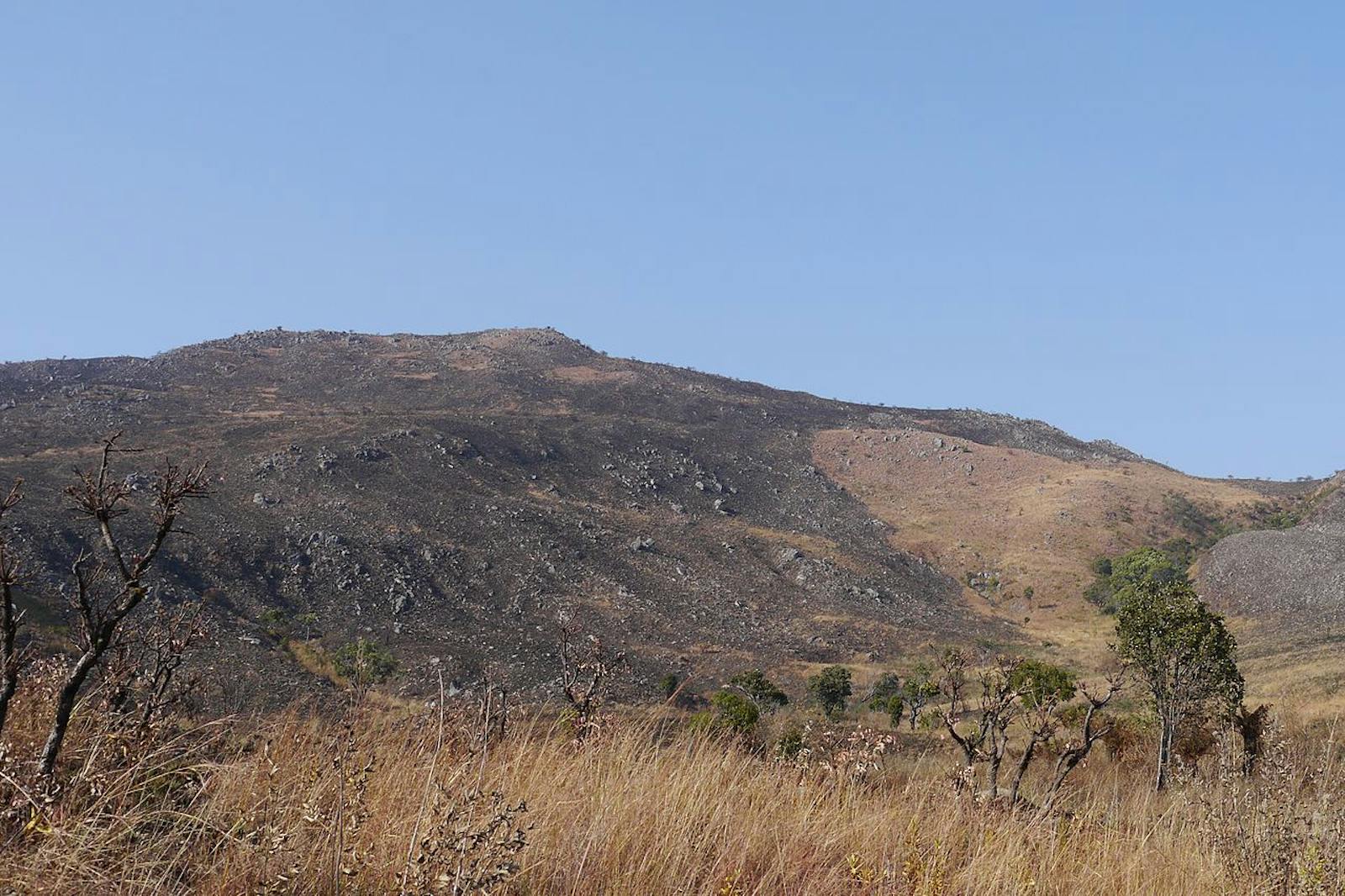
The ecoregion comprises a number of small montane forest patches surrounded by grasslands and Protea savanna in the west-central highlands of Angola. The ecoregion lies on the Marginal Mountain Chain of Angola, which is restricted to a narrow band running along the inland margin of the escarpment. Residual land surfaces that possibly date back to the Gondwanan age form the highest points of the ecoregion, reaching 2,620 m on Mount Môco, 2,582 m on Mount Mepo, and 2,554 m on Mount Lubangue.
The mean annual rainfall is between 1,200 mm and 1,600 mm, increasing with elevation. Rainfall is concentrated in the summer months, although precipitation from mists, which rise as the cold Benguela Current meets warmer tropical waters offshore, occurs through most of the year. The coolest months are July and August, when sub-zero temperatures are frequently recorded in the mountains. The mean annual temperatures range from 17° to 20°C.
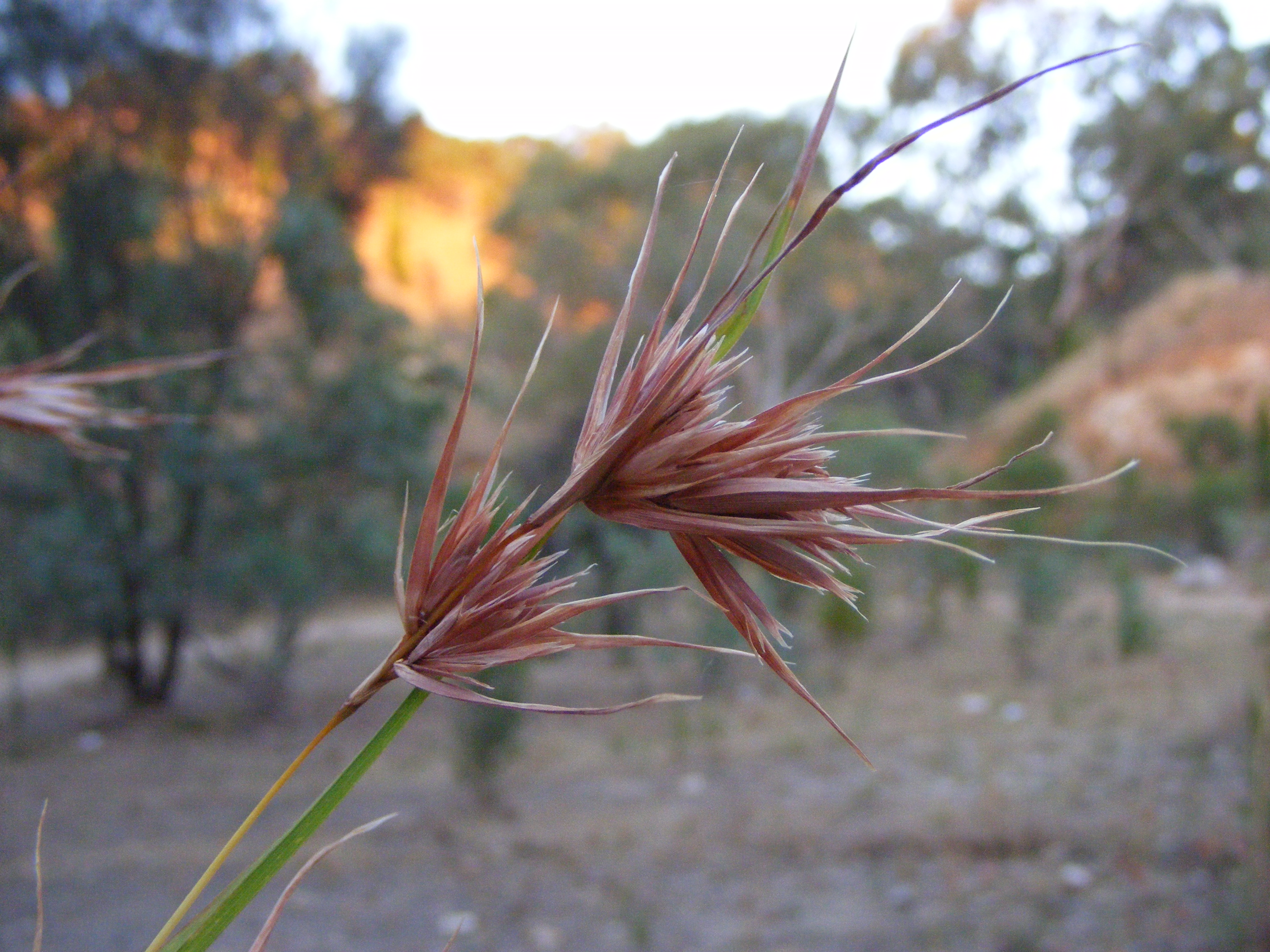
Kangaroo grass. Image credit: Creative Commons
Pockets of forest survive mainly in deep, humid ravines and on isolated peaks higher than 1,800 m. The forests patches range from 0.01 to 0.20 km2 in size and attain a canopy height of 8 m to 15 m. The dominant forest tree species is the yellowwood Padocarpus latifolius.Other common tree species include Polyscias fulva, Apodytes dimidiate, Pittosporum viridiflorus, Syzygium guineense afromontanum, Halleria lucida, Olea spp., and Ilex mitis.
Open grasslands with widely scattered trees and shrubs cover large areas of the highland plateau above 1,600 m and make up most of the ecoregion’s area. In well-drained areas, this vegetation is fire prone and includes shrub species such as Philippia benguelensis, Erica spp., Stoebe vulgaris, and Cliffortia sp. and grasses such as Themeda triandra, Tristachya inamoena, T. bequertii, Hyparrhenia andogensis, H. quarrei, Festuca spp., and Monocymbium ceresiiforme.
The montane forests of Angola are of great biogeographic interest as they are the sole surviving relics of a much larger moist forest biome that once existed during more favorable past climatic conditions. There are 64 endemic or near-endemic species supported by these highlands; 233 species have been recorded on Mount Môco.
Few large mammal species occur in the ecoregion and two shrew species, heather shrew and blackish white-toothed shrew, are considered near-endemic to this ecoregion. Boulton’s bat is known only from here and the border area between Zambia and southern Democratic Republic of Congo. Swierstra’s francolin is known only from a few montane areas in Angola. The near-endemic Angola cave-chat is limited to a few rocky hills and cliffs and surrounding forest habitat in four isolated areas, two of which fall into the ecoregion: eastern Namibe and Huíla in the southern outlier of the ecoregion.
Margaret's batis. Image credit: Nigel Voaden, Creative Commons
A number of endemic and near-endemic bird subspecies are separated for more than 2,000 km from their nearest relatives in the mountains of Fernando Po, Cameroon, Rwenzori, Tanzania, Ethiopia, and Malawi. They include long-billed pipit, mountain wheatear, mountain nightjar, western green tinkerbird, evergreen forest-warbler, Abyssinian hill babbler, and thick-billed seedeater. Some other birds have an Afromontane distribution, such as bar-tailed trogon, scarce swift, orange ground-thrush, and African black swift. The Fernando Po swift occurs on Mount Môco.
The forests of this ecoregion are highly fragmented as a result of fires, agriculture, and logging. The remaining forest patches, found in isolated ravines and at inaccessible elevations, seldom exceed 0.2 km2 in size, and their total area is approximately 7 km2. The most extensive forest areas, the Namba mountains, contain the largest area of Afromontane forest in Angola at more than 5.9 km2. Relatively undisturbed patches remain at Mount Môco between 1,800 and 2,400 m elevation. No protected areas currently exist in this ecoregion.
The high population pressure, instability due to the civil war (1974–2002), and the lack of protected areas make conservation of the forest fragments and surrounding grasslands a daunting task. Probably the greatest threat to the forest areas is from timber logging and other harvesting of forest products including firewood collection, as the forests are already confined to steep, inaccessible slopes, and ravines that are unsuitable for farming.
The moist, often waterlogged, grassland areas are unsuitable for agriculture and are not greatly affected by fires. Better-drained grassland areas are subject to frequent natural and human induced fire. It is here that slash and burn agriculture is common. Additionally, hunting has eliminated large mammals.
The priority conservation actions for the next decade will be to: 1) establish protected areas including buffer zones, particularly on Mount Môco, and reintroduce extirpated large mammals from neighboring countries; 2) decrease the need for burning land for agriculture through introducing eco-agricultural techniques as well as controlled burns techniques if it is necessary; and 3) implement reforest programmes to extend isolated forest patches.
Citations
1. Burgess, N., Hales, J.A., Underwood, E., Dinerstein, E., Olson, D., Itoua, I., Schipper, J., Ricketts, T. and Newman, K. 2004. Terrestrial ecoregions of Africa and Madagascar: a conservation assessment. Island Press.
2. Mills, M.S., Melo, M. and Vaz, A. 2013. The Namba mountains: new hope for Afromontane forest birds in Angola. Bird Conservation International. 23(2), pp.159-167.
3. Cáceres, A., Santos, P., Tchalo, F., Mills, M. and Melo, M. 2013. Human use of natural resources and the conservation of the afromontane forest in Mount Moco, Angola. Journal of Sustainable Development in Africa. 15, pp. 91-101
4. Mills, M.S., Olmos, F., Melo, M. and Dean, W.R.J. 2011. Mount Moco: its importance to the conservation of Swierstra’s Francolin Pternistis swierstrai and the Afromontane avifauna of Angola. Bird Conservation International. 21(2), pp.119-133.

Subscribe to receive monthly updates on climate solutions, environmental heroes, and the profound beauty and wonder of our shared planet Earth.
