

Angolan Mopane Woodlands
The ecoregion’s land area is provided in units of 1,000 hectares. The conservation target is the Global Safety Net (GSN1) area for the given ecoregion. The protection level indicates the percentage of the GSN goal that is currently protected on a scale of 0-10. N/A means data is not available at this time.
Bioregion: Greater African Subequatorial Savannas & Mixed Woodlands (AT11)
Realm: Afrotropics
Ecoregion Size (1000 ha):
19,267
Ecoregion ID:
34
Conservation Target:
65%
Protection Level:
6
States: Angola, Namibia
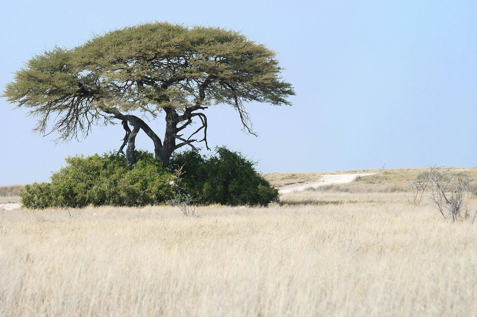
The mopane woodlands lie along the Owambo Basin and surround the Etosha Pan Halophytics in Namibia. The mopane tree dominates the vegetation in this ecoregion and is utilized by resident elephants. The woodlands also support other threatened species, including the black and white rhinoceros, lion, cheetah, and the near-endemic black-faced impala. During the wetter months, wildlife migrates mainly towards the west, away from the waterholes, and back in the dry season.
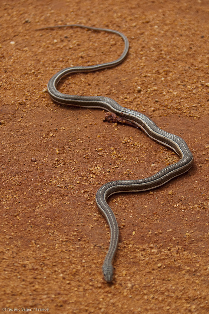
The flagship species of the Angolan Mopane Woodlands ecoregion is the skaapsteker snake (Psammophylax rhombeatus). Image Credit: Courtesy of Frederic Salein, Flickr.
The ecoregion lies on the western edge of the Central African Plateau, at around 1,000 meters (3,280 ft) in elevation along the Owambo Basin. The landscape is comprised of sand, silt, clay, low-grade coal, and tillite derived from the Karoo Sequence, dating from 300 to 130 million years. Millions of years of deposition and erosion from wind and water have produced a complex variety of soils and vegetation.
Two main river systems, both originating in the highlands in Angola, drain much of this ecoregion. Mean annual rainfall is between 350 to 500 millimeters (14-20 in), increasing inland in the coastal desert areas. The rain normally falls in the summer months between August and April. February usually has the mean maximum rainfall, about 110 millimeters (4 in).
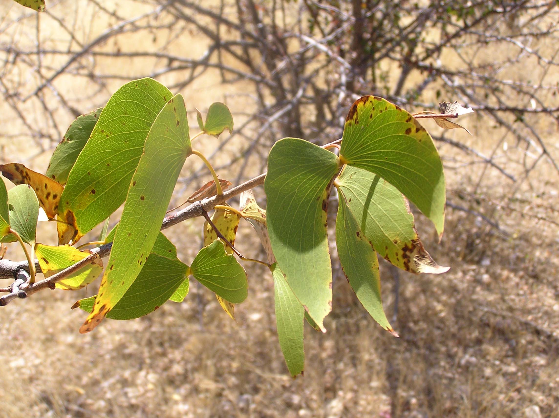
Leaves from the mopane tree (Colophospermum mopane). Image Credit: Teo Gomez, Wiki Creative Commons.
The variations in soils and climate contribute to a wide local variety of vegetation types, including mopane shrublands, western Kalahari woodlands, western part of the karstveld, and Cuvelie. Mopane (Colophospermum mopane) occurs as a shrub or a tree, depending on local conditions, and grows over vast areas in a low, thorny bushveld. It is usually associated with Acacia kirkii, A. nilotica, A. erubescens, Combretum apiculatum, Commiphora spp., Dichanthium papillosum, Indigofera schimperi, Peltophorum africanum, and Spirostachys africana, to name a few.
Levels of endemism are lower in this ecoregion than in the neighboring Namib Escarpment and Kaokoveld Desert ecoregions to the west. The largest remaining populations of large mammals occur in and around Etosha National Park, especially during the dry winter months. Damara zebra, blue wildebeest, springbok, and giraffe are the most numerous mammals. Near-endemic mammals include Thomas’ rock rat and two white-toothed shrews.
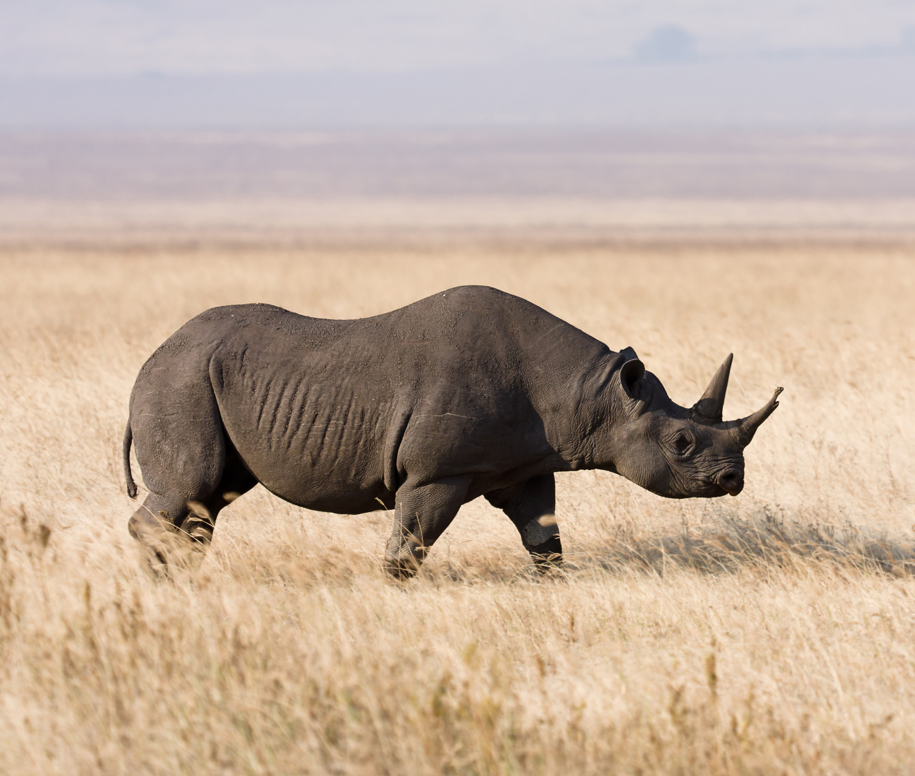
Black rhino (Diceros bicornis). Image Credit: Wiki Creative Commons.
This ecoregion has diverse avian fauna. Ten bird species are near-endemic, most of which are shared with the Namib Escarpment ecoregion. These include the Damara rock jumper, grey kestrel, Carp’s tit, southern violet wood hoopoe, and Bradfield’s hornbill. The ecoregion has a large number of reptile species, including the endemic Afrogecko ansorgii and the skaapsteker, a venomous snake that reaches up to 1 meter (3 ft) in length. The ecoregion also has the second-highest spider richness in Namibia, with 115 species native to the ecoregion.
Game Reserve No. 2 originally covered about 80,000 square kilometers (30,888 sq mi) of northern Namibia and was the largest nature reserve in the world. It included much of the Kaokoveld Desert, the northern portion of the Namib Escarpment, and the central area of the Angolan Mopane Woodlands. In 1968, this reserve was reduced to become the present Etosha National Park, an area of 22,912 square kilometers (8,846 sq mi). The excised land was reallocated to communal homelands, and today, about 50 percent of the land formerly occupied by Game Reserve No. 2 is protected, mainly by large communal conservancies, including Kunene River, Lipumbu ya Tshilongo, and Okongoro. Private nature reserves and game farms are also found in this ecoregion.
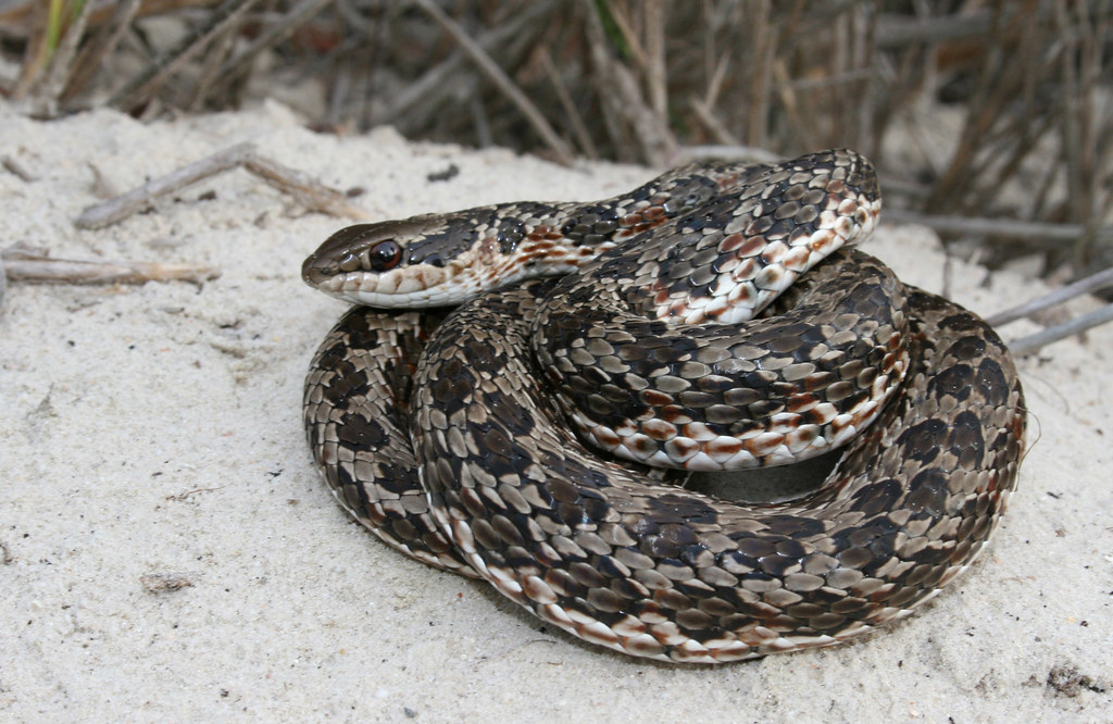
Skaapsteker snake (Psammophylax rhombeatus). Image Credit: Courtesy of Wildlife Wanderer, Flickr.
After Game Reserve No. 2 was dissolved in 1968, wildlife in this area was nearly decimated by poaching gangs, colonial officials, contractors, and local people armed from Namibia’s war of liberation. Poaching remains a considerable threat, particularly to the black rhino population. The 30-year civil war in Angola also had a devastating impact on conservation in the Angolan part of the ecoregion.
Protected areas are open to poachers, timber harvesting, human settlement, and agriculture. Few, if any, viable populations of larger mammals have survived and populations of lion, black rhino, and giraffe have become locally extinct. The serious landmine situation in Angola has afforded some protection to other biodiversity by rendering some areas off-limits to settlement or large-scale exploitation.
Anthrax has become a significant disease within Etosha National Park, and together with rinderpest, is one of the most dramatic diseases affecting wild animals in Africa. Fences erected around the park between 1962 and 1973 have disturbed the natural herbivore migration patterns in the area and fragmented the habitat. Previously, wildebeest migrated northeast of the park during dry seasons. This disturbance is a particular threat during drought years when the ungulates cannot move away from drought-stricken areas and have restricted access to food and water.
The priority conservation actions for the next decade
1) Strengthen wildlife law enforcement capacity.
2) Implement a more effective park management program, as well as in conservancies, to generate income for local communities, prevent human-wildlife conflicts, and contribute to wildlife conservation.
3) Integrate local Indigenous knowledge into conservation and the sustainable use of natural resources.
-
-
1. Burgess, N., Hales, J.A., Underwood, E., Dinerstein, E., Olson, D., Itoua, I., Schipper, J., Ricketts, T. and Newman, K. 2004. Terrestrial ecoregions of Africa and Madagascar: a conservation assessment. Island Press.
2. Government of the Republic of Namibia. 2014. Namibia’s Second National Biodiversity Strategy and Action Plan 2013-2022. Windhoek, Namibia: Ministry of Environment and Tourism.
3. European Commission. 2016. Larger than Elephants: Inputs for an EU strategic approach to wildlife conservation in Africa – Regional Analysis. Brussels, Belgium: European Union.
4. Barnard, P., Brown, C.J., Jarvis, A.M. and Robertson, A. 1998. Extending the Namibian protected areas network to safeguard hotspots of endemism and diversity. Biodiversity and Conservation. 7, pp. 531-547. -
Cite this page: Angolan Mopane Woodlands. Ecoregion Snapshots: Descriptive Abstracts of the Terrestrial Ecoregions of the World, 2021. Developed by One Earth and RESOLVE. https://www.oneearth.org/ecoregions/angolan-mopane-woodlands/
-

Subscribe to receive monthly updates on climate solutions, environmental heroes, and the profound beauty and wonder of our shared planet Earth.
