
Arctic Coastal Tundra
The ecoregion’s land area is provided in units of 1,000 hectares. The protection goal is the Global Safety Net (GSN1) area for the given ecoregion. The protection level indicates the percentage of the GSN goal that is currently protected on a scale of 0-10.
Bioregion: North Alaskan Tundra (NA3)
Realm: Subarctic America
Ecoregion Size (1000 ha):
4,978
Ecoregion ID:
407
Conservation Target:
83%
Protection Level:
0
States: United States: AK
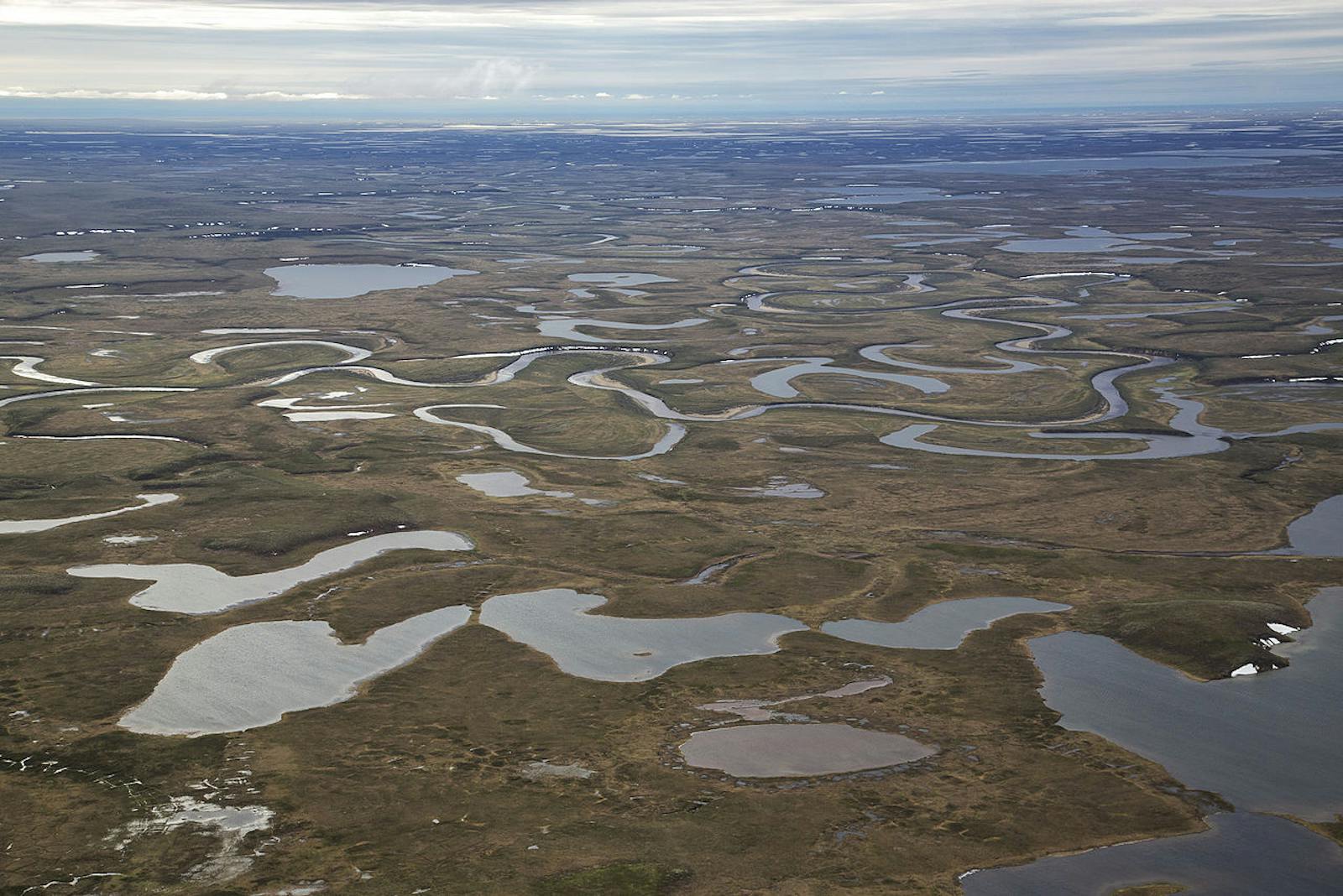
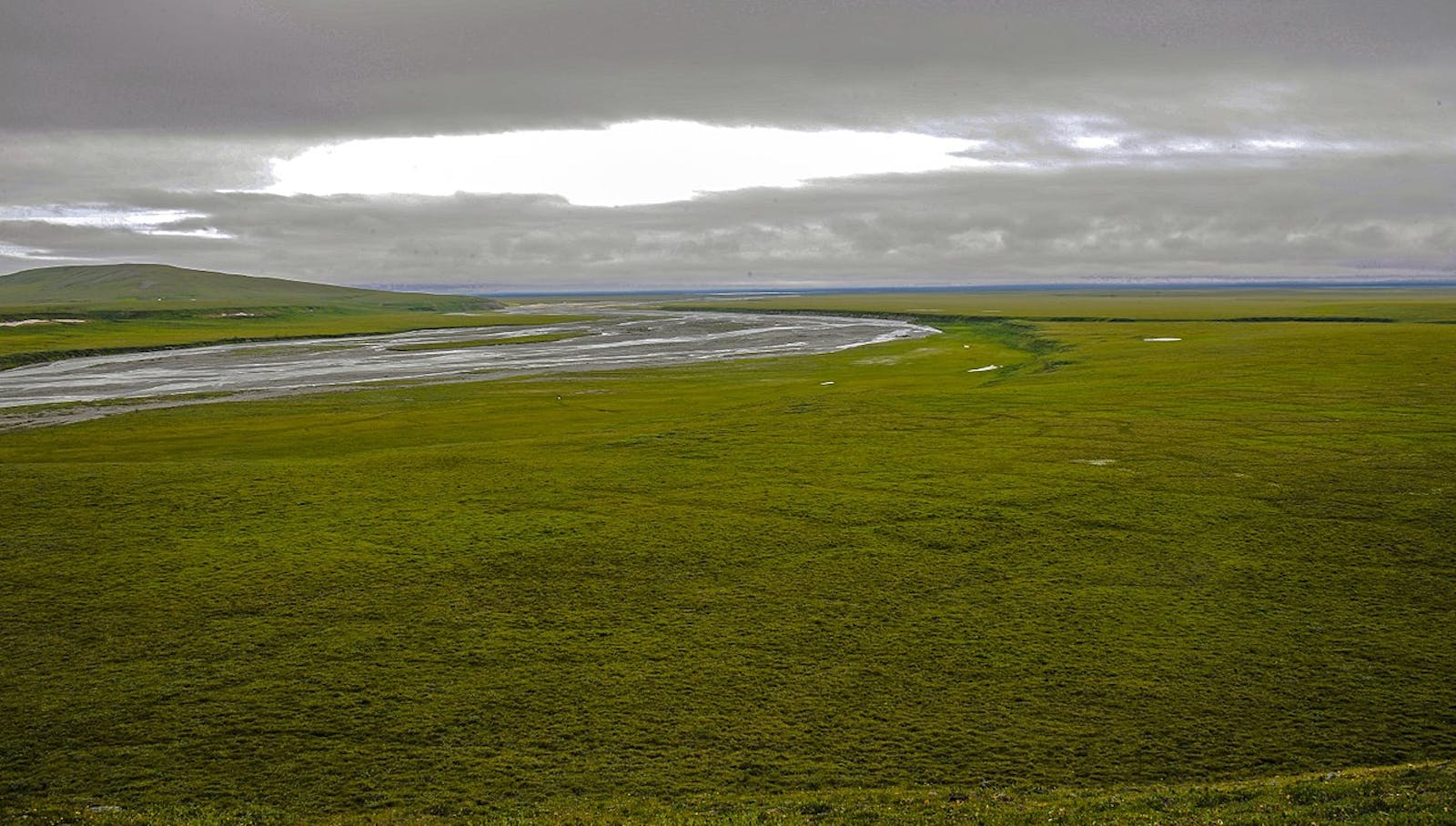
The Arctic Coastal Tundra ecoregion forms most of the northern coastline of Alaska. It is a low (0–150 m elevation), gradually rising coastal plain along the Beaufort Sea of the Arctic Ocean. It is bounded on the south by the Arctic Foothills Tundra ecoregion. The terrain is characterized by mostly poor drainage and many thaw lakes, which cover up to 50% of the ecoregion and distinguish it from the Canadian Low Arctic Tundra ecoregion to the east.
.jpg)
The flagship species of the Arctic Coastal Tundra ecoregion is the Beluga whale.
Importantly, along with the Arctic Foothills Tundra ecoregion, much of the Arctic Coastal Tundra was unglaciated during the Pleistocene and formed part of the extensive Bering Sea Pleistocene Refugium, which preserved Arctic plant communities during glacial periods.
Although a portion of the Arctic National Wildlife Refuge, the largest wildlife refuge in the U.S., lies within the Arctic Coastal Tundra ecoregion, the ecoregion, on the whole, is poorly protected. Only 4% of the ecoregion lies within protected areas. With 91% of the area outside protected areas still intact, opportunities to increase protection are vast but must be pursued quickly before additional oil development and other threats increase.
The climate of this ecoregion is Arctic. Permafrost is continuous and thick, with very high ice content, abundant ice wedges, and pingos (mounds of earth-covered ice). The summer growing season extends from mid-June through August, with mean temperatures of around 4.5oC. In winter the mean daily minimum temperature is -30oC and the mean daily maximum temperature is 8oC. The annual precipitation is low, averaging 100–300 mm, but can be higher near the southern boundary.
The dominant vegetation is wet tundra, fens, bogs, and marshes dominated by grasses, sedges, and mosses interspersed with dwarf shrub communities on higher, better-drained sites, with dwarf birch, willow, alder, and northern Labrador tea.
Characteristic mammals found in this ecoregion include walrus, seals, beluga whales, polar bears, wolves, barren-ground caribou, musk ox, snowshoe hare, Arctic hare, red fox, and Arctic ground squirrel. Seabirds and waterfowl are abundant, as are Arctic char. Three significant caribou herds—the Arctic, Central Arctic, and Porcupine—migrate here each year to breed. The Arctic National Wildlife Refuge within this ecoregion is the center of distribution for musk ox in Alaska.
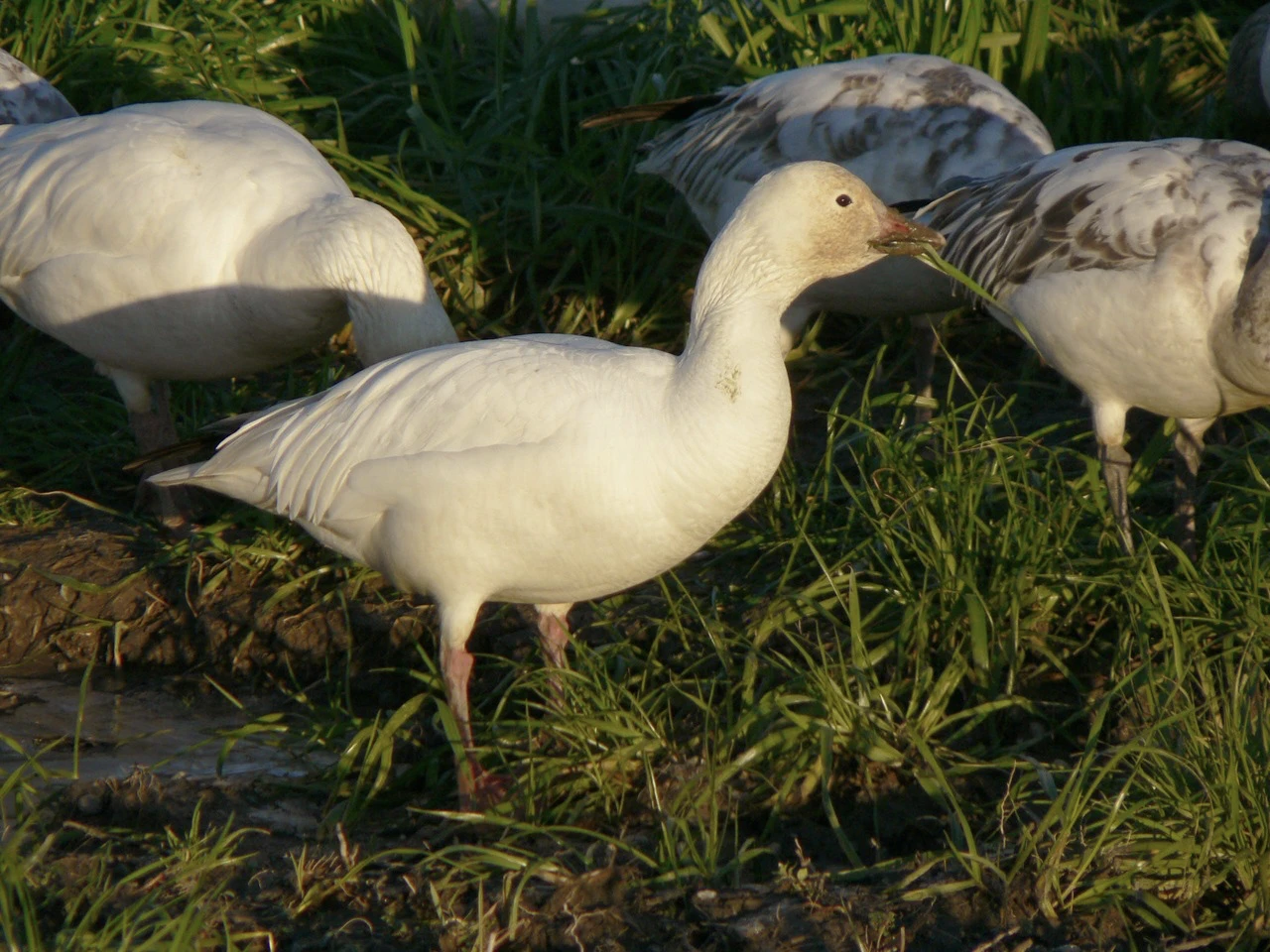
Snow geese. Image credit: Walter Siegmund, Creative Commons
The only breeding sites for snow geese in Alaska are small areas within this ecoregion. The Kasegaluk Lagoon in the western portion of the ecoregion supports thousands of beluga whales every summer, hundreds of spotted seals and walrus, and is a critical staging area for migrating Pacific black brant. This lagoon, which extends for more than 170 km along the coast, is one of the world's largest and most intact coastal lagoon systems and has been designated an Audubon Important Bird Area. Besides black brant, notable birds here include red phalarope, red-necked phalarope, dunlin, pectoral sandpiper, semipalmated sandpiper, eiders, and a colony of Aleutian terns.
The largely intact habitat but poor protection status make this ecoregion a high priority for a vast expansion of protected areas, especially given the threat of increased oil production. Existing development is centered in the city of Utqiagvik (formerly Barrow) and in the vicinity of Prudhoe Bay, the largest oil field in North America, the Trans-Alaska Pipeline's origin, and the Pan-American Highway's terminus.
Priority conservation actions for the next decade are: 1) greatly expand the network of protected areas across the ecoregion; 2) prohibit incompatible uses, including oil production, within designated protected areas; and 3) protect vulnerable species from over-harvest and monitor populations.
-
-
1. Ricketts, T.H. et al. 1999. Terrestrial Ecoregions of North America: A Conservation Assessment. Island Press, Washington, D.C.
2. Gallant, A.L., E.F. Binnian, J.M. Omernik, and M.B. Shasby.1995. Ecoregions of Alaska. USGS Professional Paper 1567. U.S. Govt. Printing Office, Washington, D.C.
3. http://www.alaskawild.org/places-we-protect/kasegaluk-lagoon/ -
Cite this page: Arctic Coastal Tundra. Ecoregion Snapshots: Descriptive Abstracts of the Terrestrial Ecoregions of the World, 2021. Developed by One Earth and RESOLVE. https://www.oneearth.org/ecoregions/arctic-coastal-tundra/
-

Subscribe to receive monthly updates on climate solutions, environmental heroes, and the profound beauty and wonder of our shared planet Earth.
