
Arctic Foothills Tundra
The ecoregion’s land area is provided in units of 1,000 hectares. The protection goal is the Global Safety Net (GSN1) area for the given ecoregion. The protection level indicates the percentage of the GSN goal that is currently protected on a scale of 0-10.
Bioregion: North Alaskan Tundra (NA3)
Realm: Subarctic America
Ecoregion Size (1000 ha):
12,969
Ecoregion ID:
408
Conservation Target:
96%
Protection Level:
2
States: United States: AK. Canada: YT, NT
The Arctic Foothills Tundra ecoregion, for most of its extent, lies between the Arctic Coastal Tundra ecoregion to the north and the Brooks-British Range Tundra ecoregion to the south. Its western edge is along the northwestern coast of Alaska, on the Chukchi Sea, and it borders the ocean again on the Beaufort Sea in northeastern Alaska, northern Yukon Territory, and extreme northwestern Northwest Territories.
True to its name “Foothills,” it is a transitional region of rounded hills and plateaus lying between the Coastal Plain and the steep mountains of the Brooks Range and British Range. It is distinct from the Arctic Coastal Tundra in having better and more defined drainage, less saturated soils, and fewer thaw lakes. Much of the Arctic Foothills Tundra was unglaciated during the Pleistocene and was part of the extensive Bering Sea Pleistocene Refugium, which preserved Arctic plant communities during glacial periods. Some 99% of the Arctic Foothills Tundra is intact, including 20% in protected areas and 79% outside of protected areas. Achieving full protection status for much more of the intact habitat outside protected areas is a high priority for this ecoregion.
The climate of the Arctic Foothills Tundra ecoregion is Arctic, but averages slightly warmer than the ecoregions to the north and south (the latter being higher in elevation). Permafrost is continuous and thick, with the active layer averaging about 1 m in depth. Average daily temperatures in winter range from -29°C to -20°C, and in summer from 1°C to 15°C. Freezing temperatures can occur at any time of year, but July and August are normally frost-free. Annual precipitation is about the same as that of the Arctic Coastal Tundra, averaging around 140 mm, but the western end of the ecoregion (in the Noatak Valley) receives about twice this much precipitation.
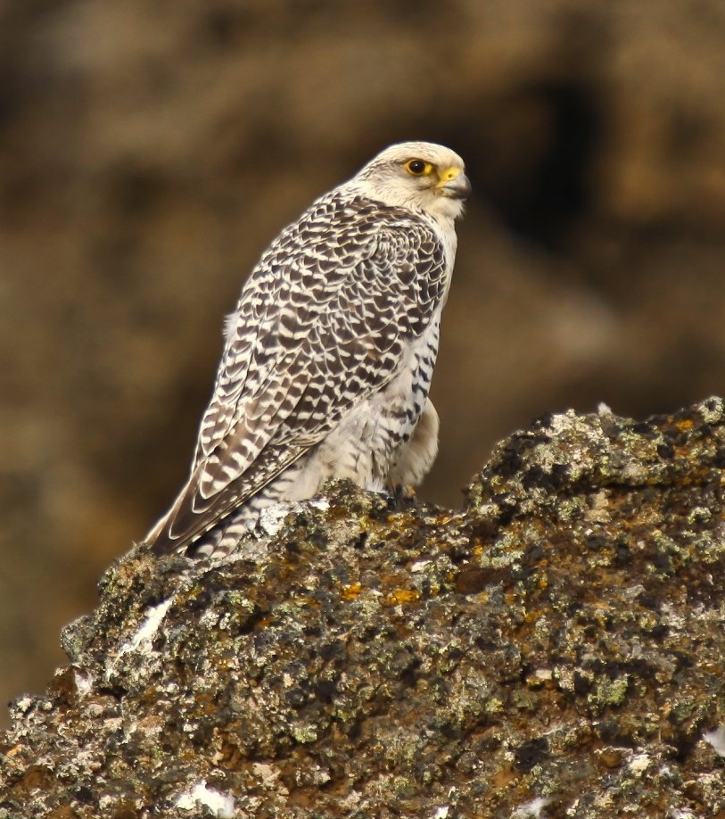
The flagship species of the Arctic Foothills Tundra ecoregion is the gyrfalcon. Image credit: Olafur Larsen, Creative Commons
The dominant vegetation includes both moist herbaceous and dwarf shrub (scrub) communities across most of the ecoregion, with some forest communities in the Noatak River Valley. The herbaceous communities are dominated by tussock-forming sedges, including cottongrass, but also include dwarf Arctic birch, crowberry, narrow-leaf Labrador tea, and mountain cranberry, along with many mosses and lichens between tussocks. Dwarf shrub communities are dominated by small mat-forming Dryas shrubs along with several shrub species in the heath family. Open low scrub communities are co-dominated by alders and willows, with abundant mosses.
The forest vegetation in the Noatak Valley includes white spruce in pure, open stands or mixed with balsam poplar on the riverbanks, with an understory dominated by willows. Balsam poplar grows farther upriver than white spruce, with typical understory species including alpine bearberry, buffaloberry, and shrubby cinquefoil.
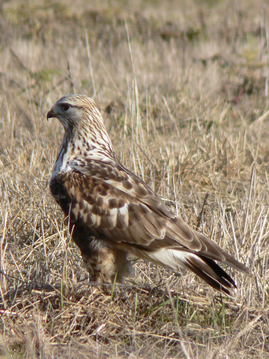
Rough legged buzzard. Image credit: Walter Siegmund, Creative Commons
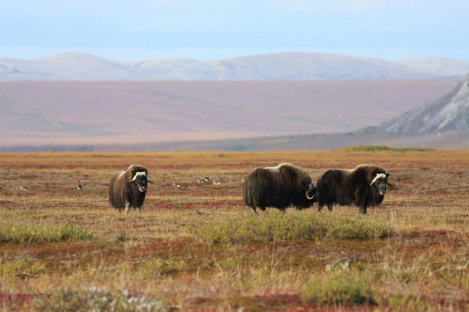
Three distinct caribou herds—Western Arctic, Central Arctic, and Porcupine herds—migrate through this ecoregion. Other mammals include polar bear, brown/grizzly bear, black bear, gray wolf, coyote, Arctic fox, red fox, ermine, moose, barren-ground caribou, muskox, many species of rodents and shrews, and marine mammals such as walrus, spotted seal, ringed seal, bearded seal, beluga whale, gray whale, and bowhead whale.
The Colville River is an important corridor for moose and many species of birds, and its bluffs provide nesting sites for large numbers of gyrfalcons, peregrine falcons, and rough-legged hawks. Other large birds include golden eagle, Canada goose, white-fronted goose, tundra swan, several other waterfowl species, common loon, Arctic loon, and Pacific loon. Fish include lake trout, Arctic char, Arctic grayling, pink salmon, chum salmon, Chinook salmon, coho salmon, and many others.
This ecoregion is almost entirely intact. However, the Trans-Alaska Pipeline and the Pan-American (Dalton) Highway pass through the ecoregion, and development along this corridor is almost certain to increase. Coal and mineral mining are also a threat, especially in the western portion of the ecoregion. Priority conservation actions for the next decade are: 1) greatly expand the network of protected areas across the ecoregion; 2) prohibit incompatible uses, including large-scale mining, within designated protected areas; and 3) protect vulnerable species from over-harvest and monitor populations.
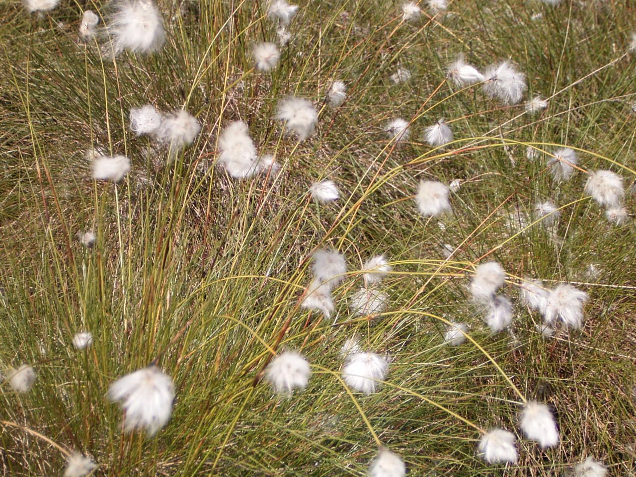
Hare's tale cotton grass. Image credit: Elke Freese, Creative Commons
Citations
1. Ricketts, T.H. et al. 1999. Terrestrial Ecoregions of North America: A Conservation Assessment. Island Press, Washington, D.C.
2. Gallant, A.L., E.F. Binnian, J.M. Omernik, and M.B. Shasby.1995. Ecoregions of Alaska. USGS Professional Paper 1567. U.S. Govt. Printing Office, Washington, D.C.
3. https://www.fws.gov/refuge/arctic/mammlist.html

Subscribe to receive monthly updates on climate solutions, environmental heroes, and the profound beauty and wonder of our shared planet Earth.
