
Beringia Upland Tundra
The ecoregion’s land area is provided in units of 1,000 hectares. The protection goal is the Global Safety Net (GSN1) area for the given ecoregion. The protection level indicates the percentage of the GSN goal that is currently protected on a scale of 0-10.
Bioregion: Greater Alaska Taiga & Tundra (NA4)
Realm: Subarctic America
Ecoregion Size (1000 ha):
4,702
Ecoregion ID:
410
Conservation Target:
95%
Protection Level:
2
States: United States: AK
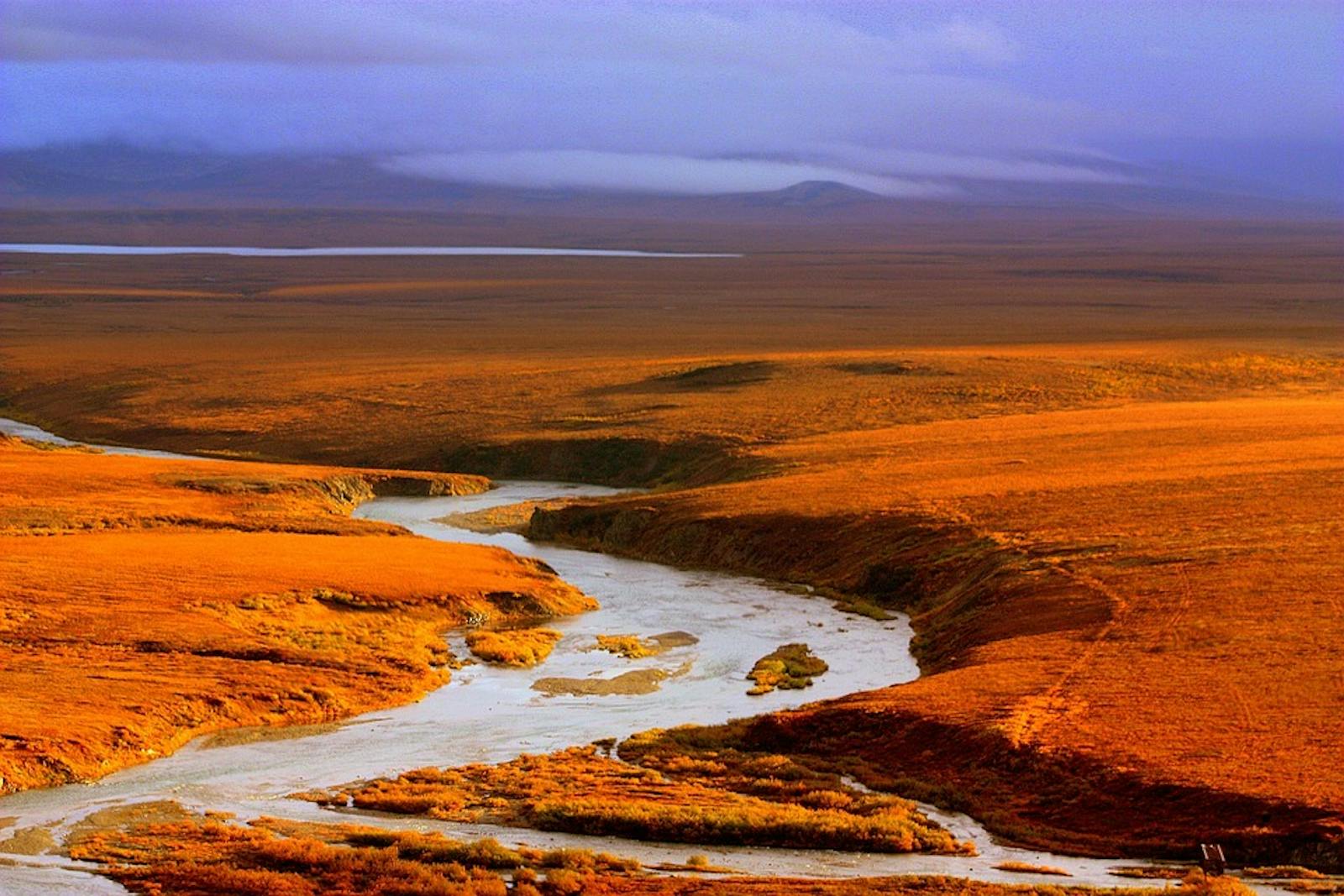
The Beringia Upland Tundra ecoregion occurs in two disjunct blocks: on the Seward Peninsula, where it is the dominant ecoregion, and a smaller area on the western half of St. Lawrence Island in the northern Bering Sea. Adjacent ecoregions are the Beringia Lowland Tundra to the north and the Interior Alaska-Yukon Lowland Taiga on the east and south.
The Beringia Upland Tundra ecoregion contains some of the oldest geological formations in Alaska and represents a remnant of the former land bridge that connected Asia to North America during at least the last glacial period, which ended around 13,000 years ago. Most of the land bridge now lies beneath the Chukchi and Bering Seas. Although some 98% of this ecoregion is intact, only 21% is within protected areas, primarily the Bering Land Bridge National Preserve (which also occurs within the adjacent Beringia Lowland Tundra ecoregion on the northern portion of the Sewall Peninsula). The 77% currently outside protected areas is a high priority for conservation.
The climate of this ecoregion ranges from maritime along the coast to transitional between maritime and continental subarctic to, in the eastern portion, continental. Long, severe winters and strong, persistent winds characterize this ecoregion, with only about 10 frost-free weeks during the summer. Permafrost is continuous across the ecoregion.
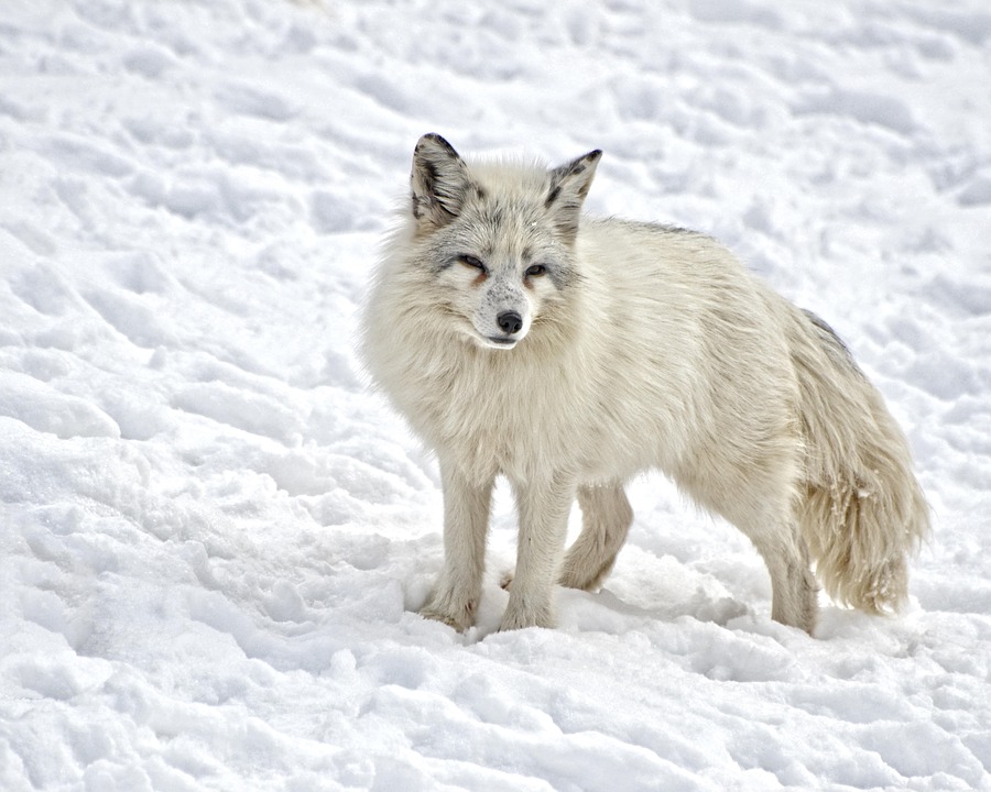
The flagship species of the Beringia Upland Tundra ecoregion is the Arctic fox. Image credit: Creative Commons
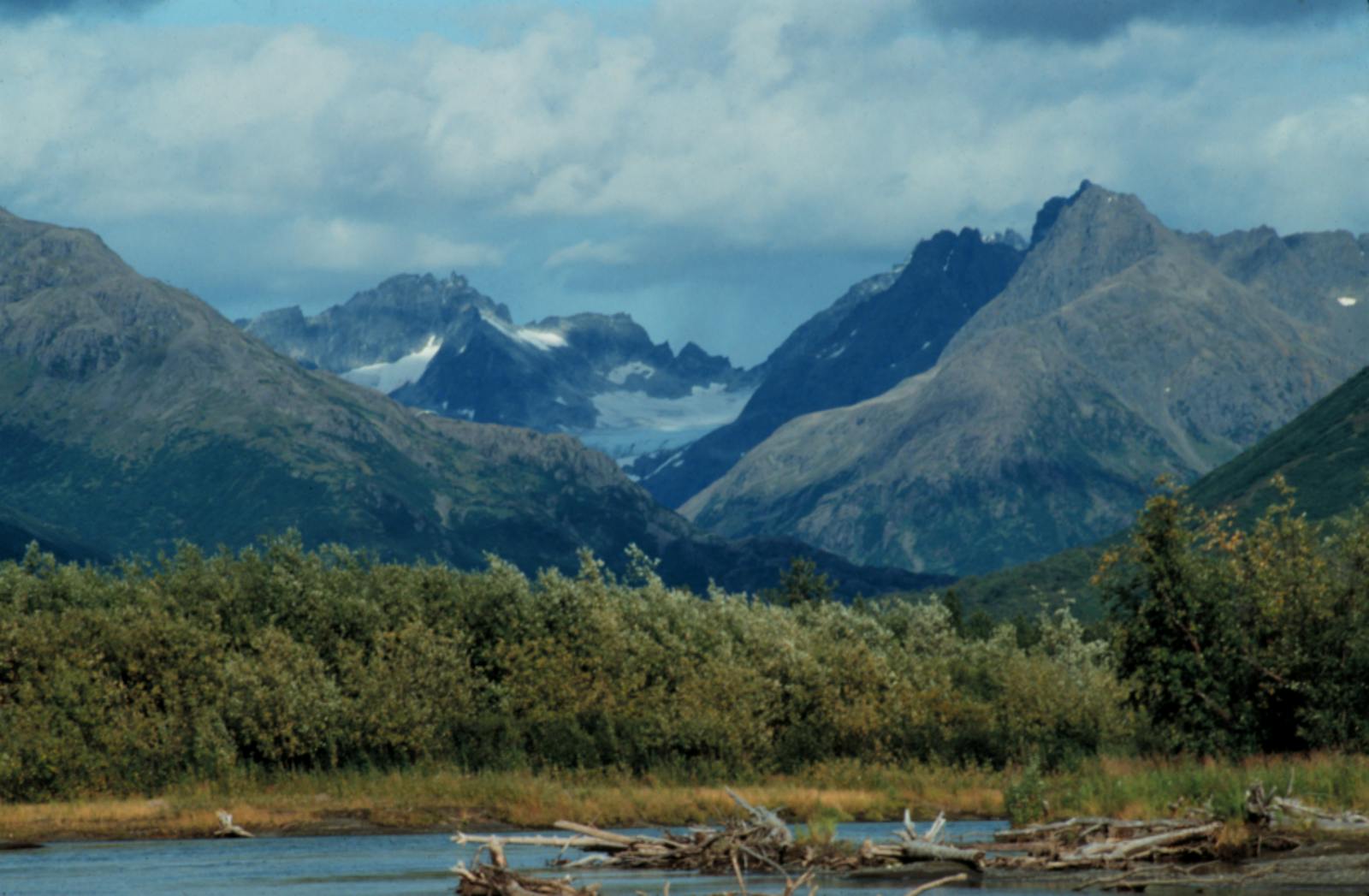
Average daily minimum temperatures in winter range from -24°C to -19°C and average daily maximums from -16°C to -11°C. In summer, average minimum temperatures range from 1°C to 6°C, with maximums from 13°C to 17°C. Mean annual precipitation ranges from 250 mm to 510 mm in the lowlands to greater than 1,000 mm in the highlands. Elevation ranges from sea level to 500 m across most of the region, with higher mountains reaching 1,400 m.
The vegetation of this ecoregion varies along elevation gradients from coastal beaches to rolling hills and mountains. Hills and lower mountain slopes are covered by moist herbaceous communities dominated by tussock-forming sedges (especially tussock cottongrass and Bigelow’s sedge) and, in areas between tussocks, low shrub communities dominated by dwarf Arctic birch, resin birch, willows, lichens, mosses, and plants in the heath family, especially mountain cranberry, bog blueberry, and crowberry.
Wet herbaceous communities with sedges and grasses occur on saturated soils, while ridges and high elevations are barren or support dwarf shrub communities dominated by low shrubs, such as mountain avens, willows, and plants in the heath family, as well as lichens and mosses. Tall shrub vegetation occurs along streams and on floodplains, with willow, birch, alders, and shrubby cinquefoil being characteristic plants. Lightning fires commonly occur during the summer, when vegetation dries out.
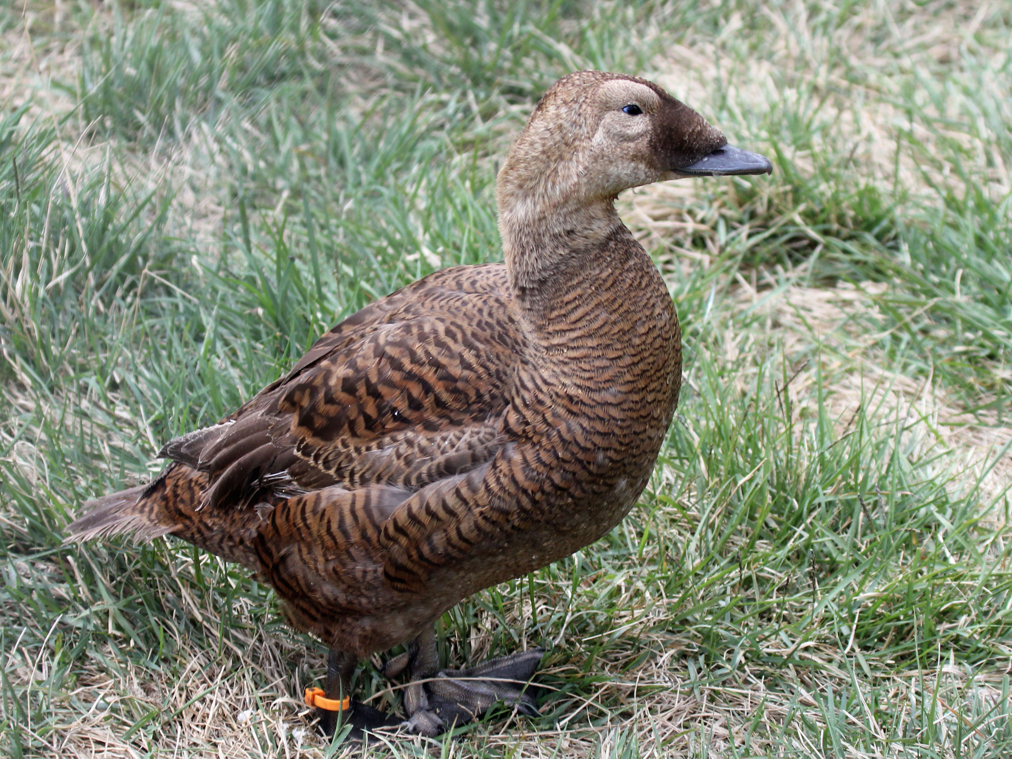
Spectacled eider. Image credit: Dick Daniels, Creative Commons
Mammals of this ecoregion include polar bear, Arctic fox, and tundra hare. Muskox and barren-ground caribou have been introduced. This is an important ecoregion for birds. Coastal areas support large populations of seabirds, including tufted puffins and common and thick-billed murres. Other characteristic birds include yellow-billed loon, spectacled eider, and sandpipers, including the rare bristle-thighed curlew, which nests on only a few sites in western Alaska and winters on islands in the tropical Pacific. Although the wintering grounds have been known since 1769, nesting sites were not found until the late 1940s.i
This ecoregion is almost entirely intact, but more land needs to be included in protected areas, especially because of the threat of expanded mining. Priority conservation actions for the next decade are: 1) expand the protected areas network and maintain the integrity of existing protected areas by not allowing incompatible uses; 2) limit impacts of recreation and tourism; and 3) protect vulnerable species from over-harvest and monitor populations.
Citations
1. Ricketts, T.H. et al. 1999. Terrestrial Ecoregions of North America: A Conservation Assessment. Island Press, Washington, D.C.
2. Gallant, A.L., E.F. Binnian, J.M. Omernik, and M.B. Shasby.1995. Ecoregions of Alaska. USGS Professional Paper 1567. U.S. Govt. Printing Office, Washington, D.C.
3. https://en.wikipedia.org/wiki/Bering_Land_Bridge_National_Preserve

Subscribe to receive monthly updates on climate solutions, environmental heroes, and the profound beauty and wonder of our shared planet Earth.
