Brooks-British Range tundra
The ecoregion’s land area is provided in units of 1,000 hectares. The protection goal is the Global Safety Net (GSN1) area for the given ecoregion. The protection level indicates the percentage of the GSN goal that is currently protected on a scale of 0-10.
Bioregion: North Alaskan Tundra (NA3)
Realm: Subarctic America
Ecoregion Size (1000 ha):
15,983
Ecoregion ID:
411
Conservation Target:
100%
Protection Level:
6
States: United States: AK. Canada: YT, NT
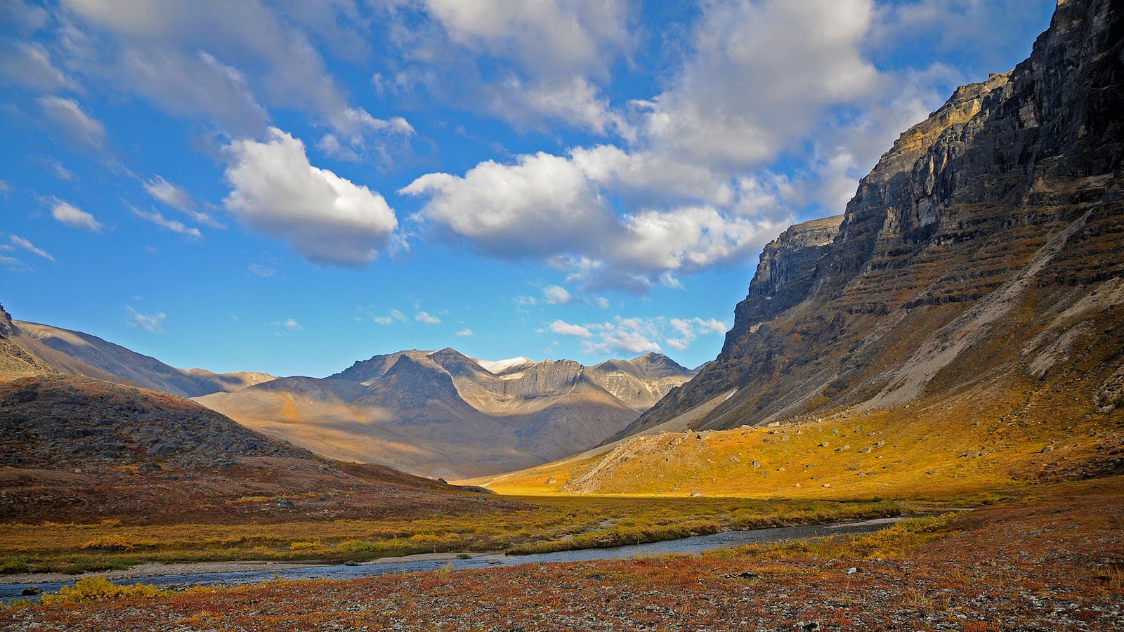
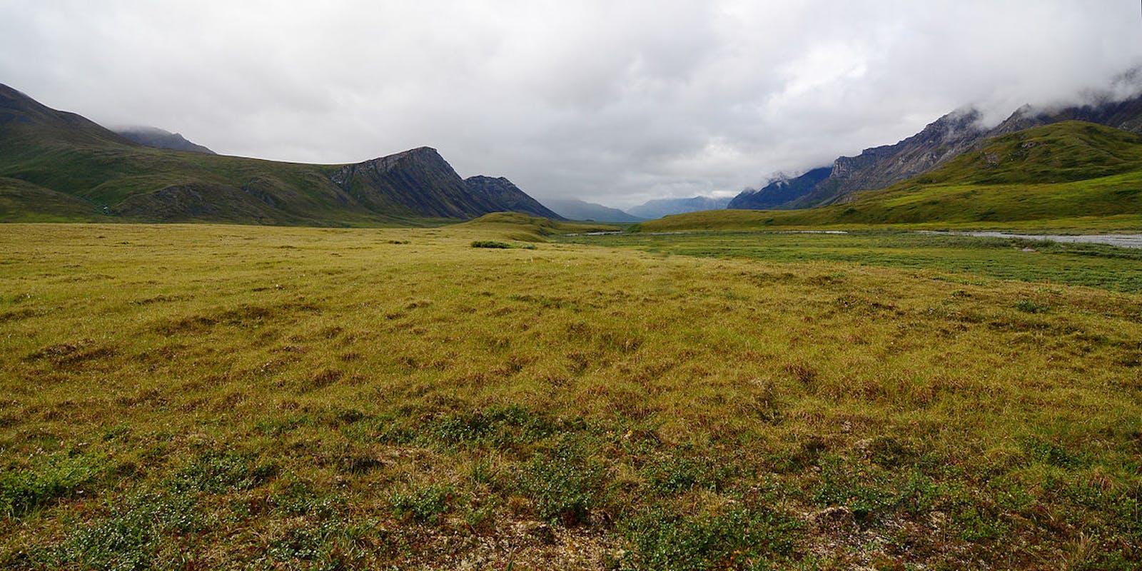
The Brooks-British Range Tundra ecoregion consists of a belt of mountains that stretch west to east from the Western Brooks Range in Alaska (with relatively low and less rugged mountains), the lower-elevation Anaktuvuk Pass in Alaska, and the higher and more rugged Eastern Brooks Range (called the British and Richardson Ranges in Canada) in Alaska, Yukon Territory, and a small part of extreme northwestern Northwest Territories.
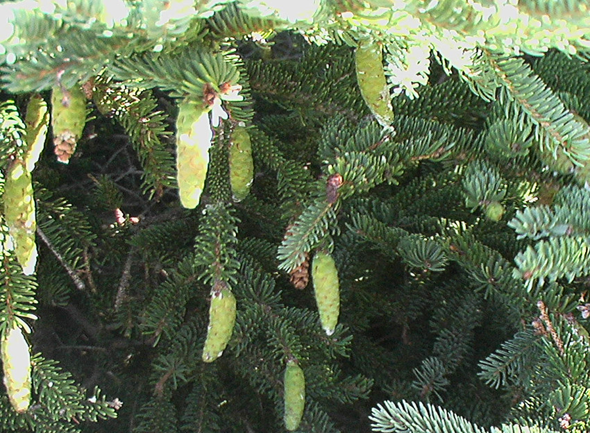
The flagship species of the Brooks-British Range Tundra ecoregion is the white spruce. Image credit: Creative Commons
To the north and west lies the Arctic Foothills Tundra ecoregion, to the south lies the Interior Alaska-Yukon Lowland Taiga and Interior Yukon-Alaska Alpine Tundra ecoregions, and to the east lies the Ogilvie-Mackenzie Alpine Tundra ecoregion. Elevations within the Brooks-British Range Tundra range from 800 m to 2,400 m, with peaks above 1,800 m retaining glaciers that date to the Pleistocene. Nearly 100% of this ecoregion is intact, including 63% within protected areas and 36% outside protected areas. Significant protected areas include the Gates of the Arctic National Park and Preserve (34,287 km2), a large portion of the 78,051 km2 Arctic National Wildlife Refuge, and Ivvavik National Park (10,168 km2) in the Yukon. Retaining the wilderness character and associated wildlife of this ecoregion is the highest priority.
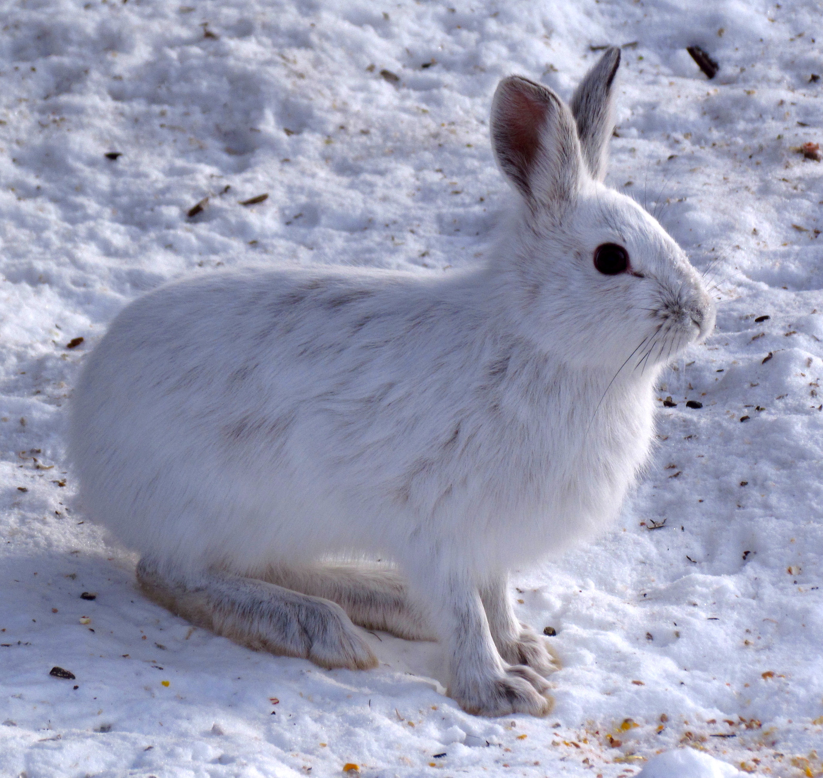
Snowshoe hare. Image credit: D. Gordon E. Robertson, Creative Commons
The Brooks-British Range Tundra ecoregion has a largely Arctic climate, grading to subarctic cordilleran, with short, cool summers and long, cold winters. The only long-term weather station is located at 770 m at Anaktuvuk Pass. Daily minimum temperatures there average -30°C, with a daily maximum of -22°C. In summer, the average low temperature is 3°C, with a high of 16°C. Freezing temperatures usually occur each month of the year. Temperatures generally decrease with elevation, especially in summer.
The mean annual precipitation at Anaktuvuk Pass is 280 mm. Across the ecoregion precipitation is usually heaviest on south-facing slopes and near mountain summits. In the Canadian portion of the ecoregion (British-Richardson Mountains), the mean annual temperature is -10°C, with a mean summer temperature of 6.5°C and a mean winter temperature of -25°C. Mean annual precipitation is around 350 mm. The permafrost is continuous with low ice content in the southern portion of the ecoregion and with higher ice content in the north.
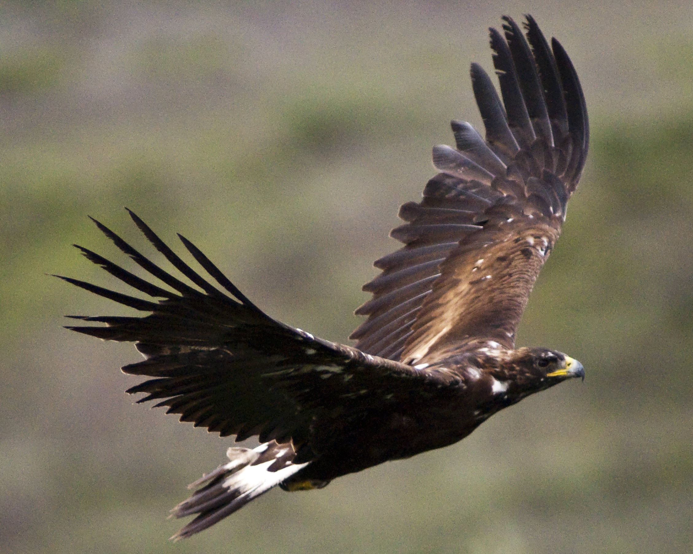
Golden eagle. Image credit: Kent Miller, Creative Commons
Due to the harsh climate and mountainous terrain, the vegetation is sparse, with drier sites supporting dwarf shrub communities and wet to moist sites supporting grassy herbaceous communities dominated by sedges, willows, and mosses. In more protected sites in valleys and lower slopes, subalpine woodland occurs, with white spruce and occasional subalpine fir and lodgepole pine in a matrix of willow, dwarf birch, and northern Labrador tea. The northern limit of white spruce in Canada occurs within this ecoregion. Southern slopes of the Brooks Range have some black spruce, the northern range limit for that species.
Higher elevations have alpine tundra dominated by lichens, mountain avens, intermediate or dwarf shrubs in the heath family, and sedges (including cottongrass) in wetter sites. Communities dominated by lichens and mountain avens are common, with entireleaf mountain avens and eight-petal mountain avens often contributing 80–90% of the vegetation cover.
Importantly, this ecoregion encompasses much of the migration routes of three caribou herds—the Western Arctic, Central Arctic, and Porcupine herds. Other characteristic mammals include grizzly bear, black bear, gray wolf, moose, Dall sheep (at their northern range limit), snowshoe hare, Alaska marmot (also called Brooks Range marmot), and Arctic ground squirrel. Some of the northernmost populations of golden eagle and gyrfalcon occur within this ecoregion. Birds breeding in montane habitats include northern wheatear, American pipit, gray-crowned rosy finch, and Smith’s longspur.
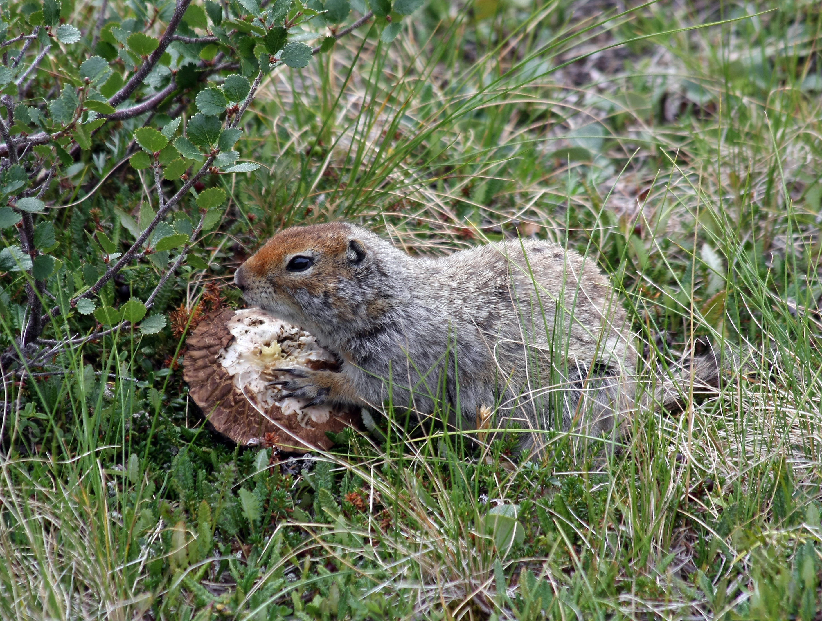
Arctic ground squirrel. Image credit: Lanare Sevi, Creative Commons
Although this ecoregion is almost entirely intact, the Trans-Alaska Pipeline, the Pan-American (Dalton) Highway, and the Dempster Highway pass through the ecoregion, and development along this corridor is almost certain to increase. Mineral (especially lead and zinc) mining is also a threat, with a major mine already on the western edge of the ecoregion.
Priority conservation actions for the next decade are: 1) prohibit incompatible uses, including mining, within designated protected areas; 2) carefully manage and reduce impacts of hunting and recreation in the ecoregion, especially along the highways, where it is most intense; and 3) protect vulnerable species from over-harvest and monitor populations.
Citations
1. Ricketts, T.H. et al. 1999. Terrestrial Ecoregions of North America: A Conservation Assessment. Island Press, Washington, D.C.
2. Gallant, A.L., E.F. Binnian, J.M. Omernik, and M.B. Shasby.1995. Ecoregions of Alaska. USGS Professional Paper 1567. U.S. Govt. Printing Office, Washington, D.C.
3. https://en.wikipedia.org/wiki/Gates_of_the_Arctic_National_Park_and_Preserve
